A SAD GOODBYE
After hearing the latest weather forecast the morning of Sept. 25, 2006 we knew it was time to leave The Eddy and start the long voyage south. Frontal systems had started becoming more frequent making our opportunities for comfortably moving more limited. It appeared we had a 4 day window of good weather, enough to make it to Old Lyme, CT.
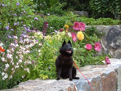
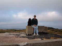
We dinghied ashore early to say goodbye to Merry and Willis (who would be celebrating their 47th wedding anniversary the next day!), thank them for their wonderful hospitality, and take Ursa for one more walk down the street that had begun to feel like our new neighborhood.
We dropped the lines from our mooring right after lunch and began the journey down the Sheepscot River on the high slack tide. It was so sad seeing Merry and Willis at the dock, and they later told us they watched until FLUKE was out of sight.
Since colder weather had begun setting in, many of the river lobstermen had either pulled out their pots for the season or moved them farther down river into deeper water to follow the lobsters. That meant that we had a much “cleaner” river to navigate for most of the way back to the ocean, compared to the tight maze of buoys we had to deal with on the original trip up the whole river.
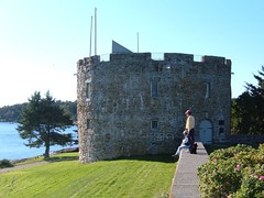
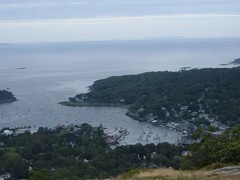
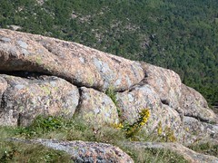
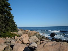
Since it was a 2 hour trip down the river, and we were leaving so late in the day, we planned a stop for the night that would be close (1 hour) by: Seguin Island. It is the sight of the second oldest lighthouse on the Maine coast, standing 180' above the sea. The island, with its picturesque lighthouse, sits in stark contrast to the ocean around it. The land rises steeply up out of the sea, all by itself with no neighboring islands around it. We tied off to a Coast Guard mooring. However, as we sat for a while on the falling tide, the rocks on the shore kept getting closer and closer, giving us an uneasy feeling that FLUKE was going to be too long when the tide was at low and began turning, with the good chance of our stern hitting the big rocks. So, we tied the stern off to another mooring that was close by, thus, preventing our stern from swinging. We fell asleep to the sounds of the water splashing against the rocks and the foghorn bleating from the lighthouse.
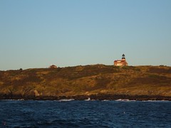
Seguin Island Lighthouse
ROUGH RIDERS
We dropped off the mooring lines at first light, not easy as the tide was low, and we worried about swinging into the nearby rocks. To our disappointment, the wind had kicked up in the night and was more than we had anticipated, almost right off our bow which meant we were pounding into the waves. I thought that was better than getting hit from the side, but all the boys (humans and felines) didn't think so and became seasick. I didn't feel very good myself, but was able to (wo)man the helm and keep occupied watching for lobster buoys to dodge and try to keep the bow into the waves as much as possible to minimize rolling. If that wasn't exciting enough, a small whale passed right in front of the boat!
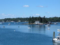
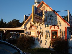
The seas calmed by the time we made it to our destination for the night: Isles of Shoals. Considered scenic by some, these rocky, treeless, windswept outcroppings of ledge and land were discovered in 1614 by John Smith, better known for being the sweetheart of Pocahontas. They have a storied past of associations with pirates, Indians, fisherman, and malcontents. While lying just 6 miles off of coast of New Hampshire, 5 of the islands are in ME and the other 4 are in NH. They are all privately owned, the most notable being Star Island, site of the impressive Oceanic House built in 1872, as the “ideal” summer resort. It is currently owned by a religious organization and used for conventions and retreats. Oddly enough, the compound was flying pirate flags! We picked up a free mooring in the small harbor, happy that the harbor was mostly deserted or we wouldn't have had room to swing. FLUKE was so covered with salt you could scoop a handful by running your hand anywhere on the outside.
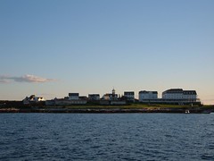
Isles of Shoals-Oceanic House
THAR SHE BLOWS!
Mother Nature was truly our friend on September 27, 2006 bringing a clear sunrise and calm seas. We would be crossing Stellwegen Bank again, heading back to Provincetown, MA and I was SO excited in anticipation of whale watching. Once again, we were treated to the Stellwegen Bank Humpback Whale Show: rolls, breaches, blows, and dives. We were just amazed to see how much water these huge mammals stir up by their movements. Watching them roll over in the water and hold up their long pectoral fin and then smash it into the water, creating a gigantic splash is awesome. The sea was alive with life as we saw many small tuna(2-3'long)feeding on baitfish.
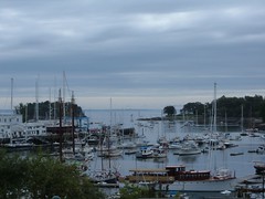
Provincetown harbor had a new look when we arrived this time. The harbor was mostly vacant, moorings had been removed from the outer harbor, and the hustle bustle we had seen a month earlier had come to a halt. The summer season was over. A calm weather forecast and the availability of some open space allowed us to drop anchor for the night instead of having to rent a mooring again.
Who's the Boss
I decided to use up the rest of my bait by fishing out of the cockpit. I didn't know what I was seeing when an enormous creature leaped out of the water not far from FLUKE. At first I thought it was a small whale, but then it flew out of the water again. It was longer and fatter than me! I knew it wasn't a whale, but just couldn't think I what I might have seen. Two fisherman came by and I asked them if they had seen it jumping out of the water, and they said it was a giant tuna coming into the harbor to chase after bluefish.
THE CIRCUS
We were ahead of sunrise in pulling up the anchor and getting started towards our destination of Cuttyhunk via the Cape Cod Canal. Plus, we were hoping to get the better part of the day of good weather before the next weather system arrived with wind and rain later in the day.
The transit through the Cape Cod Canal was just as interesting, calm, and picturesque as when we went through on the way northbound on August 17. One difference this time was that we were going against the current, sometimes only making 4 knots. Some joggers and cyclists were going faster than we were! We were treated to a special show when we went under the railroad bridge. There were 4 men suspended from cables on the bridge high overhead; we guessed doing some sort of inspections as we could not see any equipment in hand.
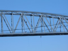
Cape Cod Canal RR Bridge High Wire Act
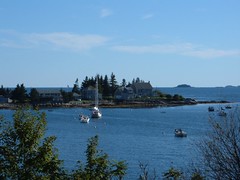
We managed to get into the inner harbor at Cuttyhunk and pick up a mooring before the wind and rain started. From the weather forecast we planned to stay in the harbor for 2 nights since heavy winds would make our next leg unpleasant. The rain passed through with enough daylight hours left so that we could take a walk around the island, which we missed doing on the northbound leg of our journey.
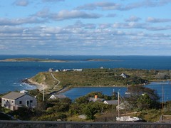
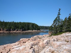
Cuttyhunk Northern Vista
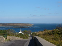
Cuttyhunk Eastern Vista
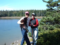
We had a great time walking around the quaint little harbor and community, enjoying the vistas afforded from all the highest peaks. On the western most end of the highest point there are old bunkers left over from WWII. They are good to climb on top of to get a better vantage point of the surrounding hills. If you take a little used trail that leads to the most remote bunker you will find a surprise. Look down in the bunker's open hatch on the shelf for a plastic box. It is a message box; inside you will find paper and pen. First you have to climb down the metal ladder to retrieve it and bring it back up to the outside light. Read what others have written and add your own words of wisdom. Two interesting texts I read were: “My dad always tried to get me to sail out here with him and I never would. Now, I came here with two friends and have seen all that I missed. I can't wait to get back and tell my Dad” and “Enjoy life's journey; it's not a dress rehearsal”.
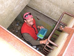
Retrieving the Message Box
The Girls on a Cuttyhunk Bunker
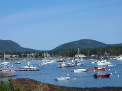
FLUKE in Cuttyhunk Harbor
SHAKING UP THE NEIGHBORHOOD
We arrived back at Old Lyme Marina on the afternoon of September 30. While we weren't put back on the mooring where we had the previous incident during our last visit, we were still put on one adjacent to the same boat that hit us before. Fortunately, that boat got moved before nightfall, leaving a vacant mooring between us and it. However, within a week which included a full moon with extra high tides and some contrary winds, the sailboat immediately to our north could touch us during the slack tide cycle when FLUKE and it would swing in different directions. To solve this problem, we tied FLUKE's stern to the vacant mooring to our south, preventing us from swinging at all. All parties were happy after that.
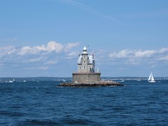
Race Rock Light
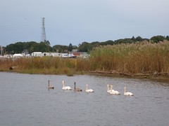
7 Swans a Swimming
Carol's brother (Charles) was generous enough to loan us his truck again, so we were able to run errands, shop for food and parts, visit friends, and do some sightseeing.
Better yet, on October 9 we drove up to Charles and Louise's cabin in Andover, Vermont for an overnight visit to get the full effect of a New England Fall, something none of us has seen in decades. It has been fun this year seeing the foliage color changes beginning in Maine and in the surrounding hills visible from the Old Lyme Marina during the 2 weeks we have been here.
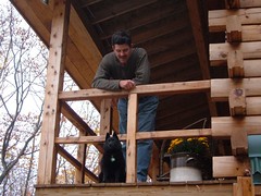
Cabin Visitors
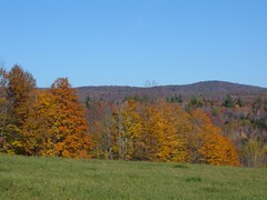
Vermont Fall Field

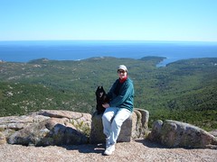
Fall Climb in Vermont
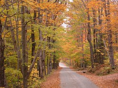
Road to Cabin
Fall also begins to see the cold blasts of air moving down from the north, and we are starting to get our share of that. Without insulation, the temperature on FLUKE gets pretty cold. As of this writing, October 12, 2006, we are hunkering down for some temperatures in the 30s within the next couple of nights. Perhaps this is a none to subtle hint that it is time for the crew of FLUKE to drop the mooring lines at Old Lyme Marina and make our long, but direct route back south to our homeport of Vero Beach, Florida.
Thus, our departure is planned for Sunday, October 15, 2006. Internet access points are unknown at this time, but we will try to post when opportunities permit. While our geographical direction will be the same, our stopping ports are not planned to be so at this time. Stay tuned to the BLOG and read about our voyage with new sights and adventures afloat.