Taking and Giving
July 3, 2007
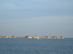
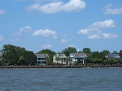
Beaufort was founded in 1710 making it the second oldest city in South Carolina. Cash crops of rice, cotton and indigo helped the town prosper and become an aristocratic center. Wealthy landowners and merchants built many beautiful mansions of various architectural styles.
When the Civil War broke out, Beaufort was taken over by the Union army and navy. As tragic as it was at the time, the take over was what kept Beaufort in tact. The Union used the town as the federal base of the south, and so when General Sherman made his famous “March to the Sea”, destroying all towns in his path, Beaufort was spared. The beautiful well-preserved, varied buildings were left undamaged to be enjoyed in all their current glory.
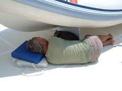
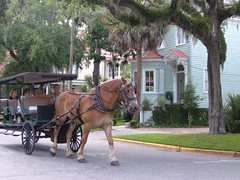
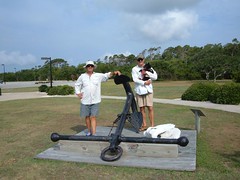
The best way to see the town is to take a walking tour using the $2.95 map you can buy at the Visitor Center or ride in a horse drawn carriage with narration by the driver. Both ways will give you a slow enough pace to get a real flavor for the well preserved mansions and period homes in the beautiful tree canopied setting. We took the walking tour, despite Eddie's whining to take the carriage tour (he had a pony when he was 7 and still has a tendency to revert back to that time), since we needed the exercise after being FLUKE-bound for 5 days. Despite being a hot day, all the trees and the breeze from the nearby Beaufort River, kept the walk pleasant.
 Easy Rider
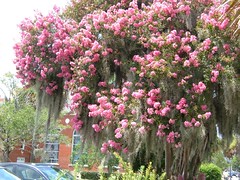 Crepe Myrtle
A few of our favorite sites included the following:
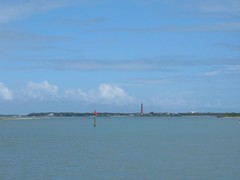
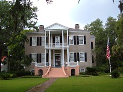
The Castle, 1850, is one of the most photographed homes in America. It is an unusual medieval style, solid brick, antebellum mansion overlooking the ICW.
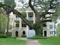 The Castle
The Thomas Fuller House, 1786, is a perfectly preserved example of Tabby construction. Lime, oyster shells, and sand, all cheap materials easy to come by, were mixed together to make the Tabby “cement”.
 1786 Thomas Fuller House
St. Helena's Episcopal Church, 1712, served as a hospital during the Civil War. It is said that the tombstones in its surrounding cemetery were used as operating tables. The fascinating perimeter wall is constructed of bricks which were used as ballast on English ships.
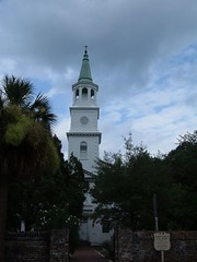 St Helena's Episcopal Church
The Taub House has to get the prize for being the most outwardly patriotic, both front and back.
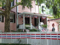 Taub House
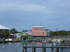
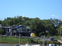
Henry C. Chambers Waterfront Park has just been completed and is a wonderful example of a waterfront showcase to draw people to an area. The winding paths, planters, bench swings, shops, restaurants, green space, and unique children's play area offer much versatility for private and public use. Contiguous to the park is the Downtown Marina with its free (that always gets our attention!) floating dock where boaters can tie up for day dockage to shop and tour.
The entire downtown area has been designated as a historic district by the National Trust for Historic Preservation. The storefronts with all their shapes, colors, and architectural features make for an interesting walk to shop in a boutique, specialty shop, and even old time department store. We had to stop at the Chocolate Tree which was where Forrest Gump bought his box of chocolates. One attorney's office had glass plates put in the new walls, built over the original, so you can look in and see what the original Tabby walls looked like.
The beautiful mermaids caught our attention. They are part of a fund raiser called the Big Swim sponsored by the Arts Council. The 31 sculptures, placed in various public areas, were decorated by local artists and depict aspects of Low Country life. They will all be auctioned off in October.
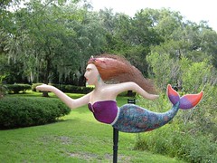 Mermaid, They're Real
Our time was too short, and we will need to return again to catch all we missed. Beaufort is worth the stop by car or boat. You won't be disappointed!
Independence Day, 2007
July 4, 2007
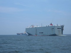
We had a discussion about traveling on July 4. We figured there was a good chance there would be a lot of day boaters and many of those would be partying, possibly causing bad “waves” on the waterway. We were going to travel on the ICW from Beaufort to Winyah Bay near Georgetown, SC , and that would take 2 days for us. This isn't a bad route as far as inland waterway obstacles and it is scenic, so despite our concerns about the holiday traffic we had the anchor up by 0600 and were underway while most of the party animals were still dreaming of the fun day they had planned.
The behavior of the day boaters was better than we had expected. There weren't as many boats as we expected, but most boats had a lot more people in them than what we normally see. Even the PWCs, or fleas, as we call them were not overly annoying.
 Homeowner Humor
Then we reached Elliott Cut, south of Charleston, which connects the Stono River to Wappoo Creek. The old Wappoo Creek draw bridge goes over the cut, and if the tide is on the low side we can get FLUKE under it without having to request the tender open the bridge. We called the tender to ask for a water level reading under the bridge, and told her we thought we could make it with 1-2' to spare if we passed under the high part of the span. We had a strong current pushing us from behind limiting our maneuverability, and we had to make sure that no other boats were coming towards us since there was only enough room for FLUKE to pass under alone. It looked like things were good to go so Eddie proceeded to move forward. Right as we reached the bridge, the point of no return, a pontoon boat pulled out from shore on our starboard side just beyond the bridge and moved into position ahead of us. At the same time on the same side, some marine police officers pulled another boat over to the shore. The pontoon boat slowed its speed, either to look at the police activity or just to try to look like they were obeying the no wake rule, which caused FLUKE to be rapidly gaining on their stern. With the current pushing our stern we just couldn't slow our boat down and there was no room to turn away from the pontoon boat. Eddie just had to blow the horn, blow the horn, and blow the horn. To our amazement the pontoon boat driver just stared at us as we were looming closer and too many seconds passed before he finally realized that we were not going to slow down and would eat him up if he didn't move over. Our horn is a BIG ship's horn and sounds like one coming from a freighter. Many other boaters who were coming towards us began pulling over and staring at the pontoon boat. Anyone who was taking a nap within a ¼ mile of the cut had to be awakened. When the situation had stabilized we called the bridge tender to apologize for the noise, but she said she could see our predicament and wished us safe passage forward. I regret not having pictures to share, but all eyes were forward on the obstructing pontoon boat.
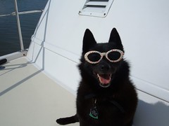
Shortly after that we passed through the very busy Charleston harbor which was easy compared to the Wappoo Creek area. When it wasn't Eddie's turn to man the helm he sat out on the foredeck with the glamorous Ursa, making passing boaters laugh.
 Charleston High Rent District
We set the anchor down in an unnamed marsh creek off the ICW north of Isle of Palms. We saw over 80' of water under our keel at one point as we went up into the creek. That is pretty amazing considering we are seeing less than 3' a lot of places in the main ICW “highway”. Keeping with the holiday festivities a parasail boat sped by us (in this creek!), and I worried that the line connecting the parachute to the boat was coming too close to our mast for comfort and avoided turning FLUKE until the line was well clear and the shadow cast from the parachute was no longer next to our starboard side.
The night sky was filled with many fireworks displays from at least a dozen coastal communities. Since we were out in the eastern marsh lands bordering those towns, we could see the colorful explosions in a 180 degree western panorama from south to north.
 July 4 Party Animal - No Autographs Please
Losers in Winyah Bay
July 5-6, 2007
Shortly after we left the unnamed creek, and were back underway on the ICW, we called the Coast Guard to report a downed ICW channel marker, still attached to its pole. It was probably a casualty from yesterday's party day. You don't knock down one of those things without doing extensive damage to your vessel and/or body unless you are a barge and then you may not even know you hit one.
Our destination was Winyah Bay. It has a Class “A” inlet which means if you have half a brain and can read channel markers you can get in and out of the inlet without needing local knowledge about possible shoaling conditions which are prevalent at most inlets. Plus, the markers are fully lighted, but we aren't going to be leaving in the dark anyway. We have never used this inlet before so we want to be able to see everything for our reference banks. We will exit out of here to the Atlantic Ocean for an overnight crossing to Cape Lookout, North Carolina.
We know that the current will be strong so we have decided to anchor bow and stern. Finding a good spot was the challenge. The most protected areas were all too shallow. We tried an area close to the shore, trying to set the Delta twice and the SuperMax once, but neither would hold the bow tight. So, we moved to a spoil area out in the middle of the channel and got the anchors to hold well. We had 3 KTs of current on our stern at full flow and the stern anchor line was like a piano wire. At least we had gotten in early enough to go through the tide change and make sure we were going to hold securely, but there was a lot of strain on the big girl and we weren't as comfortable as we would have hoped. We won't anchor out there again and have to chalk it up as another learning experience.
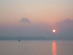
We were winners on the high seas the next day when we were making our 22 hour crossing to Cape Lookout. We didn't leave Winyah Bay until 1000 (after our Thursday pancakes) because we wanted to make sure that we were entering the Cape Lookout area after the sun was up high enough for us to see well. Confused, bumpy seas right out of the inlet made for an uncomfortable ride for a few hours, but they settled down later in the day and fortunately stayed nice through the darkness of night. We caught 2 dolphin with our trolling lures. Eddie and I cleaned and “processed” them, having improved our filleting skills since our Bahamian fishing adventures. We had dolphin steaks for dinner that night and have enough frozen steaks for several more big meals. Maybe if we keep eating a lot of fish we can get smarter!
Look at this Cape!
July 7-8, 2007
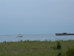
July 7 and 8 would find us securely anchored in the sandy bottom of spacious Lookout Bight located off the southern end of Cape Lookout National Seashore. We needed a day to recuperate from the night crossing and then another day to be tourists in this beautiful area. The locals use the area, too, because by midday on Saturday there were a couple hundred day boaters enjoying various activities such as fishing, sunbathing, beach combing, and using water toys.
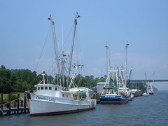
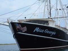 Patriotic Shrimper
Cape Lookout National Seashore exists on the sandy barrier island extending 56 miles from Ocracoke Inlet on the north end to Beaufort Inlet to the south. The park is only accessible by private boat or ferry service. Scattered sea grasses of various types help stabilize the low lying dunes on the eastern edge, while salt marsh helps buffer the waters on the western side. There are no boutiques, fashionable restaurants, or tacky tourists shops; people visit for nature only.
Our too short time here was spent doing the following:
We went swimming in the refreshing, clear water of the Bight, taking the time to scrub FLUKE's hull at the waterline. She had a good growth of algae that was giving her a shaggy appearance.
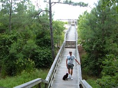
We took a long dinghy ride over to Harker's Island, location of the official visitor's center for the park. There are interpretive displays, relief dioramas, an overview film, nature trail, and picnic area. I was able to buy a postcard with an aerial view of the area where we anchored to add to our growing collection housed under the plexiglass on our storage chest coffee table in the main saloon.
 Too Big for Fluke
 Park Oasis
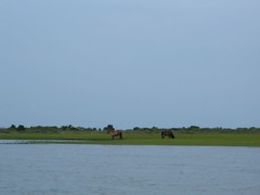
We saw one of the herds of the wild horses of Shackleford Banks, part of the park land. The horses have been there for centuries, and genetic testing has indicated evidence of Spanish ancestry. A notice at the visitor's center said that in April a filly was born bringing the total number of horses to 117.
 Shackleford Horses in the Marsh
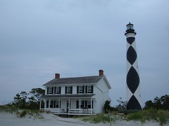
A dinghy trip across the Bight took us to the shore adjacent to the Cape Lookout lighthouse and keeper's house. This operational lighthouse, completed in 1859, stands 163' high. It is one of 7 lighthouses along North Carolina's coast. Each lighthouse has a distinctive daymark (paint job) so that mariners would be able to have an idea of their position once they could see the pattern. However, their most important job was to provide visual guidance at night, protecting sailors from the perils of the “Graveyard of the Atlantic”, the dangerous coastal area with reefs and shifting shoals. A visit to keeper's house provided insight into the solitary life the coastal keepers led. It was just a short walk through the dunes to the picturesque oceanside beach.
 Cape Lookout Light and Keepers House
Eddie and Wayne performed a scheduled oil change on FLUKE's main engine only to find out we didn't have any spare oil filters to replace the old one that needed to come off. The old one was put back on with the intention of getting a new one when we stop in civilization in a couple of days. Yes, we are still having fun, but you should have heard the blame fairies buzzing around the boat when it was discovered there were no spare filters. I think we should be eating fish every night!
Compass Change Range 057 – 337
July 9, 2007
The title of this section shows the directional variation we are moving, lots of twists and turns. However, the waterway remains picturesque and mostly very rural. In fact on this night of July 9 we are anchored off a cornfield north of Bellhaven, North Carolina. There is deep enough water far enough from the ICW for us to just ease right on in toward the shore. Easy in, easy out in the morning.
Crossing the expansive Neuse River a rainstorm passed over with the usual blustery winds, but it moved quickly, and we did well. As we passed through the tiny town of Hobucken (the name even sounds rural) we slowly eased by the R.E.Mayo commercial shrimp docks. I enjoy seeing the shrimp boats tied up, the loading hoppers, and buildings associated with this working dock. Today one of the boats is being sand blasted. Passing boats get so close the blasting operation has to stop for each one that goes by or else the mess would get on us too! I think that it looks like an “evil” job to do, especially in the heat of summer.
 R.E. Mayo Dock
Today we see our first oyster shell recycle center. We had read about the need to do this, but had never actually seen a site. In nature, oyster larvae need a substrate to attach themselves to, and one of the best sources are old oyster shells. Communities where oysters are a big commodity have regular drop off areas on docks. Restaurants and private individuals can drop off the shells which are picked up and taken to a recycle area. The one we saw had huge piles, big enough to have been dumped by a dump truck. It appeared to be at a dead end road in a backwater area along the ICW with a tiny dock that had a swing down ramp that would connect to a barge. A small front end loader was sitting there to shovel the oyster shells aboard. See, these are things you just don't think about as that slimey mollusk slides down your throat.
Really Bugged
July 10-11 2007
We saw three bald eagles as we passed through the Alligator/Pungo Canal. The cypress, sweet gum, oak, and other hardwoods are beautiful at this time of year, all lush and green. I think that this route is superior in scenery, comfort, and safety to taking the Dismal Swamp route like we did last year. I remarked that our first day on the Dismal Swamp Canal last year is in the top 3 of my “Worst Day of Boating” list.
Swamps can bring other surprises at night as we sadly found out when we anchored off of Broad Creek south of Coinjock. We were enveloped by a massive flight of buzzing insects only 1/2” long. They landed by the tens of thousands on the lee sides of the boat. They even got underneath the dinghy cover and it sounded like an electrical appliance was humming under the tarp. They made a noise so loud you could barely hear the tree frogs croaking. Fortunately they didn't bite. Even after we got underway in a steady wind they wouldn't fly away. I had to take a rag and swish off as many as I could get to. When we stopped to take on fuel (320 gals.-enough to go 800 miles), the attendant couldn't believe how many were still on the boat and to my way of thinking most of them were gone. He told us the locals called them fuzzy willies (real scientific!) and said they only lived a couple of days and suggested we wash the ones remaining off the boat with the dock hose. There were still enough left to clog up the deck drains!
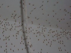 The Swarm
I'm sitting in front of the beautiful Great Bridge in Great Bridge, Virginia on July 11. FLUKE is docked at the free dock which is supposed to have a 24 hour limit, but we are going to push it to 42 or so hours and spend 2 nights so we can get some shopping done and catch up on some chores.