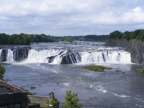
Sunday, August 30, 2009

MOVING LIKE A SNAIL

August 30, 2009

In The Gorge
In The Gorge

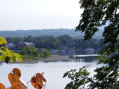
In three days since the last post, we have traveled 37 miles and have gone up another 61' to bring us to 272'. While we didn't pass many other vessels on the river to get to where we are now, there are 4 other cruising boats docked with us now, and about the same number of eastbound boats have exited Lock 12 that I can see from our dock. The southern fall migration has begun, and we are still going north! Oh well.
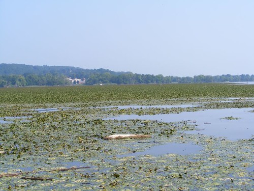
Winding Mohawk
Winding Mohawk

The Mohawk river has been very winding in some areas, passing through a lot of rural countryside, where field corn is growing right down to the river's edge. We passed a hillside dairy farm that I think I could smell from a couple of miles away. There have been other farmsteads that look like they may have once been dairy farms too, but now their overgrown fields are ablaze with goldenrod in full bloom. One of the walking trails associated with the canalway recreation areas had placards telling about how people mistakingly think goldenrod is related to the allergy-causing ragweed and do not fully appreciate its beauty and usefulness in nature. Saturday, at the local Farmers Market a teenage beekeeper told us that his current honey crop comes from the nectar of the goldenrod growing on the preserve near his bee hives.

You Can Have It All
You Can Have It All

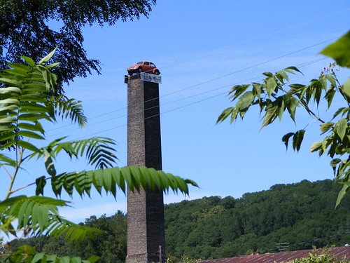
It is surprising to us, coming from where waterfront property is such an expensive commodity, that we don't see sprawling high end developments fronting the river. Even the small towns we pass do not have many buildings close to the river. This probably has to do with how much the river can expand its banks during flood stage. Life along this river just doesn't move at a frantic pace, or sometimes it can't move at all like the VW perched on top of the 80' tall old factory chimney.

Foot Paddler
Foot Paddler

Lonely Little Bug
Lonely Little Bug

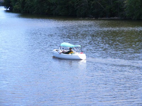
The longest we've had to wait at a lock was because of these 4 kayak travelers locking through. Once they safely exited the lock, the water from the flood control dam pushed them along quickly and they steered out of our way.
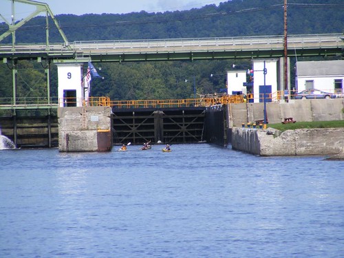
River Kayaking
River Kayaking

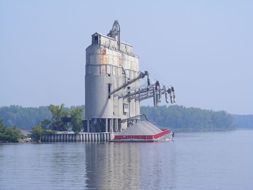
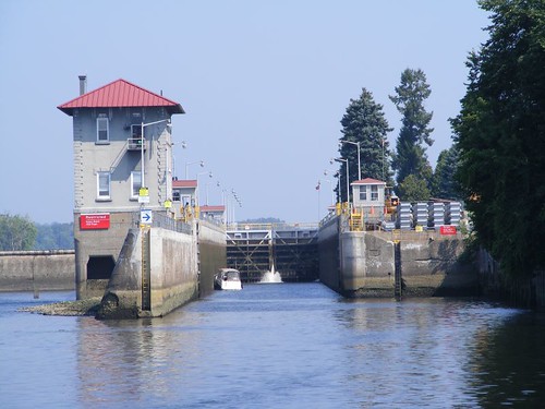
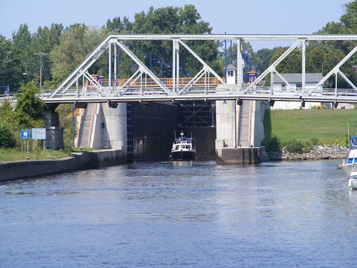
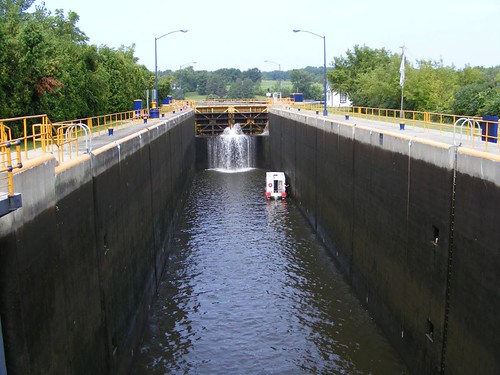
We learned that those dams not only control the flow of water, but are important in controlling the flow of ice and debris. Today, only 1% of the river traffic is made up of commercial vessels; all the rest comes from recreational boating, and the NYS Canal Authority does a fine job keeping the locks and river safe. The operators are helpful, pleasant, and friendly. We have spoken in length to several of them, all of which gladly answered our questions. You can imagine my delight in hearing about, and later meeting, the chief lock operator, a WOMAN named Cindy. They all take pride in keeping their lock in top operating order and appearance. The color coding is the NY state colors.
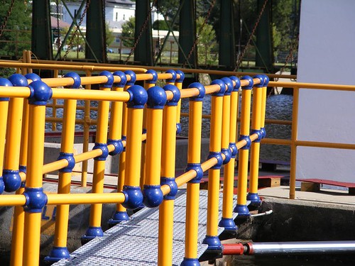
Attention To Detail
Attention To Detail

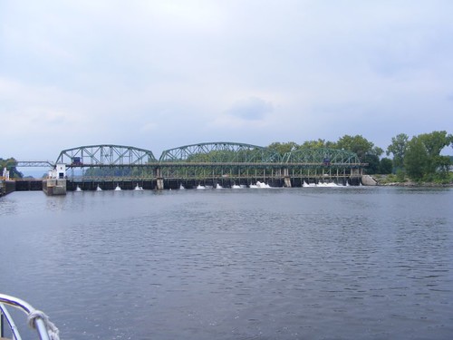
The railroad is right down along the banks of the Mohawk because that is where construction was the easiest to deal with. In the areas where there are no trees between the river and the track the freight train operators blow their horns at us. The railroad from NYC to Buffalo and Chicago is one of the busiest rail corridors in the U.S. We are amazed at how many long trains we see. Many of them are carrying the same name containers we have seen at the ports we have passed along the eastern seaboard, like the China Shipping containers we saw being off loaded in the Port of Miami.

The Mohawk River, Erie Canal, railroad, and NY Thruway all passed through the two Noses. They are the two separate mountains, one on the north side and one on the south side, that edge their way down to the Mohawk river, providing the lowest natural passing point in the Adirondack Mountain Range. They are a fascinating sight to see coming up the river. Our angle wasn't good to be able to get a good picture headed west, so I am hoping to get one when we are headed east again on the return trip, hopefully with the mountains dressed in their Fall colors.

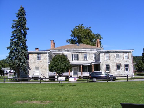
Guy Park Manor House

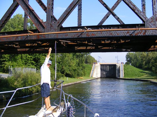
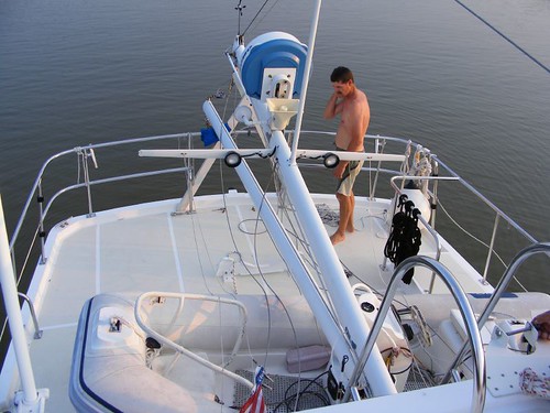
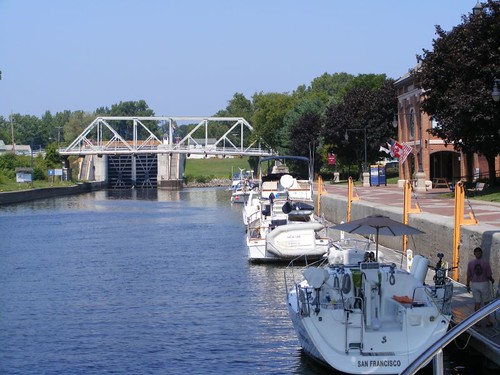
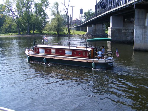
We are finally getting some experience in docking FLUKE and line handling since there are about no places to anchor a vessel such as ours along the river. Fortunately we can tie up for free at many of the lock areas which are designed with space available to tie off vessels that have to wait to lock through, especially in the days when commercial traffic was heavy along the canal. We have even stopped two times in one day: to take in the sights at Guy Park (Lock 11) and then move on to Lock 12 to spend the night and do some more land touring.

The beautiful stone manor house in Guy Park, at the town of Amsterdam, was owned by Guy Johnson, a loyalist who fled the country to Canada when he feared for his safety. The manor house served as a way stop along the canal for sleeping and a trading and commodity center. When the canal was at its heyday, the front of the house faced the river; when the railroad became king, the back of the house was changed to the front of the house to face the railroad track. The house sits right on lock area property where there are also some informative displays about lock activities.

Where Are We Anyway
Where Are We Anyway

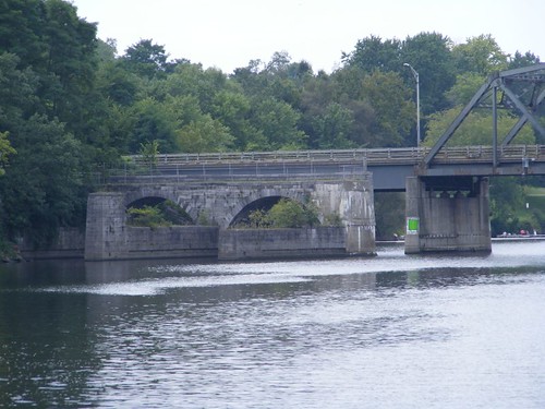
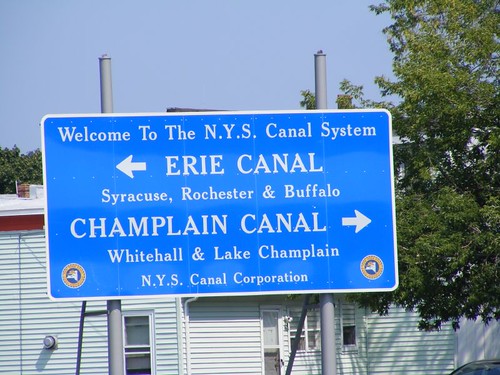
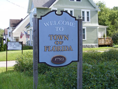
Reading the signs can be confusing. We thought we were going to Schoharie Crossing, a NY State Historic Site and certainly weren't ready to go back to Florida! This is the only place where you can see all 3 phases of the Erie Canal and the best preserved aqueduct at the same location. The original Erie Canal was completed in 1825. 10 years later Phase 2 construction went into effect by widening the canal and improving the locks to accommodate larger barges that were trying to compete with the burgeoning railroads. The third phase is the canal we are using today, the Mohawk river. We found an informative visitors center where a docent instructed us how to find the old locks and their associated canal structures, much of which was reclaimed from deep undergrowth. Some of you may remember the name of Schoharie Crossing from the 1987 NY State Thruway bridge collapse here where 5 cars took the plunge into Schoharie Creek.
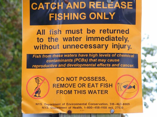
Not The Gum
Not The Gum

You can't miss seeing this sign when you are passing the Canajoharie Riverfront Park where we have been docked for 3 days now. The new park has free floating docks with electrical hook ups, a big picnic pavilion, nice landscaping, and is conveniently located to the village area. There have been quite a few people fishing from the bulkhead, and the fish you catch can be eaten in “moderate” amounts, whatever that means. The only signs that are posted here say not to feed the waterfowl, which also enjoy hanging out in the park area and leaving huge piles of duck poop on the dock where they come to roost at night. This wayward snow goose is keeping company with 3 domestic geese, which must give it some sense of security since it has been separated from its own kind.
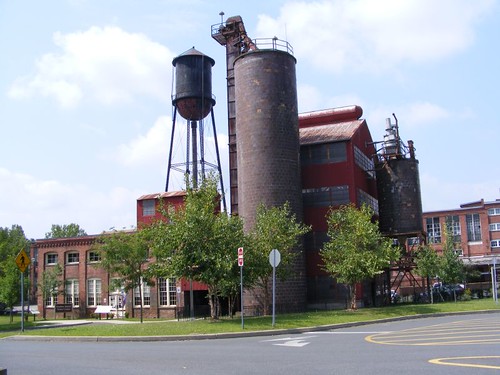
No Golden Eggs
No Golden Eggs

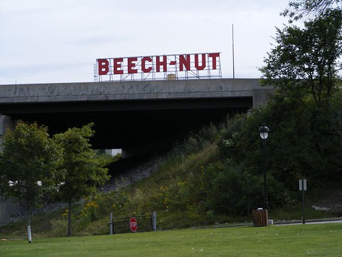
I called the Beech-Nut factory to find out if they had tours; a long time ago, yes, but not any more. This factory makes baby food and is now called Beech-Nut Nutrition. The company has a long history in this village which has prospered from its original founder. In 1859 James Arkell invented and printed the first paper bag. His son started the Imperial Packing Company in 1891 which eventually evolved into the Beech-Nut company. The Arkell family donated a retirement home, library, and museum to the community, and the Beech-Nut company still operates as a major employer in the area, as it has done for over a century.
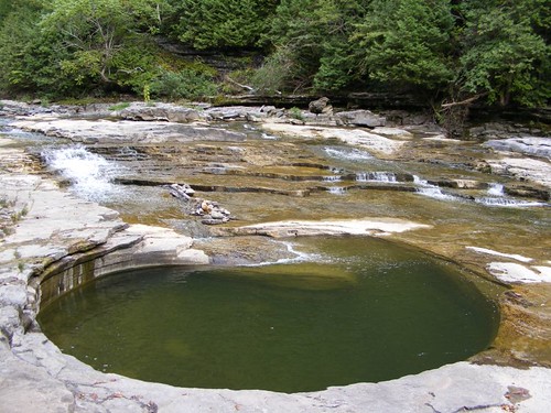
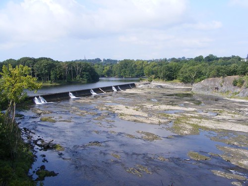
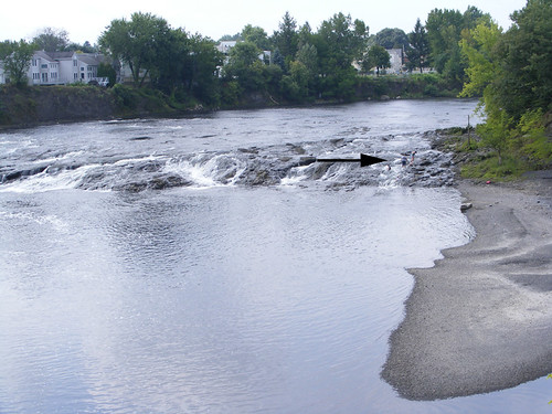
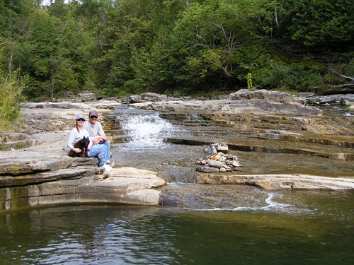
Nature's Spa
Nature's Spa

Canajoharie comes from the Mohawk word meaning “The Pot That Washes Itself”. The Indians thought that's what these potholes in the gorge of the Canajoharie Creek reminded them of. The gorge has a lot of sedimentary rock in it, and when the creek tumbles downhill, creating the falls and all its spillways, some of the water gets swirled around repeatedly, creating all sizes of potholes. It is a gorgeous area, so cool and refreshing. When we were there we were able to walk out onto the creek bed and peak into many potholes, ranging in size from less than 1' to swimming pool size.
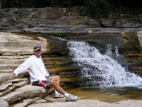
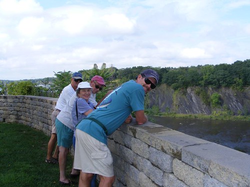
Chief Take-A-Break
Chief Take-A-Break

Mr. Trout operates Trout's Florals, founded in 1900, right by the creek. He told us that when the creek is at flood stage you can't see any of the bottom part where we are sitting in the photos. We always enjoy talking to the locals; the older ones are full of historical information and seem to enjoy taking the time to chat.

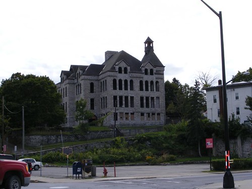
The High High School

The elderly volunteer at the Tourist Information Booth told us this used to be the high school in the late 1800s, reflecting how big and prosperous this village once was. She said that a few years back a foreign businessman came in and gutted the whole building and pulled out all the beautiful windows and then up and left town. Many residents are enraged that this magnificent building was allowed to be left in such a state of disrepair.

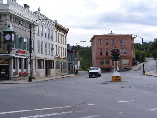
First Electric Signal

After that fiasco the seniors said if anyone tries to take out this traffic signal they are going to strap themselves to it!

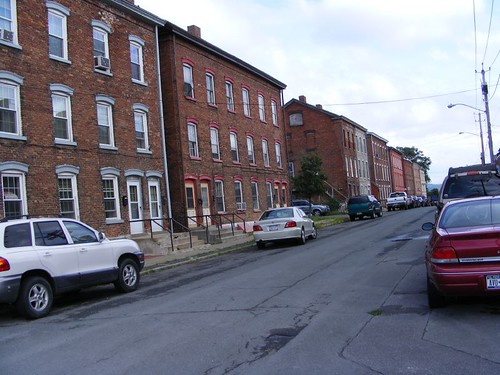
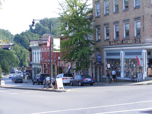
Canajoharie is said to have the most architecturally intact original Erie Canal commercial district of any town along the Mohawk River. The main street buildings are beautiful, but in need of some repair work, and many are vacant, sadly typical of so many downtown districts we have seen. The original neighborhood homes have magnificent architectural details, indicative of a time of wealthy owners when the village was prosperous in the late 1800s. Now some many of them look like big work projects to restore them to their original glory. Most people can only afford something like this now.
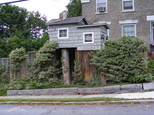
A Stump House
A Stump House

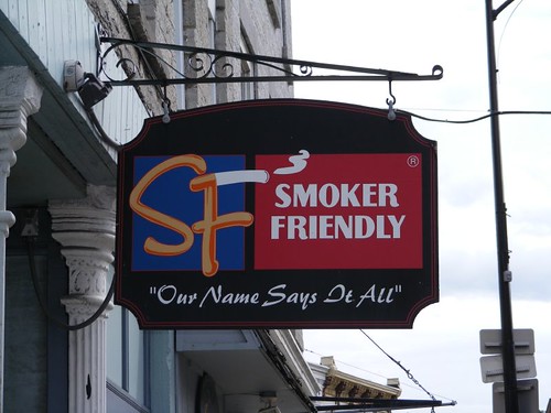
The businesses that occupy the old buildings are usually restaurants, small professional services, and oddly enough businesses like salons, tanning parlors, tattoo parlors, and body piercing establishments. I am puzzled how people who are struggling financially can justify spending money to support these types of businesses. This sign caught my attention, and it was right next door to a combo tattoo/piercing parlor.

Ugh!!
Ugh!!

A lot of people no longer have the interest, time, or money to make the commitment to keep up with all the restoration work needed on the homes and buildings from over 100 years ago. Having a boat like FLUKE is a big handful for the three of us, and we always look forward to having a day like these village residents were having when we saw them as we were walking to the gorge in the afternoon.

Growing Cattails
Growing Cattails

We've just had 1½ days of rain and the Mohawk is flowing fast, but now that the weather is clearing we need to think about moving on. Time to look ahead. The forecast is for much colder weather, Wayne says we might have to stay here a while where we are plugged in and can run the heat!

Wednesday, August 26, 2009

CRUISING TO LOCK 8

August 26, 2009

We started the day off with another first for the crew of FLUKE: We used the coin operated sewer pumpout at the Visitors Center. The pump sucked great, and we didn't have any sewer explosions or stinking drips. And, there wasn't any yelling. Maybe you were able to look at the web cam and see us sucking our sewer!

Today we traveled for 6 ¼ hrs to go 23 ½ miles, pretty slow by even walking standards. There are several reasons for the slow pace. We had to lock through 8 locks which take about 30 minutes to complete the cycle. We used the line method to secure FLUKE. Eddie held the bow area line and I held a line at midship. The lines were slimy, but easy to keep a grip on. Wayne jostled FLUKE back and forth with the throttles and side to side with the bow thruster because when the lock was filling FLUKE wanted to move around more than we were able to keep the big girl secure by just holding onto the lines. The method worked much better than securing two lines to the fixed pipe like we did in the Troy lock.

Eddie Checking The Height Gauge

We had to pass under 14 bridges. The photo shows the “gauge” we have mounted on the bow, set to match the top of our ladder, now the highest point on the boat. Supposedly we should be able to get under all the bridges, but just to be sure the gauge will tell us if we can fit before we hit the ladder and tear it and a lot of fiberglass off the boat. The bridge would definitely win that fight!

One of the locks was associated with a large dam area and nearby power generating facility.

Power Generating Lock Area

Another of the locks, the one we tied up next to for the night, has a sophisticated mechanism for flood control, a type we have never seen before.

Flood Control Lock Area

We are now traveling along the Mohawk River. In the days when the original Erie Canal was in use, the real canal was located close to the river, or one of its tributaries, in most areas. The river couldn't be used by the barges because it is too wide, the banks are too irregular, and the current can be too swift; the mules wouldn't have been able to walk easily to pull the barges. The areas next to what was the original canal are still used today for recreational areas, bike paths, and walking trails. Portions of the Canal are still visible from the Mohawk River.

There were places where the Erie Canal had to actually cross over the Mohawk River using aqueducts. These were water bridges, constructed of stone. Some of the original (1800s) stone arches from the aqueduct system are still visible.

Aqueduct Arches
Aqueduct Arches

Today, the NY State Thruway runs right along the Mohawk River, and we have traveled with the noise of the highway not too far away. We have seen a few fishing boats on the river and have passed 2 other cruising boats, headed east. Going so slowly it was easy to be able to enjoy the riverside sights, some of which were unusual.

Hudson River Replica Ship

Tribute To The Original Landowners

So, here we are 211' higher up than when we started out up the river this morning. When we are sitting high in the locks after they are filled up all the way, it is an interesting sight to look downhill back to where we were. Who knows what we'll see tomorrow?

(This is from Wayne) I wanted to try using google maps to show you where we are. This is the satellite view. You can also select the map view and then zoom out to see where this is in the bigger picture. If anyone likes this, they can comment or send email and I'll decide if I want to keep doing it.

Tuesday, August 25, 2009

GOODBYE, HENRY


Learning As We Go
Learning As We Go

Well, Henry gave us a great cruise up the Hudson, but it was time to “branch” out our adventure and turn west up the Erie Canal. While it was only about 65 miles from Kingston to where we would leave the Hudson to head up into the Erie Canal, we had to divide the trip into 2 days to get FLUKE prepared for the Canal transit. FLUKE had been that way before with her previous owner so we knew we could do it.

In the short distance we passed two premier lighthouses. The Saugerties Lighthouse, 1869, sits on a tiny peninsula jutting out into the river. Its upkeep is partially financed by being run as a bed and breakfast. So, if your life list includes sleeping in a beautiful lighthouse, schedule a visit. That sure would be a great surprise for your sweetie!


Saugerties Lighthouse

Not too far away, but well out of earshot, is the picturesque Hudson-Athens Lighthouse, 1874. Its present day claim to fame among the lighthouse crowd is that is has one of the last working fog bell mechanisms in the U.S.

Hudson-Athens Lighthouse

Not all the sights were as nostalgic as the lighthouses. America must keep on building, and the rivers serve as a great corridor for moving materials or the fuels needed to run the plants that make the goods. Even this far up the river we have continued to pass several loaded tugs. Hopefully the gravel barge being loaded in this photo will be more evenly balanced when it is completely full.

Better Than Shoveling By Hand

At midday on August 17 we pulled into Schodack Creek, south of Albany, to anchor and make FLUKE canal ready. Schodack Creek is a dead end spur off the Hudson. Since it doesn't have any through traffic we knew we wouldn't have to worry about having other boats wake us. It took us two tries to get the anchor to set properly; the bottom just wouldn't get a good grip. Since the creek isn't very wide, we had to make sure we were right out in the middle, and were limited to putting out only 100' of anchor chain. More than that might have caused us to swing too close to one of the shores when the tide changed, and there is no telling what might be lurking in the shallows closer to the shores. Getting hung up on a big log in some backwater creek wasn't on our agenda.

Number one on the list was to lower the mast. We had to do this because our height with the mast up is 34', and the lowest bridge we planned to go under is 20'. When we lower the mast, we will be 17 ½', or so we hope. We also hope that there will be no major flooding to where the water level gets raised enough to put us over the lower bridge limit, since we don't have much margin for error.

The WEMMT had practiced lowering the mast at the home dock a couple of times, so were familiar with what was required. However, the dry run was done with the dinghy off the boat, and this time, not only would the dinghy have to remain on the boat, it would have to be rotated 90° onto temporary chalks. I hope you can see why we didn't want any boat wakes during this operation. I expected to hear some yells and squeals, but the guys pulled the whole job off with minimal voice raising and no runs to the head. Even FLUKE was unscathed and adjusted fine to carrying her reconfigured weight once we transferred fuel from one tank to another to try to level her off.

What Do We Do Next
What Do We Do Next?

The creek area was very quiet, other than when the commuter train went roaring by. Wayne said at least it didn't blow its horn, but it is right next to the creek, close enough that if you knew sign language you could communicate with people on the train. At least I was rewarded with an interesting wildlife moment early the next morning. I saw a gigantic (it had to be at least 30# ) snapping turtle lumbering along the muddy shoreline at low tide. It was trying to climb up the embankment and finally pulled itself up by clawing hold of some low lying branches. It looked like some kind of miniature dinosaur.

FLUKE certainly doesn't look as grand with her mast down; someone may even think we had some sort of accident, but up in these parts, that is THE LOOK amongst the taller boats. Radars, satellite TV dishes, VHF antennae, and any other pieces of equipment that gets your boat too high has to be lowered. You should see the sailboats carrying their masts, extending from bow to stern flat down the entire middle of the boat. Some of those cruisers have a hard time seeing over the whole thing, and don't have much room to move around their decks or in their cockpits. BUT, all will agree it is worth the extra work to make the trip.

The river wasn't very busy as we approached Albany, and the waterfront area is not picturesque to say the least. It is strictly an industrial area: scrap yards, fuel storage depots, product terminals, freight docks, and numerous abandoned buildings of dead industries. There are no modern city buildings or residential units directly on the riverfront. The big freighter in this photo caught my attention for obvious reasons.

FLUKE'S Distant Relative
FLUKE'S Distant Relative?

Troy, not far up river from Albany, was the site for our first lock, where we would go up 15'. In general, the locks have been built where once upon a time existed a waterfall created by a change in the elevation of the land. Ships couldn't navigate the falls, so the locks were built as a bypass to the falls. The falls may have been converted into a dam to function as a riverside power plant and to control the water flow in the river and help the lock to function.

The Troy lock opens on the hour and half hour, so it is worth it to time your arrival so you don't have to hover outside the lock. You have to call the lock tender and indicate what direction you are traveling and get clearance to enter the lock. Once you enter the lock you have to get your boat secured by putting one of your lines around a pipe or cable affixed to the side of the lock wall or holding the boat in place with lines that are hanging into the lock, if the lock provides them. The whole point is to make sure you have your boat held tight so that it doesn't get pushed into the slimy and rough sides of the lock when the water is filling or emptying the lock, causing your boat to want to move around. Most people think that the water enters the lock by flowing in through the big gates that seal off the ends of the lock. That is not the case, thank goodness, or it would be easy to be really swept away. The water enters the lock basin from down below the surface, close to the gates, thus minimizing the turbulence.

Locking Up 15' At Troy

About 2 miles later we saw this sign, so it was time to leave the Hudson and begin our journey on the Erie Canal, fed by the waters of the Mohawk River.

Which Way To Go
Which Way To Go

The Erie Canal extends all the way to Buffalo, on Lake Erie. However, we can not take the canal all the way over there because there are bridges that are lower than the 20' clearance we can reasonably accommodate. However, we could still get to Lake Erie if we traveled up into Lake Ontario and took another canal system. With our late arrival to these parts we will not even enter Lake Ontario, accessed from the Erie Canal by the Oswego Canal. We may get to Oswego, but we are really winging it at this point with our motto being “We don't have a schedule and we're sticking to it”. We are just going to take it easy, see the sights, and move when we feel like it. It is a great feeling not to have to worry about Hurricane Boat Anxiety. HBA is truly a dreaded malady suffered by all boat owners in Florida during the summer months, but we will be safe from it up here.

Life At An Intersection

Pointed Westbound
Pointed Westbound

FLUKE is the boat at the far right, just beyond the bridge. We have been docked at the Waterford Harbor Visitors Center since arriving here on August 18, and today is the 25th. So, we have set another new record: this is the longest period we have ever been at a dock! There are several good reasons why we have stayed here for so long.

Our Waterford Homesite

The Visitors Center is a wonderful facility designed to attract cruising boats. There are floating docks that supply water and electric service for free for the first two nights, and then it is only $10/day after that. There is an information center, newly opened, that is staffed by volunteers who pleasantly answer questions and try to be helpful. The grounds are beautiful. Paver bricks, depicting the entire length of the Hudson River and the canals that branch off of it, with the locks and major cities, line the walkway parallel to the waterfront. It is fun to walk along and see where we've been, where we want to go, and even the areas we won't be visiting. There are tables where boaters can get together for cocktail hour to exchange boating stories and information Yesterday I discovered that there is a live web cam, and you may be able to see us walking around if we are still here, or watch a boat lock through, when you access the site at: http://town.waterford.ny.us/video_clips.htm. On Sundays during the summer months a Farmers Market, with a live band, gets set up right along the waterfront. The produce is locally grown on the small farms close by. It is so fresh; one of the vendors sold out of corn, so she sent her husband back to the cornfield to pick more to bring back to the market.

Floating Free Again
Floating Free Again

There is always a bustle of activity since the VC is adjacent to Lock 2, the first of five locks that lift boats up a total of 170', in the span of only 1.5 miles, to get to the Mohawk River. It is fun to watch boats lock through, and you never know what kind or size of boat may be using the lock. We have seen boats that are put in the river on trailers and we have seen barges go through that take up the entire width and length of the lock, obviously constructed with those limitations in mind. There is a fleet of these charming, easy to operate, canal boats that you can rent to cruise the canals, styled after those you might see in Europe.

A Real Canal Boat
A Real Canal Boat

Local residents come down to the waterfront to walk and watch the locks and boats. We have people stop and ask us questions about FLUKE and our travels. Everyone laughs after they ask us where we're going and we point at the lock and say “that way”. Fishing is a popular past time for the locals, and they use the lock area bulkheads and nearby river banks from sunrise to sunset. It is fun seeing what people catch and seeing how passionate they are about the sport, despite having to release anything they catch. These signs are posted anywhere around here where people may be fishing.

Learning To Read English IS Important

The PCB contamination is mostly associated with a GE factory up river which discharged large quantities of contaminated water before it was discovered how dangerous the polychlorinated biphenyls were and how they concentrated in the food chain. Years passed before someone decided that the river bottom should be dredged down to the contaminated layer to remove the toxic material. So now, for the last 10 years, the river is being dredged, stirring up the contaminated layer into the water as they remove it. A volunteer lady at the Visitors Center said her son has worked on the project for 10 years and thinks it will take another 10 years to finish. Then they are talking about finding other areas down stream from the initial site that may need to be cleaned up. That will all probably depend on what political climate exists at the time a decision has to be made, and how much tax payer money is available for a stimulus.

Waterford, founded in 1794, is the oldest continuously incorporated village in America. We have enjoyed walking from the waterfront to the main street, seeing old public buildings and private residences, many of which are multifamily dwellings of various sorts. Like many of these old towns in the northeast where livelihoods were originally dependent upon mill industries which have now long been shut down, Waterford struggles to keep going. The main street, the old downtown area, has a difficult time keeping the stores rented, and hasn't been able to get an artist or boutique business basis in place since Waterford is not a destination town for land travelers. Troy, is located right on the other side of the Hudson River, and we can walk over there to shop at chain grocery stores.

Factory Powerhouse
Factory Powerhouse

We can walk over the dark bridge (old railroad bridge, now a pedestrian walkway) you see in the earlier photo to go to Peebles Island State Park. In 1909 Cluett, Peabody & Co. bought the land for a factory that bleached cloth to be used for mens shirts (the Arrow shirt) and collars. The process of sanforization, or preshrinking fabric, was developed at the factory. It was a convenient site because the railroad ran right through the property and the nearby river had water readily available for power use, transportation, and waste discharge. The factory operated until 1972, and then the 191 acres of land was purchased by the state.

Part of the old factory powerhouse building houses the Peebles Island State Park Visitors Center. You can look at an old steam generating system, see displays on the natural history of the island, and displays on the industrial history of the surrounding towns and places of interest. Another part of the old factory buildings houses the Peebles Island Resource Center which evaluates artifacts for their historical significance and develops preservation programs for historic properties.

Hiking the trails around the island is popular for locals and visitors. There are several prominent bluffs that overlook branches of the Mohawk River and its associated water control dams. We saw deer and lots of bird life.

Branch Dam
Branch Dam

There are still natural cataracts that haven't been dammed, and they can provide some family fun, if you want to break the no swimming rules of the park like this family (see arrow in photo below) has chosen to do. Older locals tell stories about all the fun and excitement of cascading into the river from its inlets and over the cataracts. Now-a-days, no one can assume liability for such “dangerous” activities where an accident could lead to trying to lay the blame on someone else via litigation.

Peebles Island Cataract

There are numerous trails, for walking and biking, along the locks and along the original parts of the Champlain and Erie canals that transversed this area. The trails were originally used for pulling the barges along the canals using mules. There are shoe prints and barefoot prints in the cement along the Visitors Center waterfront depicting this work. We have walked a lot of the trails, and one night I saw my first muskrat swimming in the canal. After a torrential downpour, which caused a lot of erosion, I found an old spike, from whose knows what, but I call it my “artifact”. You can walk or drive right up to the locks themselves and talk to the lock operators; the two we spoke with were so friendly and they answered many questions. One of them even opened up the coverings housing the main motors and electrical system to explain how they were meticulously maintained and how the lock worked. They still use electrical panel equipment from 1915, 250V DC. It looks as new as the day it was installed The operator showed us his scars from where a spark arced from the panel and burned him, but that only happened once!

1915 Still Operating Electric Panal

It is fun to stand right next to the empty lock and look way down and see boats enter the lock and tie themselves up. Then the gates slowly close and the water swirls in eddies, filling quickly from the bottom, all 3 1/2 million gallons at a time, even for this little pontoon boat in the photo. The water has to fill all the way up to the top of the dark line. Transiting the locks isn't free. Our season pass cost $100 and is good for all the locks and the entire time they are open,depending on the weather, but generally May – November.

Needing a Lift
Needing a Lift

Walking on the trails on Peebles Island you can look across the Mohawk in a couple of places and see parts of the town of Cohoes. A prominent structure is one of the old gigantic Harmony Mill buildings. Harmony Mill was originally built in 1837 and became the largest and most technologically advanced cotton factory in the U.S. by the 1870s. The mill operation was successful for 61 years. During that time, Cohoes became a true mill town. 1 out of 4 of the 3100 residents worked at the mill. The mill constructed 700 tenement houses; in the early 1900s it cost 39 cents/week for rent. The housing was so well constructed many of the units are still being used today. The old mill building is on the National Historic Register and is being converted into luxury apartments, with gorgeous views of the Mohawk River and hills in the distance.

Factory Houses
Factory Houses

Part of the prominence of Harmony Mills was due to Cohoes Falls. It is the largest waterfall east of Niagra Falls, and it supplied the power for the mill machinery during the Industrial Revolution and still is a major source of hydroelectric power today. A visit to the falls is well worth the trip, less than 5 miles away from the Visitors Center. When my brother and sister-in-law visited we were able to get a ride over to the falls.

Cohoes Falls
Cohoes Falls

One of the volunteers at the Visitors Center told me that under normal flow, water runs at 90,000 cubic feet/sec, but last May when it was at a flood stage 640,000 cubic feet/sec was flowing. That caused the Mohawk River to be in a rage. Lock 2, the one in front of us, couldn't open because the water around here was flowing too swiftly, and traffic couldn't move through. The docks at the Visitors Center floated above the bulkhead, and water was 4' high in the VC building. As we all stood there looking at Cohoes Falls we could imagine what the Falls and River looked like during the flood stage.

High Above The Mohawk

Talk of the day is that we will be leaving here tomorrow. I love it here, but am looking forward to seeing the other sights along the Erie Canal. I'll keep you posted.

Tuesday, August 18, 2009

THANK YOU, HENRY

Since leaving the Bear Mountain area, the land surrounding the river has opened up more, and there are fewer dramatic mountains right next to the river. The exception, though, is Storm King Mountain, elevation 1350'. It juts right out to the western edge of the river. If you look closely you can see a notch where the scenic highway runs along the outer edge. In the distance we can see some of the peaks of the mountains which are part of the Catskill range.

Storm King Mountain
Storm King Mountain

The sprawling West Point facility extends all the way down to the river and takes up several hillsides. The older buildings look like a medieval castle fortress. Before 9/11 passing cruisers could tie up at the facility docks and take a tour. I could see groups of people walking around, and I figured they might be new recruits, with their parents, getting ready to begin the Fall school term. It was very disconcerting not to see an American flag flying at the facility until we got all the way around to the northern end of the campus, where the buildings are set back farther from the river.

West Point
West Point

With the flatter land areas on the nearby hillsides we can see large estate homes, old mansions, colleges, and government buildings of various ages and architectural designs. There are numerous tour boats, some replica crafts of days gone by, that probably tell their travelers the names and histories of the buildings we are seeing. There is lot to see, so those cruisers can't be bored.

Tourists and the Culinary Institute of America

A lot of the hillside buildings are too far away to be able to photograph well, but we can get real close to the lighthouses, some of which have very unique styles and their own interesting locations. The Esopus lighthouse, built in 1872, is one of the few that we've seen that has marked a mud river shoal; when we passed it was low tide, revealing a huge mud flat.

Esopus Lighthouse
Esopus Lighthouse

The new Queen of the Hudson had her 11th birthday while we were underway. I baked a cake, so that she could watch the rest of the crew eat it on her behalf. She got to lick one of the plates.

Anticipation
Anticipation

We decided to visit Kingston, the original capital of New York. Our cruising guides suggested possible anchorages in Rondout Creek which flows right along the original Kingston waterfront. It is easy to see why Kingston was such an important shipping center of commerce and business; the creek is very deep and wide for quite a distance, and it has a broad entrance right off the river, marked by the beautiful 1915 Rondout lighthouse, the last family occupied lighthouse on the Hudson. However, it is now filled with many marinas, boatyards, bulkheads, and docks and a gazillion vessels of various sorts. We took FLUKE about 3.5 miles up the creek almost to the low, fixed bridge before we ran out of water. The farther in we went the more apparent it was that FLUKE was one of its own kind; most of the other boats were smaller day or weekend cruisers, and they were packed in for Saturday fun along the docks and beached on the sand bars. There was no room for us, so we slowly headed back to the Hudson.

Rondout Lighthouse
Rondout Lighthouse

We ended up dropping the hook just south of the lighthouse off Port Ewen, a hamlet community located on the south side of Rondout Creek. Even though we weren't that far from the main channel the wakes from passing boats weren't too bothersome, we had a great breeze, and we could watch the boating traffic on the river.

Sunday was slated to be a going to land day, starting out with a walk on land with Ursa to check out the residential community of Port Ewen, or so we thought. Cruisers frequently have a problem trying to find a place to safely land their dinghy when they are anchored out. We couldn't see a boat ramp from the river, but we could see a private yacht club called Hidden Harbor. We dinghied over to it and asked if we could land our dinghy and go for a walk, but were told that, for “insurance reasons” unless we were a member or guest of a member we couldn't land. I wondered if the rangers at Bear Mountain had notified the communities along the way about our “criminal” record of behavior.

There was a town “beach” right next to the yacht club where we may have been able to land the dinghy, but the whole shoreline area in front to about 100 yards out into the river was filled in with this noxious, invasive weed called Chinese water chestnut. Since we hadn't had any experience with that pest, we wondered if we could motor through what looked like a thin section. Big mistake. We went about 10' before the prop was fouled. That plant is all connected underneath the water to each other plant like a big piece of lace, and then many of the sections are rooted. To make matters worse, the plant has these hard, bladder-like floating bulbs the size of a silver dollar that are prickly. Wayne got stuck having to pull the plants out of the prop and then got real grumpy.

The Weed Barricade
The Weed Barricade

Besides the weed problem, Wayne was already “disturbed” because we had gotten run off from the yacht club, not that the guy who told us we couldn't land was rude about it. Wayne just doesn't like a negative encounter with anyone. I, on the other hand, take the attitude that it doesn't hurt to ask, and we won't be shot or even arrested for trying. Plus, we will never see that person again, so who cares what he thinks of us. Let's just have a life list draw!

So, back to the point I'm trying to make. We still hadn't reached land. I had noticed that on the east side of the river there appeared to be some sort of public landing area that had been getting filled up with colorful tents all morning. I suggested that we cross over the river and go investigate that activity. I said tents like that were usually associated with some special event and we had nothing more to lose if we went to check it out. Since that logic prevailed, we motored across the river.

We discovered Rhinecliff, the hamlet of Rhinebeck, a dutch town from 1696. The town was having their annual Waterfront Day, and the people were very friendly (both to people and dogs), receptive to questions and more than willing to share information. Many of the Hudson River communities are holding events throughout the year to recognize the quadracentennial birthday of Henry Hudson discovering the Hudson River, 1609-2009. Vendor tents sold shirts commemorating the discovery. There were water safety displays, craft sales, food sales, face painting, fund raiser projects (trolley, fire, library, museum), and educational exhibits. The Coast Guard had one of the boats they use to service channel markers docked with a channel marker aboard and free tours. We checked out all the exhibits and took a walk up into town to look at the old homes and buildings. We wanted Ursa to have a nice walk since she would be confined on FLUKE during the afternoon.

Toy Boat
Toy Boat

After lunch, we dinghied back up Rondout creek to visit the Hudson Maritime Museum and the Kingston waterfront area. Since we were going to visit the museum ($4 admission fee) we could dock in one of their slips. Even though there is a municipal marina there is no official free public landing area. Like many small towns, Kingston is having a difficult time trying to keep its waterfront alive and doesn't have the funds to keep up enough dock space even though there is plenty of room available. The museum is housed in one of the old waterfront brick commercial buildings and relies on volunteers to keep the place running.

Hudson River Maritime Museum

This museum is the only one featuring the Hudson River along the entire 300 miles of its length. Most of the displays feature old photographs, models, and various parts and memorabilia from the early days of river life on the Hudson. You can travel through time from its original discovery by Henry Hudson and his 60' sailing ship, the Half Moon. Oddly, Hudson was hired by the Dutch government to find a trading route that could be used to connect Asia and the Orient. Even though he didn't accomplish his goal, he opened up the river route to the development of many coastal communities that became important centers for the military and commerce which help develop the wealth and success of early America.

There are displays featuring the development of the steamboat and how important those ships became for moving people and goods along the river. There is even a section devoted to the importance of the river lighthouses, with a scaled replica of the Rondout lighthouse, as seen in the background behind me in the steamboat wheel photo.

Too Big For FLUKE
Too Big For FLUKE

There are also some educational displays and a video about the ecology of the Hudson River and its importance as a major source of drinking water for millions of people. One segment even talks about that awful pest weed that we tangled with. The river is an important habitat for sturgeon and stripers. The peregrine falcon, once extirpated from the river, has been reintroduced and is making a comeback, nesting in the high bridges that cross the river. The bald eagle has established several nesting habitats; we saw one flying right alongside of us this morning! For a little place, there is something that should interest everyone.

There are many interesting-looking store fronts and buildings in the old waterfront area, but most of them are vacant. At least they aren't all beat up and do look nice from the outside The main street is on a steep hill sloping all the way down to the water's edge; it is good exercise to walk up to the top. If you ask someone for directions, they reply by saying it's either up or down the hill. We walked to a Stewart's convenience store, all up hill and then some, probably about a mile. There are some nice views of the river from way up on the hillside.


The Main Drag

Arriving back to FLUKE in the later part of the afternoon helped us avoid being aboard dThe Main Draguring the Sunday driver wakes for the most part. We began to discuss the plans for the next couple of days of travel, where we would need to find a calm anchorage so we could lower the mast and get ready to pass through the first lock and extra low bridge. Both of those events should be good for some yelling and anal distress!