Friday, October 30, 2009

GROUNDED IN THE CAROLINAS


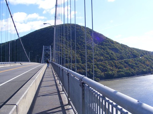
Where The Incident Occurred

October 21-26 2009

We left the free dock at Great Bridge in time to make the 0700 bridge opening. Less than 100 yards through the bridge we pulled into the fuel dock at Atlantic Yacht Basin to take on fuel and water. We knew we needed to get the water hooked up right away because on the way north when we had stopped here to get fuel and water the water flowed so slowly it took forever to fill the tanks. AYB employs an interesting strategy with their water hose. The measly little 5/8” hose is so kinked and worthless no one would ever be interested in stealing it or accidentally taking it with them. While we have our own water hose that we use to enter the boat and hook up to our tank we still have to use their hose to get over to the boat.

So, I monitored the water tank while the guys took care of the diesel fuel. On August 8 we paid $1.97/gal. and this time we had to pay $2.43/gal. We only took on 250 gals, but that, and what we already had in the tanks, will get us back to the home dock. I never did get to finish topping off the water tanks; we would have probably had to stay there until lunch for that. I shouldn't complain since the water is free.

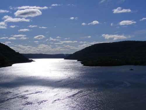
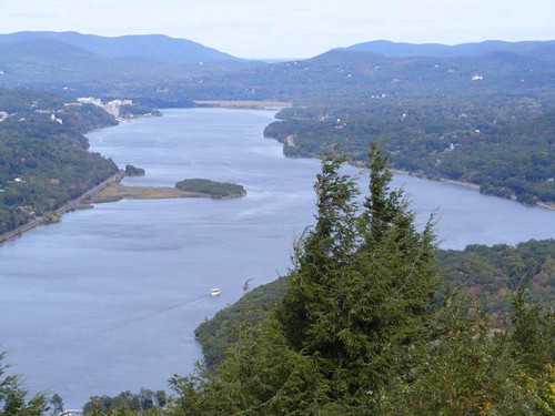
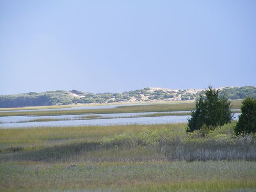
We had clear skies and no wind to make our run through the marshes of Virginia, Currituck Sound, Albermarle Sound and then into the long stretch of the Alligator River. I like traveling through those areas under good conditions. It is peaceful, scenic, and if it isn't the weekend, boating traffic is not bad.

We ran until dusk, and since there was no wind, we just pulled off the main waterway by Red 28, north of the beginning of the Alligator Pungo Canal, and dropped the hook. 14 other boats were anchored within a couple of miles from us. We tied a trip line with a float attached to the anchor. The area has a lot of sunken logs. If our anchor was to get caught on one we may not be able to pull it up with just our windlass. Using the trip line we would be able to grab the line and pull it in a different direction and hopefully free the anchor from the bottom.

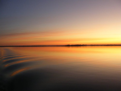
With no towns in the vicinity, and surrounded by miles of swamp, the night sky was the blackest black. The stars showed up brilliantly in the clear sky. A crescent moon slipped out of sight, leaving the night to the stars alone. A beautiful sunrise greeted the glassy waters of the morning, reflecting the colors of the sky and the silhouettes of the trees along the shore. We were relieved not to have to use the trip line as the anchor came up with no problem.

Double The Pleasure
Double The Pleasure

When we rounded the southern point and entered into the confined waterway at the beginning of the Canal mist clung to the gnarled cypress trees and low lying swamp vegetation. I love that habitat, and always think the mist gives it a magical quality. The morning is a buzz of activity, and if you keep an eye out you will see a variety of wildlife. We have always seen at least one bald eagle in the neighborhood. We had a big surprise on this trip to see a pod of dolphins. The swamp is freshwater, and Albemarle Sound is 25 miles away, and then it is another few miles to the ocean.
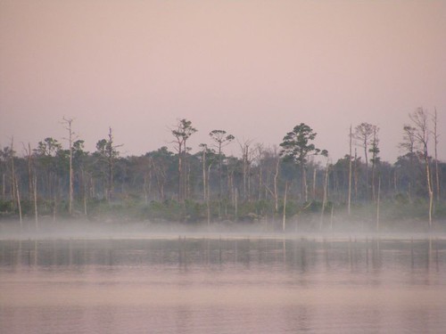
Magical Mist
Magical Mist

Since we wanted to get an early start and the waters were calm, Wayne made pancakes underway. It was one week ago that we had pancakes, and Eddie had lost his in the Potomac, so he was looking forward to enjoying the new batch. Unfortunately half of Eddie's and mine were raw in the middle, so we will wait patiently until next Thursday when pancakes will be on the menu again.

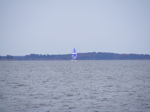
We didn't pass this sailboat until the mists had lifted. Maybe this Halloween maiden hoped aboard when they weren't looking. She is colorful, but the best waterside decoration I saw was at a marina: a blowup Harley motorcycle being ridden by an evil looking skeleton!
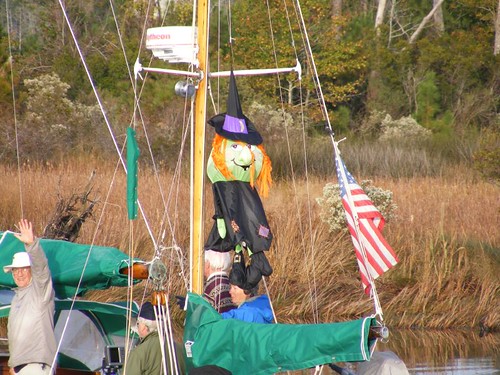
Halloween Stowaway
Halloween Stowaway

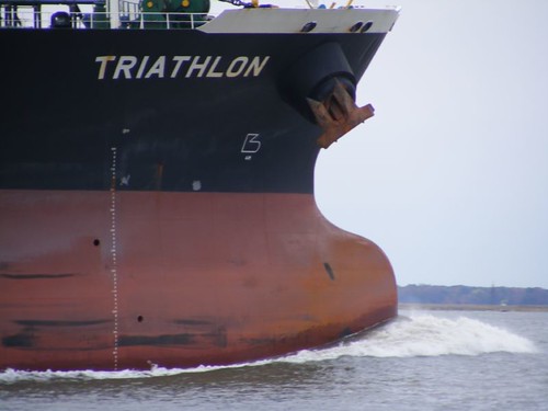
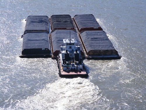
We could have thought we were in a horror movie when we finally caught up to a tug towing a dredge and all of its equipment that we had to pass in a narrow section of the waterway near Hobucken, NC. The whole rig was at least 300 yards long; I called it THE BEAST. The huge dredge unit required a big tug to pull it, but 4 little tugs were also needed to help push all the nonpowered equipment in the correct direction whenever the waterway curved. We had to wait for the rig to go through a bridge that had a curve beyond it, so we were able to watch the little tugs in action. Two of them had to help maneuver the long dredge, and two had to deal with the long string of piping. They looked like worker bees diligently attending to the big queen bee. When the rig was running straight again, Wayne called the tug captain to coordinate a pass. He gave us as much room as he could, but we had to go far to one side where the water under our keel was only 1.5' deep, and the depth alarm went screaming. The powerful tug props generate turbulence that tries to pull FLUKE into it. Lots of anxiety until the pass is over. Since the tug captain runs the rig 24/7 until he reaches his destination, we had to pass him again the following day, but it was in a much more open section of water. Wayne asked the captain where he was going, and the captain said Jacksonville, FL We wished him luck.
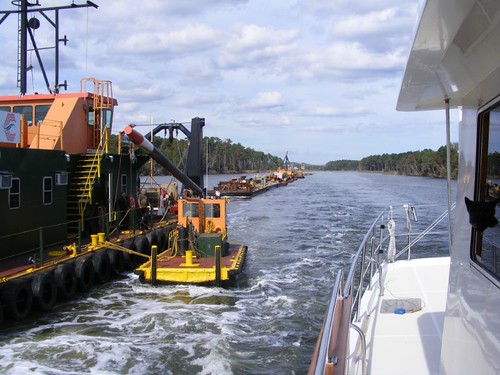
The BEAST
The BEAST

In the photo you can see part of the big dredge which is connected by a towline to the main tug, not visible in the photo. You can also see two of the little tugs on our side, one right next to the dredge. Ursa is sticking her head out one of our windows to see what all the commotion is about.

When we reached the area near Beaufort, NC the weather forecast was not favorable for us to be able to go out the inlet and travel offshore to Wrightsville Beach, NC where we could safely enter another inlet to anchor again. That meant we were stuck having to go down the ICW if we wanted to keep moving. It had been several years since we had last taken that route, so we decided to give it a try. We are such boating morons at times.

One of the big problems about traveling along the coastal area is trying to deal with the areas where the inlets empty right into the waterway. They are constantly filling in the ICW, and dredge funds are not readily available to keep the ICW adequately cleared to reliable depth. You have to be really careful if the tide is low or flowing hard to where you can get pushed onto a shoal or sandbar.

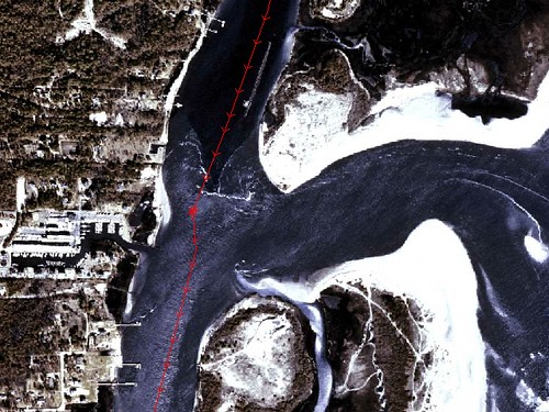
As we were approaching Carolina Beach Inlet we were watching the sailboat ahead of us. He said he was getting into shallow water. Eddie was at the helm and saw him bump hard. We could see we were getting in shallow water too, so Eddie slowed down to try to find the deeper water and not run up on the sailboat if he became stuck. The tide was coming in fast and pushed us to the far side of the channel onto a sandbar. The satellite photo at the beginning shows our track, marked in red, coming from the north and the spot where we went aground and then our track heading south again. On the right hand side you can see the opening for the water coming into the ICW, and on the left you can see a big sand bar. We sat there for about a half hour until we were able to get free again by using our bow thruster to try to spin our bow into the incoming tide and wind and get as much water under us as possible.

We were lucky the tide hadn't been falling or we would have had to call for towing assistance or wait 6 hours for the next tide change. We probably scraped the paint off the bottom of the keel where now barnacles will be growing, but at least no damage was done to FLUKE. It was particularly humiliating since one of our sister ships, ALLEGRIA, went by, and Greg and Susan couldn't do anything to help except offer sympathy and tell us about some of their grounding experiences. They said they had just been warned about the area by a tug& barge they had passed that was also headed our way. We REALLY didn't want to be sitting there when the T & B arrived. There would not be enough room for both of us! The T & B ended up running aground in the same spot after we left anyway!!! The flood tide caught him and pushed him to the side just like us. Later on we could hear him talking to the captain of THE BEAST, telling him to wait until slack tide before he tried to get his rig through the area. We had our depth alarm go off a couple of more times in other stretches, but we didn't touch the bottom a second time.

It didn't take long again to realize why we hadn't been that way in a few years. Boating traffic was heavy, cruisers and weekend locals. You had to worry about being waked and always watching for small boats zipping back and forth, weaving between other traffic. The ICW channel near Lockwood's Folly inlet and Shallotte's inlet, NC was jammed with fishing boats, netters and pole fishers, trying to catch a species of fish that was running heavy with the tide. We had to pick our way through the mess, and it was dangerous.

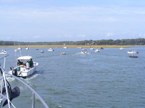
Clogging The Channel

We heard the southbound T & B that had run aground at Carolina Beach inlet call the Coast Guard to tell them that a northbound vessel had told him that the channel was blocked by the fishing boats at both of the locations, and he wanted the CG to clear the channel before he got there. The CG seemed to be hesitating, so we got on the radio and said it was really true and that we had had a difficult time getting through the crowd, with FLUKE only being 18' wide. The T & B was 250' long and 56' wide,and he was fully loaded to 17' high. We could hear him issuing a security warning announcing the areas he was approaching and that vessels needed to clear the areas. When he was 5 minutes from Lockwood's Folly he announced he was approaching and a nervy fisherman got on the radio and said “What is your authority?” The tug captain gave him the specifications of his rig and added that he had limited maneuverability. Since we didn't hear any maydays we assumed the CG had managed to clear the channel.

Bridges are a real problem because most of them have timed openings, some just once/hour. If you miss the opening you have to wait in traffic, wind, and the current. Maneuverability is limited in the tight quarters, and it's stressful having to drift for so long. Timing your approach to reaching the bridge is complicated by shallow water, traffic, and currents as you pass the inlets. Fortunately high rise bridges have been built to eliminate some of the old ones that require waterway openings. However, this dreadful little relic of a pontoon bridge still exists at Sunset Beach, NC. It only opens on the hour. That is assuming, they can get it open. If the tide is too low, the bridge can't be pulled over to the side to let the boats through. The picture shows our sister ship, ALLEGRIA, passing through. What looks like a pile of junk on the right hand side of the picture is really the bridge.

Passing The Relic
Passing The Relic

We were trying to reach another bridge that only opened on the hour, and it was going to be borderline. We had the engine revved up the highest we had ever had it. 5 go fast boats needed to pass us, and they were worried about getting to the bridge too. We decided to tell them to pass on plane, without us or them having to slow down at all. We figured we would let our stabilizers “save” us from rolling and we would carefully turn into their wakes, reducing the roll. 4 of them passed with minimal roll. The 5th one slowed down a bit and then sped up as he was right beside us, creating a huge gaping hole in the water right next to us. We crashed down into it, just like a gigantic ocean wave. FLUKE rolled violently as we all held on tightly, and we could hear things crashing down below. Eddie's TV had flown off the desk top and slid on the floor. Somehow it still worked. We managed to make the bridge, but the 2 sailboats trailing behind weren't close enough, and even though they begged the bridge tender to leave it open longer he wouldn't. They would have to wait another hour.

ALLIGRIA was leading the way when we came up to the Barefoot Landing swing bridge. Greg called the bridge tender on the radio to find out what his opening requirements were (he was on demand) and also what the water clearance was under the bridge and that both of us would need to get through. The tender told him that the depth was 31.5', and Greg said he needed 31' to get under. The tender said “You should try it” and Greg said “That's cutting it a bit close, and I could damage some equipment if I touch”. The tender said “This is a busy bridge. If I have to open it it will hold up a lot of traffic, so you should try it” I got on the radio and said “We are the second boat, and we need 34', so you're going to have to open it anyway”. Then Greg said “I guess that settles it”. Then the tender wanted our boat names and hailing ports, so we are probably being added to some new government dissenters list.

The coastal ICW is not all terror and no pleasure. Some of the scenery is just beautiful. The coastal dunes and vegetation are fascinating, and I never tire of looking at them no matter how miserable or frustrated I get with the waterway traffic. You can see the ocean and hear the roar of the waves in several places. Looking across the open golden marsh areas and tidal creeks is a pretty sight.

Serenity Of The Dunes

It is important to look high and low, in the water and on the land because you never know when nature will treat you to a special surprise. We have seen so many golden eagles and bald eagles on this trip, usually flying or perched in trees, so seeing this pair on the ground was interesting.
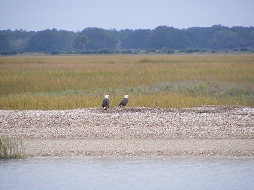
Marsh Watch
Marsh Watch

It is a surprise to see the Camp LeJeune firing range sign for the first time and think what an odd contrast to the peacefulness and splendor of nature all around it. We were lucky that no live firing exercises were in progress and we didn't get held up for that too.
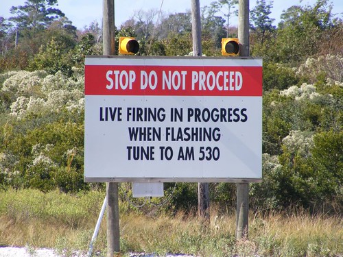
Keep Your Head Low
Keep Your Head Low

You can easily see several of the practice targets that get fired at. They are old pieces of equipment riddled with dents and bullet holes, sitting out in an open area.
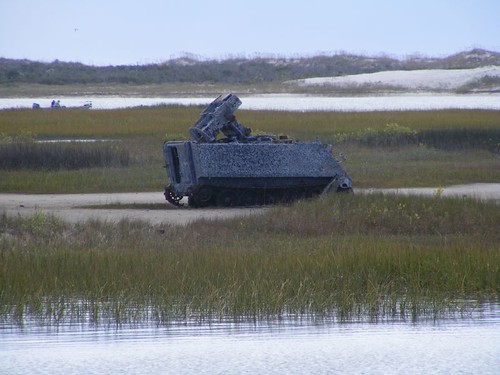
Recycled Equipment
Recycled Equipment

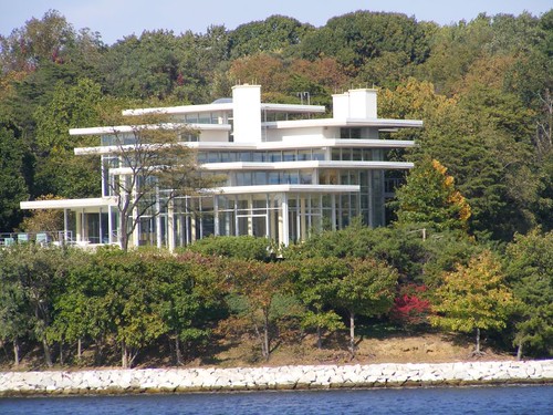
I enjoy looking at the waterfront homes and developments. We all have different tastes here in the U.S., and that is apparent in the variety of our homes. There is something to suit everyone's tastes, but all the homes along the waterfront in these areas command a high price tag. We have seen residential docks running out to the deeper water that are over ¼ mile long. Everyone takes a picture of this bright house, no matter if they like it or not since it sits all by itself and is so glaringly obvious.
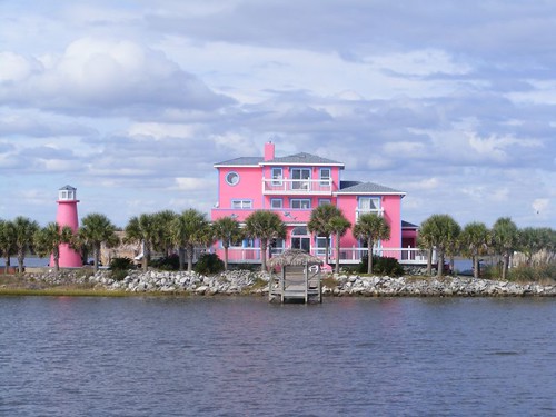
The Pink One
The Pink One

In previous postings I've included some photos of yard art that I've found interesting for one reason or another. I would like to know the significance of putting a creature like this in the backyard of your expensive waterfront home since we're not in Africa or close to any zoo.
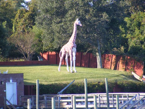
Waterfront Vigil
Waterfront Vigil

This fanciful aquatic creature is more my idea of keeping within the boundaries of the seaside art category.
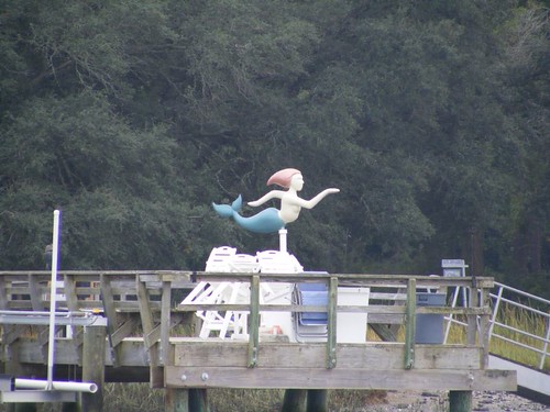
Go That Way
Go That Way

Dealing with passing wakes is very frustrating for waterfront residents who want to try to keep a boat docked along the busy ICW and not have it get beat to pieces by some of the tidal wakes. One resident “hired” this gentleman to try to help solve the problem.
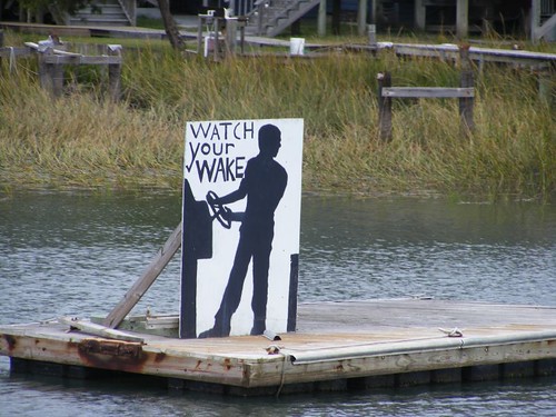
Working Full Time
Working Full Time

When we got close to the Myrtle Beach, SC area there were no anchorages that we could feel comfortable with to drop the hook, so we decided to go to Barefoot Landing Marina. It is part of a big outlet mall type complex with lots of places to shop, eat, and be entertained. Since we arrived late in the day there wasn't time for shopping. Eddie decided to treat the crew to a delicious pizza called the Big Kahuna from California Ultimate Pizza. While we were waiting for our take out pizza we stopped in at Bullys Bar and sucked down a cold draft beer. It hit the spot after having to listen to that bridge tender. We further eased our pains of a hectic day by visiting Maggie Moos for ice cream treats. Wayne and I had something called Chocolate Extreme that was even extreme by my standards. I never thought I could say that about any ice cream concoction, but this thing actually had too many M & Ms in it to go with the chocolate sprinkles, chunks of brownies, and fudge that were mixed in with the dark chocolate ice cream. Eddie had something that had a couple of kinds of nuts in it, and he said there were too many of those too. We recommend that you visit Maggie Moos and make your own rating.

Myrtle Beach waterfront has lots of houses, condos, bars, marinas, and golf courses, plenty to gawk at as you go by. One golf facility has its parking lot on one side of the ICW, and the golf course on the other side. You take an overhead tram high over the waterway so you can tee off.
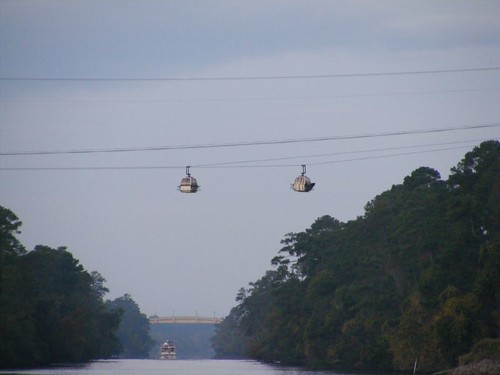
Golf Course Gimmick
Golf Course Gimmick

In previous postings of our other adventures through the Carolinas I described the fascinating parts of the waterway in more detail regarding the communities along the way. There is so much to see if you are lucky enough to be traveling at a leisurely pace like we do aboard FLUKE. Hilton Head and Beaufort,SC areas provide a lot of rubber necking opportunities. No stopping for us this time, though.

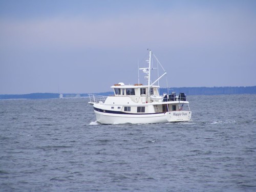
Despite several days of cloudy and misty weather, we continue to have a super time, just like this boat we passed south of Beaufort, SC.
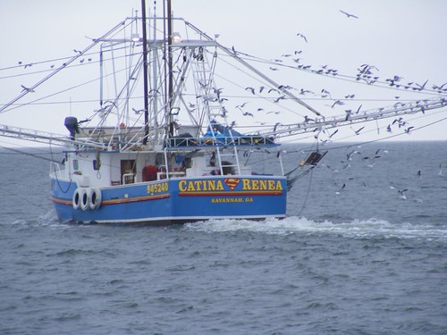
Super Shrimper
Super Shrimper

We're hoping to try to get out in the ocean to avoid the shallows of the Georgia ICW and the same perils that we faced in the Carolinas.

Tuesday, October 20, 2009

ROUGHING IT ON CHESAPUKE BAY

October 13-20, 2009

We had an uneventful trip through the C & D Canal. The same overcast, dreary weather stayed with us, but we had low enough winds not to have conditions made even worse (that would come later).

One odd happening occurred after we had exited the canal. The Aberdeen Proving Ground lies just north of the west end of the canal. I've written before about going by there and seeing explosions of varying sorts in the distance, on land and in the water. This time we could hear the explosions and then really feel the shock waves hit FLUKE; it was like a big dull thud on the boat or like someone pounded on the hull. One time we heard a huge explosion, didn't think anything unusual about it until a big wake wave rolled by us. There wasn't another boat anywhere we could see, so we assumed we got hit by a shock wave from one of the underwater detonations.

Baltimore Light
Baltimore Light

Our first anchorage was up the Magothy River, in a cove area known as Broad Creek. To reach the entrance to the river you have to go by Baltimore Light. Compared to some of those beautiful lighthouses we saw on the Hudson River, Baltimore Light is not too glamorous, but it is unique in its own way. However, of its type, it is one of the better preserved ones on Chesapeake Bay and it marks not only the river, but the big ship's channel going up towards Baltimore, where it has guided ships since 1908.

There were originally 74 lights on Chesapeake Bay, 30 of them still stand and 23 are still actively used as aids to navigation. Several of them look similar to Baltimore Light (but are mostly ratty looking), the last one constructed, but do not have its same history or exact construction features.

The three story octagonal brick cottage that you can see is constructed atop a 103' tall concrete and stone filled cast iron caisson designed to help support and anchor the structure in the soft mud bottom. The red base and house make up 55' of the visible height above the water. Another 82' of the caisson sits below the water, much like an iceberg.

In 2006 the U.S. Coast Guard held a public auction to sell Baltimore Light. The winning bid was $260,000. Restoration efforts are now conducted by Keepers of Baltimore Harbor Light, L.L.C.

Once we passed the light, getting into the anchoring area was easy. We dropped the hook right off the shore from this architecturally unique glass house. I thought the modern design blended in well with the natural setting, nestled amongst the trees with great views from all the rooms. It was very beautiful lit up at night too, with reflections of golden twinkles in the glass.

No Stones, Please
No Stones, Please

The next morning it was cold and drizzling; we had to get an early start, in the dark, to get all the way down to the Potomac River (85 miles) where we planned to anchor for the night before moving on the following day. Eddie got suited up for anchor duty, dressing in his full set of rain gear and boots. Wayne turned on the generator to run the windlass and wash down pump used when pulling up the anchor chain. Since the genset was on anyway, he also turned on the heat to take the chill off the pilothouse and run the 3 fans we had set up to help defog the windows.

Hauling up the anchor went smoothly, and we got underway as Eddie finished up the on deck chores of carefully stowing and tying things down properly. Wayne turned off the generator, like we always do when the deck wash is completed. Eddie came inside and had a temper tantrum when he realized the heat wasn't on any more for him to use to get warmed up with. I felt bad that we hadn't left it on a bit longer, so I told him to get the portable heater from downstairs to bring up to run for a while until he got warmed up. He didn't want to have to do that, so he went downstairs and brought up his “blankie” to cover up with, right over the top of his salty rain gear. He then pouted the entire rest of the day, only coming out from underneath the blanket to eat lunch.

Trying to Recover
Trying to Recover

The sun tried to come out and peek through the thin veil of clouds that persistently hung over the Bay, but didn't stay out long enough to make us feel comfortable. It was just another dreary day. Our spirits were lifted and we had a cheery distraction when we recognized a familiar shape and movement of a vessel approaching us in the distance. I squealed “Hey, look it's us!”. When the boat was only about a hundreds yards away I called out on the radio “That's a great looking Whaleback”. We exchanged pleasantries on the radio as we passed each other. HAPPY OURS was one of the Whalebacks we had tried to purchase before we bought FLUKE.

One Of FLUKE'S Sisters

A barge carrying gravel was traveling on a parallel course and similar speed to us so I could see it for many miles. On other occasions I have seen gulls getting a free ride on barges with gravel piles. It is a mystery to me why they do that. The barge travels much slower than the birds could fly to where they are going. Gulls are not particularly social birds trying to be friendly with each other when they are flocked together. They are not getting anything to eat off the gravel. I've seen them perched on fishing boats before, but that makes sense since they can get scraps of food. I have noticed that a lot of them are preening themselves during the ride, with feathers streaming into the water. Maybe they just think of the gravel pile as a protected spot to take care of personal business and the actual ride is secondary.

Taking It Easy
Taking It Easy

By late afternoon the wind had started to get gusty, so we were glad to turn up into the Potomac River and head into Smith Creek to drop the anchor in a nice, protected cove, well out of the wind. A bald eagle swooped down to greet us, and I could see 3 deer and a groundhog in a cleared field area on the shore. My idea of a nice anchorage which I would be longing for the next day.

Our first mistake of the following day was pulling up the anchor and leaving that nice, peaceful anchorage. Winds were out of the NW, coming down the Potomac, 20-25 with gusts up to 30KTS. We figured once we turned south we would only have a northerly component to the wind and we could take it pretty well on the stern. We didn't anticipate what would await us when we entered the area where the waters of the Potomac River intersected Chesapeake Bay. That area was like being in a washing machine. The second mistake was not turning around and going back to where we had been.

We had to go a fair ways out to avoid shallow waters to the south that prevented us from making a favorable turn to starboard to ease our ride. In fact, since we had high winds hitting us at 60 degrees off the port bow we turned more northerly into the waves to reduce the wave angle to 30 degrees even though it meant we had to go a longer distance. Seas were only 3-4' but the wind and chop was so awful it was difficult to get a smooth ride. One wave hit us from the side that threw so much water on the front windows it was green, not just a big splash of stray water and foam. It hit the roof and then rolled all the way down the port side of the pilothouse, emptying itself off the back deck. That was the most water I've ever seen hit the windows, even compared to some bad ocean conditions we've been through. Thankfully there was only one like that.

Visitor was the first one to throw up, on a rug, of course. Eddie knew then he was probably doomed to be next since the cat is usually a good indicator of what Eddie can take. While I was downstairs cleaning that up, Wayne's closet flew open, and a plastic storage container filled with a hundred bits of “stuff” spilled out all over the floor in the front cabin. Shortly after that poor Eddie lost the pancakes (and homemade maple syrup purchased from a farmer's market) he had eaten for breakfast over the starboard side. I tried to keep my food in my stomach, thinking of those peaceful critters back at that nice anchorage we had left behind. We all agreed our next order of business was to get off the Bay ASAP.

Fortunately our misery was abated when we could fully make our turn to the south and have the winds and waves off our stern for the most part. By the time we could finally anchor it had been 5 hours since we had left earlier that morning. During the next several days we would wish we had just kept going for the rest of that day.

We sought calm refuge up the Great Wicomico River, west of Sandy Point, nestled safely out of the wind. That is one of the great things about cruising in the Chesapeake; you can find many places to safely anchor in a reasonable amount of time.

Just because we had a nice anchorage it didn't mean that we would be comfortable. With the winds raging out on the Bay, warranting small craft and gale warnings, we couldn't get out of the river. We had to sit idle for 3.5 days: no sun, rain and mist all day and night, and damp cold, never getting above 55 degrees. We would run the generator midday for 1-2 hours to help take the chill off the boat and then again in the evening for 2-3 hours. When the generator wasn't running the warmest the boat would get was about 7 degrees warmer than the outside temperature. Several times we could see our breaths inside the boat. One day when I went to turn on the heater for our midday warming session the thermostat read 52 degrees.

My yachting “outfit” consisted of a heavy pair of pants, turtle neck, sweater, long, lined vest, sweatshirt, wool hat, and shoes and socks to wear inside FLUKE. The guys dressed similarly, and if we were just sitting still we would throw a blanket over our legs. If we had to go outside we would put on a rain jacket. We looked like we should be on a garbage scow huddled around a 55 gallon drum burning debris. At night I even slept with a blanket over my head.

The cold temperature wasn't just a problem by itself. Since the boat isn't insulated and has all the glass windows, condensation was a major issue. Water would accumulate so heavily on the windows, it would run down the glass or drip down from the frames. We had to squeegee a couple of times/day. The wiping towels would never dry no matter where we put them.

Jeff and Karen Siegel, founders of Active Captain, from Castine, Maine pulled into the anchorage the second day and dropped the hook. It was nice seeing their beautiful boat aCapella, a 53' DeFever, and to know our friends were in the same situation (the old misery lovers company philosophy). Neither of us wanted to launch our dinghies, so we promised we would hook up when they were in Vero later this winter. Their blog is at takingpaws.blogspot.com if you are interested.

We finally left the Smith Creek anchorage when the weather forecast dropped the gale warnings and the skies had hopes of clearing when we got underway. Even though 20 KT winds were still forecast, since they were out of the NW and we were going to travel down the west side of the Bay, we thought we could get a decent ride.

When we got out of the river right at sunrise we were so happy to see the sun's rays shining upward from behind a thin bank of clouds on the eastern horizon. We knew that we would finally have a sunny day. We weren't going to complain about the bumpy ride, and despite the cold air temperature, we were able to get some warmth in the pilothouse. No one got sick the whole day, and by the time we made it to Hampton Roads at the south end of the Bay, waters were fairly mild. This car carrier, an odd-looking ship, passed us in the channel. See how the precious freight is all enclosed.

Aquatic Parking Lot
Aquatic Parking Lot

When we made it to the Navy shipyards at the north end of Norfolk, the sun was in the western sky as bright as we had seen it in two weeks. The Navy yards and ships were illuminated the best we had ever seen them (usually we are traveling by them at sunrise and can't see squat).

Two Pairs
Two Pairs

Navy Art
Navy Art

We had decided to try to make it at least to downtown Norfolk and check out a couple of free tie ups we had read about: High Street and Front Street, on the west side of the river in Portsmouth. There is room for a few boats at each place, and even though signs say “No Overnight Dockage” cruisers have reportedly been staying there with no problems. I hope we do stay there for a day in the future whereby we could catch a ferry across the river and tour some sights in downtown Norfolk. The city looked the prettiest we have ever seen it with the clear skies and bright sunshine.

Waterside Norfolk
Waterside Norfolk

Both docking areas looked OK, but since we had made good time we thought we could go a bit farther and get ourselves in a position to get a better start the following morning so we could get through the Great Bridge Lock at the 0800 opening. To do that, we ended up tied up at a floating dock belonging to a shipyard almost at the intersection of the ICW and Deep Creek, the waterway to the Dismal Swamp Canal. We had traveled 88 miles that day.

I've written before about the Great Bridge Lock. It's primary function is to keep the fresh water
of the back country of North Carolina from the salt water of coastal Virginia. The 30 locks we had transited in NY were used to move boats through changes in elevation. The weather system we had been experiencing had caused extremely high tides, and the lock was having to be closed a few hours midday during the high tide cycle, wrecking havoc with southbound boating traffic The Coast Guard had been broadcasting that info over the last 3 days, so we were aware of what was going on. I asked a lock attendant why the lock had to close, and he said water was spilling over the top of the gate on the VA end, and they had no where to move the water.

There was plenty of room for us at the Great Bridge free dock since we had gotten there so early and cruisers from the previous night had already left. We had a hot breakfast to thaw out from the 36 degrees it was when we locked through. Then, we had enough time to do some grocery shopping (October special was 5% off the total bill for senior citizens on Tues. & Thurs, so we lucked out!), get some boat chores done, and take a walk to one of our favorite destinations, Dairy Queen. Banana splits were on sale for only $1.99. Eddie wondered if it would be possible to take an extra one back to FLUKE and freeze it. I think it is so weird how we had been freezing to death for days, but we couldn't wait to eat ice cream. However, I wasn't complaining as I sat in the warm sun slopping down my Blizzard.

We also had a great time watching the parade of boats that locked through subsequent to us throughout the day. One opening locked through 21 boats; just listening to the lock attendant giving the captains entry and positioning instructions was entertaining. One of the display plaques at the Great Bridge Lock Park says that the lock can hold as many as 20 boats, so you know it was really packed with 21.

They all have to jockey for position when they come out of the lock into the narrow waterway since the Great Bridge is only ¼ mile away, and the bridge tender starts yelling at them over the radio to hurry safely forward so he doesn't have to keep the bridge open and hold up vehicular traffic any longer than necessary. Once they pass the bridge they have to go by a huge marina, and they get yelled at again for going too fast past the fuel dock and moored boats.

Here They Come
Here They Come

From here forward the weather will dictate the route we take, i.e. whether we will have to travel down the crowded, sometimes shoaled, heavily bridged, ICW or take a short cut with overnight passages in the offshore solitude of the Atlantic Ocean.

Wednesday, October 14, 2009

DULL TIMES IN NEW YORK AND NEW JERSEY

October 9-12, 2009

The weather continued to go downhill (hah) after we left the Bear Mountain area. Cold, windy, and dreary conditions followed us south down the Hudson. I was feeling sorry for the cruisers we had spoken with that would be heading into the New York harbor area, not just because they were sailors having to be out in the lousy weather, but because the city's waterfront just doesn't look as exciting when the sun isn't shining on all the buildings. I didn't even take any Manhattan skyline photos since the skies were just so gray. As long as conditions aren't so bad to where they are literally making us sick, I try to find excitement by watching for anything of interest that may be new to us or things that will generate conversation.

Since it was early afternoon when we reached the area by the Statue of Liberty we took a short detour to a place called Liberty Landing, a small anchoring area west of the SOL. We didn't expect to be able to drop the hook back there, but many cruisers do. We followed the narrow channel all the way to the end and saw 3 small anchored sailboats. There may have been room for another boat, but we wouldn't have felt comfortable in that tight of quarters with the weather that was expected later that night. If you anchored there, here is a view you would have (Eddie was so fascinated to see Miss Liberty from her backside):

The Side You Don't See

I guess we were motivated by the explorations of Henry Hudson because we made another bold move and turned into the Kill Van Kull. This river runs around the back side of Staten Island and may be considered an alternate route to get to the Atlantic Highlands area if the Lower Bay area is too rough. We haven't talked to any other cruisers that have mentioned taking this route, but we weren't in a hurry and wanted to see what it was like.

From its entrance by Bayonne all the way to Perth Amboy, the area is a marine industrial area lined with loading docks and storage areas for freighters and tankers. It also appears to be a haven where fleets of the big working tugs are stored when they are not called into action for a hook up. All three of us always enjoy seeing the activities of a working waterfront, but you have to be on alert at all times for moving behemoths in the tight quarters.

BIG Fenders
BIG Fenders

This colorful tanker caught my eye. Notice how high above the waterline the ship is sitting. We didn't know if it was getting filled up or unloaded, but I'm guessing it was unloaded since we heard the ship conversing with a tug about moving shortly after we went by, and there would have been no way the ship could have gotten filled that quickly.

See My Point
See My Point

Kill Van Kull turns into Arthur Kill and then it empties into Raritan Bay south of Perth Amboy. By the time we made it into the Bay, it was too late for us to go all the way over to the Atlantic Highlands, where cruisers typically anchor behind a breakwater. So, based on the weather forecast we dropped the hook on the southwest side of Raritan Bay in a sandy area off a beach west of Keyport marked on the charts as a sewer.

We had a steady night, but a front moved through by mid-morning, bringing strong winds out of the northwest. With the long fetch across the Bay, the water in our area kicked up bouncing us around too much.

Since things had gone so well with the anchorage on the south side of the Bay, rather than move all the way over to Atlantic Highlands where we suspected there would be a big crowd, we decided to just move across the Bay and anchor on the north side where we would be able to get wind and wave protection from the south side of Staten Island.

We dropped the hook in a sandy area about a mile south of Great Kills Harbor, another popular cruising anchorage. We didn't bother to go in there because we had heard it was crowded, and we felt we would be comfortable out in the open area based on the weather forecast. Plus, we knew we could easily head out to sea in the dark the following morning after the winds had shifted to make our Atlantic Ocean passage safe and comfortable.

We were anchored off a beach near a residential neighborhood with homes of varying styles to say the least. This one home caught my attention because of the row of palm trees that lined the fence around the back yard. I am assuming the palm trees are just a summer planting as they would never survive a winter in that location.

Staten Island Palms
Staten Island Palms

We had the engine started by 0545, and were delighted to see some clear sky when the sun rose. Seas were fairly calm and the sun stayed out enough to keep the pilothouse comfortable. It was the first day we had seen the sun since our hike up Anthony's Nose. However, another front was on its way, so we decided to stop in Atlantic City, about 2/3 thirds the distance down the New Jersey coastline.

We ran for 11.75 hours to get to Atlantic City, and there was a stream of cruising boats going into the inlet, all having tried to take advantage of that small weather window. We had never stopped here before, so we were apprehensive about how much room would be available for us to anchor, but we decided it was time to finally check it out. This was our late afternoon view coming in the inlet:

Seaside Gambling Haven

5 windmills look odd amongst all the big buildings. It is fascinating to see this alternate energy source in this location.

Power For the Slots
Power For the Slots

Many communities do wonderful jobs decorating their water towers, usually a prominent feature in the landscape, and this cute one caught my eye:

High Flying Fish
High Flying Fish

The area we were headed towards is called The Pond, and it is connected to the inlet's main channel by a deep, narrow passageway, wide enough for about 2 boats to pass. We heard inbound cruising boats talking about how to enter and pass through the channel, which was very helpful to cruisers like us who had never done it before. You have to drive almost on shore on the port side of the channel when entering; it is as though you are trying to pick up some of the marsh grass, but the deep water extends all the way to the shore.

Once you make it through the channel, the area opens up into a nice sized anchorage. With all the boats there, 15, we only put out 100' of chain, but knew we had good holding and weren't expecting real strong winds. The views around the anchorage vary from condos, single family residences, to the skyline of the casinos. One of the buildings flashes an array of rainbow colors along the entire side of the building; it is very pretty at night.

The Anchorage View
The Anchorage View

Before Atlantic City got built up as a gambling center, its inlet, easy to navigate, was important for commercial and recreational boaters and required a tall aid to navigation, a lighthouse. That lighthouse still stands, but is no longer important for navigation purposes because it is dwarfed by the huge buildings, which are always shining brightly and can be see from farther out to sea than the lighthouse ever could be. Now the lighthouse just sits amidst the buildings, looking sadly out of place.

Off Duty
Off Duty

We left Atlantic City with a poor weather forecast in regards to us being able to go outside again down the Delmarva Coast as an overnight trip; we would be forced into traveling up Delaware Bay, across the C & D Canal, and then down through Chesapeake Bay. We debated about trying to wait for a weather window behind the breakwater in Lewes, DE, but none looked in the near future that would guarantee decent sea conditions. The best part about not having to make that run was not having to cross over the intersection of Delaware Bay and the Atlantic Ocean. The water there can be quite swirly and very uncomfortable depending on the tide with the powerful influences of both the ocean and bay colliding.

The offshore run from Atlantic City to Cape May at the southern tip of New Jersey was sloppy, but not bad enough to make anyone sick. It was a day without sunshine, cold, and just plain dreary. It was a relief to be able to get out of the ocean to cut through the Cape May Canal even though we generally don't like having to go through that area. It is too congested, the fishermen drive like idiots, and there is usually shoaling somewhere and/or there is a dredge operating.

Going up Delaware Bay can be a real challenge when the winds are bad and the current is against you. Even though it was gray and windy, the winds were northeast/east and since we were traveling northwest, they didn't make for a real bumpy ride. Plus, the tide was coming in, so it was giving us a big push, frequently giving us a 2-3 KT boost to get our speed up over 10 KTS (11.5 MPH). When you're doing double digits in a trawler you feel like you're flying over the water!

The day was just so dreary, like a dismal veil was draped over the whole waterfront. Late in the day, a sailboat appeared that had a brightly colored spinnaker. It was such a stark contrast to everything around it.

Light Up the Day
Light Up the Day

Delaware Bay is the main thoroughfare for ocean going vessels traveling to/from the Chesapeake via the C & D Canal or Philadelphia. It is very important to keep an eye out for those guys since they are moving wide open on the waterway and can't quickly maneuver to avoid smaller vessels like FLUKE. We usually travel just outside the main shipping channel, and keep our radio on the commercial shipping channel While it is easy to see the big guys approaching, it is also important to keep an eye behind us since we could easily be overtaken without realizing it. This fuel tanker went by closely; look at the wave he is pushing ahead of his bulbous bow.

No Contest For Us
No Contest For Us

We made such good time heading north we were able to get all the way to the Reedy Island anchorage before dark. It was our first time stopping there and a good time to try it out with the weather we were having. Reedy Island is a small spot of land surrounded by 10-25' water close to the western shore of Delaware Bay. A shoal area extends north of the island, and a man made dike extends south. There is a marker opening (you have to pay attention to the chart and look carefully) through the dike that takes you into the deep water anchoring area. The island, shoal, and dike all help to block down the wake and wave action coming off the Bay. The island and close proximity of the west/northwest shorelines help block the wind. We got safely tucked in and dropped the hook with good holding.

The Salem nuclear power plant provided a good reference for our location during the night since it is brightly lit. It is rather a dismal looking facility even with the sun out, but I found it particularly industrial and ominous looking on the dreary day we passed by. You can easily see the 3 reactor units, and the big cooling tower looks like it is spewing all the nasty weather we are enduring.

Watts Up
Watts Up

We are keeping our fingers crossed for a change in the weather as we head down the Chesapeake Bay. (Not so far!)

Sunday, October 11, 2009

PICKING ANTHONY'S NOSE


We're On Top of the Nose!

October 7-8, 2009

The water in the anchorage area at the base of Bear Mountain where we wanted to drop the hook was calmer, but the wind was still really howling when it gusted down between the mountains. The next day was supposed to be clear and nice, so we decided to anchor south of the dock for the night and stay with our plan to hike up to the top of Anthony's Nose the next morning if the winds calmed enough to where we felt safe to leave FLUKE unattended.

We had gotten anchored in the afternoon which would give us plenty of time to see how well we were going to hold before it got too dark to move somewhere else if we started dragging anchor. We clocked gusts as high as 40.6 KTS, but our 88# Delta and 200' of chain kept us in place. We saw a steady stream of cruising boats heading south. Imagine our surprise when we looked up to see this freighter loaded up with all the Dutch canal boats that we had seen when we went through Albany. In the background is Anthony's Nose.

Goodbye Dutch Beauties

There was a lot of water slapping the hull when the tide changed and the wind and the tide were going against each other. Fortunately we weren't anchored farther out toward the river where the current was even swifter. Still, it was so noisy I decided to sleep in the pilothouse where I would just hear the wind. Plus, if we started to drag anchor during the night I would be able to quickly start the engine and yell for the guys to come up to help.

When we awoke the following morning the winds had died down and the sky was so clear. The high temperature was only going to be around 65°, so it would be perfect for hiking up the mountain. We had even come up with a new plan to get to the Bear Mountain Bridge without having to break the park rules again by taking Ursa through the no dogs allowed area. Wayne thought we could just walk along the railroad tracks until we got to the base of the bridge and then climb up the side of the mountain until we intersected the park trail leading over to Fort Montgomery that we had used on our previous expedition.

We packed a picnic lunch, launched the dinghy without mishap, and docked at the floating dock next to the big fixed dock where people were fishing and crabbing. This time we even remembered to bring the lock to lock the cable from the dinghy to the dock!

We found a path through the brush that took us over to the tracks. It was easiest to walk right down the middle of the tracks since we could stand on the ties or the flatter big rocks in between. No trains came in either direction. When we reached the base of the bridge we could see a faint path leading up the mountain, so we tried that and meant with success in intercepting the Fort Montgomery trail. We back tracked on it up to the sidewalks on the bridge.

You don't walk very far until you see this sign. It is a really LONG way down to the water, and it is closer to the parking lot..

If You Need a Friendly Ear

It is also a LONG way over the bridge and is a cool, breezy walk, especially when it is early and the sun isn't shining enough to warm things up yet. The bridge intersects Anthony's Nose on the east side of the river and is visible in this photo.

High Walkers
High Walkers

The views from the bridge were so interesting in the early morning light as it was rising up on the sides of the mountains and reflecting off the water. This photo exposure makes for an interesting effect off the water, almost looking like it could even be ice as the Hudson River flows south. FLUKE is at anchor on the right side, all alone.

What Time Is It
What Time Is It

We saw several vessels of varying types and sizes pass beneath the bridge, but this one caught our attention. We don't get to see the tugs and barges from this angle.

A Big Six Pack
A Big Six Pack

When we finished crossing the bridge we were faced with two obstacles. The first was to try to figure out which way, north or south, the Appalachian Trail went once it left the bridge since we knew that the AT eventually intersected the trail we would need to take to get to the tip of Anthony's Nose. We would later see, on the return trip, where the trail marks for the AT were painted on the side of the mountain directly in front of the bridge, but were obscured by a patch of weeds. Once we guessed that we should go north, we had to figure out how to cross the highway to get from the south side of the bridge without getting run over. There are no crossing aids, and it is a weird intersection with one side being the rock of the mountain with no room to stand; you just have to wait and make a run for it.

The Appalachian Trail shared highway 9D for about a quarter of a mile before it began its way again up the side of the mountain, and the trail head was easy to find. We sure were surprised to see how steep the trail was to begin with. We had to climb for about 1.5 hrs mostly straight up the side of the mountain until we reached the intercepting trail. There were so many acorns on the ground in some places it was like walking on marbles, and you had to be really careful not to slip. Sometimes the rocks were just like stairs, but at least they were solid. The trail was clearly marked and well used, so there was no fear of getting lost. I must say it was quite a strain for Eddie and I compared to our hiking days of years past when we were much younger and more agile.

Rocky Stairs
Rocky Stairs

We had relief when we reached the trail to Anthony's Nose. It runs along the top of the mountain, mostly flat with only a few ups and downs. It was so beautiful walking amongst the trees with their falling leaves, wide open areas, large boulders, and cool temperatures. There was even a small pond in one area, nestled in the trees.

The Relief Trail
The Relief Trail

The high winds from the previous day had blown a lot of leaves , sticks, and branches off the trees and even blew over some dead trees. We were able to pass through all the debris easily. This tree caught our attention.

Checking To See If It Is Male or Female!

When we reached the end of the trail and were all the way out on the Nose's point we were not disappointed with the effort it had taken to get there. The view is breathtaking, from looking far in the distance over the other Appalachian Mountains, all the way down to the river and bridge below, and to the long vista to the south as the river winds its way through the other mountains. FLUKE looked like a little dot from our 950' perch.

The Mountain Vista
The Mountain Vista

This photo shows the west side of the bridge where our morning walk began way down below and many of the mountains in the distance. Bear Mountain State Park is to the left. We were told by some other hikers you can see the buildings of Manhattan from the top of Bear Mountain. That hike is on our list for the future, whether we arrive by boat or car.

Wayne used the video feature on our new camera to take a short panoramic video standing on the peak and scanning from the south until the view is blocked by vegetation to the north. Clicking on the image will play the video for you. Enjoy!


On Top Of Anthony's Nose

We found a sunny spot out of the wind to have our picnic lunch. We didn't have to have much conversation because it was thrilling sitting out on the very tip of the peak watching the world go by all around us. Plus, we were really hungry from the appetites we had worked up. I wish I could say we were dining with eagles, but we had to settle for the vultures, now at eye level, which were gliding effortlessly by us on the winds coming off the side of the mountain, a stone's throw from where we were sitting. We heard only the wind and the rustle of leaves.

During our ascent we saw a couple of side trails that warranted checking out. I thought this little trail was fascinating because it was so neatly lined with a thick moss border. You can see a lot of acorns on this trail, but they didn't pose any hazard since the trail was so flat.

The Fairy Highway
The Fairy Highway

Another side trail took us to a spectacular overlook that gave us a northern view up the Hudson River. We could see West Point (in the upper left), and several of the other mountains we had passed.

The Northern Vista
The Northern Vista

Gravity was our friend as we wound our way back down the mountain to the highway. Back across the bridge, down the mountain to the railroad tracks and back to the dock. The dinghy was still safely locked up and hadn't been molested and we made it safely back to FLUKE who had been in our sight most of the day, although from quite afar.

It was a grand day to remember with a sense of accomplishment and wonder. Plus, I carried two pieces of quartz in my pocket, souvenirs that I picked from the tip of Anthony's Nose, which I called the two boogers!