Peeping into Eden
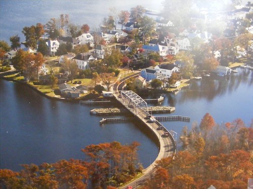
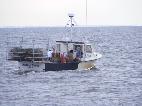
Since it was Sunday morning, the S-bridge didn't open up before 8:00 a.m., so we had plenty of time to wake up and get ready to leave our lovely, peaceful swamp. By the time we rounded the bend and had the bridge in sight it was just before 8, so we radioed the bridge to request the first opening. The cheerful operator replied, in one of those friendly Carolina accents, that he had been waiting for us and just to bring her on up and he would open the bridge.
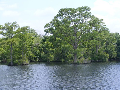
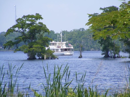
Our trip back down the Perquimans River was uneventful; the action didn't take place until we got back out on Albemarle Sound. We were overtaken by clouds of these midges, mostly ephemeral, nonbiting insects. However, before they mate and die off, they poop a lot and make an awful, green slimy mess. They were all over any lee area on FLUKE, by the thousands!

Being bugged
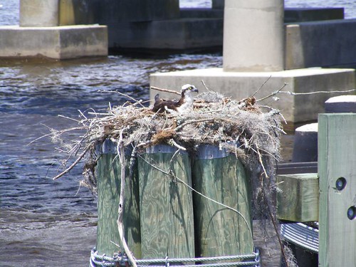
We passed under a very high set of power lines. These cormorants took advantage of the height and remoteness of the support structure to find safe, affordable housing.
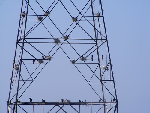
Cormorant condo
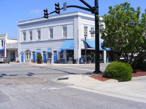
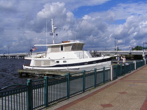
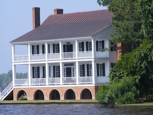
By midday we were pulling into the Edenton, NC town dock. One of the great things about this facility is that you can make online reservations ahead of time. For us, that was critical because FLUKE could only fit on the t-head at the end of the dock because her beam is almost 18'; the slips are designed for narrower boats. There are very few, if any places to anchor in the vicinity, so we would have been stressed to find somewhere to go if we came this far up the Sound without a reservation. The town allows boats two nights at no charge and then additional nights are only $1/ft. 50 amp power is only $6/night and free water is available on the docks. We signed up for 3 nights. Within half an hour a pair of sparrows visited us, filling their beaks with the midges (despite Eddie have rinsed off the boat) on every return trip back to the boat. They picked bugs from everywhere they could, including looking up under the bicycle seats! Obviously we weren't the first buggy boat to land in their town.
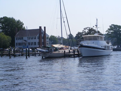
FLUKE at Edenton town dock
The town docks are protected by a large breakwater, a necessity since the whole area is open to the south and the winds blow in with a ferocity that slams the water into, and through the breakwater making lots of noise and even creating quite a bit of water movement within the breakwater. Secure lines and boat fenders are critical and need to be checked frequently.
The town dock area affronts a popular waterfront park, and there are always local people and tourists walking, picnicking, fishing, or just people watching. One of the newest attractions is the Roanoke River lighthouse. The exterior has been restored and is still awaiting some interior finishing before it is placed in its new permanent home, right there on the waterfront.
The lighthouse was originally built in 1887 and was one of the type of many that were used on inland waterways in the area. They were all built on a type of screw pile that elevated them over the water, and this one is believed to be the last of its kind. The lighthouse was decommissioned in 1941 and purchased by a private individual in 1955 to be moved and used as his residence for 50 years. Upon his death, the Edenton Historical Commission purchased the lighthouse to spearhead its very expensive restoration.
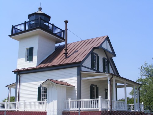
Roanoke River lighthouse
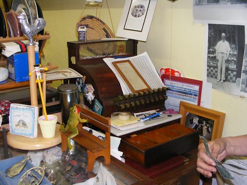
In the picture of FLUKE at the dock, the Barker House (1782), home of the Eden Historical Commission, is visible in the background. This is open to the public and is staffed by very friendly volunteers who have a wealth of information about Edenton's history and present day goings on. There are informative historical displays, a gift shop with fabulous books, and to my complete delight, a real screw pile. The FLUKE crew had had discussions about what these might be since we had never heard of them. This one doesn't include the metal casing that would have gone on the tip to help get it into the river bottom.
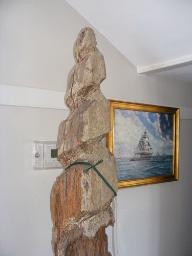
A screw pile
The Barker House is a great place to sit in one of the rocking chairs and catch a breeze from Edenton Bay and view the lovely waterfront residential homes or read your travel brochure and plan your walking tour of the town.
Barker House
There is also a Visitor's Information Center located within walking distance in the opposite direction of the waterfront. It is worth a stop so you can see a 15 minute video giving some history of the town's original development and its key citizens and their significance to the country's fight for liberty and independence. The town was incorporated in 1722 and named to honor the recently deceased governor, Charles Eden. Because of having a decent harbor and access to the Atlantic Ocean via Roanoke Inlet, the town flourished as a port of entry and an important trading center and colonial capital with connections to the other American colonies, the West Indies, and England. Goods were shipped in and out providing wealth and jobs to the area. That history is still evidenced today by the many grand homes and churches that are wonderfully preserved. The cemetery at St. Paul's church (1736) has many lavish, artistic tombstones that must have cost a fortune even in their day. I think this is one of the most elaborate; it is located in a private family plot area. Each of the four upper corners has a different face. Notice the intricate stone carving work over the top area. It is built like a gazebo with a female statue standing inside.
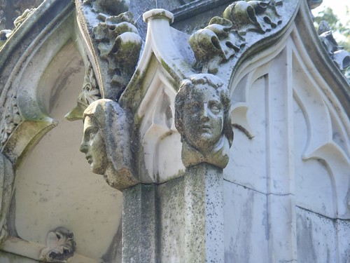
Tombstone art
Edenton has a bit of political notoriety to its history. In 1774, Mrs. Penelope Barker (the Barker house) organized a group of 51 women to hold what was known as the Eden Tea Party. They had agreed to support their husband's stands on taxation without representation as proof of their patriotism to the cause. They resolved not to drink any more tea or wear any British clothing. Unfortunately, organized women's movements were not in vogue at the time, so were not taken seriously by even their fellow colonists, mostly because they were men who had hang-ups about those activities for women.
Harriet Ann Jacobs, an Edenton black woman born into slavery in 1813 became a writer and abolitionist. In 1842 she escaped to freedom from Edenton via the Maritime Underground Railroad. You can read about her and other people of historical significance on the many information signs located throughout the town.
One of the most photographed dwellings is the Cupola House (1758) because of its distinctive Jacobean-Georgian architecture and beautiful gardens in both the front and back of the house.
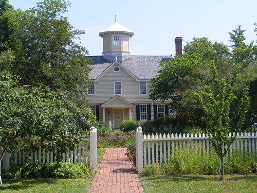
Cupola House
Mother Nature, shifting economics, and politics led to Edenton's decline as a commerce center. Roanoke Inlet got silted in by the 1795 hurricane, cutting off the town's ready access to the sea. Opening of the Dismal Swamp Canal in 1805 diverted river commerce to Norfolk. The community opposed railroad development, further hampering jobs and the distribution of goods. Fortunately the Civil War bypassed Edenton, allowing many of the architecturally unique homes and buildings to be preserved in their original state.
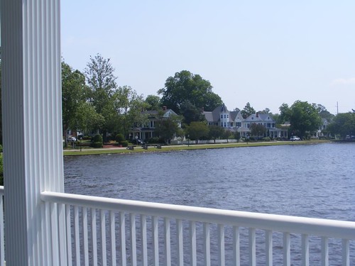
Residential waterfront
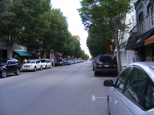
Today's main street houses businesses and restaurants in many storefronts from the late 1800s. Bloomingdeals, an upscale consignment shop, proved to be my favorite. We got a delicious pizza from Kristy's, a restaurant specializing in Italian cuisine.
Edenton is home to one of the oldest (1863) fish hatcheries in the U.S. The U.S. Fish & Wildlife Service produces warm water species of shad and striped bass for restocking public areas. When we heard the facility was only 2 miles outside town we decided to ride our bicycles to take a tour.
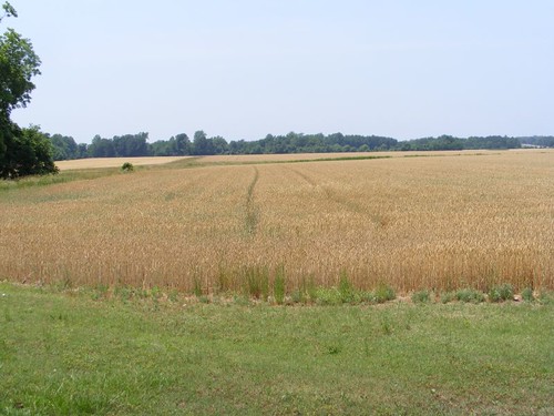
Amber waves of grain
We sure were surprised to see wheat fields right on the edge of town.
The fish hatchery is open free to the public, and you are on your own to view the buildings and grounds. The main building has aquarium displays with freshwater species of fish found in Eastern North Carolina. The hatchery ponds are in various states of use or maintenance. They are drained to remove the fish for relocation and then left to dry to help reduce disease organisms.
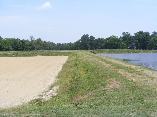
Hatchery ponds
Notice that there are no fenced areas around the ponds so you can walk right up to the edge to look in. People are urged to exercise caution, but are still left to their own accords, with the assumption that they may actually use common sense and not fall in. That trait must be something endemic to this state since we first heard about it with the railroad track situation in New Bern. If that could be marketed for other parts of the country it could help reverse the dumbing down of the population and the need for a Nanny State.
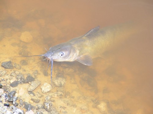
Hoping for some Little Friskies
Wetlands preservation and education are a big environmental concern throughout the country. The facility has a short nature trail that lets you take a raised boardwalk through a natural wetland that overlooks Pembroke Creek. There are elevated duck boxes placed on the opposite side of the creek since the facility is part of the North Carolina Birding Trail. Notice the cottony catkins (probably from a poplar) littering the walkway.
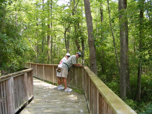
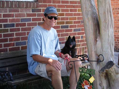
Two cool guys
The hatchery is also a repository site for oyster shells. They are placed inside big yellow collection bins.
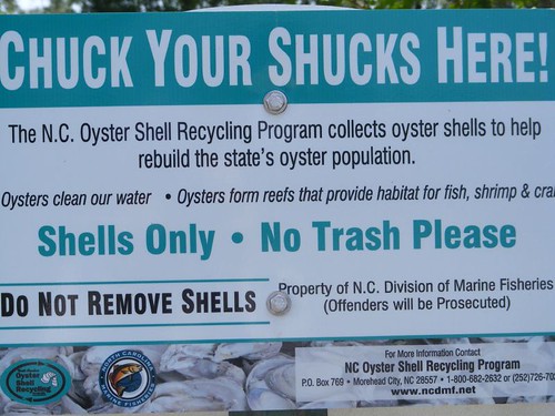
Be a good shucker
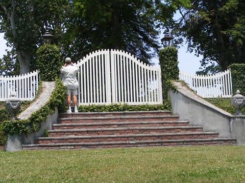
We had one more bike riding adventure not mentioned in any of the tourist information literature. One of the locals who frequents the waterfront told me we should not miss a ride out to Hayes Plantation, the beginning of whose property lies just outside of town. He said to ignore the no trespassing/private property signs by the big gate to the property and take the walking entrance to its side. So, that's what we did early one evening. The Hayes Plantation comprises 1000 acres of land, the whole tip of one peninsula and has been in farming types of various sorts since the colonial days. The paved road goes through forested land, fields of wheat and sage, past the original gatehouse and slave quarters, and ends in a small enclave of private, modern homes (obviously developed to help defray costs of maintaining the plantation). The plantation house is nestled in a heavily treed area and is barely visible from the road. It was great to see the lavender-colored sage fields in the peak of growth and the field irrigator slowly creeping along through the rows. These plants stand about 2' tall and are more fragrant flowers than leaf material. The ladies at the Barker House had told me that sage is a modern day crop profitable for use in the perfume industry. Bluebird boxes are set amidst the roadside brush, and I got to see a pair of bluebirds! I am a strong advocate of taking the road less traveled in case you haven't guessed that by now.
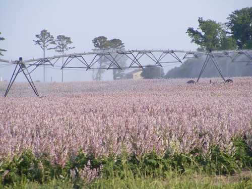
Irrigating the sage
You will see that last thought reflected in the next chapter too.
Saying goodbye from a nice spot on Pembroke Creek, I am
Mistress of the blog