OLD LYME, CT TO EDGECOMB, ME
This 2006 Voyage North update posting is taking place on September 6. If everything had gone according to plan I would be writing about an uneventful departure from Old Lyme Marina and our trip eastward out of Long Island Sound.
Remember, for the first time in our boating lives "we don't have a plan and we're sticking to it". That proved to be the case after the last posting, announcing we were leaving OLM on August 15. Ordinarily, that philosophy is designed to minimize our troubles, maximize safety, and let us have more fun. So, our story continues as follows.
COLLISION COURSE
Log date: August 14, 2006
If you looked carefully at the photos posted of Old Lyme Marina, with FLUKE in the middle, you would notice that all the other boats around us are sailboats. I mentioned that OLM is not a marina used by transient cruisers of our "kind", i.e., large power boaters. Most of our kin elect to go up the river about a mile to the town of Essex, CT, much better known for cruising dockage.
Well, sailboats and powerboats behave differently at anchor or on a mooring because of the shapes of their hulls and even top decks. FLUKE is even odd for a powerboat because she has both a very deep keel and large top deck, with lots of windage. Our neighboring sailboats first responded to the wind and then to the current, while FLUKE responded to the current (very swift through OLM) and then to the wind. While we had been at OLM for the 2 weeks we watched this behavior many times over, noticing that the sailboat to our south (named Dovekie) would seemingly come very close to us. We foolishly assumed that the OLM operators knew what they were doing when they assigned us our mooring.
Wayne and I were at the library getting off the last posting. Eddie was out making final social rounds. He arrived at the marina midday, as the winds had begun to pick up, blowing quite hard out of the south. The tide was going out, also headed south, so the water had developed quite a bit of turbulence with the wind and tide going against each other. Eddie looked out to see FLUKE's stern locked up with Dovekie's stern. Dovekie was being dominated by the wind, and FLUKE was still responding to the outgoing current, so the two boats were pulling on their mooring balls in the opposite direction, making them come close together. Eddie quickly jumped into the dinghy and went out to see what could be done. He managed to unhook the sterns, but Dovekie had already taken a thumbnail size piece of gelcoat out of FLUKE's portside transom.
Wayne and I showed up just as Eddie was returning to the dinghy dock to report what had happened. We all immediately went back to FLUKE as the weather was getting worse. As Wayne was on the bow checking our mooring line, Dovekie surged forward, having been forced by the current to turn around, and came at us bow first, smashing into our portside cockpit caprail. Doviekie's bow has a large pulpit that protrudes quite a ways forward, so it looked like we were getting harpooned! Eddie had already put our large fenders in the cockpit, but we couldn't act fast enough, and the situation was very dangerous, as Dovekie was surging forward multiple times, once actually passing us on the port side, forward of our entire cockpit! She could have smashed through the port side salon windows or those going out to the cockpit.
By this time, two marina employees had shown up with a workboat and could see the dangerous situation that had developed. One of them owned the sailboat on our northern side and decided to move his boat for fear that the same thing could happen when the tide changed or conditions worsened. They told us we could move to another mooring, but we told them it was too dangerous for us to try to move a tank like FLUKE under those weather conditions in that tight anchorage where our maneuverability was so restricted. We asked them to move Dovekie, which they did.
We went to sleep feeling as secure as we could under the circumstances, but happy no other boats were around us. However, at 2:00 a.m. we awoke to the sound of a motor going by our hull! Keep in mind, there were smallcraft warnings and the description of the currents at OLM and it was pitch dark. We went out on our foredeck to see a sailboat trying to pick up the mooring to our south. We could see it was a struggle for him, but we had to yell at him not to pick up that one for fear we would have the same thing happen again. In the calm of the next day we told him our story.
Old Lyme Marina assumed responsibility for the collision and will repair our damages when we return.
HAPPY BIRTHDAY
August 15, 2006, Ursa's 8th birthday. Smallcraft warnings prohibited our departure from OLM. We rendezvoused with Charles & Louise at an old time ice cream store (from Eddie's childhood!) to return Charles' truck and pig out on ice cream, an internal salve for soothing our wounds of the previous day.
HEAVE HO, BUT NOT OVERBOARD
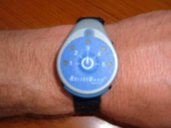
We successfully departed OLM at 0600 on August 16. Seas got a bit rolly after we cleared Point Judith, RI and were out in the more exposed areas of Buzzards Bay. None of us do side to side rolling very well, so we had to deploy our seasickness remedy, the Explorer Relief Band.
We are all skeptical of gimmicky devices that are supposed to solve medical maladies, but the ERB really does what it says it will do. I would have never tried the item (retails for about $100 on sale) except I read an article in a boating publication written by a man who was extremely prone to both seasickness and car sickness, and his first hand account motivated me to give it a try. The ERB was first developed for use by pilots and then spilled over into its other uses. Apparently it works on some of the same principles as acupuncture, stimulating a nerve that runs through the wrist area that is responsible for nausea resulting from pregnancy or motion sickness. Some accounts have indicated it may even help for nausea caused by chemotherapy drugs. It sure works for all three of us, so much in fact that we can even feel its effects by turning the band off, feeling seasick, then turning the band back on and not feeling seasick. Using this product is so much better than having to rely on drugs that cause drowsiness or those you have to worry about taking in advance. Eddie went into a state of panic when he thought his batteries died, and we didn't have any spares!
Our destination for the night's anchorage is Cuttyhunk, a small island within sight of Martha's Vineyard. It is an Indian word meaning “land's end”, perhaps because it is the end island of the chain of Elizabeth Islands that extends off the southwest end of Cape Cod. We are going to use this anchorage to stage our transit through the Cape Cod Canal tomorrow morning. Since we are having a late afternoon arrival and early departure we have decided not to even go into the inner harbor and will just anchor out.
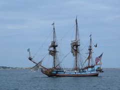
Cuttyhunk, and its neighboring small islands, look like terrain you would see in Scotland: expansive grassy undulating hills, small, scraggly trees, and rocky coastlines with small pocket beaches; very picturesque. In the distance we could see the distinctive cliffs of Martha's Vineyard. We were even treated to the sight of Kalmer Nyckel, a Pilgrim era replica ship, dropping anchor across the bay from us. We later learned that KN had to pull into Cuttyhunk to repair damage to the rigging caused by the same weather system that gave us the trouble in OLM.
TAKING THE SHORT CUT
The 10 mile long Cape Cod Canal is our destination for August 17. It opened in 1914 and through the years has experienced navigational improvements to make it the world's largest sea-level canal with a channel width of 480' and average depth of 32', quite large enough for FLUKE to share with commercial vessels. It is important to time our transit to coincide with a favorable tide, as currents can run up to 6 knots, putting a considerable strain on our fuel usage and maneuverability if we have to fight the tide. Boaters are required to complete the transit in no more than 2.5 hours or be subject to getting towed through at their own expense.
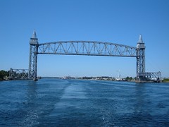
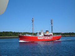
As we enter the west end of the canal we can see the campus of the Massachusetts Maritime Academy and then the landmarks of the Bourne Bridge and the ornate, vertically lifting railroad bridge. Wayne is delighted with memories of crossing the BB to visit his grandfather's cottage on Cape Cod while growing up. We are all pleased to slowly travel on the calm waters on this clear, sunny day, enjoying the sights of the joggers, walkers, bicyclists, and just sitters using the paved recreational paths on each side of the canal. We are greeted by a huge (maybe 100) herd of common dolphins heading toward us after schools of fish. We marvel in their grace and beauty, with their striking white undersides, smaller than the Atlantic Bottlenose Dolphin that we are used to seeing on our southern travels. The beautiful lightship Nantucket passes slowly by.
Lightships are marine safety aids of the past, but there are a few that are still maintained for touring purposes and are worth visiting and learning about if you have the chance. The lightships were used to mark dangerous areas, mostly shifting shoals where lighthouses or buoys weren't practical or had been destroyed. The ships are ruggedly built, bright in color, and watertight as they had to stand in place through treacherous seas. We know that we are not sailors enough to be able to withstand a tour of duty on a lightship, even with our Explorer Relief Bands with a new set of batteries!
GAY PARIS
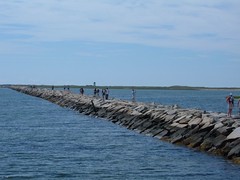
No, we didn't cross over the Atlantic Ocean to France! From August 17 – 21 we were in Provincetown, MA. Our originally planned 2 night stay turned into 5 because of bad weather, mostly to the north, our intended cruising area. Not to worry-we had LOTS to see and do, with never a dull moment.
Ptown (as the locals say) is way out on the very end of Cape Cod. Succinctly put, it is a town that prides itself on personal freedom and expression. Probably best known for a predominantly male gay lifestlye setting, spending a few days in Ptown will open up your heart and mind to delight in all the wonders the town really has to offer.
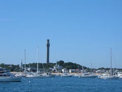
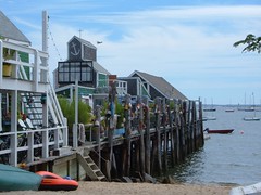
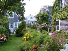
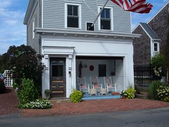
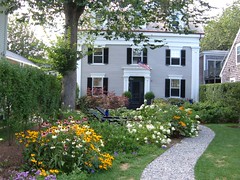
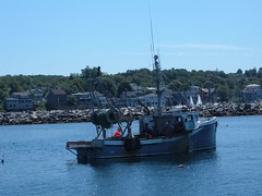
You have to be captivated by the beautiful working harbor, where the centuries old tradition of fishing works side by side with modern fast ferry boats, packed whale watching tour boats, gawking tourist vessels, and locals looking for fun day cruises. The Pilgrim Monument keeps watch over both the busy waterfront and the surrounding high tranquil sand dunes. Beautiful, architecturally fascinating cottages with well-kept colorful gardens line the quaint streets in the older sections of town. Commercial St., the main business street, paralleling the waterfront, bustles with tourists and locals alike. It is the place to people watch and pass the time. Upscale restaurants, boutiques, nightclubs, cabarets, art galleries,and bakeries offer something for everyone day and night.
You could say a lot of this about many tourist towns, but what makes Ptown stand out above all other is tolerance. It is a feel in the air – you don't need a document or sign to let people know you can be whatever you want: gay, lesbian, fat, ugly,old, young, short, tall, poor, rich, beautiful, Christian or atheist. Let me be me, and you be you; we can all live together in the same little place. No finger pointing, just acceptance.
Unknowingly we arrived during Carnival Week, and this year's theme was Gay Pareé (a farce on all things French and appropriately titled for most participants in the festivities). We stepped on shore for the first time just as the parade was starting, one of the highlights of the week's events. The two hour parade itself would have been worth the stop at Ptown (Eddie says it will be the only parade he will ever remember!). It was like a mini Mardi Gras parade, with floats, throwing beads, music, outrageous costumes, wheeled vehicles, and walkers. The creativity, artistry, humor, and work that went into the whole thing was commendable. Cyndi Lauper was the grand marshal and the headline concert performer to cap off the week. Hedda Lettuce, wearing a gorgeous sequined lime green evening gown was giving out flyers to see his/her show, but Eddie wouldn't let me photograph him with her, so I downloaded this photo. There were many cross dressers like Hedda, wearing beautiful gowns and walking in stiletto heels to the delight of the jeering and raucous crowd.
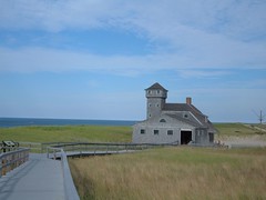
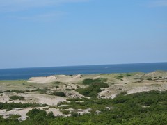
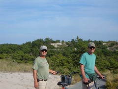
Going away from the commercial areas of Ptown takes you to another one of its marvels: the Cape Cod National Seashore's Province Lands. This is a 10 mile bike loop that traverses through towering, undulating dunes, ponded lowlands, and the coastal beaches.
We spent the greater part of a day riding the course, enjoying the sights. We've finally had the opportunity to use the gears on our bikes, something we Floridians seldom have the use for. In fact, there were some dunes that were so steep, our lowest gears couldn't get us up the hill and we had to walk! (I'm ashamed to have to say that). By the opposite token, there were several downhill rides that were so fast and curving there were signs posted warning of the danger for collision or skidding ( I had to use the brakes on the bike going downhill to slow my speed). We can't wait to do it all again!
THE REAL FLUKE
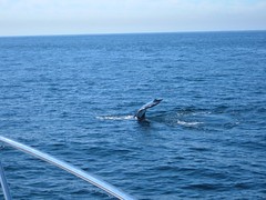
August 22 took us through the interesting waters of Stellwegen Bank, a marine sanctuary area off the coast of MA. SB is a shallow area with as little of 60' of depth with the deep ocean a step away. This combination makes for nutrient rich currents that attract all kinds of marine life, including everyone's favorite, whales. We were treated to a whale show that only nature can provide as we saw Humpback whales breaching high out of the water, rolling over, creating gigantic tidal waves when they crashed back into the sea. We had to alter our course 2 times to avoid resting whales that were laying in our path. We took the boat out of gear as we came close so we could see the whales and not disturb them. It was exciting to be in the wild next to these large animals that were bigger than our own FLUKE. Harbor seals, with their cute compact faces, made us laugh.
It would had been easy to spend the whole day on Stellwegen Bank, but we needed to reach our destination of Rockport, MA to get settled for the night. In approaching the inner harbor we had to go through an active sailboat race of tiny little sailboats going in all directions, reminding me of gnats. Their activity, plus numerous lobster pots, presented a navigational challenge. When we finally made it to the inner harbor we were disappointed to see that there were so many lobster pots we could not find a place to drop the anchor without having to worry that we would get tangled up in the pots. So, we headed back out, through the races again, and moved on to Plan B.
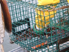
Lobster pot density had been increasing since we entered MA waters, and we had to constantly keep a lookout for them. Getting one tangled in our prop, rudder, or stabilizer could pose some major problems, up to not being able to control the boat and keep her off the numerous rocks that always lay beneath us in these waters. Lobsters like rocks, so that is where the pots are placed. We needed to find an anchorage with a sandy bottom, where there wouldn't be any lobster pots.
We found a safe bottom off the town of Annisquam. We could see the mouth of the Annisquam River as it emptied into Ispswich Bay. The dunes and beaches of the area were picturesque. While the anchorage was very exposed, calm weather allowed us a safe haven.
BEING BLUE
We would finally enter Maine waters on August 23. Our destination for that day was Potts Harbor, north of Portland, at Dolphin Marina where we would rent a mooring for the night. While we thought we were seeing a lot of lobster pot buoys in MA we weren't prepared for what we had to go through to get into Dolphin Marina. I was convinced Potts Harbor had to be so named because of all the lobster pots. Potts Harbor has a clearly marked channel which would be easily navigable if it wasn't for the fact that the lobster pots are put in the channel. It is even worse once you get out of the channel and have to make your way into the marina harbor. There were even lobster pots in the mooring field!
After picking up a mooring and securing FLUKE, we were told if we wanted to go ashore to call for a launch pick up by blowing the horn. FLUKE has a BIG ship's horn that is very bold, but we gave a blast, got picked up, and went for a shore walk. The area was residential and very rural. We saw a sign that said blueberries were for sale and to proceed up a long winding dirt driveway. A friendly woman greeted us, and we told her we wanted some blueberries. She, like so many others we have run into, was interested to hear that we have come from FL and ask questions about our adventure. She had been growing blueberries for years, and hers were gigantic and juicy. We have enjoyed them in pancakes and on cereal.
CAUGHT UP IN THE EDDY
Real time, September 9, 2006. Here we are, having arrived August 24, at what was our originally planned final destination for the 2006 Voyage North. We made it!
So, now I can say "Eddie is at the Eddy Marina on Eddy Road napping on FLUKE moored in The Eddy". Wayne is working on the FLUKE job list, wiping down ceilings, and I am finally getting the blog caught up to be posted within the next couple of days. We don't want you thinking that we sailed off the edge of the earth like what many people thought happened to Christopher Columbus because he didn't keep up with his blog postings in a timely fashion!
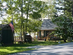
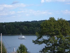
Today the angle of the sun and clarity of the blue sky makes the ripples of water glimmer like diamonds on the Sheepscot River where the Eddy Marina is located here in the tiny town of Edgecomb.(Since I know you haven't heard of it, I can tell you it is just a short distance by land to Boothbay Harbor) I am used to hearing the low rumbles from the lobster boat engines as the fisherman come close to FLUKE to check their traps, thousands of which are located on the river between the marina and 13 miles south to the ocean where we first entered the river. Potts Harbor proved to only be a practice ground for what we faced coming up the Sheepscot River. At one point, during my turn at the helm Wayne asked me where I was intending to go as I was weaving my way through the floats and I told him I had to pretend like I was putting FLUKE in a boat slip; in some areas the floats were so close together the space between wasn't much wider than our boat! If we didn't have to drive through them, I would delight in how colorful they all are, reminding me of the old fashioned hard Christmas candy with its myriad of colors. I couldn't even take the time to enjoy seeing the tiny harbor porpoises cross by the front of our bow; we needed 3 pairs of eyes all forward to watch for floats as we came up the river at high tide and many were being pulled under the water, making them even more difficult to see. We only heard one thud on the hull and considered ourselves more lucky than skilled to have made it to the marina without any entanglements.
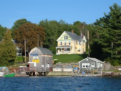
The Eddy Marina is owned by Willis and Merry Clifford, a couple we met in Vero Beach, where they spend the winter on their boat at the Vero Beach Municipal Marina. The land has been in the Clifford family since the 1800s; the family home and some of the marina buildings are original. In the 1800s the property housed the post office and general store. There are pictures of majestic four masted sailing schooners docked right where we dinghy up to get to land every day. In its heyday, the place was bustling with activities of an old New England seaport; many of the homes we walk by every day once belonged to sea captains from that era.
Willis and Merry opened the marina over 20 years ago after Willis retired from the navy. They cater to mostly local powerboaters, renting dock space, selling fuel and marine supplies, and a side business, enjoyed by landlubbers as well, selling Maine's finest lobsters. Yummy! The marina is open from May to October. Its name is derived from the fact that the mooring field is located in an eddy. This area has swirling waters caused by the currents that are pushed into a basin-like dead end off the Sheepscot river as it turns its way around the corner to the little town of Wiscasset. It is kind of like a gigantic whirlpool. The tidal fluctuation has been as much as 14', something that we 2' tide Floridians are not used to seeing.
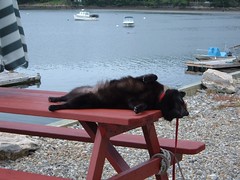
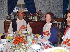
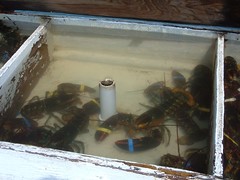
We are spending time helping out with some tasks at the marina (Ursa is the official guardian of the fuel pumps and lobster tanks), enjoying the Clifford's hospitality and trying not to get in their way. They hosted a lobster dinner (a tradition for anyone who makes it all the way up here from FL!), have carted us to the grocery story, let us use their washing machine, forced us to pig out on ice cream, shared fresh produce from their garden, and have treated us like family members. Willis and Merry each hold private lobster licenses and have their own traps out in the river. They have let us go out with them when they pick up the pots, and have patiently endured my gazillion questions about lobstering. Willis finally just gave me the book that is used to study for the test required to get a lobster license; it is interesting and answered my questions!
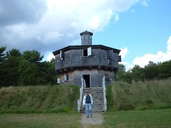
FLUKE's mooring is overlooked by Fort Edgecomb, originally built in 1809 to protect the harbor from British attack and then was later used in 1864 during the Civil War period to defend against Confederate ships coming up the Sheepscot River. The unusual, well-preseved blockhouse is the fort's most prominent feature and being the highest point, was used as the principle lookout point. From the waterfront we can see the circular stone battery where cannons were mounted.
Right around the corner from the fort is the town of Wiscasset. Founded in the late1700's, it was Maine's largest seaport, its economy driven by being a shipbuilding center and lumber port. Some tour guides describe Wiscasset as Maine's prettiest village because of the handsome homes built by ship builders and sea captains prior to the 1807 Embargo Act. The town has prided itself on preserving the homes and maintaining the New England village flair of the historic district.
We spent one evening at the Windsor County Fair, originally started in 1888. It is an event of real rural fun: agricultural exhibits of animals (the sheep were my favorite) and vegetables (the 640 lb pumpkin was a hit), midway games and rides, megacalorie fair food, tractor pulls, and stunt car driving.
While we have had our share of overcast, damp cold days and peasoup fog we have delighted in days like this and mornings of pine scented crisp air with birds chirping and flying across our paths and chipmunks scampering for cover as we walk Ursa in the mornings. Locals have been so friendly, often stopping their cars or walking from their homes to talk to us, wondering who we are. They have given us produce from their gardens, told us to use their yards for shortcuts, given us historical insight about their period homes, and invited us into their beautiful flower gardens. We are so grateful for their hospitality.
Coming up next: Travel to the Backwoods of Maine. We are getting a rental car for a week and will do some land touring. Please, Mother Nature, send us good wather!
Saturday, September 16, 2006
Subscribe to:
Comments (Atom)
