Wednesday, November 09, 2011

2011 By the Numbers

May 10 to October 31

Here are some numbers for our travels on FLUKE in 2011. This was by far our longest trip yet. We bought fuel 3 times totaling 1121 gallons at an average cost of $3.51 and burned over 1600 gal.

The fuel usage numbers include the hours running the generator, primarily to recharge the batteries, but sometimes for cooking or laundry. This was significantly less than in the past due to the solar panels. We could definitely see the effectivity of the solar panels drop as the days got shorter and the sun got lower in the sky. The MPG numbers would be higher without the generator.

The days at dock includes all the free docks and the lock walls where we tied up. We paid to stay at a marina dock for 4 nights total while we had the engine worked on and one night when the Champlain Canal closed due to high water. We also paid for 2 nights on a mooring in St Augustine ($42 total).

2011 Trip North Statistics

Dates May 10 to Oct 31
Days 175 (61 anchor, 105 dock, 4 mooring, 4 at sea)
Engine Hours 599.1
Gallons Fuel 1608.2
Nautical Miles 3756 (4322 Statute Miles)
Nautical MPG 2.34 (2.69 MPG)
Generator Hours 144.4 (about 50 min/day)

Let us know if there are any other numbers you would like to see. (You can Post a Comment to do so.)

Thursday, November 03, 2011

The Rest of the Way Home


October 24 – 31, 2011

At first light, on October 24, we had a great start since when we pulled up the anchor we didn't have one of the underwater cables attached to it which would have really complicated our departure plans.  The passage out of Beaufort inlet was mostly calm.  Two other Krogens came out right behind us, so we knew we would have some radio company at least until we got to Wrightsville Beach, NC where at least one of the other two would be going in for the night.  The FLUKESTERS were leaving our options open, hoping to take advantage of a small weather window, to be able to stay out in the ocean for an overnight passage to at least Charleston, SC.

The seas weren't very nice from the beginning, and continued to decline a bit in their level of comfort throughout the day.  They weren't high or dangerous, just kind of sloppy, making the ride kind of corkscrew-like since we were getting pushed from the stern quarter.  It makes for a tiring, boring ride.  However, we knew that the forecast for the following day would be worse, and if we went in at Wrightsville Beach, we wouldn't be able to get back out in the ocean again.  Travel on the inside, on the ICW, could prove to be more frustrating and dangerous, with all the other boat traffic, low tidal areas, and excessive shoaling that would we would have to face.  So, we decided to stay out all night long and press on to Charleston.

We were optimistic toward sunset when we approached Frying Pan Shoals, off of Cape Fear, NC and the seas calmed down quite a bit.  We thought we would have nice night seas, but once we completed the long arc around the Shoals, King Neptune turned on his washing machine and made our lives miserable again.  I think it's stressful enough traveling at night when visibility is extremely limited and you have to rely on the radar screen, but when you are getting jostled around at the same time, it is really miserable.

I had the first watch, until midnight, and couldn't wait to be able to go down below and lay down.  When I awoke, it was daylight with calm seas, and I was surprised that we hadn't entered Charleston harbor yet.  When I went up to the pilothouse I was told that since the seas had calmed down so much Captain Wayne had made the decision to keep going south, maybe to St. Marys, GA, if the passage proved to be comfortable. 

Within half an hour, the sea conditions changed drastically which often happens when the sun fully rises above the horizon.  The wind really kicked up.  Since we had just passed Charleston we should have turned right back around and headed to an anchorage off the ICW.  We were all tired and just the thought of spending another day in the “spin cycle” didn't bode well with any of us.  I heard 2 other boats that had left Charleston say that they were turning back to port because of the poor sea conditions.

However, we decided to try to head into St. Helena Sound which wasn't too far south.  We had never been in that inlet before, so we put out a call on the radio for anyone to answer with local information about how suitable it would be to use under the present sea conditions.  A research ship responded favorably, so we changed course to angle into the sound.

BRIDGOT DENISE
BRIDGOT DENISE

There were two shrimp boats trawling by the outer markers.  You can see how the waves are kicked up and how murky the shallow water looks.

The approach into the sound positioned us to get hit broad side by the wind and waves making FLUKE roll quite a bit to the port side.  We had to hold on to keep ourselves upright and steer the boat in conjunction with the oncoming waves to reduce getting hit directly.  It took over an hour to get far enough into the Sound where we could get some protection from the land enough to calm the water.

Once we finally intersected the ICW, and had a favorable tide, we continued onward another 3 hours until we reached Beaufort, SC.  That meant we had traveled 34 hours straight from Beaufort, NC to Beaufort, SC!  We were rewarded with a quiet, calm, peaceful night at anchor.  Thank you.

When the sun rose the next morning with a forecast for calm seas and light winds, we were underway again, out the Port Royal Sound inlet.  We hoped to be able to stay offshore all the way to St. Marys, GA and anchor near Cumberland Island.  Once we cleared the outer marker, we could see 6 container ships, bound for either Savannah to the south or Charleston to the north.

Research project
Research project

I've told you before when the seas are calm you can do a variety of things aboard while underway.  I was fascinated by the great numbers of these brown jellyfish that were floating n the water.  They ranged in size from those as small as a ping pong ball to those as large as a softball.  They clearly had the ability to orient themselves in a specific direction and also propel themselves at a pretty good pace.

Ordinarily Captain Wayne is reluctant to slow the boat down for me to take pictures or try to collect anything, but to my delightful surprise, he agreed to let me try to catch one of the jellyfish with my bucket on a rope.  I think he was feeling sorry for how miserable we had all been the day before.  Anyway, it was no easy task to try to capture one of the jellyfish with the bucket as the boat was moving even at idle speed.  So, Wayne just let us drift in neutral, and I was able to scoop one up.  He laughed at me when I squealed in delight over my success.  I declared that we were now RV FLUKE.  Once I had completed my examination of the specimen I dumped it back into the sea. 

Captain Ursa
Captain Ursa

Eddie, on the other hand, finds other, less cerebral, diversions to break his boredom at sea.  Some of the time that means one of the animals will get harassed.  While Ursa loves sitting up on the helm so she can see out, she wasn't enthused about steering the boat.

It was about this time that Eddie made some “profound” statement that made me remark, laughing, about the possibility of him being our resident savant.  He puffed himself up until Wayne went on to explain that there are two extremes to someone being a savant.  Since one  of Eddie's favorite movies is Rain Man he got the message of what I what kind of savant I had in mind for him!!  Idle time at sea also has its dangers.

We reached the entrance to St. Marys inlet at 9:00 p.m.  Since we had been in here before after dark, we had confidence in getting safely to the anchorage.  The only “hazard” we encountered was an extinguished (light out) channel marker that we came way too close to.  Wayne reported that to the Coast Guard the next day. 

We had hoped to make the short run over to Fernandina Beach the next morning and pick up one of their mooring balls for a day or two.  However, when we called about availability, we were told all the moorings were “down for maintenance”.  Sounds like that means there must have been an incident, like a boat breaking loose, that would cause them all to be out of service right at the beginning of the Fall migration of cruisers heading south.

So, we decided to head south to St. Augustine, where we would visit with Wayne's family.  After we upped the anchor I was able to see 5 wild horses on Cumberland Island grazing in the morning light.  A great start to my day!

More winter visitors

The upper portion of the Florida ICW allows cruisers to get really close to large flocks of white pelicans that have migrated south for the winter.

Surfboard art
Surfboard art

Not all the areas of the Florida ICW are wide open, natural areas like in the previous photo.  Some of the waterway is very channelized and flows by residential areas with a wide range of home styles and prices.  I thought this directional patio signage was clever and colorful.

Pirate ship
Pirate ship

We arrived in St. Augustine in late morning and were greeted by the tourist pirate ship,  BLACK RAVEN.  This cruise had a bunch of kids aboard, and Eddie gave them a blast on our big ship's horn and the kids went crazy.  Since it was a pirate celebration weekend, lots of people went out on the ship, and judging by all the singing and loud arrghs coming from the passengers, they were having a fun time.  A lot of people we passed on the street were dressed in pirate garb, going to various pirate functions.  I kept my eye out for my favorite pirate, Jack Sparrow, but I didn't see him or the BLACK PEARL.  Guess I'll have to watch the latest movie to see him again.

Happy Halloween
Happy Halloween

We picked up one of the new moorings, south of the Bridge of Lions.  This old style house was right across from us and had some Halloween decorations.  At night, the archways were lit with orange lights, and looked really neat.

Holiday advertising
Holiday advertising

St. Augustine should be on everyone's tourist stop; there is so much to see, and the historic sites are all close to the marina and easy to walk to.  However, we were not really tourists this time since we stopped just to visit with Wayne's  Dad, Russell, and his wife, Rayma.  We could walk to their house from the marina, so it was nice to be able to go back and forth as we wanted without having to worry about transportation.  We usually visit them on a holiday like Thanksgiving or Christmas, so it was really nice to see them this time without all the holiday chaos.  One thing was the same as the holidays though, they always bake cookies and feed us way to much!

Home observatory
Home observatory

We left St. Augustine at first light with the intention of making it all the way to Mosquito Lagoon and anchoring for the night outside the channel.  Since the tides had been running high, we didn't have any trouble with the usual shallow spots that would have slowed us down.  I have always been fascinated by this intracoastal home with its own astronomical observatory, even more so after looking through the binoculars that night back at the swamp in Alligator River. 

I could really tell we were back in Florida because of all the dolphins and manatees that we could see.  Some of the dolphins gave us private acrobatic shows with high leaps fully out of the water, always with that gleeful “smile” they have, looking right at us.  Mother Nature also treated us to a flock of three dozen rosette spoonbills, flying right over us.  There were so many together they had a pink aura around them, just gorgeous.

When we got to Mosquito Lagoon, it was way too windy to anchor.  Even though it was nearing sunset, I told the guys I wouldn't be a happy cruiser if we anchored there and that we had enough light left to make it through Haulover Cut and get over to the ICW where we would have better wind protection.  Plus, the lighted channel markers would provide safe enough beacons for the short distance we would need to travel in the total darkness.  Then we heard a radio conversation between another cruising boat and the Titusville Municipal Marina about their new moorings.  We figured we could make it there in the dark and pick up a mooring. 

When we made it to the mooring field, it was more difficult than we thought it would be to even see the mooring balls, but there weren't many boats, so we had plenty of room for error in maneuvering toward a ball.  Once we radioed in to pay $15 for the mooring, the marina employee said the mooring would be complimentary.  It sounded like the whole mooring system was brand new and they weren't set up to take customers yet anyway.  Okay by us, thank you.

Rain came during the night, along with even stronger winds.  At first light, we upped the anchor in the rain, and it stayed with us until about 1:00 p.m.  The wind never let up, blowing 20 – 25 KTS, but at least it was behind us, so we got a good push, and arrived at the dock at the Vero Beach Municipal Marina at 3:30 p.m. and pulled into the same slip we left 6 months ago.

We'll be posting our usual summary blog within a couple of weeks once we tabulate all the data.  I'll also be making a few additional comments now that I don't have to worry about being restricted to the confines of FLUKE and having to put up with any whining from my two crewmates if I divulge too much personal information.


Thursday, October 27, 2011

South Through North Carolina

October 21 – 23, 2011
With great travel weather in the forecast, there was a mass exodus from the wall at Chesapeake, VA.  We were all in a line waiting for the 8:00 a.m. Great Bridge opening.

Squinting required
Squinting required

I tried to take a shot of what we have to see on clear mornings when we are headed in the same direction as the sun is rising.   Even though FLUKE has raked windows that have anti-glare protection, the direct sun can still be blinding.  If the windows are dirty, it can be impossible to see out of them.  With all the glare, reflection, close quarters, and other moving boats, we like to have all “eyes on deck” to help with seeing what's ahead.

Our goal for the day was to make it all the way to the south end of the Alligator River where the Alligator Pungo Canal begins.  It is one of my favorite natural areas on the whole ICW, and I always write about how magical I think it is, especially at sunset and sunrise during calm weather.

Since this uninhabited area is so vast and isolated, on a clear night, like we had, the Milky Way looks like a big belt of thick foam in the sky.  A city person would think they must be on a movie set since so many stars are visible.  By looking through our binoculars into the heavens I can see the diversity of star size, color, and brightness, and it is breath-taking.  The night chill doesn't even distract me from scanning the sky.  Groupings of stars take on a three-dimensional appearance and look like jewels on black velvet.  The vastness of the universe makes me feel “smaller” than the tiniest particle of matter that I can think of.  I am so lucky to see these wonders of nature.

Beating the sun
Beating the sun

I could have said that this was taken when we were setting the anchor since we arrived right as the sun was setting, another day of about 75 miles.  We were the last boat of 20 in the area to anchor for the night.  However, this is Eddie getting ready to pull up the anchor the following morning.  By the time we had the anchor up and chained cleaned off, there was enough light to see so that we didn't run over a crab trap buoy since they are numerous in that area.

Lovely in lavender
Lovely in lavender

When the sun rose enough to bring color to the swamp, we were treated to a morning cloaked in all shades of purple.  The clouds were reflected in the glassy calmness of the water.  The swamp mist clung to the shore vegetation until the sun's rays burned it away for another day.  A lone bald eagle perched on a snag and cautiously watched us pass through his territory.

Hello sunshine
Hello sunshine

The big cloud bank on the eastern horizon extended the morning sunrise.  When the sun could peek through the clouds, the tree silhouettes provided an interesting shoreline panorama.  Sunrise never lasts as long as I wish it would; it is my favorite time of the day when the swamp is being lit up and bathed in all the gentle colors of morning light.

Who goes ahead
Who goes ahead?

The mist clung to the canal for quite a while where the vegetation was near on both sides.  Look closely to see the sailboat up ahead.

Another golden day
Another golden day

When the sun rises up high enough, it casts a golden glow on the shore line vegetation.  Notice the diversity in the hardwood trees and grasses, coming into their Fall colors.

Yearlings
Yearlings

Creatures of the night, like these two young deer, will be scampering into the underbrush when the sun rises higher and the rest of the parade of boats goes by them.

Swamp rescue
Swamp rescue

Since we were the lead boat in the “pack” leaving the anchorage that morning, we were the first to come upon this sailboat that had either grounded itself on the bottom or on an underwater log.  As we approached, the captain motioned for us to come closer.  I called on the radio and asked what they wanted, and they asked if we could pull them free. We felt sorry for them since it was a young couple with a small baby, and the woman couldn't do anything to help because she had to hold the child.  We had to be cautious in how close we could get since we didn't want to run aground either, and we drew more water than they did.  So, we approached them with our bow.  The captain threw a line over to Eddie (took four tries), and we had ample power to pull them free.  The “law” of the sea says you always lend assistance whenever you can, even if it is an inconvenience for you.  I wonder why we can't live like that on land?

So, I hoped you liked sharing our morning on the Alligator Pungo canal!  Those kinds of mornings sure make cruising wonderful.

The rest of the day was uneventful as we went another 75 miles until we reached South River, across from Oriental, NC (a boating mecca).  We planned to anchor there for the night and half the next day until we moved to a better staging area to make an offshore run out of the inlet at Beaufort, NC to sea places southward.  It is a great area to anchor because there is a LOT of room, and you can try to tuck in on either side of the river, depending on the wind direction.

The weather forecast for the next couple of days indicated we should have good sea conditions to make an offshore run to Charleston, SC, requiring one night at sea.  We had about 20 miles to go to get to the inlet, where we would anchor for the night so we could get an early start the next morning.  So, we left South River around noon.

Dreams aground
Dreams aground

We had to travel through the Adams Creek Canal area, which had sustained damage from Irene.  A couple of large vessels were still stranded.  At least they weren't in the water where cruisers would have to worry about running over them.

Sitting pretty
Sitting pretty

This stretch of the waterway doesn't have much in the way of scenic natural areas.  So, I try to find other sights to entertain myself.  These house colors and the porch chairs added some real brightness to an otherwise rather dull stretch of the ICW waterway.

Castaway
Castaway?

It was very easy to spot this inflatable raft aground in a marshy area right alongside the waterway.  At first I just assumed it was some kind of water toy that had blown off a boat.  However, upon closer inspection, I could see that there was a body lying close to it.  What a weird place to stop and take a nap, if that was what this guy was really doing.

Just after 4:00 p.m. we arrived at the Beaufort inlet.  We had talked several times about trying to anchor in the inlet, right off the beach by Fort Macon and the Coast Guard station, so that it would be easy to get out the inlet at first light.  There was some confusion where an underground cable area was supposed to be located according to our nautical chart and there were no signs on shore indicating exactly where the cable crossing was, so we picked the best spot we could with the information at hand.  We found there to be great holding, and the wind kept our bow pointed toward the channel, helping to minimize roll from the few boats that came in late in the day.  If we had been there earlier when a lot of boats were coming in, their wakes would have made the anchorage too uncomfortable.

Almost to port
Almost to port

We were treated to a show of two tugs assisting this ocean freighter through the inlet and over to the port dock, visible from where we were anchored.

We breathed a sigh of relief the next morning when we pulled up the anchor, by itself, without a cable attached!   The anchorage had been quiet and calm through the tide changes.

We had an easy, smooth exit out of the inlet, with the intention of saying goodbye to North Carolina for 2011.

Sunday, October 23, 2011

Goodbye Virginia

October 16 – 20, 2011

Our remaining time at the Piankatank River anchorage was spent being glad we hadn't tried to move down the Bay a day sooner since the wind really did pick up a lot. We were tucked in well enough not to be affected, but we could hear radio chatter from boaters who had tried to go out, but turned back to a safe port because conditions were too rough. I was actually hoping for some decent rain to move through with the weather system because FLUKE was covered with gritty salt from the water we took over the bow on the way in and the rain would help wash it off. No such luck.
Bagelmania
Bagelmania
Baker Wayne made his first attempt at baking blueberry bagels, quite a different process from his usual bread making projects since they have to be boiled before baking. They tasted as good as they look in the photo, and we will add them to the stock list. With all of his bread projects, Wayne lets the bread cool enough to slice or package, and then puts it in the freezer. We find freezing right away like that keeps the bread fresh.

A couple of fighter jets flew by over the treetops (probably smelled the bagels!), and one of them did a barrel roll, like our own private air show.

When the winds died down, we were anxious to get going again, and wanted to be able to put in a long day to get all the way down the Bay and through Norfolk. The Great Chesapeake Bay Schooner Race had been in progress the previous week, so we had hoped to see some of the beautiful schooners out on the Bay, but all the ones that passed us didn't have their sails up.
In the pink
In the pink
This sailboat with a colorful spinnaker provided a bright diversion.
Vessel diversity
Vessel diversity
This was the first time we had seen a cruise ship in port when we have gone through Norfolk. Later in the afternoon, when we were south of Norfolk, we heard the captain of Carnival GLORY on the VHF announcing his intentions to leave the dock for his move to the sea.
Taxi anyone
Taxi anyone
This paddlewheel boat water taxi was taking people from the Portsmouth side to the Norfolk side of the harbor.
Undercover operation
Two navy warships were in dry dock. In this photo, with warship 55, you can see the dry dock frame on either side. When the ship pulls in, the bottom of the dry dock is below the water level depth of the keel of the ship so that it can float freely. Then, the water is pumped out so that work can be done to the bottom and all the other parts of the ship after the bottom is raised. Note the big cranes attached to the dry dock frame, used to move heavy parts on and off. The covers on the ship help protect the workers and contain debris as well as keeping spy satellites from seeing what kind of refit work may be being done to the ship. Notice how the bow at the water line is covered, so that you can't see what is being done to the sonar area. The upper levels of the superstructure are covered where a lot of the electronics are located. The floating barrier fence keeps people in watercraft from getting too close.

We really lucked out at one of the bridges that only opens on the hour when a northbound tug requested an opening at half past the hour. Commercial vessels don't have to adhere to the time schedule, and if a recreational vessel is at the bridge when it opens for the commercial vessel, we can go through too. That can save a lot of waiting time, and less anxiety if the weather is bad, pushing the boat around.

Our destination was the floating dock that belongs to the Chesapeake Yacht facility on the waterway that is the entrance to the Dismal Swamp Canal. We were hoping to find space available for us to tie up for the night, and we had a surprise when we got there.
River gunboats
River gunboats
We ended up sharing dock space with 4 Navy river gunboats and one other cruising sailing catamaran.
Mission tents
Mission tents
In one corner of the shipyard, the Navy had set up their sleeping and kitchen quarters for their base of operation. They had an armed guard for sentry duty, and portable bright lights that shined all night long over their tents and out onto the dock. Plus, their big generators ran all night, making for some loud sleeping noise. We figured that they must be getting set to do some practice maneuvers in the nearby swamps.

Sure enough, when we were underway a few days later, one of our sisterships, who had been anchored out in the Pungo River swamp area, radioed to us to tell us about seeing a river attack show in the early morning hours. There was lots of blank shooting between the swamp boats and the “enemy” on the shore of the swamp, and apparently it was a really, intense, interesting show. I would have gladly anchored out in the swamp just to get to see that!

We left the CY dock to get to Top Rack Marina by 7:45 a.m. so that we could take on fuel and water and make the 9:00 a.m. Steel Bridge opening, right next to the marina facility. We took on 558.7 gal. of diesel at the best advertised price of $3369/gal. If you dine at their nice restaurant (the food is said to be very good) and spend about $75 you can stay overnight free at their dock.

Once we left Top Rack, it was only a short distance to the Great Bridge Lock, and we locked through with 3 other boats.

We were the only boat to pull over to the wall to tie up, and there was only one other boat already there. The wall area would fill by midweek when the wind kicked up and another frontal system moved through bringing the rain I hoped for to finally wash the salt off.

This stop, Chesapeake City at the Great Bridge, is always one of our favorites. Of course, we never miss a visit to Dairy Queen where we get our Blizzard “fix”. Plus, all the stores for shopping are within easy walking distance. Eddie even ended up getting his seasonal flu shot at one of the local drug stores.
Boat parade
Boat parade
You can pass the time watching the boats lock through the lock and then wait to go through the Great Bridge. The Annapolis Power Boat show had just ended, so there were a lot of the show boats that passed through the area. We usually see many other cruising boats that we know, and it is fun to step outside on our bridge area and talk with their owners while they wait for the bridge to open. Everyone always ask the same question “Where have you been and where are you going?”
Barging through
Barging through
There are a lot of tug and barges that go through the area, carrying a variety of cargo. This tug was pushing two heavy barges.

A trawler from Toronto was docked ahead of us. Three Customs and Border Patrol agents showed up to review their papers for some reason. We suspected the lock may have notified them when they locked through. The armed agents positioned themselves with one agent standing next to the bow, one to the stern, and the other one talked to the vessel owner and really harassed her about their paperwork and check-in procedure. Keep in mind they had to first check in to the U.S. at the same place we checked in on the north end of Lake Champlain (where the agent boarded our boat alone when we weren't there). The Canadians are required to call in at each port they stop at, but what is defined as a stop and a port is not very clear. So, how in the world could they have anything out of order by the time they reached Chesapeake, VA?!! We had them over for dinner, and they do not fit any conceivable profile of some kind of renegade, terrorist Canadians. We felt so sorry and embarrassed for how they were treated. We will be looking forward to seeing them again and find out if they had any other such encounters.

We left the Great Bridge wall early on the 21st, with only about 25 miles to go to get to the North Carolina border. It really feels like we are homeward bound now.


Saturday, October 15, 2011

Time Flies, Even on a Slow Trawler


October 7 – 15

I can't believe it's been over a week since the last blog post! 

After leaving Barnegat Light with our repaired engine we had a safe run down the 40 miles of coastline to arrive in Atlantic City at 4:30 p.m.  We sure were surprised to find out we were the first ones to pull in to anchor in The Pond for the night.  3 sailboats had entered the inlet ahead of us, and we just figured at least one of them would head into The Pond, but none of them did.  We had just finished our anchoring drill when another trawler pulled in, and then within half an hour, 4 more trawlers arrived.  The other 5 had all come from Sandy Hook so they had had a really long day like we would have had if we hadn't broken down 5 days earlier.

The next morning we got going at first light, amidst a stellar sunrise, because we had a long way to go, most of which would be traveling up Delaware Bay where the tidal currents can be very strong if they are against you.

The ocean was almost like a lake.  There wasn't a cloud visible anywhere in the sky.  I say that that is how cruising should always be like and then we all laugh out loud knowing I'm just having some kind of fantasy.

When we popped out of the Cape May Canal and saw 6 tug and barge rigs anchored on the west side of Delaware Bay, we knew we were in for a long, slow ride up the Bay against a strong outgoing tide.  The big rigs like that will wait for the outgoing tide to slow so that they can get up the Bay more economically than trying to fight the tide.  We heard one tug captain report that there was a pod of at least 3 whales at the entrance to Delaware Bay, but we were headed in the opposite direction.

Even with no fish it's still a great day

This Cape May party boat was fishing right next to the Miah Maull shoal light.  Notice how calm the water is and how the sky is perfectly clear and bright. We haven't seen many days like that on our numerous transits of the Delaware.  I wondered if the people fishing were bothered by the long, low horn sound coming from the light.  That is so you can still know where the shoal is in the fog when the light isn't visible.

We finally dropped the hook behind the Reedy Island dike right as the sun was setting down over the tree line, making it a sunrise to sunset day.  With the current having been against most of the day, it took us 1.5 hours longer than the previous time we had made the same run from Atlantic City to Reedy Island with a more favorable tide.

The next day we had an easy transit through the C & D Canal, only had one commercial ship pass us.  However, there was a LOT of debris, and we had to be on the lookout all the time so that we didn't hit anything.  At least with the calm water it was easy to spot all the junk.  The highlight of the canal passage for me was seeing the zebras again.  I wrote about them when we were eastbound, telling you I saw them in a barn, and the guys couldn't see them.  This time, they were clearly visible grazing in a hillside pasture.

A sailboat named N TITLED 2 crossed quite closely in front of our bow.  We all sadly commented how that name appropriately reflects the current attitude of many Americans.

Our destination for Sunday. Oct. 9 was to reach the Corsica River, off the Chester River, so that we could position ourselves in closer proximity to cruising up the remainder of the 26 mile long Chester River to Chestertown, MD on Monday.  A noteworthy landmark on the Corsica River is the rural country retreat for the Russian Embassy employees.  In the 1920s the man who built the Empire State Building built a mansion at the mouth of the river.  The estate was purchased in the 1970s by the Russian Embassy.  The bright, old brick buildings are obscured by large trees, so I couldn't get any photos.  The roof tops didn't look like they were covered with spy surveillance equipment, so maybe the place is strictly used for R & R.

Cruising on the Chester River provides an opportunity to see the rural Maryland countryside's gently rolling hills and riverside farms.  The river is up to 3 miles wide in some places, so you don't have a feeling of being closed in.  We saw thousands of Canada geese in the plowed under fields and along the river banks.   Huge flocks flew in from over the treetops joining the others, honking endlessly.

We waited until Monday afternoon to anchor off of Chestertown.  Since we knew it was a popular weekend and holiday destination we hoped that the Columbus Day crowd would have left.  There were only 3 other boats anchored out in the river.  However, we couldn't get a good set on either of our anchors; the bottom was just too soft to give us secure holding under the backdown pressure.  Since no winds were in the forecast, we figured we would be fine for the night especially since we would be aboard FLUKE if the anchor started to drag.

The next day, we called the municipal marina and made arrangements to tie up to the dock for the day while we went sightseeing in town.  That way we wouldn't have to worry about if the anchor was going to hold while we were away from the boat, and we wouldn't have to bother launching the dinghy.

Brief history of Chestertown

Our first destination was the Kent County Visitors Center to pick up a brochure entitled “Walking Tour of Historic Chestertown”.  Chestertown became prosperous in the early 1700s because of seafood and agriculture.  With easy access to the river and nearby extensive farmlands, Chestertown became a major trading hub.  The FLUKE crew is in agreement that Chestertown is the most well-preserved, small historical town we have visited this summer.  It is worth a visit by land or by sea.

River life of the past

Merchants prospered allowing the building of superb homes featuring many architectural styles: Georgian, Federal, Italianate, and Queen Anne.  Scores of these original homes from 1700 – early 1900s have been lovingly restored and preserved. 

Flemish bond brickwork

Having used brick for home construction enabled many of the homes to be better preserved and restored.  I really liked the look of the Flemish bond bricks with the glazed headers.  This home is used by Washington College, the first college chartered after the Declaration of Independence.  The main campus of the private liberal arts school sits just outside of the old part of town.

Holiday decoration
Holiday decoration

One of the old homes with a magnificent entry from the street had this beautiful holiday decoration above the set of big front doors.  The variety and color in the gourds and their arrangement above the door was very artistic.  Chestertown is a haven for several renowned artists, and there are numerous galleries and studios throughout town.

Downtown
Downtown

It is a pleasant exercise to stroll around town, whether in the residential section or the “business” section.  The brick walkways are lined with trees and beautiful planters.  The storefronts are varied and inviting and are next to the in town park.  Restaurants, inns, boutiques, and soft commercial business all blend well to give a warm and inviting feel to the town.  We ate a delicious lunch at Play It Again Sam, where we could sit at a table on the outside walkway, more convenient for us since we had Ursa along.

Chestertown Public School

Originally built in 1901, Kent County offices now occupy this Colonial Revival style building.

While there are no commercial waterfront businesses that reflect those of the past, Chestertown is home to part of the historical heritage of the riverfront days of yesteryear.  The  public dock areas are permanent locations for the skipjack ELLSWORTH and the buyboat ANNIE D which are owned by the Echo Hill Outdoor school.  We had toured both of them when we were in Rock Hall for Fall Fest a couple of year's earlier.  The SULTANA, a reproduction 18th century schooner, is also berthed at the Chestertown waterfront.  She wasn't there for our visit and we were disappointed to miss seeing her.

With rain and wind predicted for later that night and the following day, we decided to head back to the Corsica River to anchor out for the night after we left Chestertown.

The following morning while I was at the helm watching Eddie pulling up the anchor, a bald eagle swooped down just beyond the bow, wings fully spread and  the fat, feathery legs with long talons outstretched.  It went right into the water, but didn't get a fish.

Since the winds were out of the east, we thought the water would be the calmest in Eastern Bay, and we would spend a half day cruising to our next anchorage on the Wye River.

Kent Narrows draw bridge

The shortest distance for us to reach Eastern Bay was to go through the Kent Narrows.  That meant we had to get an early start to catch the high tide.  The channel from the north that accesses the Narrows is shallow, and we wanted as much water as possible.  As it was, our depth alarm still sounded a couple of times.  Vessels having the current behind them, as we did, have priority through the narrow bridge opening, and the accommodating bridge tender lets cruisers know if boats are on the opposite side since visibility is limited.

Pump pieces
Pump pieces

We found good wind protection and good holding in Lloyd Creek, off the Wye River.  Right after lunch, the W & E Marine Maintenance Team took action to try to diagnose why the generator water temperature had been creeping up a bit too high.  The most logical place to start was to take apart the cooling water pump and look at the impeller.  The photo above shows what was left of it, i.e., not much!  Since that is a common part to have to replace, we always carry spares, and the WE Team is well-versed in the repair process.

We pulled up the anchor at first light the following morning because we had about 83 nm miles to go.  The Bay conditions turned out to be worse than forecast.  We spent most of the gray, misty day beating into the waves which gets to be very tiring.

Black and white
Black and white

I thought this sailboat looked interesting, because everything, including the sky and water, was color coordinated in gray scale colors.

A bright spot in the mist

We noticed that the spinnaker on this sailboat was set off the aft mast, as compared to those we usually see off the forward mast as in the previous photo.

Always room for one more

Notice how the cormorants align themselves so that the lower ones aren't in direct line to get pooped on by the ones above them.  I bet you never wondered if that was a problem for birds, huh?

As the sun was setting, we dropped the hook just inside the southern point at the mouth of the Great Wicomico River,  our 5th time anchoring there.  5 sailboats anchored for the night too, our first time having company (other than off Chestertown) in any of our Chesapeake anchorages. 

A 6:00 a.m. wake-up call was scheduled to check the weather to see if we could make some progress heading south.  Small craft warnings were forecast starting at 2:00 p.m., so we decided to give it a try up until about noon.

Once we left the anchorage and got out on the Bay conditions were worse than forecast, but we toughed it out, with water regularly coming over the bow and slamming us forward.  We traveled about 15 miles to the mouth of the Piankatank River.  Another 7 miles upriver brought us to Berkley Island.  It is well-protected from the high winds that are blowing up the Bay waters as I write this.  We are all busy with plenty of boat chores to keep us occupied the day and a half we expect to be holed up here. 

We really want to be able to transit the Norfolk and Portsmouth areas tomorrow, Sunday, since the numerous bridge openings are more favorable for boaters on the weekends.  Plus, we want to get a jump on the many boats that will be leaving from Power Boat Show in Baltimore on Monday.  However, the weather forecast is borderline because of high winds, so we will have to get an update early in the morning and make the decision to move at that time.


Friday, October 07, 2011

Stranded on the Jersey Shore


September 30 – October 7

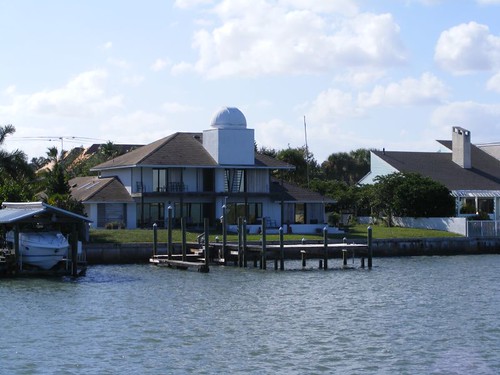
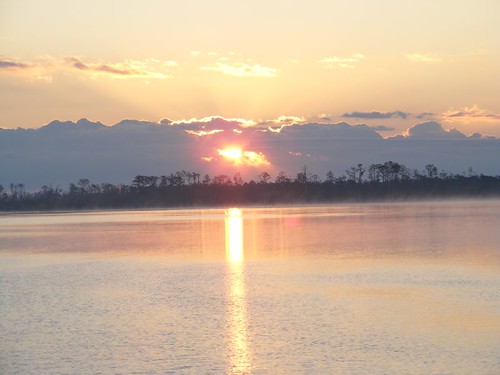
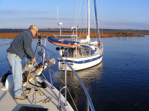
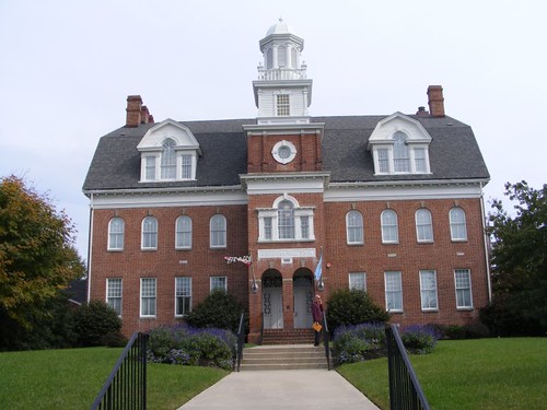
After leaving the Hudson River, we first anchored off the east side of Staten Island near Huguenot Beach, an area of single family residential homes, most of which are very large, but built right on top of one another.  We had anchored here before and knew the sandy bottom provided good holding and there was plenty of room. 

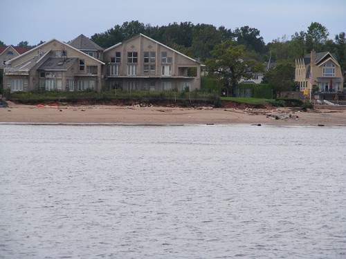
Losing the back yard

We sure were surprised to see how much beach erosion had occurred since we were here in 2009, presumably from the Irene storm event since the yards looked newly eroded.  There was a lot of new-looking debris:  decks, railings, wall pieces, etc.  Being from the east coast of Florida, it is easy to relate to beach erosion, but we had never thought about it being an issue in these parts.

After two nights of intermittent wind, rain, and thunderstorms, with a weather forecast indicating an unfavorable wind shift for our anchorage, we elected to move over to the Atlantic Highlands area.  We would have better wind protection and we would be able to pump out the holding tank at the municipal marina, a task long overdue.  Plus, we would finally be able to check out the anchorage in the area.  Most cruising boats anchor there, but we never have because we felt it would be too crowded for us.

When we were tied up to the municipal marina's dock, trying (the suction wasn't the greatest) to pump out, a pump out boat called the HEAD MISTRESS pulled up on the opposite side of the dock.  The captain handed me a brochure and told me he could have pumped us out at anchor, and his pump out worked better than the one at the dock.  That service is operated free by an environmental group called the NY/NJ Baykeeper whose goal is to try to eliminate fecal matter in Raritan Bay.  Many comments could be made about that.
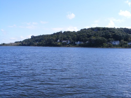
Atlantic Highlands
Atlantic Highlands

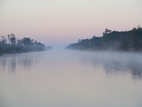
After pumping out, we motored a short distance away and dropped the hook on the southernmost end of the normal anchoring area where we could have plenty of room to ourselves.  The area is very scenic because the high hills of the Atlantic Highlands are looming right out of the anchorage area.  There is a well-used (bicyclists and walkers) waterside recreational path that looks to run along the whole area.  It would have been fun to see how far it goes, but we didn't have the dinghy inflated and we only planned to stay one night.  This anchorage will go on our list of acceptable places now that we have finally seen it.

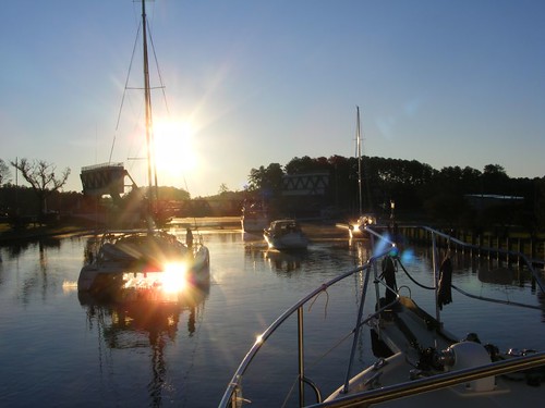
By 5:40 a.m. on Oct. 3, with decent weather finally in the forecast,  we were underway headed out into the Atlantic for an 11 hour cruise to Atlantic city, or so we thought. 

For 6 years we have cruised in FLUKING bliss without having a serious mechanical failure.  That record came to an end after we were underway about 4 hours.  Eddie was at the helm, and I was standing up looking ahead when suddenly the engine starting vibrating oddly.  I looked at Eddie right away, and he said “Do you feel that?”  I said “Of course”, so he dropped the speed back a couple of hundred rpms, and the vibration stopped and stayed fine even after we resumed normal cruising speed.  An hour later, the vibration began again, and it wouldn't go away.  We had to drop down to 1000 rpms (from a normal of 1600rpms), which allowed us to only make 5 KTS.

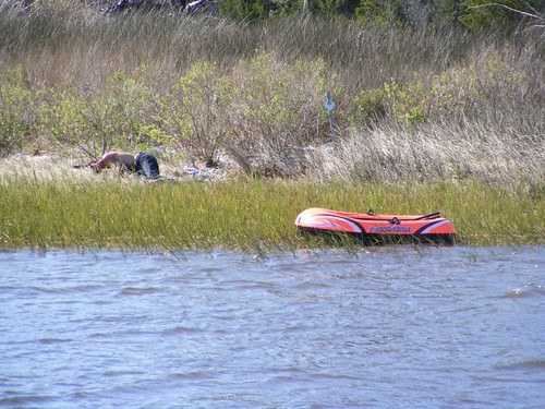
We had to try to figure out what could be wrong.  Our first thought was the vibration was due to something on the prop.  I mentioned that the first time we felt it we were in an area with active commercial fishing boats, so maybe we picked up a piece of netting. 

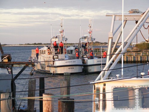
Since the ocean was too cold and rough to jump in and look at the prop, we knew we needed to get into a safe harbor.  We were about 7 miles from Barnegat Light inlet, where we had gone in before to anchor, but said we wouldn't do that again because there wasn't enough room for us and the current is wicked.  However, beggars can't be choosers, and that was the closest place, so that's where we headed.

We called Towboat U.S. to find out about inlet conditions to make sure we could get in under our own power and to be on standby if we ended up needing a tow.  Plus, we asked TUS to arrange for a diver ASAP.

Via cell phone we arranged to get a slip at Lighthouse Marina.  Eddie commented that he thought the “marina” was just for commercial fishing vessels, but we had no where else to go.  When we got to the marina, Eddie was right; we were the only pleasure craft.  But what the heck, we are a trawler anyway, so we were with our own kind in a way.
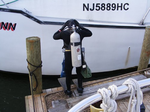
Diver Don
Diver Don

Diver Don showed up in the late afternoon with enough daylight left to still be able to see all the underwater parts clearly.  He gave FLUKE a clean bill of health, being impressed with how great her underwater parts actually looked.  We had hoped to get off with an easy fix of just having a fouled prop that he could clean up, but no such luck.  That meant something was wrong with the engine, and we probably had real trouble.

We did some of our own trouble-shooting and could determine that the vibration only happened when there was a load on the engine, which meant it was calling for more fuel, but “coughing”.  We ended up calling our home mechanic to get some advice, but it was clear some diagnostic testing beyond our means was in order. 

Early the next morning, Wayne called a diesel mechanic, and he was able to come out right away.   We had to do a load test at the dock – really scarey!  We were “bow in” the slip, so we tied off the stern and forward spring lines with our hurricane lines to hold us securely in place.  Then we put the boat in forward gear and upped the engine to 1500 rpms.  FLUKE was pulling on those squeaking lines with a lot of power trying to pull herself forward just like we were underway free in the ocean.  I was at the helm with the throttle control just envisioning the lines giving way or the pilings getting pulled out and the bow crashing into the dock ahead of us.

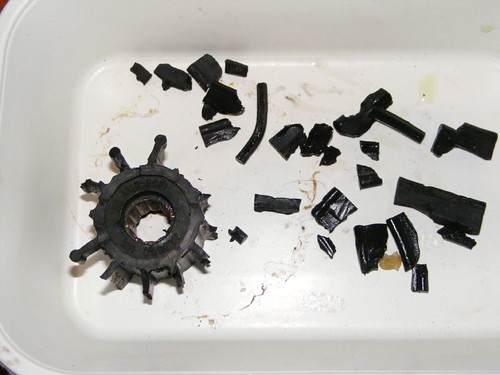
The load test indicated that not enough fuel was getting into the engine, at least in one or more cylinders.  So, that meant it could be some bad injectors (we have 8) or a bad injector pump.  We decided to start with the easiest and least expensive option, the fuel injectors.  They were removed, and the next day we found out that 3 of them were bad.  We elected to replace the whole set.  This news was on Wed. and the mechanic said that unless we had them sent overnight express, he couldn't get back out to us until Mon.!!  We were spending $128/night to be stuck in the slip, so it was a no-brainer to spend an extra $40 to ship overnight.

The parts didn't arrive until late afternoon on Thurs., so the mechanic said that he would show up at 8:30 a.m. on Fri.  If everything worked, we hoped to be able to get underway before noon and not have to pay for another night's slip.  We needed to have enough time to get to the Atlantic City anchorage before dark and before all the other cruising boats got there ahead of us.

Well,  rather than sit on the pity-pot fretting about the engine situation, we decided to keep ourselves busy with local sightseeing and boat chores.

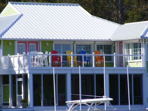
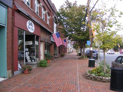
The little seaside community of Barnegat Light is really very nice and would be a great vacation destination.  Lucky for us, the summer season is over, so there are no crowds, no traffic, and lots of vacant wide open beach scenery to enjoy.  Even when the season is in full swing, this isn't a cheesy, seaside resort.  There are a few stores, artsy boutiques, small motels, and several family restaurants and bars.  There are no high rises, carnival rides, or glitzy commercial signs.  You would come here to fish, enjoy the expansive dunes and white beaches.  There are many cute artsy beach houses for rent.
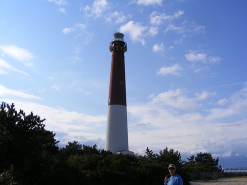
Barnegat Lighthouse
Barnegat Lighthouse

If you arrive by boat or car, you can't miss the lighthouse at 165' high.  It was first lighted in 1859.  It is open daily, free, and is a great way to see the lay of the land and sea.  At the intermediate levels there are information posters about lighthouses and other safety keepers of the sea.
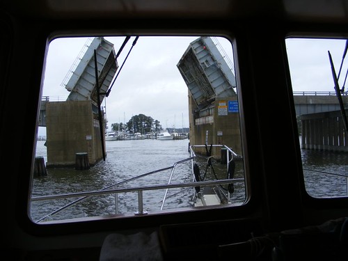
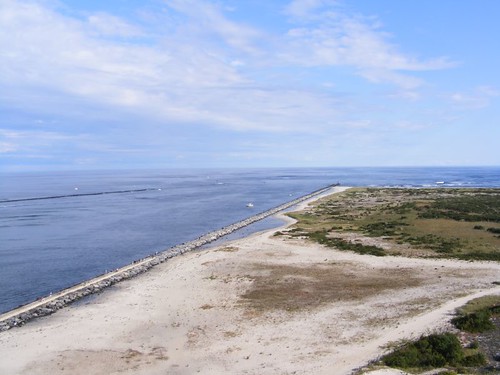
The inlet
The inlet

While the inlet in this photo may look benign, it can be very treacherous in windy conditions, and no matter what the wind or the tide are it is critical to follow the channel markers because of constant shoaling.  We read that the inlet is dredged up to 3 times/year.  Barnegat Inlet State Park is to the right of the inlet in the photo.
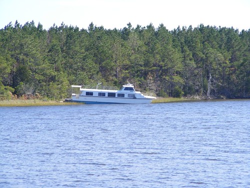
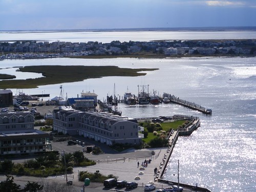
The marina
The marina

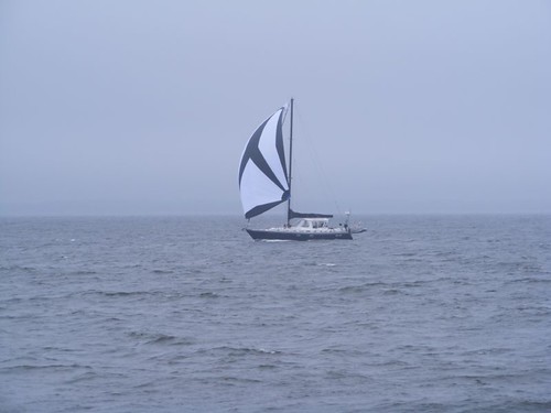
See if you can pick out FLUKE in the photo.  Most of the fishing fleet is out, so it is easier to see her.  We had the opportunity to get to know several of the fishermen, and I found myself looking forward to seeing them return and hoping they had good catches of fish or scallops.  It didn't feel “right” being at the marina without the fishing boats!  They asked us as many questions as we asked them, and they were very sympathetic about our breakdown.

Homeland Security
Homeland Security

The Coast Guard station is on the property right next to the marina, so we watched them take out their boats daily.  When the wind was really howling, they would practice towing and docking maneuvers at their own dock, and even at our marina docks, as seen in the photo.
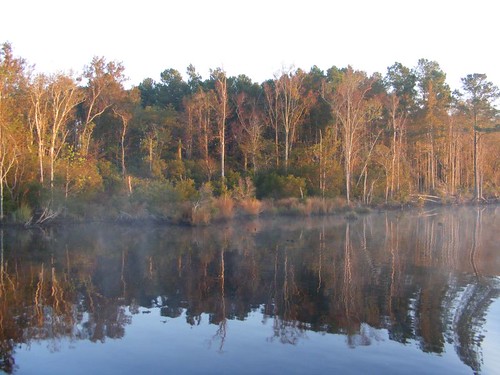
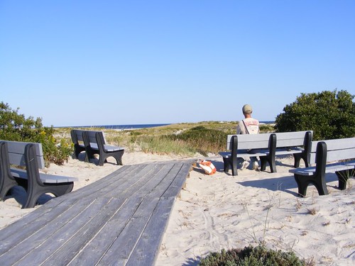
Dune dreaming
Dune dreaming

The dunes cover an expansive area.  Even when you arrive at the crossovers, a short distance from the street, it is a LONG walk to get to the beach, and in some places, the beach is quite wide, so it is even farther to get to the water.  But the terrain is beautiful, and you can find peace and solitude.  It is nice seeing a beach community where there are no houses right on the beach; all the homes are on the west side of the big dunes. 
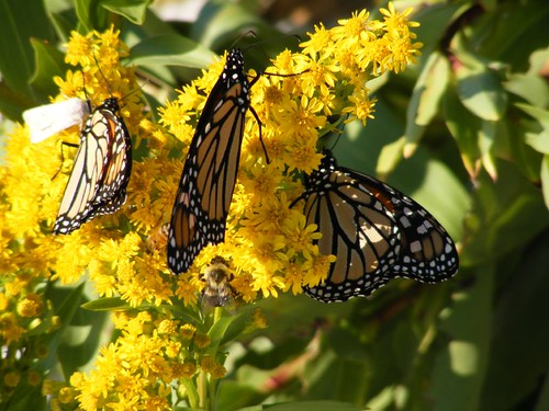
Golden sweets
Golden sweets

Right now the dunes are ablaze with flowering goldenrod.  The monarch butterflies are everywhere; we even saw them out in the ocean.  These 3 butterflies had some other dinner company, the bumble bee and white moth.
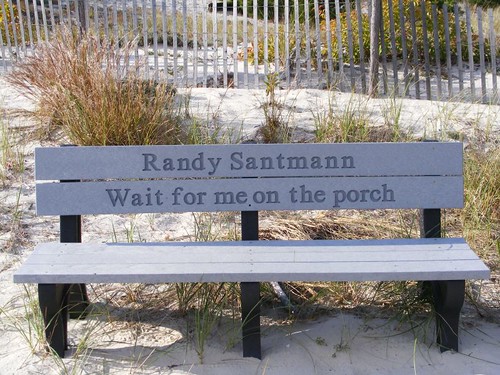
Bench memorial
Bench memorial

The community has had a successful funding program for putting up memorial benches.  They are everywhere:  on the crosswalks, fishing areas, along the streets, park trails, etc.  Most have personalized messages in remembrance of a loved one.  What a great idea.
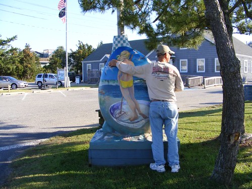
Clammy hands
Clammy hands

An environmental program has been established to try to repopulate the bay area with clams.  To draw awareness to the program, artists have decorated fiberglass clams, which are on display throughout the community.  Eddie was trying to get chummy with this clam digger.

When Friday morning rolled around we were in a state of anxious anticipation of the mechanic arriving and getting our engine fixed.  We all had a list of jobs we needed to take care of so that we would not be delayed any more than necessary once the engine was fixed.  Foolishly, I actually thought he might arrive early.  Good thing I wasn't holding my breath.

The mechanic showed up at 9:30, not a word about being so late.  Installation of the new injectors went along smoothly.  Diver Don even showed up again wondering what had turned out to be the problem.  However, when it was time to start the engine, it wouldn't fire up, presumably because air had gotten into the lines.  It took a while to bleed out the air, but the engine finally turned over and was purring like a big CAT should.  FLUKE still had to do that dreaded in gear test tied up in the slip to make sure all the cylinders were firing properly, and she passed.

Within half an hour, we were headed out the inlet (we have faith in that engine!), on our way to Atlantic City.

P.S.  For you pop culture fans, we never did see Snookie or The Situation!