Wednesday, August 31, 2011

Creeping Along the Rideau Canal - Part 13

August 7 – 8, 2011

Part 13 - Long Island

After leaving Merrickville, we would have our biggest day of travel on the Rideau – 31.5 miles. Most of the locks that we would go through did not have mooring sites available, so we kept going until we really needed to stop. More about that later on.

We locked through Clowes, Nicholsons, and Burritts Rapids. When we were at Burritts Rapids it looked like there was a boater's convention going on. The place was packed, with some of the boats rafted up. We saw the 4 French boats again, and they cheered when we locked through. We were hoping to be able to reach the wall in Ottawa before those 4 showed up, thinking that space would be limited. So we were happy to see that they were tied up and happily partying. Maybe we would be able to stay ahead of them.

We experienced low water depths in the lock cuts, but when we were out in the Rideau River, we had good water most of the time. We just had to go SO slow, which created a hidden problem I will talk about later on.

Eye level worker
Eye level worker

This stretch of the river took us by several communities that had associated infrastructure and businesses such as busy marinas associated with them. A bridge under construction was the first big construction project we had seen since leaving Kingston. The bridge wasn't part of the canal system; it was part of the road transportation.

All together now
All together now

One community had a huge rowing club on the river bank. There were several different types of rowing vessels out on the river, but this one caught my attention. Notice how all the paddler boys are on one knee, and the rudder boy is standing up. There were some of the same kind of boats with only one or two people racing each other all around us like water insects.

Near to our hearts
Near to our hearts

We can sniff out ice cream on land or sea. The name of the boat, Ice Cream Float, is just too cute and so appropriate. He tooted his horn at us, and you should have seen the look on their faces when we answered back with ours!

A few miles ahead of Long Island lock, Eddie went down in the engine room to do one of his engine room checks. He noticed that the exhaust elbow was extremely hot, well above an acceptable level and he found out that the Shop Vac hose that had been touching it was completely melted. Now I must say that there had been a melted plastic odor for several days, but the source could not be found. Having found it, and now knowing what caused it, was concern for alarm. So, we decided to tell the lockmaster that we would lock through the 3 locks and tie up on the dock below them to try to figure out what our problem was. At least it looked like a great place to be stuck.

FLUKE  trying to recover at Long Island
FLUKE trying to recover at Long Island

The heating issue had to be related to reduced water being available for cooling the exhaust gas. However, the same water is used to cool the engine, and our engine had not been experiencing an overheating problem, or so we thought according to the temperature gauge.

So, we checked the strainer which is where the water gets “cleaned” of debris before it is sent to the engine heat exchanger. It had some organic debris in it, but not enough to justify reduced water flow.

So, the W & E Marine Maintenance Co. decided the problem had to be in the elbow, perhaps a crack. That meant disassembling the whole big thing which took the entire following morning, and it is hard, physical work because of how tight the hoses are and how tightly they and the elbow are crammed into their positions. Upon internal inspection, the hoses and elbows were clean, and had no cracks. That meant the obstruction had to be before that area too.

So, the next, and what should have been the FIRST place to look, was on the outside of FLUKE, where the water comes into the boat. Eddie, a.k.a. Lloyd Bridges, jumped into the water to look at the intake strainer. Sure enough, it was covered with aquatic debris. After cleaning that off and letting the water flow freely into the boat with the hose disconnected before the strainer, a big, disgusting plug of organic debris popped out. Poor FLUKE had been running with COPD for who knows how long. We were lucky that she did not suffer permanent damage to any systems. That was truly a Sea Stooges blunder on our part since we knew we were running through deep weeds a lot of the time and should have expected trouble of some sort.

In retrospect, as part of the crew break down analysis discussion, we figure that the engine didn't show the effects of low water because we were going so slow, at low RPMs for such long periods of time, it lessened the strain on the engine. Had we had a exhaust temperature gauge on the elbow, we would have been alerted much sooner. So now we know to monitor that area more closely, and are contemplating installing a gauge.

A Rideau scow
A Rideau scow

We sure were surprised to see this maintenance scow come through the lock to drop off some planking for dock repairs. Long Island Lock has a canal maintenance yard in one section of the huge property (the largest in acreage that we have seen); we walked by it and could see floats, markers, and other canal supplies. This was the only time in 3 weeks of canal travel that we ever saw a maintenance vessel, and it was just by its home base.

The Karwartha Voyageur, that cruise ship I featured in the Narrows blog, came through, locking up. It takes so long for them to get through the 3 locks, many of the passengers get off and walk around. Several of them came over to FLUKE to talk to us about their trip and ask us about ours. When they, and everyone else, sees we are from Florida, they all ask the same question: How long did it take you to get here? If you have been following this blog for any length of time, you know that is not easy to answer, and it always generates many more questions.

A day boater with his two little girls and a dog came through the lock to tie up and let them all get out and run around. He couldn't get his engine started because his battery was dead. Out of desperation, in his best English (he was French), he asked if we could help. Ever ready Eddie has supplied FLUKE with a customized set of 20' long jumper cables (he made them) so we had the guy back up his boat to our stern, and we could just get the cables stretched to make the two end connections for a successful jump. FLUKE always tries to be a goodwill ambassador.

Ski chair
Ski chair

We took a long walk over the top of the dam to Nicholl's island, on the opposite side of the river to where we were docked. I think once upon a time, it used to be just a few weekend seasonal fishing cottages, but now there are several cute, upscale homes. This unique chair made from snow skis was sitting in front of one of the dwellings, a clever recycling idea!

We're not always in a fog

When it was time to depart, the fog wasn't bad enough to keep us from leaving the dock early. We had a big day planned since we would be making the final stretch into Ottawa, only 14 miles ahead. The 4 French boats never had passed us, so we hoped there would be space for us.

Tuesday, August 30, 2011

Creeping Along the Rideau Canal - Part 12

August 5 – 6, 2011

Part 12 – Merrickville

Merrickville was named after William Merrick who arrived to the area in 1793. He recognized the enormous potential the falls in the area presented for industry and set up several milling operations. By the time the canal building began, 1826, Merrickville was a prosperous community. The citizens welcomed the idea of having the canal go through the area because they realized how it would make distribution of their goods much easier. Colonel By went out of his way to lay out the canal such that it would not affect the milling industries, unlike in several other towns, where he just bought out the mill owner and shut the mill down.

That “generosity” came back to bite him when William Merrick needed to fix one of his mill machines. He constructed his own dam to alter the water flow to aid in the repairs, and in so doing, cut the flow of water downstream for the canal system to an unnavigable level. Colonel By was furious, and told the government he needed to have full control over the water for the canal system or its operation couldn't be relied upon. The government agreed, and passed laws about water use that still apply today.

Overview of Merrickville Locks 21, 22, and 23

It was a good thing we timed our arrival to Merrickville (7.5 miles from Kilmarnock) for early in the morning because by noon all the dock space was filled up. We knew that those 4 French boats we had met at Poonamalie were headed this way, so we wanted to make sure we were ahead of them.

The lockmaster was expecting us, and told us to tie up to the wall where you can see one boat in the above photo, under the “lock station docking” text. That area is known as The Pond. One sign behind us said “Danger”, and the other sign in front of us said “Extreme Danger”. That gave us a comfortable feeling!

FLUKE on The Pond wall

This photo shows how weird it is for the motorists to see boats above the level of the road. Since we are so high, the effect is intensified.

Notice that each of the locks has a basin associated with it, so they are 3 individual locks. Lock 23 has to operate in conjunction with a bridge, which was having some operational problems when we were there. The left side of the approach into Lock 23 is also a campground; the sites are really nice since it is quiet, and campers can easily watch all the boats go by.

The Rideau River rapids

Part of the original river bed and rapids still remain and are visible in the photo to the right of the strip of green space located to the right of Locks 21 and 22. You can see how rocky the river bed is, some areas having solid sheets of hard rock especially visible now since the water level is so low. An organization called Friends of the Rideau has created a waterfront trail that takes you from their headquarters, called The Depot, above Lock 23, all the way around to the entrance to The Pond, next to the lock cut. Pick up a descriptive brochure for your walk from The Depot.

The main street
The main street

The little town is very charming. There are plenty of restaurants, clothing boutiques (I think a lot of the French Canadians shop here for their line handling outfits!), gift and artisan shops, and importantly, ice cream vendors. It is worth the time to walk all the way to the opposite end of the street to the glass blower's gallery. He actively works on his treasures out in the open and willingly answers questions between the different melting stages. His creations are truly works of art, not cheesy trinkets. Eddie purchased a Witch Ball, purported to ward off bad spirits and create peace and harmony. We certainly need that for FLUKE, but since he can't figure out where to safely hang it, it is not performing its magic yet.

We ate at the Goose & Gridiron because when we were at Poonamalie the French people told us it had the best fish & chips in Canada. The fish was great, but the chips were just mediocre.

Eddie and I browsed many of the shops during the town event called “The Inside Out Sale”. We bought a bat house, made in Canada. We had been trying to find a bat house for a while and were happy to finally get one.

Percival House, 1890

Wayne and I took a couple of our requisite neighborhood walks. The Merrickville & District Historical Society (MDHS) publishes a walking style brochure. This style is called Richardsonian-Romanesque. Roger Percival was a foundry owner who must have had a good business to build a home this opulent. Notice the entry arch for the old coaches.

Because Merrickville was the most prosperous town between Ottawa and Kingston, Colonel By felt it would be a logical target if an invasion by the Americans was to occur. So, he built a defensible blockhouse, the second largest in Canada. You can see that it is right next to Lock 23 in the overview photo. Today, the MDHS manages the blockhouse as a museum. There are a lot of canal artifacts, canal period lifestyle memorabilia, and even an original one room schoolhouse. Most of the items have been donated by residents.

Dog treadmill
Dog treadmill

This thing really fascinated me since I am such a dog lover. You can see where the dog would be placed, and by walking, would make the wheel turn to run a churn or grinder. This was the first time I'd ever seen a dog-powered piece of equipment like this.

Merrickville merits a stop, whether traveling on the waterway or roadway. You won't be disappointed.

Monday, August 29, 2011

Creeping Along the Rideau Canal - Parts 10 and 11

August 3, 2011

Part 10 – Smiths Falls, Where It Finally Happened

It was only 2 miles to reach the first lock at Smiths Falls. I think we were all looking forward to arriving here. A lot of people had talked about it, and the town does the best marketing job of any community along the Rideau promoting itself with a lot of glossy advertising. Turned out for us, the advertising was a lot better than the real thing!

Overview of Smiths Falls Lock Area

The first thing you should notice is that it looks like we have arrived at a city. For me, it was a culture shock to be in such a congested setting (population 9000). The canal builders had to overcome a 36' drop in a quarter of a mile. One of the contractors wanted to circumvent the falls area altogether, but Colonel By didn't like the alternative which would have been working in extensive swampland with lots of hard rock.

So, in the photo, what we had to deal with was first locking through the detached lock, indicated in the upper part of the photo. If you look closely, up a little, about an inch from the arrow you will see a basin area to the left. That is a wall where boaters can tie up to stay overnight or go shopping at the nearby big box stores of all sorts that have sprung up on the outer part of the original town. Rather than lock through right away since we wanted to do some big grocery shopping, we decided we would tie up to the wall and then lock through after we were finished shopping.

We always pull into the wall area very slowly, and as we were headed towards it, we felt a thump and another thump. I looked over the side, and my heart sank because I could see a rock ledge. I knew that's what we were sitting on. Even though we had hit the bottom in Poonamalie, that really didn't count since we knew we could just push away from the wall, and it wasn't our fault that we touched there anyway. This grounding had the potential for real trouble.

Wayne tried reversing the engine to back off, but we have such limited power that it had no effect. Our only choice was to try to use the same strategy to get pivoting power from the bow thruster. Inch, by slow inch, the bow began turn as we heard the keel getting scraped along. Forget about worrying about the bottom paint, we probably scraped off some gelcoat with that grounding. Fortunately, the keel is very thick, so we have some layers to spare before we have to worry about any leaking or structural damage.

Once we were off, but pointed in the wrong direction to enter the lock, we had to go back out into the lock cut since that appeared to be the only place with enough room for us to turn around again. The lock attendants were yelling at us, asking if we were leaving or wanting to go through. We told them we wanted to go through, so they had to hold the lock open until we made the turn. When we thought we could circle back, we touched the bottom again, but we knew it was silty, so Wayne just powered the bow around with the thruster. By the time we got into the lock, everyone's patience had been tried to the max. We apologized since that's about all we could do.

The DANGER sign was appropriate for us

Needless to say, our welcome to Smiths Falls didn't get off to a good start. I was already thinking about leaving as soon as we were tied up! Pretty ironic, since we before we arrived we planned on staying at least 2 nights. Notice we are tied up by another dam, but at least the water running over the dam helped block out some of the traffic noise.

Back to the photo. You can see Combined Lock 29A. In 1973 it was constructed to replace old locks 28, 29, 30 to try to streamline the transits. 29A has the highest lift on the canal, 26'. Unlike all the other lock chambers previously, this one is fenced off all the way around; people can't just walk up to the edge and peer over like they do in the other ones. The lock chamber, hydraulically operated, uses 750,000 gallons for each fill and has its own fire suppression sprinkler system. For historical comparison, the old locks were left in place so people can conveniently view the old and the new. Smiths Falls was the site for the construction of the first locks on the Rideau Canal.

The open area with all the water between detached lock and the combined 29A is park area of varying sorts. On the left, just under the arrow for detached lock is a whole row of RVs, followed by several docks. They are part of a combination campground/marina. Of course the marina supplies hydro. Just above the arrow for combined lock 29A is the lock wall area under the jurisdiction of Parks Canada, and that's where our mooring pass allowed us to tie up, in deep enough water, with no hydro. Most of the green space around the water is city park areas, which get an enormous amount of use for walking, biking, and lock watching.

Railroad bridge
Railroad bridge

If you look closely above the detached lock you can see this bridge from the overview photo. It is the signature canal marker for Smiths Falls. This bridge is visible from quite a distance upstream as you are making your way through the marshy flats towards the town. The landmark is a National Historic site because it is a rare example of a Scherzer rolling-lift rail bridge (but you probably already knew that, huh?!) which lifts up from one side, rather than swing out. The canal celebrated its 150th anniversary in 1982, and the bridge has been frozen in that position since then.

The abandoned lock chambers

Some water is diverted into the old chambers and cascades downstream over all the sills. For reasons I have no idea about, huge flower pots are set in the chambers.

We walked out to the new town area with the big box stores and did our shopping. Plus, there was a new laundromat within easy walking distance in the old town area, so I was able to do 4 loads of wash at the same time. Wayne was able to glean helpful and encouraging information from the friendly lockmaster at the combined lock as to what would lie ahead for us and areas we needed to watch most carefully.

Rideau Canal museum
Rideau Canal museum

This old mill building is the nicest preserved building in the old town area, visible from the locks. It houses the Rideau Canal museum. I went in and looked around, but since we have been reading every placard and viewing all the videos at all the locks we have stopped at, we decided not to tour this museum.

The residential areas immediately adjacent to the old town area have some fascinating homes from the canal building era. Many of the them are multi-family, duplex type homes that must have been popular in that day to house the growing town centered around the canal building project.

The black, gray squirrel

I haven't mentioned that I've been trying to get a good picture of one of these black (the term used is, melanistic), Eastern gray squirrels. When we were walking through an old town neighborhood early in the morning, this one was feasting at a bird feeder and I could get pretty close before it ran away. While I've seen a lot of them, they always scamper off or up a tree before I can get a good picture. My hopes of getting a good loon photo are further diminishing because the canal habitat is changing, and we are seeing fewer of those birds.

After we had been at Smiths Falls for a day and a half, we decided to move on, back out to the rural part of the canal again and better position ourselves for the next lock we wanted to spend time at. This was the first time on the canal that we just looked at each other and said “We've had enough of this place” and left.

August 4, 2011

Part 11 – Kilmarnock Lock

Edmunds Lock dam
Edmunds Lock dam

Once you leave Smiths Falls it doesn't take long in terms of distance to get back into the country. We locked through Old Slys and Edmunds Locks without incident. The dam at Edmunds was so long, and the photo gives you an idea of how flat the land has become. No more of the big boulders and rocky rises covered with conifers.

One of many farms
One of many farms

Large farms, mostly dairy, lined both sides of the canal. Corn is coming to harvest and some of the fields go out of sight.

Evening stillness for the FLUKE crew

Kilmarnock Lock is really in the middle of absolutely no where. It is the first lock we came to that didn't have any people watching the lock activity, swimming, or picnicking. Although, towards evening some people came to fish. It is as opposite to Smith Falls as you can get; it only has a 2' lift, the smallest on the canal. It has a unique swing bridge. To move the bridge, it is pushed out of a little groove and then just swung to the open position. There is no crank mechanism like I showed you on the other bridges. If you look in the photo you can see cables attached from top to bottom. A couple of times/day, the bridge has to be “tuned” to be able to swing properly. The changes in heat and humidity throughout the day cause it to warp enough such that it will not swing out properly if fine adjustments aren't made.

Kilmarnock swing bridge

When we pulled up just short of the lock, the lockmaster and his assistant were standing next to the swing bridge watching us come down the lock cut. When we got close enough, they asked what we wanted to do, and looked surprise when we told them we wanted to stay the night there. Since it wasn't obvious where to tie up (they only had these little rings attached to the side wall), I asked where we should stop. The lockmaster, whose body language clearly indicated he had some kind of attitude, harshly replied and pointed to the spot to stop.

The lockmaster commented that he was surprised we had made it as far as we had. He went on to say that the worse would be ahead of us, and said he doubted that there would be enough water depth for us to make it to the end of the canal. Plus, he knew that the canal level was dropping daily and that the places we had already passed by wouldn't be able to carry us either. He never made any positive suggestions or gave us tips for areas that lay ahead; he was the only, and most negative, lock person we had encountered the whole trip.

This is for that lockmaster

After dinner we took a walk up the hill and along the country road and encountered farm pastures. There were a couple of donkeys in the field and they came over to the fence so I could scratch their heads. The deer flies were eating them up!

We should get an A for effort

We walked by a beautiful apple orchard. The trees were heavily laden with colorful apples of all sorts. The sign said that the place would be opening in only a week. We were sorry to have to miss it. The orchard is on a hill slope adjacent to the canal and we could see down the tree rows and into the swampy marsh areas of the canal.

Dam floats
Dam floats

After an exceptionally quiet night's sleep, we went for an early morning walk to look out over the marsh. These colorful dam floats looked interesting in the still waters.

In the right light
In the right light

FLUKE looked exceptional, even her reflection in the still water. This photo captures a lot of what I will remember about traveling on the Rideau.

Despite all my anxiety and frustration over that nasty lockmaster, I am happy to say that I may have finally gotten a halfway decent loon photo. I can't show it yet though, because the contest hasn't officially ended and more candidates may be entered. My crewmates will be so relieved when I have completed this miserable challenge.

Saturday, August 27, 2011

Creeping Along the Rideau Canal - Part 9

August 2, 2011

Poonamalie Lock

After we pulled up the anchor at Colonel By Island, we got back out in the main canalway with our sites set on traveling 15 miles to our next stop. On the way we decided to stop at a marina, Rideau Ferry, right next to the canal for a pump-out. This facility could easily handle FLUKE, and it was easy to get to the dock. Other than almost getting hit by a powerboat that came roaring into the dock, we had success. Ordinarily we would want to take on water and fill our tanks, but we have been afraid to add any more weight. Rain has been in the forecast, but not having gotten any in about a week, added to warm, windy temperatures, the amount of water in the Rideau has been dropping. We are having more anxiety. Floating on the edge is the pits.

Overview of Poonamalie lock area

We planned to stop at Poonamalie because it would better stage us for where we wanted to be the following day. This lock name is so far off from the others thus far I will tell you what I found out about it. The terrain and cedars in the area reminded one of the Royal Engineers of the Tamil region in India where he had worked on a previous job. The name actually means “cat hill”. I didn't see any cats, just a rabbit, ground hog, mink, and chipmunk!

I've used the photo above to point out some more of the features of canal construction and how they affect our travel. This lock cut is VERY long; you can't even see the lock yet in the photo. It is also VERY narrow. So, when we were approaching the cut, from the lower right hand corner, there is a sign that says “Sound Your Horn”. That is so the lock people and other boaters know that you are approaching and to take heed that there may be a passing issue. The boats you see in the photo are very small ones, so don't fill the lock cut like we do. We would have been challenged to have another boat pass us, and we couldn't have given way to either side as they are rocky and narrow. Colonel By realized that this could be a problem and built a lay-by about half way up the cut, a basin where boats could pull to the side while other boats passed.

You can see a portion of the Rideau River in the photo. Notice how it has a sharp turn in it. In this area, the river is very twisting and turning, which would have made navigation difficult, so having the long cut helped.

The water control weir here is used to control the level of the water in the Lower and Big Rideau Lakes. That level affects the level in the canal and the level at the docks of all the lake owners. If it is too high, their properties could be flooded; if it is too low, the canal passage can't be maintained.

When we pulled up to the gray line at the lock at around noon, there was only one other boat present. The assistant lockmaster, Remi, came over and asked what we wanted to do. We told him that we would stay there for the night, but if other boaters came in that needed hydro we would happily move to the opposite wall and tie up since we didn't need the hydro.

In a couple of hours, 4 Montreal boats arrived, all wanting hydro. So, we asked Remi where we should go, and he pointed to the wall just across from the gray line. One of the lock attendants showed up to help with our lines. As we were nearing the wall, we felt a thud and saw that we had stirred up the bottom. We knew we had run aground, but it felt like we were on a soft material and not rock. We supplied some entertainment trying to get away from the wall and get floating again. Using the bow thruster, the boat was able to pivot off the bar and get out of there. The French people from Montreal all cheered, and one of them brought us a bottle of wine.

We decided to go through the lock and tie up on the low side (after checking the depth!). After we got settled, we tried to have a conversation with them. Fortunately a couple of them spoke English well and could translate for all of us. They suggested we consider staying in Canada until the U.S. straightens itself out! At the rate things are going, that would mean the FLUKE crew would all end up dying in Canada.

Canal paddler
Canal paddler

This guy set up a tent for the night at the lock. We had never seen a boat like this before; it operates by paddling with your legs or the sail can be unfurled to catch a breeze and move the boat.

Our final resting place

So far this has been the only lock where we have had 3 different dock positions. At least we finally ended up having a peaceful night, all to ourselves in this rural area.


Thursday, August 25, 2011

Creeping Along the Rideau Canal - Parts 7 and 8

July 31, 2011

Part 7: The Narrows

Overview of the Narrows Lock

Looking at the above photo, you can see why they call this lock The Narrows. Before the canal construction days, Big Rideau Lake and Upper Rideau Lake were all one lake. Colonel By figured out it would be easier to build a dam and a lock at this narrow portion of the lake which would raise the level of the Upper Rideau side about 5', allowing for less digging through bedrock to make a navigable channel on the Upper Rideau side.

A pinhole channel in the lake

You can see from this photo how narrow the channel really is even though it is surrounded by a broad expanse of lake water. We had to pay close attention to markers like this, so that we could be “guaranteed” to find the deepest water for our passages. Remember, I told you that Colonel By wanted to minimize having to dig through bedrock, and we sure didn't want to end up on any of it he didn't dig out, outside the channel.

We had only traveled 5 miles from Newboro before tying up to the dock in the right hand side of the photo, on the side where you can see the two boats. It was pretty windy, so we wanted to wait for another day before we locked through here. It would be the first time we would enter a full chamber to begin locking down, and we had heard that the water level would be almost up to the top of the lock. That could mean that if it was windy we could get pushed too close to the side of the lock and scrape the hull. We were also worried that the lock attendants would be in added danger of trying to push FLUKE from the sides.

All that silvery looking stuff in the upper right of the photo isn't ice; it is a big mat of algae and aquatic plants I spoke about earlier. That area is very shallow.

Notice how really long the docks are for this lock. That is because this lock gets so much day use by locals making ice cream runs to the nearby town of Westport. (We couldn't visit that town because there isn't enough water in the area for us to get into the town dock.) The blue lines fill up quickly with boats waiting to lock through, and the little lock runs continuously on nice days during the season.

Local land lubbers come to the lock just to watch all the boats locking through. A lot of people are there to look at not only the boats, but also the people, mostly women, on the boats. Through not so astute observations, I have learned that in these waters, a critical part of every woman's boating wardrobe is what she will be wearing to handle the docking lines for going through locks. This can vary from small pieces of fabric covering critical parts so as not to be arrested, but still leave little to the imagination, to flowing sarongs, long or short in length (mandatory to be cut as low as possible), and all kinds of outfits in between. There is no age requirement for any specific outfit either. It is not easy to move around on some of the boats to handle the lines because the bows are very steep and the railings low and flimsy. That forces the line handler to slide around on her butt, many looking like sea lions trying to move on land. No matter what the outfit is at that point, there is no element of grace involved. Call up Eddie to hear him describe what that maneuver looks like if a woman isn't wearing any underwear! No photos will be shown of me in my line handling outfit because I never did get one. As usual, I'm just not with “it” as far as fashion goes.

The Narrows swing bridge

This little bridge operates in conjunction with the lock. It is cranked opened and closed by hand as demonstrated by the lock attendant walking the crank around a gear set in the bridge. To our complete surprise, spectators are even allowed to be on the bridge when it is moving. You can also see one of the little traffic gates which are manually opened and closed. On Sundays, the entire lock is operated by an all-women crew.

Kawartha Voyageur
Kawartha Voyageur

Imagine our surprise when we looked out to see this canal cruiser in the lock. It was constructed specifically to fit through the locks by having a fold-up bow. In the photo, the bow is in mid-position, waiting to get fully lowered. We ran into the Kawartha another time later on and had the opportunity to talk to some crew and passengers. It makes a 5-day cruise from Ottawa to Kingston; we spent 3 weeks. The draft is only 4', but that is across the whole bottom, so they, too, are challenged in some of the shallower areas, especially where the weeds are really bad. One of the passengers told me they served food 8 times/day and it was all homemade and really tasty. Most passengers gain 10 lbs. on the trip!

Eddie made his first French-speaking friends here, Francoise and Louise. Because Francoise spoke such good English, Eddie was able to communicate well with him, engaging in boating and political conversations over a couple of beers. We would end up seeing them again a couple of more times before we left Canada, and it was always nice to see their familiar faces in the crowds of French-speaking people in which we would find ourselves.

August 1, 2011

Part 8 - Colonel By Island

We can't believe it is already the beginning of August. We must be enjoying ourselves since we have lost track of time. We even think we are going to be able to make it all the way through the Rideau without having to turn around and go back.

After we left the dock at the Narrows, and locked through and down without incident, we entered Big Rideau Lake. It is named that for a reason since it is the largest body of water on the Rideau system, and one of the prettiest. I always talk about how shallow the water has been for us. Well, on BRL, we passed over one spot that had water 330' deep – can't complain about that! There are beautiful vistas all around because of the interesting rock formations, some with significant elevation changes. It is said that there are so many places to anchor here, a cruiser could spend the whole summer exploring, and living off the waters since the fishing is supposed to be excellent, and there are sources for ice cream nearby.

Our destination was Colonel By Island, currently under the ownership of Parks Canada. However, the island was originally a summer cow pasture, called the Isle of Guernsey, until the late 1890s when it was sold to be used for a fishing lodge location. After a few other changes of ownership Parks Canada purchased it in the 1980s with the idea of honoring the canal's builder. After exploring the island, I think Parks Canada could have picked a better island, more representative of the beauty of the canal, complete with more of the geological and natural challenges that Colonel By had to overcome during construction.

The crowded dock
The crowded dock

We originally intended to tie up at the park dock. However, when we pulled up there were 3 boats at the dock, all with large spaces between them. If any one of the boats could have moved closer to one of the others, we could have found space. By the time we had our anchor set, we could see 3 other boats headed toward the dock. When they got to the dock, the other boats moved. Clearly, they were saving the space for their friends. They could get away with doing that there because no park personnel are present to direct dockage like what happens at the lock docks. Oh well, we had a nice view from where we were anchored and didn't have to listen to all the noise from the dock party that developed.

We did launch the dinghy to go ashore to explore the island. A placard said that there was a 2 mile hiking trail loop around the island so we decided to take that.

Scenic overlook
Scenic overlook

Overall, the island is mostly flat, so the trail is easy. We did find one nice overlook, with the big rock formations that are present around the lake. Since it was originally used as a cow pasture a lot of the native vegetation had been cleared for the pasture field so there are no old stands of conifers or hardwoods.

Thistles
Thistles

One dry area had some thistles that had already gone to seed and were flying in the wind. I always like to see those delicately dancing through the air. They were next to a berry patch where I could pick a few for a snack.

The picnic area
The picnic area

The public area off the dock has a nice picnic area and neatly mowed grounds. The pretty, curved, stone wall breakwater is a great place to catch some rays after you get out of the cold, clean water. Just beyond that is a great swimming area which has a natural, flat rock bottom so you don't have to worry about swimming in so many aquatic weeds.

The best part about visiting Colonel By Island is not going ashore, but just enjoying the beautiful scenery in the vicinity; it reminded me of some of the islands in the Thousand Islands. Plus, I saw several loons and tried to take some more pictures to add to my growing collection of lousy possibilities to share with you. I haven't given up, but my optimism is waning.

Wednesday, August 24, 2011

Creeping Along the Rideau Canal - Parts 5 and 6

July 27 – 28, 2011

Part 5: Davis and Chaffey's Locks

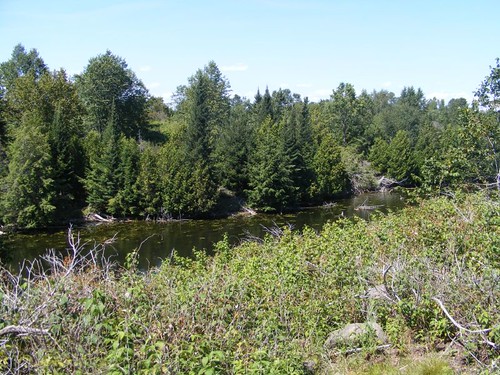
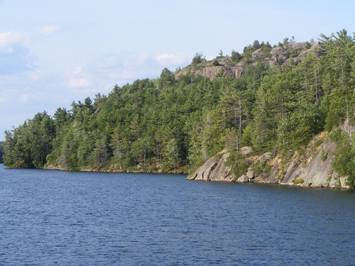
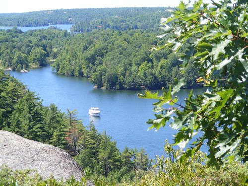
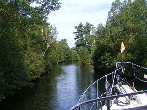
As soon as we left the Jones Falls dock, we entered a very narrow channel with tight turns; it was necessary to sound the horn so other boats would know to exercise caution and hold back or get ready to react to oncoming traffic. Fortunately, since our horn sounds like it belongs on a destroyer, other boaters usually take heed. The narrow waterway turns so much in a few of the passages, there are those ninety degree turn signs attached to rocks and trees.

We only traveled another 5 miles from Jones Falls before we reached the Davis Lock. It is a single lift chamber, only 9' up. It has a reputation for being one of the quietest locks since it is in a rural area, with many lake cottages on Sand Lake to its south and Opinicon Lake to the north. Since we knew that Chaffey's Lock and the tiny town of Elgin were both within bicycling distance, we decided that we would stay a couple of nights at Davis.

What we didn't know was that the lock is run like a military encampment by the lockmaster John. He has been there forever and knows all of the local boaters and property owners, and from our observations, is well-liked by all of them. So, when we came up to the lock and announced that we wanted to lock through, but stay on the upper level, John came over and said that if we didn't want to hook up to hydro (which we didn't), he prohibited us from using our generator. He said he had “folks that came to his lock for peace and quiet”, and he wanted to keep it that way. Well, okay, we like the quiet too.

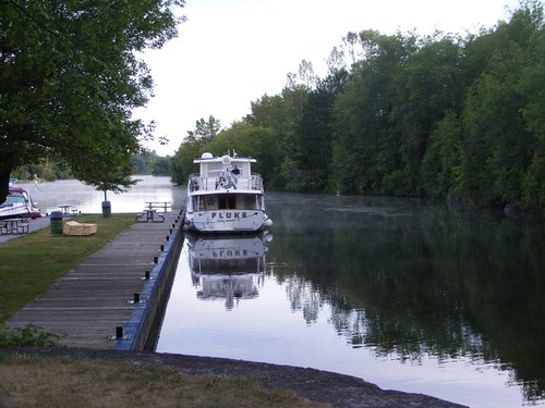
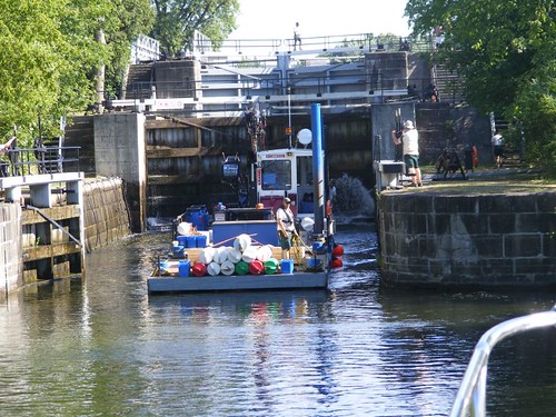
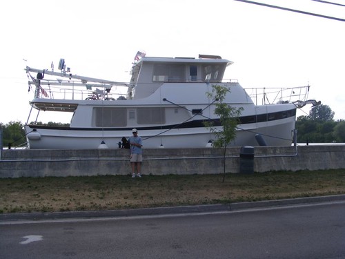
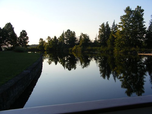
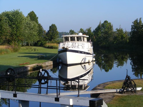
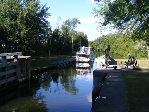
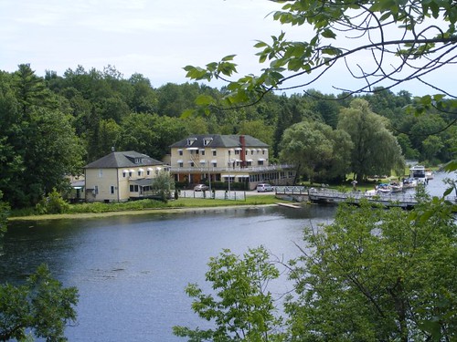
FLUKE at the Davis dock back annex

Then, he instructed us where to take FLUKE, which was away from the regular dock and back around the corner, right next to the overflow dam. With great reluctance we slowly inched our way to where John stood, yelling at us to get over to him. We asked if we had enough water, and he said he knew what he was doing and we should just do what he said. So, we did.

We sure were surprised to see that John was tying us up to one of the wooden sections that are fitted into the dams to control water flow. When they aren't in the dams, they are left floating in the water. We threw him the lines, and he tied them through the lift hoops on the dam wood, and he told us to float our fenders in the water since the dam section only sat about 4” off the water. He said that no other boats would even be back in the area so we didn't have to worry about having the “dock” submerged or the fenders floating over the “dock”. Then, he suggested it would be a good idea to tie off to the cedar tree on the shore too, which would keep the boat from going forward into the dam spillway. Gee, thanks, John! Then, he picked up that big block of wood you can see on the “dock” and dropped it next to our cockpit gate so we didn't have so far to step down and said “Welcome to Davis lock”.

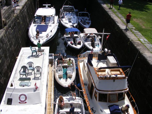
In the photo you can see the dam float in the foreground, our private “dock”, and some of the lake cottages to the right. There are many of the cottages within walking distance which we would learn, makes for some interesting social interactions and activities. There were 23 boats at this little lock the first night we were there.

As soon as we got off the boat, Molly had to check us out. She is John's Golden Retriever, and really the mistress of Davis Lock. She checks out everyone, and especially all the dogs that go ashore. While Ursa wasn't impressed with Molly's title, she tolerated her and didn't embarrass us any more than usual with her anti-dog behavior. Besides, Molly had more interesting canine friends to tend to. Every morning, Owen, Tess, and Juniper, local cottage dogs, came to the lock to visit Molly. Davis Lock is an off-leash park for dogs because “most everything is up to the discretion of the lockmaster” according to commandant John, and he is a dog lover.

Besides the dogs, several of the locals would also visit Davis Lock throughout the day to see John, other neighbors, boats, and boater friends who may be at the lock for a few days away from their cottage. Little chat groups would take place in the cool shade of the big trees. In the late afternoon, they would turn into cocktail parties. At dusk someone from one of the local cottages would play taps and O Canada on the trumpet, really cool. Then, the boaters would toot their horns, and we would sound a blast on FLUKE's horn, and then the others would yell and toot some more. Davis Lock is THE summer social mecca of the lake region.

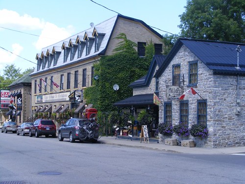
We rode our bicycles over to Chaffey's Lock, about 5 miles, because even though we were going to have to lock through there, we did not plan to stop and wanted to see what was around the lock. It is a great place to ride a bike because the roads are all rural, and no traffic is there except the cottage locals or people going to the locks. There are a few hills, some of which we couldn't get all the way to the top, especially for the second 5 miles on the way back.

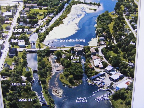
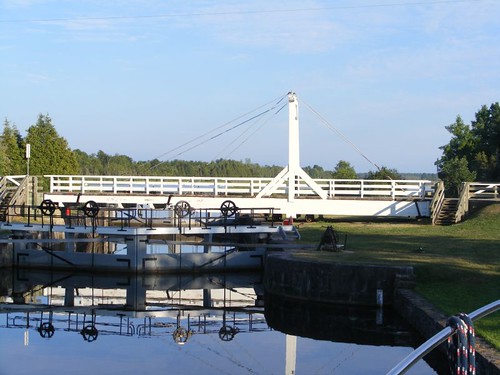
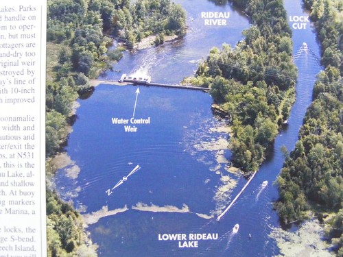
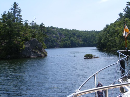
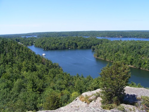
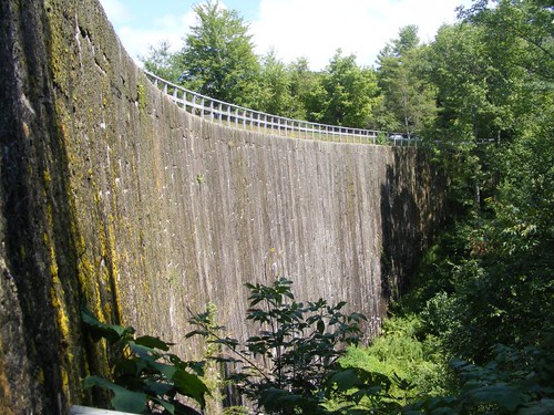
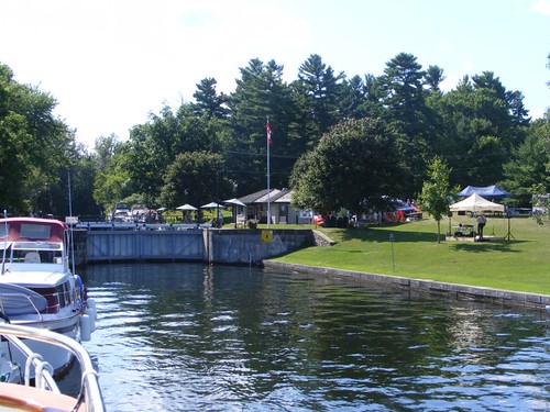
Chaffey's Lock overview

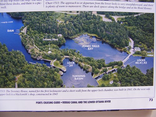
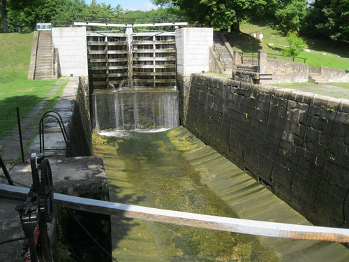
We wanted to talk to the lockmaster and make sure that we would be able to get through the approach and lock OK. If you look in the photo above, in the upper right hand corner is the approach to the lock. That shiny, green area is algae and aquatic plants which grow in the shallow water. The channel boats take is visible through the weedy area as the darker patch. We knew that this was one of the shallowest passages we would have to go through. In fact, as we would learn, only 10 days after we went through here, the Rideau Canal from Jones Falls to Chaffeys lock fell below the 5' level, and we wouldn't have been able to get through at all.

You can see Brown's Marina in the photo too. It not only serves as an important canalside fuel and repair facility, but also is the site of the government liquor store, the nearest one to the Rideau Canal. So, it is convenient to just pull up to Brown's dock, run up the stairs, cross the country road and make a liquor purchase. We got that info from those fine folks at Davis Lock.

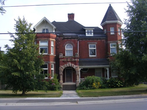
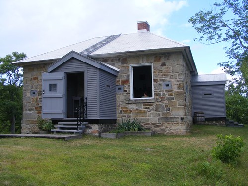
Lockmaster's house museum

Chaffey's Lock has another one of the restored defensible lockmaster's house similar to the one I described at Jones Falls, complete with some period artifacts. However, at this one, you have an opportunity to see a video that talks about some of the history of the town around Chaffey's lock. Plus, there is a small gift shop that sells some nice t-shirts. Eddie bought one.

We took a walk to the nearby Opinicon Hotel. It is a big facility, nestled in the trees, that was built to house workers at Chaffey's mills before the lock was built. Its history includes being an inn and fishing lodge, and when you walk on the property today it feels like you are going back in time. Even the little snack bar/grocery store has been lost in a time warp. We followed the trail of people licking ice cream cones to the snack bar to get one ourselves. Just when we were marveling at the size of ice cream scoops the kid was dishing out, the owner came and yelled at him, saying that they were running out of ice cream because he was giving people too much in one scoop and he needed to cut back. Since we were the only ones in line at that time, I suggested he cut back after we got ours, and he obliged. Eddie left him a loonie for his college fund!

The following day we decided to bicycle into Elgin, the closest town to the locks, another 5 mile ride. Back in the day, this was the town that had the quarry that supplied stone for lock construction. Today, it is just a sleepy little town, but it does have a grocery store.

We just needed to pick up a few fresh vegetables, but I always look around to see what else is in the store. It was the first time I had ever seen milk sold in plastic bags. I wasn't sure what I was really looking at until I looked closely and poked at the bag. I couldn't see how milk is dispensed from the bags, other than pouring it into some other rigid container for table use.

We sure were surprised to look across the street and see the couple whose garage sale we visited when we were at Morton Bay. Easily recognizing Ursa, they laughed when they saw us, and we told them about some more of our adventures. They said they had gone to Jones Falls to try to see FLUKE, but they didn't look at the right dock, so missed us.

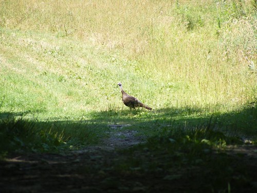
Wild turkey, no loon yet

On the way back, those country hills were sure not getting any easier for me to get up. Eddie was complaining that his stents were overheating and could use a rest. I welcomed the chance to get off the bike and run down a pasture road to try to photograph a flock of 6 wild turkeys. By the time I got close enough, the last one was all I could get in the picture. I will feel like a real turkey anyway if I can't get a picture of a loon.

We were all glad to get back to FLUKE and load up the bikes; our butts and legs had had enough for a while. We needed to come up with a strategy for our next destination since the weekend was approaching, and the locks are always busier.

July 29 – 30, 2011

Part 6: Newboro Lock

We left Davis Lock early enough to be able to get to Chaffey's, without getting grounded at the approach area I talked about in the last posting, and be the first to lock through. They all begin lock operations at 8:30 a.m. Since it was Friday, we knew we needed to get settled early in the day and wouldn't be able to move until Sun. since everyone stays put for the most part on the weekends. We decided that we would stop at Newboro Lock, only 5 more miles from Chaffey's.

In the last posting, I told you about Brown's Marina, just past Chaffey's lock. We decided that we would stop there to pump out and take on water and run up to the LCBO to buy beer since it was still so early. No one else was at their dock so we were able to pull in easily.

Wayne ran up to get the beer, just a regular Canadian brew, $36/24 pack of cans. We are not used to paying 13% tax on most things, including beer, and then there is a can deposit. We didn't plan on buying any more beer while we were in Canada.

The marina owner came out to ask what we wanted, and we told him we were going to the store for beer and also wanted to pump out. We asked him if his pump out could handle our boat, and he said he had never failed to pump out any boat. We pointed out how high our bow was and how far down the suction would have to pull. He said he would just grease up his machine, which looked beefy, but old, and then we would be ready to go once he got the prime established. Well, he tried and tried, but just couldn't get the prime to gain a suction hold. With great reluctance, he had to admit to his first failure. We told him thanks for the effort, and not to dwell on the failure, since his machine wasn't the first one to fail for us. Importantly, thank goodness we weren't in desperate need of a pump out since we had no idea when the next opportunity would arise.

Newboro Lock, looking north from south dock

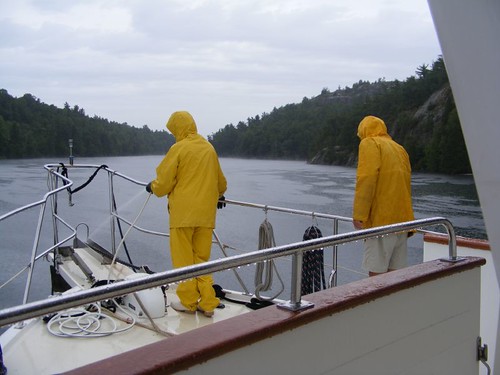
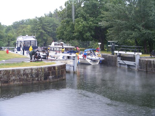
Even though it had begun to rain by the time we got to the lock, named after Newboro Lake, there were still a lot of boats moving around and waiting to lock through. We tied up to the blue line on the east dock which would give us a chance to talk to the lockmaster. We were told there were no spaces at the top of the lock (hydro was there), and that a couple of the boats on the low side would be leaving the dock shortly. So, Wayne and Eddie waited out in the rain holding our dock lines, indicating we planned to pull into the west dock when the other boats left. We were lucky to get a space since it was already midday.

There would have been a lot more dock space available on the lower side, but the east side dock had been crushed out on the end by ice, and they hadn't repaired it yet, so no one could tie up there. It was the only concrete dock we had seen. Maybe the ice incident was the reason.

If you look in the photo, to the right, you will see several tents set up. The Rideau Waterway Land Trust (owners of Rock Dunder) were having a benefit chicken bar-b-que. We ended up going, saving the galley slave a night of cooking on the boat. There was a comic musician that provided live entertainment.

There is a monument on site dedicated to the Seventh Company of Sappers and Miners without whose diligent work efforts Newboro Lock wouldn't have been built. Newboro Lake used to be called Mud Lake, indicating that there were many shallow spots in it filled with lots of mosquitoes. Colonel By had hoped that the lake level would rise enough when he flooded Chaffey's mill area to make it so that a lock wouldn't have to be built at Newboro. The water never rose high enough, so they had to build another lock. They ran into solid bedrock that took so long to try to dig through that two different contractors quit the job because the loss of life from malaria was high and the working conditions were brutal with all the mosquitoes attacking the workers. So, Colonel By used the military group of Sappers (demolition workers) and Miners (the diggers) to complete the lock, but not without a high loss of their lives too.

Newboro public dock
Newboro public dock

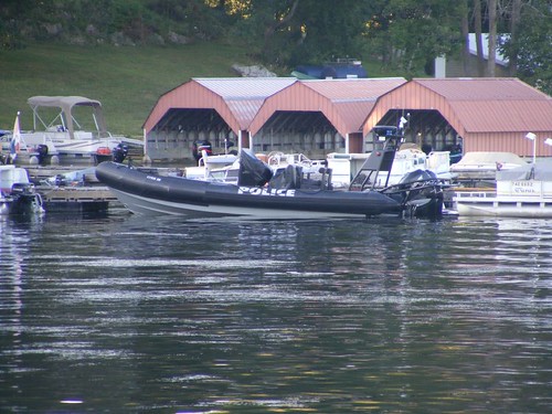
The lower dock at the lock isn't really a great place to be. People launching their fishing boats from the public boat ramp make a lot of wakes and noise. Plus, there are two big fishing lodges just beyond the public dock and their guests are speeding by the lock too. The sinister-looking police boat went out on some kind of lake patrol; it was the only vessel like that we ever saw on the whole canal, and this was the only place we ever saw it. Seems weird having a boat like that just to catch fishing regulations violators.

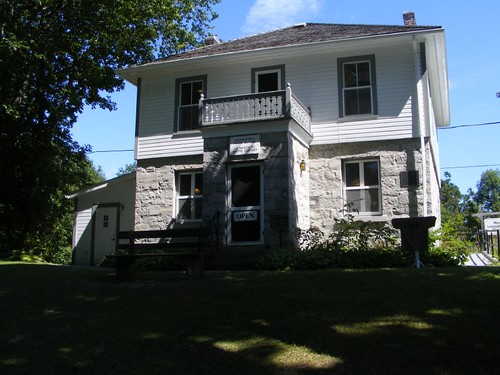
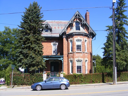
Most interesting home in town

It is a nice walk into the tiny town of Newboro, which is only 1 street. The fishing lodges occupy the most public space, but there is one interesting store, Kilborn's. It reminds me of a small version of LL Bean because it caters mostly to the needs of outdoor enthusiasts, having quality outdoor apparel and supplies. It also serves a critical purpose, selling ice cream. Eddie ended up buying a Tilley hat (lifetime guarantee) and a pair of Keens (Captain Wayne is jealous), after hearing me rave about how much I loved the pair I bought in Alexandria Bay. He is so happy with both purchases, and even had another guy remark about his Tilley hat while we were on a street walk in another town.
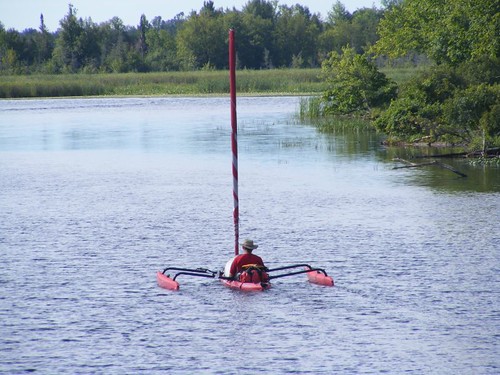
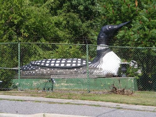
My best loon photo
My best loon photo

This wooden loon was on the grounds of what looked like an abandoned gift shop of some kind. I know it is kind of cheesy, but it really gives a good idea of what the loons do look like. I will tell you I am still not having much success with the live birds at this point, but I'm not giving up.

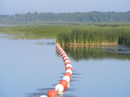
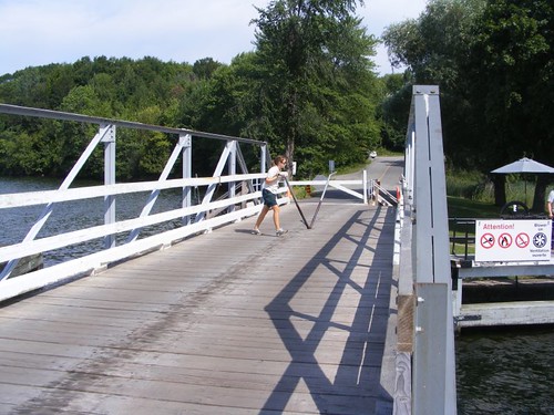
Beware of oncoming traffic

Newboro lock has one of the 3 hydraulic locks on the Rideau Canal. We were glad to lock up the 7.7' without incident, sound our horn in the narrow, tight turn and be on our way. We had reached the highest level of the Rideau Canal and all the other locks would be lowering us down.

Monday, August 22, 2011

Creeping Along the Rideau Canal - Parts 3 and 4

July 23 – 24, 2011

Part 3: Morton Bay

Peeking in at Morton Bay

The cruising guide's description of Morton Bay sounded just like the kind of place we try to seek out: beautiful, well-sheltered, scenic, with loons and ospreys. It is not too far off the main cruising route of the usual Rideau traffic path, so it is well worth the time to take to spend at least one night at anchor. There is really not another place like it on the Rideau.

From the opening photo you can see that the entrance is very narrow, only about 30' wide. However, the water is deep to get in, and you just pass between that straight down-to-the-water cliff on the left side of the photo and keep the green channel marker next to that clump of rocks sticking out of the water on your starboard side. As soon as you get through the entrance your jaw will drop and you will be so surprised to see that you are in a big basin with high cliffs all around you.

Our destination- the highest peak
Our destination: the highest peak

The bottom of the long bay is muddy and very weedy with thick, rotten gigantic mats of decayed vegetation. We switched back to our Delta anchor and got good holding. As long as you aren't close to anyone else or the rocky shoreline you should have plenty of time to react if your anchor drags anyway.

As soon as the anchor was set and we could look around, we spotted people at the highest point on top of the boulders visible in the photo above. We knew we had to figure out how to hike up there!

The next morning we launched the dinghy to take to the opposite end of the bay (20 minute ride), where the cruising guide said was a dock. We figured that there might be some information there that could tell us where the trail head was to Rock Dunder, the boulder peak.

The half mile ride through the bay was very picturesque since the sides are steep with lots of overhanging boulders and trees. One big boulder had a huge flat surface and extended out quite a ways from shore. Plus, there was a long rope attached to a nearby tree. It must have been a really neat jumping rock for the locals.

We were disappointed to arrive at the dock and not find any signage except no trespassing signs for the private property near the dock. Since there was a road going down to the dock we decided to walk uphill and see where the road went.

The road exited into the little, dead village of Morton, right next to a yard where there was a garage sale. Eddie and I love to go saling, as we call it. Plus, the woman was selling home-baked cookies in addition to all kinds of typical garage sale stuff we don't really need, but had to look at anyway. In addition to the cookies, we even found some things that we wanted, but we didn't have any money on us. We told her that we would go back to FLUKE and get some money after we hiked up to Rock Dunder, if we could find out how to get there. She had no clue about Rock Dunder, but she called her husband to come outside. While, he wasn't sure exactly how to get there, he remembered that the Boy Scouts used to have cabins in the area, and he knew the road that they took to get to the cabins. Even if we couldn't find the road at that point, we had had a great time talking to those two friendly locals.

The entry road was about ¾ mile from the garage sale, and then we had another 1/4 mile until we came to a parking area with the Rock Dunder signboard map. We learned that the Rock Dunder property consisted of 276 acres and was managed by a conservation group called the Rideau Waterway Land Trust. RWLT had purchased the land from Scouts Canada in 2006 to provide recreational opportunities for nature enthusiasts like the FLUKE crew.

There are several well-marked trails through the property that wind through a variety of habitats, from boggy areas with beaver ponds, up through mixed hardwoods and pines, all the way up to the lichen-covered boulders. We decided we would hike a 2.5 mile loop that would give us a chance to see a lot of the property.

Dragonfly
Dragonfly

One of the wetland meadow areas had lots of these pretty dragonflies. Mosquitoes weren't really a problem anywhere along the trail. However, the deerflies were very pesty, especially going after Ursa's ears, always trying to burrow down through her thick hair. Once we got to the open areas along the top of the ridge they weren't bad.

We could see everything!

When we finally arrived at the highest ridge, 550', and looked out into the distance, we knew all the effort to find the place had been worth it. We could see well beyond the bay to the waterway we had taken from the last lock and that which we would take after we left the bay. FLUKE was visible way down below, as you can see in the left part of the picture above.

FLUKE crew conquers Rock Dunder

We all managed to gather together for our group photo. It is amazing how happy we look. Right before the photo we were all yelling at each other about where to put the camera, how to get the auto setting to work right, and who was going to be where in the photo. Since I was the one having to push the button and run back to the group I got yelled at the most; it took me 3 tries to get it right!

FLUKE from another level

Eddie scampered around on some other nearby boulders, and Wayne and I found some wild blueberries to snack on. It was well past our regular feeding time, so we had to get back. Thoughts of those cookies at the garage sale were foremost on our minds.

The garage sale was still going on when we passed through on the way back to the dock. Eddie said he would meet the guy at the dock and give him the money in 40 minutes, 20 for us to get back to FLUKE to get the money and then another 20 for Eddie to have to dinghy back to the dock to make the payoff.

Earlier in this post, I mentioned loons. They are the official bird of Ontario, and if you ever see one you will know why. At this time of year the males have their full breeding plumage, striking black and white stripes and dots. These big birds are 2-3' long and have wingspans of 4-5'. However, they are very cautious and do not come around to beg for food or let boats get very near them. I am going crazy trying to get a good photograph of a loon that really shows the beautiful plumage, but I am not having much success. Before this trip ends, I will show you my best effort, but don't place any bets that I'm going to come up with something great as far as these elusive birds go. Another thing, they have the strangest call of any bird I have ever heard, especially at night; it sounds like a cackling howl. Trying to get a good photo is going to drive me into becoming a real loon-a-tic before it's over!

All weather cruisers

“In every silver cloud there is a dark lining” isn't really how that old familiar saying is supposed to go, but it describes how the skies changed from one day to the next. Those beautiful blue skies that shown upon us as we stood on top of Rock Dunder had changed to these gray misty skies early the next morning when it was time to haul up the anchor. As Eddie was looking at the anchor chain coming up out of the water, he said it looked like we were pulling up a 100 year-old Christmas tree since all the ancient organic matter was clinging to the chain, draping back down towards the water.

As we squeezed out the skinny opening to head back into the main cruising stream, we all agreed that secretive Morton Bay should be on any cruiser's “must stop” list.

July 25 – 26, 2011

Part 4: Jones Falls

Overview of Jones Falls

We only had 2 miles to go once we left Morton Bay before we reached Jones Falls. If you look in the photo above, we tied off on the floating dock (the blue line) next to the bridge visible towards the right side of the photo. Since this is a combined lock (3) and a detached lock, and you are required to lock through them all once you begin, we needed to see where we would fit in the time schedule. So, Captain Wayne went up the hill to talk to the lockmaster and explain the need for us to have as much water as possible. We had been instructed to say that every time we went in a lock. Word gets passed by telephone to other locks when boats like FLUKE are coming anyway, so that the lock staff can do whatever they need to do to get ready, especially in regards to holding the lock open and waiting.

Notice the lock numbers are decreasing for the direction in which we are traveling; the combined chambers are locks 42, 41, 40 and the detached lock is 39. Even though the turning basin appears to be very large, protected, and have nice walls all around, it is very shallow and boats are not permitted to stop. The basin is a popular swimming area for travelers and locals who come to use the facility.

Locking through rain or shine

Since it appeared that it was going to rain all day anyway, we told the lockmaster we would lock through on the first available opening he had, which turned out to be the first lock up of the day. We just put on our rain gear and did the job. Because it was so early, we were lucky to find dock space just above Lock 39, to the right, below the Sweeney House. It was a great location to be able to watch other boats locking through like in the above photo.

All of the locks are land parks too. They have picnic tables, grills, and places to fish. A lot of them have historical buildings (with interpretive displays or artifacts), swimming areas, or hiking trails. Many people canoe the Rideau and set up camp right on the lock property. Day people come to the locks just to watch all the activity going on. Jones Falls is one of the most popular day use parks because it has all of the above, plus you can buy ice cream at the Hotel Kenney snack bar. In the aerial photo it is located on the right hand side, just above the floating dock we tied off to before we went into the first flight lock.

Hotel Kenney
Hotel Kenney

The Hotel Kenney was built in the 1880s as part of the building “boom” associated with the tourists coming to the Rideau Canal. It was built as a fishing lodge. If you go in the main lobby and just sit in front of the fireplace you can imagine that you are in the late 1800s.

A good place to start a visit at Jones Falls is to stop at the Visitor Center located on the east side of the flight locks. You can't see the building in the aerial photo because of all the trees. The building has served for storage since the turn of the century, but now also has restrooms and the orientation center where you can pick up written literature and watch some interesting audio/video presentations about different parts of the Rideau Canal. There is also a stone-cutting demo that lets you see how the big key-shaped blocks are cut so that they all fit in correctly to hold themselves in the walls.

Stone arch dam
Stone arch dam

It was necessary to build a dam so that water for the locks could be controlled. It had to be 60' in height, making it the biggest dam of its time built on the North American continent. Each block was 6' x 3' x 2' in size. The huge blocks were moved from their quarry site 6 miles away in winter since the frozen ground made it easier for the oxen teams to pull them. The final dam was 217' wide at the top and 100' wide at the base and still looks as good as it did 175 years ago.

The original plan called for water to flow over the dam as needed for high water levels, but erosion at the base of the dam was feared so a waste weir was constructed. It is now a small trickle down waterfall, all that remains in the name of the original Jones Falls.

The Sweeney House
The Sweeney House

A big boulder's throw from the little falls, and just above where we were docked, is the 1841 Sweeney House, visible in the photo above. It is one of the defensible lockmaster's houses built as a cheaper alternative to the blockhouses Colonel By had hope to build for each lock. The beautiful stone walls are very thick, and you can see the gun slit holes all around the structure. The casement windows, rare at the time, were used because they swung inward and could be fitted with fireboards during an attack.

The Sweeney House is set up as an interpretive museum. The house is furnished much like it would have been when John Sweeney and his family lived in it. It is open free to the public and a person in period costume is available to answer questions. When I went in, a girl was spinning yarn from raw wool. She pointed out that John Sweeney's diary was found in the house and a copy was available for reading excerpts. He wrote about the isolated, difficult life he had with his wife and daughter. He was particularly frustrated with the two women drinking and he tried to take away their liquor bottles, but they kept hiding them out in the woods where he couldn't find them. At one point he paid his wife to leave him, but the locals sent out a search party and brought her back because payoffs like that were illegal. Times sure have changed!

Blacksmith shop, 1843

Working in another defensible building, the blacksmith played a critical role in helping to repair and maintain canal structures. Being in such an isolated area, workers would have had to wait weeks for repair parts if they hadn't had their own blacksmith on site. Today, the forge is fired up, and you can watch metal hardware items being created by a blacksmith. He makes nails to give out free to children, and sells decorative tools and hardware as well as some artistic metalwork pieces.

Packing them in
Packing them in

If you want to see some real lock action after you check out the historical buildings, there will be plenty to see, especially on the weekends. The lock staff does a wonderful job trying to move as many boats as possible into the locks. It is surprising how much cooperation even exists amongst the boaters themselves, squeezing their boats in place and getting their fenders and lines in order without tempers flaring.

Repair time
Repair time

Boaters get a bit frustrated when they hear that the locks are shut down temporarily for repairs. Not only can't boats enter the lock, the space also gets very congested at the blue line, and boats have to end up rafting up or turn away altogether, and that can be difficult when the waterway approaching the lock is very narrow. During our stay, the Jones Falls locks were shut down a couple of hours during midday one day. The lock chamber had to be drained so the maintenance man could do the repair work. This photo shows the drained chamber. Note the sill visible towards the end of the chamber. For FLUKE to clear the sill, there needs to be just over 5' of water above it. If you look closely on the sides, you can see the water stains which hardly look like they are much more than 5' up the sides of the wall.

There are several hiking paths around the facility, some of which give you the opportunity to see what the terrain was really like when the lock was being built. After we had hiked all the trails, visited all the displays, and waited for good weather to return, it was time to leave the dock again and creep slowly onto to the next lock.