May 8 - May 9, 2007
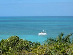
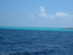
Water Cay is a 45 mile trip north from Raccoon Cay, made especially delightful for us because of calm seas and clear skies, topped off with a school of dolphins jumping high out of the water rushing from our port side to ride our bow wake. I peer over the pulpit to see them turn on their sides to look up at me, wondering what they are thinking. A couple of them drop back to ride our starboard quarter wake. Ursa goes crazy when she hears them splash or breathe.
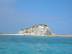
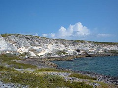
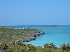
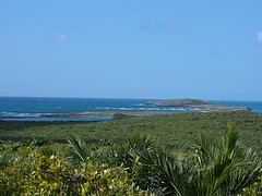
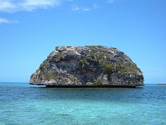
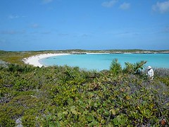
As we get close to Water Cay we are surprised by the different appearance of this cay compared to the others we have visited farther south: there are high white cliffs with sparse vegetation. We are relieved to see that the anchorage we had picked out using the information from our charts is vacant.
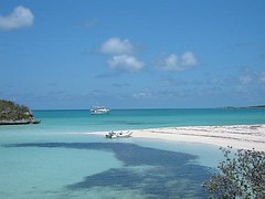
Right after we have the anchor set, a Bahamian fishing boat (a skiff from a mother ship) with 3 men aboard pulls up along side and asks if we have any water they can have. We tell them we don't have a watermaker and ask how much they need. To our relief they only want 2 gallons, which we are surely willing to give them, along with a bunch of granola bars for their afternoon snack. Another fishing boat pulls in to clean the day's catch of conch.
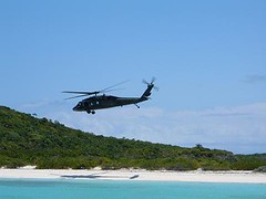
I was awakened at 12:15 a.m. to the sound of a boat motor and looked out the pilothouse window to see a boat approaching the island. I watched 2 skiffs leave the bigger boat and go towards shore. Kind of late to be cleaning conch if you ask me, and better yet for me not to ask them what they're doing. I'll leave that up to the guys with the Black Hawk helicopter.
Calm conditions at the time of our morning land tour allowed us to walk along the windward (oceanside) of the island.
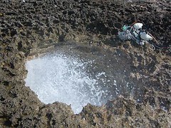
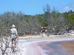
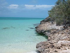
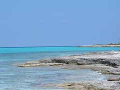
The shoreline right along the water's edge was rocky limestone, but not of the big boulder type terrain we had seen on the other islands. There were several blowholes, some quite a ways from the ocean's edge, so it was interesting seeing the waves come toward the shore and hear the water traveling in the tunnels beneath our feet and then come rushing out the blowhole with force making the water a foaming white spray.
One blowhole was set way up into the base of the sand-colored cliffs. The down slope from the hole was littered with millions of tiny (less than a quarter size) pieces of plastic of every color plastic comes in. This was caused by the long distance the water came from the ocean through the craggy limestone being pushed by tremendous force, and then being blown out of the hole up into the overhanging cliff, further pulverizing the plastic. Some pieces could be expelled from the hole area, but other pieces would fall right back into the hole to get further macerated
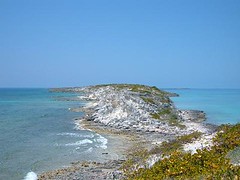
We delighted in being able to climb to the very top of the island and walk along its “spine”, taking in a 360 degree panoramic view standing still; the island is so narrow.
It was an easy walk back down to sea level on the leeward side where we had left Fin in the glassy calm cove.
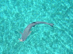
An afternoon snorkeling expedition provided adventure. Swimming in calm water 5-20' deep with unlimited visibility let me peak in on lots of underwater activities. I delighted in hovering over a gigantic school (500!) of southern sennet, an 18'' long rather thin fish resembling a barracuda. They hovered silently, just swimming in a large circle. They made me think of a giant underwater tumbleweed. When I would dive toward them, the circle would slowly open up and then close again when I was out of the way. I had never seen these before, and I always marvel at the diversity of life the sea contains. As many times and places I have been underwater it is never boring and there is always something new. I managed to sneak up on a green sea turtle laying on the bottom pulling something off a rock before it could see me, so I remained motionless to capture my own National Geographic moment. A queen angelfish darted in and out between the turtle's front legs, hoping to get some scraps. The bright purple and yellow hues of the fish starkly contrasted to the creamy ivory and dark brown of the turtle's reticulated skin, making them both beautiful in their own ways.
Seven remora had been hanging around under FLUKE, eating anything thrown into the water before the large barracuda that steadily circled the boat ever had a chance at even a bite. I named one of the remora Captain Hook because he had a hook sticking out of his mouth. He had lost a piece of flesh off the upper part of his lip, but it had healed and he was none the less of a remora for that injury. Besides, body piercings are the rage now, even in the Bahamas!
Watching the flaming sun melt itself in the western horizon, with a slice of pizza in one hand and a beer in another, we said hooray for Water Cay!
Friday, May 18, 2007
The Jumentos: Raccoon Cay
May 5 - May 7, 2007
Getting to Raccoon Cay was an easy 5 mile trip from Buenavista, short enough for us to even tow Fin (the dinghy) behind us. The anchoring area for our current wind conditions was easily accessed and was totally vacant, so we had our pick of where to drop the hook. There are no raccoons here now, but some of the islands have a few.
We're right next to a tiny cay that the fisherman use to store some fishing traps on and to roast bait to put in their traps: a boat has come by several times to start up a little fire and then take off again. Eddie and I were out on a snorkel expedition and the fishermen came up to us (probably to check out our gear and see what we were doing), so I asked them what they were burning on the island, and I got the info from the native's lips. He told me they were trying to catch grouper with the roasted bait. It sure looks like a tough job to us.
The big island
No, not in Hawaii, here at Raccoon Cay; the largest one we have visited, a little over 3 miles long and a half mile wide. Beacon Hill, the highest point on the island towers 120' above.
There are numerous ruins, of buildings and pasture fences. Salt was once gathered here from the inland ponds. In more modern times, someone tried to raise cattle. Now the island has a large population of goats and a small one of sheep – we hear lots of bleats and baas! The Ragged Islanders come here to hunt them, but goat and mutton won't be on any menu on FLUKE.
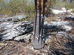
The terrain is distinctive and unique from the other cays we have visited. The narrow strip of beach on the side of our anchorage varies from having the rocky limestone outcroppings, smooth slab rocks, and fine sand. There are even a couple of little coves that have some small clumps of mangroves growing in them. Along much of the island after you leave the beach, a gentle incline takes you to a distinctive dune line, the habitat for the pretty palmate Thrinax palms. Any one low enough for a goat to reach, standing on its back legs and neck stretched fully out, has had all its fruit stripped off. The trunks house large numbers of a land snail.
The dune drops off to lowland areas, with small ponds surrounded by rocky ground where the silver buttonwoods thrive. Hills rise up from these areas and lead towards the ocean side with its rocky shore of big, sharp boulders.
Island highs and lows
Eddie has been nursing some sort of ear infection, but I whined enough to get him to go snorkeling with me in Horsehead Bay, a short dinghy ride from where FLUKE is anchored. It is a wonderful spot with colorful coral heads, an interesting drop off, a great variety of fish, and we even found a hidey hole containing 5 nice lobster. We just enjoyed spying on them; lobster is out of season now, and we aren't starving to the point where we need to break the rules.
The whole crew lathered up heavily with sunscreen for the big land tour. I was very vocal about wanting to try to find a path up to Beacon Hill, but was overruled, so settled for a calmer, but still interesting, morning in the lower elevations. We'll hike that peak on the next trip!
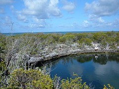
After 3 attempts involving landing on different beaches, we managed to find the trail head to the blue hole that we could see marked on the map, but it wasn't really clear exactly where the hole was. We clearly marked it so subsequent adventurers could save some time. These land blue holes, despite their distance from the water or elevation, are connected to the sea by underground channels so that they are tidal, getting fresh water from the sea with each ebb and flow. You never know what may be in one, but this one just had a few small fish. It is still fascinating to look at the cavernous hole with the dark blue water right in the limestone rock.
With minimal effort we found a well-marked wide trail that started along the dune line, went around the perimeter of a large salt pond, snaked easily up over one of the hills, following some of the pasture wall ruins, all the way to the ocean side.
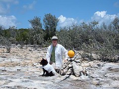
We scavenged through all the trash and debris, but alas, no glass ball yet! Eddie and I took a small detour at one point, finding a shaded area where there was a large herd of goats. They snorted, bleated, and stomped at us and then reluctantly moved on. When we walked through the area where they had been, we picked up the strong odor of wild goat which remained on us the rest of the day. We smelled worse than the dirty laundry bin which is very “ripe” right now!
Janet and Bruce Smith, cruisers on a KK42 that we met last year in the Berrys, pulled into our anchorage. It was great touching base with them to hear about their travels and plans; they are seasoned cruisers with valuable info.
Early in the morning when we were hauling up the anchor, a Bahamian fisherman came up to us and asked if we would trade a Helmut conch (large, pretty mollusk) for a beer. I passed him a beer in a plastic bag and got the Helmut conch. As he drove away, he took the beer out of the bag and threw the bag overboard! Since the conch was still alive, I threw it overboard too.
The Jumentos: Buenavista Cay
May 1- May 4, 2007
Buenavista Cay lies about 30 miles south of Flamingo Cay, so it took us almost 4 hours of bumpy cruising (more wind) to get here. We're anchored off a sandy beach over a mile long with good holding, so I will have less worry about FLUKE trying to venture out on her own when the wind kicks up. One sailboat was here when we arrived and two others came in later the same day.
Good views
That's what the name of the cay suggests, and that's appropriate. The ¼ mile wide island is about 2 miles long with a couple of 50' hills. There are two gaping caves tucked into one of the hillsides, and they are open to our anchorage so we can see them from the boat.
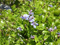
There are several lowland ponds, now mostly drying up, whose perimeters are circled with silver buttonwoods whose shimmering leaves are in vivid contrast to the other green vegetation. Scattered on the hills are huge Agave (Century) plants, many blooming with their colorful spikes towering 20' in the air. They used to be grown for their fibers which were made into sisal for various rope-like products.
We are anchored off a thin, very white sandy beach that stretches 1 ½ miles. The waters and beach are mostly clean of trash on this Banks side, but a dinghy trip to the windward, open ocean, side of the island revealed enormous amounts of cruise ship garbage, the most we've ever seen in one place. We continue to wonder how those commercial passenger ships can still get away with throwing their garbage overboard, no matter how deep is the sea or far from any land. Plastic lasts forever.
We found a path, well marked by old buoys hung on the vegetation, that took us over one of the hills and all the way to the ocean side. It was mostly high and rocky but had a small pocket beach set within the rocks. We love to hunt through what the sea has washed up, usually looking for shells or interesting pieces of driftwood. However, no shells are found on the ocean side of any of these islands because the coast is just too rocky and the offshore sea bottom doesn't provide a good habitat for mollusks. Every beach combing cruiser dreams of finding the most sought after prize: a glass ball from an old fishing net. We of FLUKE search diligently, but as of yet, have not met with success.
Critters
We awake each morning to the raucous sound of a flock of several hundred laughing gulls who roost on the island during the night and then fly out onto to the Banks during the day. At dusk they return, just as noisily. FLUKE has been showered from above during the daily migration, and I won't stand out on deck when they are passing overhead. I have never seen a bigger flock of birds anywhere in the Bahamas.
As I was trying to take a photograph of one of the flowering plants, a hummingbird zoomed right into the same plant to gather nectar from the flowers, not 2' from my hands. I actually heard its beating wings before I saw the bird.
There is a resident population of goats. We can hear them bleating from the boat and have seen them drinking from the lowland pond areas. When we hiked to the caves, they stunk with the smell from the goats who had sought refuge in them from the heat and wind.
Absent are the big, bold, slow curly tail lizards that sat on the rocky outcroppings on Flamingo. Here, they are replaced by the quick, shy, blue lined skinks that stay mostly hidden in the underbrush. Ursa has a difficult time lunging at them.
Night life of the deep
May 2 marked the day of the first full moon of May. The Bahamian fisherman head out onto the Banks on this night to try to fish for mutton snapper, for reasons I know not why. If it works for them, then it must work for us too.
For the last several years I have been telling Eddie we need to go for a night snorkel. We haven't got around to doing this for various reasons, the biggest one being that we have just been too chicken. Well, I have convinced us our fears are unfounded (I hope!), and we had to commit to doing one. What better time than a full moon? Plus, one more big factor was in our favor: less than 50 yards from where we are anchored is a wonderful coral head which I named the Disney Reef because of all the numerous species of fish which use it for their meeting place. So, we made the pact to go for it.
As luck would have it, the sky was completely clouded over during the early evening when we were still awake enough (cruisers don't stay up too late!) to go into the water. Lightning was popping in the sky to the east of us. I suggested maybe we do it another night, but Eddie already was getting suited up and said we just needed to press onward and carry out the plan anyway.
In we went, with one light between the two of us, so we stuck together like Siamese twins. It was a strange feeling to just be able to see only what was in the beam of the light, especially knowing during the day how quickly different fish can just swim into your field of view from out of nowhere.
Night life at the Disney Reef was certainly different than that of the day; the colors weren't as vibrant and activities were slower. Fish were lying more idle within the holes in the rocks. Many schools had moved off the coral head into the open grassy areas, huddled close together moving as one. Ghost-like bioluminescent organisms softly floated through the water, disturbed by our movements, spiraling with iridescent rainbow colors. Fast moving, tiny insect-like creatures were drawn to the light, sometimes clouding the entire beam in front of the lens. We could feel them bouncing off our masks. Everything seemed so peaceful and quiet. Sometimes a lone fish, like a big jack, would zoom across the beam of our light and swim quickly out of sight again. The beam caught the sparkling golden eyes of a spiny lobster as it moved from one rock ledge to another. The event was worth the effort, our fears were unfounded, and we are looking forward to dropping in after dark again.
Thursday, May 17, 2007
The Jumentos: Flamingo Cay
APRIL 22-APRIL 30, 2007
Yes, it is worth the effort to get here.
Flamingo Cay lies at a latitude of 22.53' N/75.52'W. We are actually further south than Havana, Cuba! We are too far south now to pick up satellite TV, so we will finally get some reading done and catch up on watching some DVDs. The uninhabited island is about 1 ½ miles long and ¼ mile wide at the widest point with the highest point being a peak of 90', pretty high for this part of the world. The western shore, facing the calmer, shallow Banks, has 4 pretty little coves with small sandy beaches.
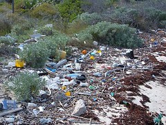
The eastern shore endures a violent existence open to the ocean; the shoreline is all sharp, gigantic limestone boulders, littered with flotsam and jetsam from both Mother Nature and us, indestructible plastic and rubber obsessed, humans. You might as well just drown yourself rather than to try to land on the shore. We can see the windward side of the island to the south of us, and waves are crashing the shore with water spraying 20-30' high when the wind is peaking. Even from our distance it is a formidable sight.
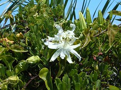
Vegetation is now nice and green, but everything is more bonsai-like because of sparse rain, tiny amount of soil, and constant wind. Some of the "trees" look ancient; they are gnarled, bent over, and their roots are anchored tightly into the cracks and small holes through the rocky substrate. The plants have thick, waxy coatings to protect from the salt air and drying heat. There are a few species of plants in bloom, and their colors are vivid in the brush with butterflies making frequent forays for nectar.
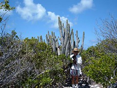
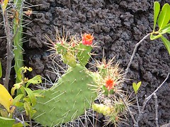
Like many of the islands, this one has the resident number of cactus plants and poisonwood which makes it essential to watch where we walk.
Several species of birds (no flamingos now!) make the island their home, and their songs are ever present in the air. I have taken sugar ashore for the bananaquits, birds we've had land on our boat and take sugar out of our hands while in the Exumas. Apparently the ones here haven't turned into beggars yet. There is a resident hawk who we have watched chase other birds for an evening meal right out of the sky. The lower parts of the island have a couple of inland ponds and even a blue hole.
We have good holding in a sandy bottom, close in to one of the beaches; we call it our beach, since no one else is around us. We can only stay here if the winds continue to blow out of the N, NE, SE, and a little S, for if we get a westerly wind we will be blown upon the shore. We have 200' of chain on the bottom, and our anchor sits within 200' of the shore. Eddie and I actually snorkeled in the water to find the right spot to drop the anchor as many places are just a thin layer of sand over a hard bottom and the anchor won't hold us tight in areas like that. We are always watching the weather. We have been getting mostly reliable weather information from our NAVTEX system, which is being broadcast by short-wave radio out of Miami. Because the island is small, with ocean cuts on either end, our anchorage is prone to the dreaded ocean surge which sometimes comes from the north or other times, the south. We just roll back and forth and hold on to everything. The potatoes were rolling in the microwave, so I had to judge the roll to get them properly positioned. Yes, it is still worth that inconvenience too.
This is considered a remote area by cruising standards, so it is with much sadness that I will speak of how much garbage abounds, on land and in the sea. There are huge bags of garbage left up in the brush along the shore. Some people have had the sense to burn it, but not everyone is willing to make that extra effort. The sea floor is littered with bottles, cans, personal items, and cast off boat parts. This is a popular stopping area for Bahamian fisherman, as evidenced by the piles of hundreds of conch shells that litter the sea floor in areas where the mother ship anchors for the night or day to clean conch and rest. We would like to hope that the natives are leaving the trash rather than our fellow cruisers.
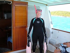
On a more positive note, the waters surrounding Flamingo Cay abound with numerous isolated coral heads, many of which are close enough to FLUKE so that we can swim to them from the boat. They are in water ranging from 8-20', so it is easy to see the habitat and even swim down and look under ledges and into holes. So many different species of sea creatures find shelter in these isolated coral heads since they provide good shelter from the open water predators. While, the water is still pretty cool by my standards, I have a new wetsuit that is working great, and I can stay in the water as long as I want without feeling uncomfortably cold. Plus, I can leave the boat on my own and don't have to listen to my crewmates tell me to hurry up because they aren't taking the time to see the undersea wonders that I seek. Oh, Jacqueline Cousteau is my nickname, in case you hadn't heard!
The Fish Market
Eddie and I have continued to try our luck fishing from the dinghy over the isolated coral heads using the same technique that we tried over in Andros. We have been more challenged here though.
We still need to catch our bait by trying to use tiny hooks so that we will only get tiny fish. However on one coral head we ran into some large queen triggerfish (they all have giant buckteeth) who just kept getting the bait before the little guys could latch onto it. We brought up a couple of them, but didn't want to keep them for food and didn't want to cut them up for bait because they were just too beautiful so we threw them back. One even bent our hook with those big teeth! There are 3 large (3') remora that are hanging under FLUKE's big belly. They are the sleek fish with the funny grooves on the top of their heads that you always see stuck on the undersides of sharks. They eat whatever scraps we throw overboard and would be easy to catch for bait, but now they seem like pets, and we're not desperate enough to have to do them in. We are NOT ruthless hunters!
We are fishing in about 20' of water, and all the fish look smaller than they really are as we peer through the looking bucket. I had a BIG surprise when I was looking down at the bait when it was eclipsed by only the head of a nurse shark. Nurse sharks breed in nearby waters in May and June. That beast was so big I had to move the bucket back and forth to see the whole length, and Eddie thought it was almost as long as the dinghy. We haven't ever seen one larger. Yet, that shark was so determined to get that little snippet of bait-it would be like one of us eating a single M & M. I kept yelling at Eddie to get the line out of the water since we would definitely loose that battle if the shark got a hold (we've already had that happen, and it's just frustrating to lose everything).
When Eddie would bring up the bait, the shark would go right to the bottom where the bait had been and scoot its snout into the sand in a circular motion just trying to find the little piece. This behavior was so persistent that we had to move to another coral head. In the edible species department we did manage to get a nice red snapper which was filleted and put in a tequila-lime marinade, covered with bread crumbs and baked until flaky. Real yummy.
The Cave of Enlightenment
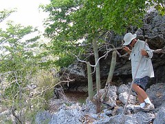
I've told you before that a big part of our cruising adventures involves land exploration. Flamingo Cay offers a lot to see if you put on a good pair of durable walking shoes, lots of sunscreen and a hat, and watch where you step. We hike right after breakfast before the heat of the day becomes too overbearing for all of us. Ursa scampers along like a mountain goat, but we don't want to let her get overheated. Walking is difficult: the rocky limestone ground is sharp with lots of loose rocks. Some places feel like you are walking on the points of dull knives. You can't afford to slip or your skin will be sliced open, even through your clothes. There are a lot of cacti in some areas. Eddie brushed up against some with his leg and bent over to try to pull out the barbed spines, only to get a bunch more stuck in his rear end!
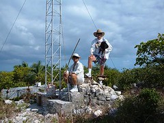
We have hiked to the highest peak on the island where a navigational beacon is located. It works by a solar panel to generate power for a flashing light so sailors can use it as a good reference point from the sea or the Banks. The view is so beautiful: down into the leeward cove where FLUKE rests, out into the roiling ocean, over the green of the landscape below dotted with colorful salt ponds, and right down the rocky chain of islands to the south.
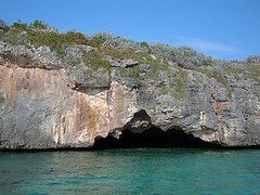
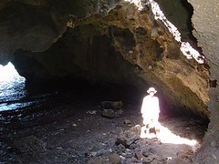
The island is best known for a large sea cave that you can actually drive your dinghy right up into. The cave is also accessed from the landward side through a small opening in the rocky cliff. 3 holes in the roof of the cave provide light to the darkness below and make for an interesting effect on the waters splashing within.
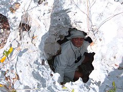
There are some ruins of an old homestead, walls made of some cement mixed with pieces of shell and rock. A big pit in the rock near the site is an old well which was the home's water source. Grave sites are nearby. You can't dig in the ground, so bodies are just laid out and piles of rocks are stacked thickly on top. The area is pocked with vacant cavities-you have to be careful not to fall down in any. One hole is big enough for one person at a time to climb down into and can hold 5 people under the ground.
In the cove nearest to the homesite sits the wreck of the John T. Davis, an island freighter who made its last, probably unscheduled, delivery to Flamingo Cay when it was wrecked upon the shore.
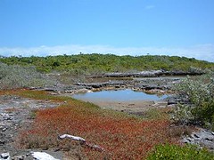
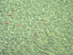
We always want to try to get to the far side of the island from that which where we are located. So, we sited the land, looked for a trail and made the effort to try to get to the cove located on the north side of the island. We walked through a lowland area that was pocked with several small irregularly shaped ponds circled with shimmering silver buttonwoods and red hued succulents. Two of the ponds contained 2" long shrimp, brilliant orange in color. There was also a blue hole, only about 3-4' in diameter, but whose bottom was not visible even in the crystal clear water.
There were a few cairns (piles of rocks) haphazardly marking a trail but we managed to get to our destination. We named the cove, airplane beach because of the amphibious plane wreck that sits in the cove.
From there we hiked over some exceptionally rocky terrain with a couple of burial mounds (probably from the plane wreck) to the ocean.
No sand here, just lots of rocks and whatever the ocean has thrown upon them. We collected a couple of dozen shoes (the number one human item, besides plastic garbage, we see in the islands). On the way back we clearly remarked the trail with the shoes, so future hikers could easily follow the way using the new “footpath”. A few days later some friends we met tried out the new marks and said they were great.
Black Hawk Down
Since the Bahamian Defense Force (a kind of Navy) is mostly non-existent (they are too poor to keep up with the overhead) the U.S. government pays the Bahamian government some probably ridiculous sums of money so that we can fly drug interdiction flights along their coastline in the never-ending battle to combat drug smuggling. The little remote area of the world that we are floating in used to be an easy place to offload drug cargo from small ships or planes for transport to attractive ports. So, frequently we have seen a Black Hawk helicopter skimming just over the top of the island. We always give them a friendly wave, and they wave back.
One day, while Wayne was making lunch I heard the helicopter approaching from its northern flight path. Here is what I said: "Wayne, it's coming in lower than usual today. I think it is beginning to turn over the southern end of the island and is banking hard to the right, bringing it toward our beach. I think it's going to land!" Sure enough, the pilot slowly lowered the chopper onto the thin strip of sand, causing the sand to violently swirl upward and outward to where we wondered if it was all going to blow onto FLUKE. Fortunately the wind was in our favor and kept it away. Two men got out of the chopper, one wearing a gun strapped on his leg. They began to walk toward the cave of enlightenment. Another man got out and stood in a guard position outside of the open door to the fuselage. The two pilots remained at the controls. We waved at them, and they waved back. After a short period of time the two men who went to the cave area came back, laughing and smiling, one pulled a ski mask over his head so the sand that was still being kicked up from the rotating blades didn't cover him, and then all 3 piled back into the chopper and took off. It was the week's biggest event in this tiny speck of paradise.
The Human Element
We haven't been totally alone in this little corner of the world.
The afternoon we arrived there were 5 boats already anchored, to our surprise, although because it had been so windy, Flamingo offered better protection than some of the other islands in the chain. 4 of the boats left within a couple of days. 2 more showed up, 1 of which only stayed 2 days.
The boat that remained was Highlander, a beautiful sailboat belonging to John and Mary Ann Cowell, land home Geneva, NY. They are the same age as Wayne and I, have traveled to places we hope to visit, retired early, and love the Bahamian islands. It was fun visiting each other's boats and sharing stories about adventures.
The day before we left Veda L, a Krogen 48 (it has the same hull as FLUKE, but different superstructure) with Bob and Linda Turrentine from Stillwater, MN arrived. We enjoyed talking with them, and it is always useful to see how other boaters with a boat like yours run things.
The Bahamian fisherman have been using the western side of this island for anchoring their mother ship while the fisherman go out in their launches to get conch from either the Banks or shallow areas around the islands. Their mother ships are a varied sort of boats in the 50-60' range, some wood, some fiberglass with open deck spaces to store fishing supplies. They have generators to run their refrigeration units so that they can store their catch while they are out 7-10 days before having to head back to port to sell their catch. We hear them talking on the radio with island names such as Green Lizard or ones you wonder how they come up with, like San Diego. The launches are small skiffs about 15' long with 25HP outboards. Usually 2 fisherman go out in each skiff and have to free dive in water 15-25' deep to hand pick conch which they throw into the skiff. We have seen them cleaning the conch while underway or waiting until they get back to the mother ship. This year the Bahamian government has issued a new fishing regulation saying that cruisers are prohibited from getting any conch at all. What all the cruisers in a single season combined would catch is probably less than what one of the fishing boats takes back after a single trip. There is no question that the conch population has been seriously depleted: we see few mature adults now compared to even 5 years ago and the fisherman are having to go to farther, more remote areas to find them. However, cruisers are not the problem, but at least regulating their catch may be a start in the right direction.
We watch the Bahamians do their work while we do our work too: all is not just fun in the sun. We sat at anchor for 3 days before we launched our dinghy; it was just too windy. So, we have spent some time trying to modify our launching technique, with our safety and that of the dinghy and FLUKE in mind. Last year our winch motor failed and the boom crashed into the upper deck railing, bending the railing and scaring us to death, so that event is always on our minds.
Wayne and Eddie had to spend an entire morning working on the sewer system, which included the totally disgusting job of disassembling the pipes (heavily coated with you-know-what) to the master head to determine that the bellows had a crack in it, so the system was not getting the adequate amount of air to create a vacuum to move the waste through properly. Having a spare bellows on hand is not part of a normal inventory item, so we had to declare that toilet to be inoperable. So now we will all have to use Eddie's, and he is less than thrilled about that.
This is the second sewer problem we've had on this trip. When the guys start talking sewer issues I make it a point to say that I need to work on food preparation. That always works to get me out of having to help them with that nasty job. The position of head chef carries a lot of clout on FLUKE, and I reward them dutifully. After the bellows episode they were treated to one of their favorites, taco salad and cold beer. Oh, but I like it too!
We've had a couple of rain showers and have managed to collect about 15 gals. of rainwater from drains we hooked up to the pilothouse roof. Eddie has gotten out his camp shower and suspended it over the swim platform and delights in taking outdoor showers-it reminds him of his Cub Scout days, before they kicked him out. We also use the water to rinse the salt off our gear and the cockpit floor where we always step with our wet feet or clothes that have gotten salt water on them.
Wednesday, May 16, 2007
On the Tip of the Tongue
(The Tongue of the Ocean, that is)
After leaving South Bight we headed to a tiny speck (only 1 square mile) of an island at the tip of the Tongue of the Ocean called Green Cay for a two night stay. We decided to stop here to be able to reduce the long distance we would have to travel next to get to our intended destination in the Jumentos. Hardly any one stops at Green Cay except native fisherman, so we didn't have a lot of information as to what we would expect; it was just going to be pot luck. You travel from water depths of 5000' with deep sapphire blue water to 20' with crystal clear water over pure white sand in an instant; the color change looks to be painted on the surface it is so dramatic.
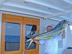
On the way we hooked a spanish mackeral, and then our most coveted trophy, a 30# dolphin. It took Eddie and Carol 2 hours to fillet the dolphin and clean up the cockpit of the boat while we were under way.
We had to approach the island with caution, trying to determine where best to set our anchor based on the wind and wave information. As we were poking along peering carefully into the water so as not to hit any coral heads a bird flew into the pilothouse and perched on the grab railing. The cat immediately perked up and was on the move. Carol was at the helm, hoping the cat and/or the bird didn't make a mess while Eddie and Wayne were out trying to look into the water. It was just more confusion we didn't need, but some things you just can't plan for. We finally managed to find what seemed to be a sandy area with good holding to set the anchor. The only problem was that the island was so small we were prone to surging from both the north and the south ends of the island, causing FLUKE to continually roll back and forth, sometimes enough to where you had to grab on something to steady yourself. Sleeping proved challenging, as the winds were strong enough in the night to keep the surge active, sometimes making us feel like we were going to get rolled out of the bed or we were in a washing machine.
Tasty dolphin fingers were the main menu feast for the night. Cleaning and cooking fish right out of the water like that leaves no trace of fishy smell. The next night we had baked dolphin smothered with white sauce and sweet potato/banana casserole. The rest of the fish was tightly packed into the freezer for future island meals.
Green Cay is interesting from a geological perspective. While it is an island composed mostly of rocky outcroppings, lying low and flat with with small sandy beaches in a couple of the more protected coves, the rocks are huge slabs piled on each other, smooth enough to walk barefoot on. Even right at the water's edge, they aren't slippery, but are coarse and easy to get a foothold on. Ordinarily, the island rocks are jagged croppings of ancient eroded limestone, so sharp that even walking on them with sneakers is scary because you wonder if the stones will cut through the soles of your shoes.
The island has a goat herd, and we saw several goats and could hear them bleating when the wind blew right. We also saw evidence of someone else's goat roast, having found a fire pit and two goat skulls. I guess the fisherman like a change in the menu every once in a while!
SHAKE, RATTLE, AND ROLL
On April 22 we had the anchor hauled up by 0330 after a horrible night of getting tumbled back and forth. We were so tired, but had to take advantage of a wind window and move on before conditions worsened. Leaving the island area, we had to rely solely on instrumentation as it was so dark and cloudy we couldn't see anything for several hours until the sky began to lighten with the pending sunrise.
At 0600 the USS Hayes announced a securitee call saying that they had a 5 mile clear perimeter established for torpedo testing and that we needed to alter course to stay away. While we were less than thrilled to have to do this since we were already worried about making landfall before dark, we only had to make a small course change to stay far enough away and lost little time.
Seas were only 2-4', but very sloppy and almost directly off our port beam, causing a steady side roll. Visitor vomited, and Eddie was sick all day. We were so tired from the poor night's sleep and the ocean pounding and were relieved to finally get to the anchorage at 6:30 p.m., light enough to dodge all the coral heads that were scattered about and get the anchor down. Eddie dove the anchor to find we had just hooked on a ledge and were not fully entrenched into the bottom like we had hoped. Banking on the winds holding true for the night and 200' of heavy chain on the bottom, we decided to let it be for the night. An osprey landed on our spreader bar; I hoped it wouldn't poop because they are big birds!
Andros Island, The Bahamas
WHERE'S THE TREASURE?
To our surprise, the channel into Morgan's Bluff was clearly marked with functional floating buoys, something we seldom see in the Bahamas. We got our anchor to set on the first try and knew we would be comfortable for the night.
Morgan's Bluff was named after the 17th century pirate, Jack Sparrow. No, just joking, I really mean Sir Henry Morgan who was said to have left buried treasure somewhere in the area. Now the real treasure is fresh water, found in short supply in most of the Bahamas. Water tankers from Nassau make daily trips to Morgan's Bluff (thus, the marked channel) to take away 6 million gallons of water for use on the Bahamas most densely populated, and best known, island. That's why we're not there!
Seas were only 2-4' off our port bow, but wave periods were short, making for a bumpy ride. Poor Visitor vomited (that should get him to lose some weight), and Eddie had to strap on his electronic relief band. We kept trying to hail LYCM on the VHF but couldn't get a response. Finally, Sugar Bear came to our aid informing us that he was not an employee, but on his boat at the dock and would let the dockmaster know that we wanted a space for the next couple of nights. He radioed back that there was room for us, and we were relieved to know that we had some place safe to go. We were put on the face dock, easy to get up next to on the slack tide, but could be very difficult to get away from if the tide is ripping by up Fresh Creek or out to the Tongue of the Ocean.
We needed to clear customs and immigration, and the dock master sent word to the airport requesting that a customs officer come to the dock to check us in. These officials have never worked for a fire department where speed is a virtue, and judging by the pace at which they all seem to move, probably were trained in the Vermont maple syrup forests. 3 hours passed, and the officer showed up. He reviewed all our boat papers, which were in proper order, but questioned why we had faxes for the animal import permits. I remarked that we had paid extra to get the forms faxed in the first place and had not ever received mailed copies before we departed. Then he informed us that it was not in his authority to act as the immigration officer and give us the 60 day permit that we wanted, but he would give us a 30 day permit. That means we will have to find an immigration officer within the next 30 days who will give us a 30 day extension. Sounds like crossing the Rio Grande is a lot easier!
Lighthouse Yacht Club and Marina is located in Fresh Creek, the administrative center for central Andros. The facility is small and really reminiscent of what the out island facilities were like in years gone by which suits our tastes just fine.
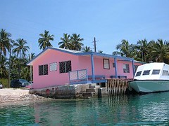
Right now there are no mega or luxury yachts, and I'm not sure many ever do come in here. This is in stark contrast to the newer facilities we see being built on some of the other islands. The pace is slow in the whole area, made of the two towns of Andros Town and Coakley Town, connected by a single lane bridge. When we went for a walk across the bridge we had to stand parallel to the bridge railing while cars passed. Like a lot of the out island homes we see, tropical paint colors like pink, green, yellow, and purple are the rage. Some yards have big trees like mango, avocado, or fig to provide some much-needed shade. The roads are in disrepair and trash is littered everywhere.
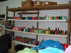
The main headquarters for Androisa Batik Factory is within walking distance of the marina. They call it a factory, but we wouldn't back in the states; it is more like a cottage industry. The building looks dilapidated and abandoned from the outside. The clothes are all handmade and dyed of beautiful tropical island colors. They make you feel cool just to look at them.
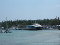
The big event on Sunday was the arrival of the ferry from Nassau, carrying passengers, autos, and freight. The ferry dock was packed with everyone trying to get themselves and their belongings off at the same time and loaded into personal vehicles. All this is accomplished without any law enforcement to direct people or vehicular traffic; I figure in the States there would be at least two murders during each ferry event.
RESOLUTE, a Krogen 42 from Solomons Maryland, captained by Phil Chapman, was in a slip across from us. His wife had gone home to spend time with their kids, so we invited Phil over for dinner. He had enough stories of his fascinating boating life to last 3.5 hours!
I worked diligently to get this section of the blog completed with the hopes that we could make a posting before leaving the dock since there is WiFi here. However, the Batelco (the ATT of the Bahamas) service has been on the fritz since our arrival. That is typical for these parts. Hey mon, we're in the Bahamas! No telling when this will get posted now.
GETTING A GOOD BIGHT
Having started to get restless dock syndrome, we were relieved to find that the winds had subsided enough for us to leave LHYCM at 0900 on April 17. Our destination was to be South Bight, Mangrove Cay area. We set the anchor at 1330 off the Point Cays for what was to be a two night stay. Shortly thereafter a laughing gull landed on the bow railing to welcome our arrival.
We spent a morning "touring" Lisbon Town and taking a dinghy ride quite a ways up into Lisbon Creek. The town is really not much: a government building, 1 small store, a few private homes, and the fish camp belonging to Leroy Bannister.
Leroy came out to speak with us, as I'm sure he likes to do with all strangers. He will be 90 in June and is well-traveled, proud of his heritage, and accomplishments. On Andros he is renowned for his boat building skills, fishing prowess, and business hospitality. He told us his place was the first one to have running water and electricity. It is always interesting talking to the locals and hearing their point of views.
Carol and Eddie dinghied out to the barrier reef to try to do some bottom fishing. The water was full of billions of thimble jellyfish; some groups made the water densely brown. To minimize loosing our tackle by the fish pulling the lines under rocks, we used a looking bucket to peer over the dinghy into the water and watch the fish bite the hook. As soon as they took the bait we could see it and would yank up the fish before it could run under a rock. That technique also prevented us from hooking anything we didn't want to have to remove, like the huge stingray that was heading right for the bait. We get them any way we can!
To our surprise, the channel into Morgan's Bluff was clearly marked with functional floating buoys, something we seldom see in the Bahamas. We got our anchor to set on the first try and knew we would be comfortable for the night.
Morgan's Bluff was named after the 17th century pirate, Jack Sparrow. No, just joking, I really mean Sir Henry Morgan who was said to have left buried treasure somewhere in the area. Now the real treasure is fresh water, found in short supply in most of the Bahamas. Water tankers from Nassau make daily trips to Morgan's Bluff (thus, the marked channel) to take away 6 million gallons of water for use on the Bahamas most densely populated, and best known, island. That's why we're not there!
WE NEED A SPACE
We pulled up the anchor at 0630 on Saturday, April 14 in hopes of getting into the Fresh Creek settlement area early in the day and increasing our chances of being able to get a dock space at Lighthouse Yacht Club and Marina. We knew that other cruisers would be trying to head to safety too in anticipation of the impending frontal system.Seas were only 2-4' off our port bow, but wave periods were short, making for a bumpy ride. Poor Visitor vomited (that should get him to lose some weight), and Eddie had to strap on his electronic relief band. We kept trying to hail LYCM on the VHF but couldn't get a response. Finally, Sugar Bear came to our aid informing us that he was not an employee, but on his boat at the dock and would let the dockmaster know that we wanted a space for the next couple of nights. He radioed back that there was room for us, and we were relieved to know that we had some place safe to go. We were put on the face dock, easy to get up next to on the slack tide, but could be very difficult to get away from if the tide is ripping by up Fresh Creek or out to the Tongue of the Ocean.
We needed to clear customs and immigration, and the dock master sent word to the airport requesting that a customs officer come to the dock to check us in. These officials have never worked for a fire department where speed is a virtue, and judging by the pace at which they all seem to move, probably were trained in the Vermont maple syrup forests. 3 hours passed, and the officer showed up. He reviewed all our boat papers, which were in proper order, but questioned why we had faxes for the animal import permits. I remarked that we had paid extra to get the forms faxed in the first place and had not ever received mailed copies before we departed. Then he informed us that it was not in his authority to act as the immigration officer and give us the 60 day permit that we wanted, but he would give us a 30 day permit. That means we will have to find an immigration officer within the next 30 days who will give us a 30 day extension. Sounds like crossing the Rio Grande is a lot easier!
Lighthouse Yacht Club and Marina is located in Fresh Creek, the administrative center for central Andros. The facility is small and really reminiscent of what the out island facilities were like in years gone by which suits our tastes just fine.
Right now there are no mega or luxury yachts, and I'm not sure many ever do come in here. This is in stark contrast to the newer facilities we see being built on some of the other islands. The pace is slow in the whole area, made of the two towns of Andros Town and Coakley Town, connected by a single lane bridge. When we went for a walk across the bridge we had to stand parallel to the bridge railing while cars passed. Like a lot of the out island homes we see, tropical paint colors like pink, green, yellow, and purple are the rage. Some yards have big trees like mango, avocado, or fig to provide some much-needed shade. The roads are in disrepair and trash is littered everywhere.
The main headquarters for Androisa Batik Factory is within walking distance of the marina. They call it a factory, but we wouldn't back in the states; it is more like a cottage industry. The building looks dilapidated and abandoned from the outside. The clothes are all handmade and dyed of beautiful tropical island colors. They make you feel cool just to look at them.
The big event on Sunday was the arrival of the ferry from Nassau, carrying passengers, autos, and freight. The ferry dock was packed with everyone trying to get themselves and their belongings off at the same time and loaded into personal vehicles. All this is accomplished without any law enforcement to direct people or vehicular traffic; I figure in the States there would be at least two murders during each ferry event.
RESOLUTE, a Krogen 42 from Solomons Maryland, captained by Phil Chapman, was in a slip across from us. His wife had gone home to spend time with their kids, so we invited Phil over for dinner. He had enough stories of his fascinating boating life to last 3.5 hours!
I worked diligently to get this section of the blog completed with the hopes that we could make a posting before leaving the dock since there is WiFi here. However, the Batelco (the ATT of the Bahamas) service has been on the fritz since our arrival. That is typical for these parts. Hey mon, we're in the Bahamas! No telling when this will get posted now.
GETTING A GOOD BIGHT
Having started to get restless dock syndrome, we were relieved to find that the winds had subsided enough for us to leave LHYCM at 0900 on April 17. Our destination was to be South Bight, Mangrove Cay area. We set the anchor at 1330 off the Point Cays for what was to be a two night stay. Shortly thereafter a laughing gull landed on the bow railing to welcome our arrival.
We spent a morning "touring" Lisbon Town and taking a dinghy ride quite a ways up into Lisbon Creek. The town is really not much: a government building, 1 small store, a few private homes, and the fish camp belonging to Leroy Bannister.
Leroy came out to speak with us, as I'm sure he likes to do with all strangers. He will be 90 in June and is well-traveled, proud of his heritage, and accomplishments. On Andros he is renowned for his boat building skills, fishing prowess, and business hospitality. He told us his place was the first one to have running water and electricity. It is always interesting talking to the locals and hearing their point of views.
Carol and Eddie dinghied out to the barrier reef to try to do some bottom fishing. The water was full of billions of thimble jellyfish; some groups made the water densely brown. To minimize loosing our tackle by the fish pulling the lines under rocks, we used a looking bucket to peer over the dinghy into the water and watch the fish bite the hook. As soon as they took the bait we could see it and would yank up the fish before it could run under a rock. That technique also prevented us from hooking anything we didn't want to have to remove, like the huge stingray that was heading right for the bait. We get them any way we can!
Tuesday, May 15, 2007
On The Move Again, Finally!
NOTE: This post is being made out of Georgetown, Exuma because this is the first time we have had an internet connection. It was actually written about a month ago. Several more posts are ready to go and will follow until we catch up.
Hello friends, family, and even strangers who are following our adventures on FLUKE. We had hoped to post a couple of updates since our Nov. 6, 2006 arrival back in Vero Beach, but we were so busy tending to other activities.
We enjoyed getting together with, or hearing from, all those who have wished us well and wanted more details of our adventures. The whole crew appreciated the diverse company of all of those wonderful Sea Oaks Ocean VII people who have invited us to many of their social functions. We shamefully regret those of you who we should have gotten together with, but never made the rendezvous appointment – we talk about many of you regularly.
The most time was spent getting the land home ready to put on the real estate market. There was so much painting, cleaning, packing and repair work to be done. We finally made it to the market in the middle of January. You can take a wonderful video tour (with no obligation to have to talk to a Realtor!) of our dream home at: http://media.homestore.com/HWC9K349.htm
The market is so poor right now, so send us any interested buyers you can think of. We didn’t expect to be able to sell this winter, and we will close up the house for the summer when we get back and try again in the fall.
We all had medical appointments. Regular boat maintenance and provisioning for the Bahamas was very time-consuming, and expensive!
In March we unexpectedly lost one of our crew members. Dennis, age 12, was taking his regular afternoon nap when he suddenly awoke, let out a little cry and died within 20 seconds. He had just been at the vet for his annual exam 3 weeks earlier and was given a clean bill of health (it must have not been good for more than a month though!). No, his death wasn’t caused by the contaminated pet food; the vet said it was most likely a stroke of unknown origin. We humans, and the other animals, miss him.
So, now that you have had a summary update, here is the latest travel news for those of you who are vicariously cruising aboard with us.
We are headed to an area of the Bahamas called the Jumentos (or Ragged Islands); we have not been this far south before. We will actually be south of the Tropic of Cancer. You will have to have a very detailed map to be able to see this tiny, croissant-shaped chain of islands. They are located south and west of Great Exuma and Long Island and will appear as tiny dots,if they show up at all. The chain is 110 miles long, but has virtually no development, industry, or even tourist trade. All visitors must be totally self-sufficient since there are no services of any kind available. These islands represent what our idea of fun in the out islands is all about: unspoiled nature with gin clear water that has good fishing, snorkeling, and beachcombing. Our time there will be limited by running out of fresh water (we haven’t gotten a watermaker yet) or being chased out by poor weather. Then we will have to head for civilization, most likely Georgetown on Great Exuma. We plan to return to Vero Beach the last week of May.
It’s now mid afternoon of Friday, April 13, 2007. We aren’t superstitious enough to believe today is an unlucky day, and you wouldn’t be either if you could see what we are looking at as I write this entry: sapphire blue water whose surface is just rippled by a slight breeze, fairy tale blue skies with cotton puffs of white clouds, and tiny dots of land in the hazy distance, Andros island, our destination for tonight.
We actually left the home dock at 5:00 p.m. on Wednesday, April 11. We made a 2 hour run south to Ft. Pierce where we tied up for the night at the dock belonging to Port Petroleum in hopes of being able to fuel up right away when they opened in the morning. Sitting alongside the face dock was Boat 762, a 60’ 1974 Vietnam war era countermeasures mine ship that still maintains her original military gray appearance, but is now in private hands used as a cruising home just like FLUKE. 762 is unique in that her hull is wood while her topsides are the typical gray steel you would expect to see on a military vessel. The hull is wood so that the ship would not be magnetic to detonate the mines laid out in the water before the crew could deactivate them. We always delight in seeing such unusual vessels and hearing their stories.
On Thursday morning we took on 510 gallons of fuel, enough so that we won’t have to get any in the Bahamas at almost twice the cost. Since weather and seas were so favorable, we decided to head out the inlet to open ocean and head south to the port of West Palm Beach, a full day’s travel for us. Staying close to shore would enable us to test out all the modifications and maintenance updates that had been performed and have assistance close at hand if anything failed.
Keeping abreast of the rapidly changing weather conditions throughout the day and hearing that a weather system with potentially gale force winds was supposed to arrive along the Florida coast by the weekend and since things were operating so well on FLUKE, we decided to skip going into WPB and just head south 4 more hours to Deerfield Beach. At that point we would evaluate the decision to head further south to Miami or make an immediate turn to the east and travel all night without stopping until we were well within shallow Bahamian waters and out of the potential treachery of the deeper parts of the ocean when the weather system catches up with us.
So, travel all night is just what we did. It was our first total night crossing of the Gulf Stream. We, and FLUKE, did great. Without a moon to shine a path for us, seas and skies were dark, but thankfully calm. Passage was slow across the Gulf Stream, as little as 5.1 knots, since the strong northerly current was pushing against our slightly southern course line. We passed our first Bahamian mark at 0500, and no one was seasick! We continued on through Northwest Providence channel, during which all previous passages seas were miserable and uncomfortable, but today it felt like we were on a lake.
We’ve been trolling fishing lines behind the boat. We’ve landed a tuna, medium-sized barracuda (no fun to take off the line with all those big teeth snapping at you!), and a decent sized bar jar who was fatally wounded by a big barracuda when I was reeling in the line. This is the first time we have ever trolled from the upper deck, so we are having to get used to working as a team with someone on the upper deck handling the rod and someone in the cockpit to pull in the fish. At least from the upper deck it is easy to see everything going on in the water, so we could watch the dark, sleek barracuda trying to hit the silvery fat jack.
Our latest weather information indicates that the system should reach us late tomorrow afternoon. Our plan is to anchor out tonight at Morgan’s Bluff on the north end of Andros. Then tomorrow we will have a short run down the eastern coastline of Andros to Fresh Creek where we will try to get into a marina for weather safety, clear customs, and hopefully be able to post this to the blog.
Andros in the largest island in the Bahamas (and the third largest in the Caribbean), but not one real popular with the tourist trade as of yet. There are only 8000 inhabitants, mostly concentrated in settlements along the eastern coastline, set behind the world's third longest barrier reef. Andros is popular for diving, and is said to be the bone-fishing capital of the world because of all the brilliant white shallow flats occupying the inland parts of the big island.
Subscribe to:
Comments (Atom)
