LAND HO!
Well, we made it the marina near Murrells Inlet, and I should have sent out the first installment of this epic journey, but technical difficulties interfered. I have no idea when I will be able to post in the future. If you have signed up for the long version, not realizing it was going to be comparable to Homer's Odyssey, and don't wish to have to tie up your disk space, please ask to be transferred to the short version or press delete. I bet no one ever said that to Homer!
We had FLUKE tied up to the Wacca Wachee Marina dock right after lunch, in hopes of maximizing our stay at the dock. We were the only transient vessel there in our size range, so there was plenty of room. It was a good thing that it wasn't a weekend, this being July 12, as there were a lot of boats and a lot of wakes, and we didn't have much protection. Plus, there was barely enough water at our dock to keep off the bottom at low tide. We made do with the situation and plugged into shore power and cranked the ACs on low to dry out the boat from all the humidity we had acquired going through the swamps. Our pump and a package from our mail service arrived in mid-afternoon, too late to start the installation. E & C washed the outside of the boat, trying to get off the plough residue, salt spray, swamp slime, etc. W went through the mail and caught up on paperwork. We rewarded ourselves by dining out at the Boondocks Grill, located at the marina. The name aptly describes the location, and the atmosphere is casual to say the least. As a result, the restaurant can get away with their motto, “Shut the Duck Up”. No, we didn't buy one of the license plates to display the motto in civilized locations.
WHAT EVER HAPPENED TO QUALITY CONTROL?
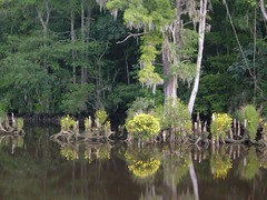
The morning of July 13 was spent on a 10 mile (roundtrip) bike trip to go to the P.O., grocery store, West Marine, and Home Depot. When we got back it was time to call for a pump out of the holding tank, always a potentially exciting event, generally of the unpleasant nature.The dock hand shows up with the hose to connect to the suction fitting that was sticking out of the dock next to the boat, and it wasn't long enough to reach the fitting on our boat, so we had to pull FLUKE backwards. I asked the guy if it was going to work, and he said it was the first time that suction valve had been used, since all the other docks had had theirs already done, and our dock was the last one to get the new system. He assured me that his 5200 suction pump was the strongest on the market and the city of Detroit kept their city dry with them. OK. We managed to get everything hooked up, he turned the on valve and then his fitting going into our deck promptly broke, spilling raw sewer on the foredeck and down the side. Two more hoses, and E figuring out what the problem with his fitting was, finally got us pumped out. The 5200 did the job! We ate lunch at the dock and then took the boat a short ways up the river to what we thought was a suitable anchorage-it was just an offshoot of the river, very scenic. I could look at cypress trees and knees all day. I think the colors and shapes are so fascinating. They can live for 600 years and their heartwoood is rot resistant. Bald cypress are also indicators of the salinity of the water; they can tolerate brackish water, but cannot live in salty water.
W & E decided to install the new washdown pump, only to find out that the new one leaks around the shaft, probably has to do with some seals. Typical. A call to the company and conversation with the “engineer” confirms the theory and he will ship out the seals. Like, how are they going to be delivered, by Alligator Express?! W just tells him we will have to figure out when we can conveniently go to land again and let him know a future shipping date. W & E do a necropsy on the old pump to try to figure out how they will install the new seals once we get them.
ALWAYS FEAR GETTING YOUR CAPE WET
Life in the peaceful swamp took a tumultuous turn very early on this, the 14th day of July, 2006. The crew rose early to try to make the 80 mile run to get to what we thought looked like a safe anchorage. When W & E were preparing to drop the stern anchor line, FLUKE shifted, the anchor line went taught, and W, who was holding the line, was actually propelled into the eerily dark water in belly flop fashion; the noise of his impact with the water shattered the calm stillness and silence of the swamp. He scrambled out of the water onto the swim platform quicker than the nearest alligator could say “Did someone say dinner?” Shortly after that, FLUKE drifted over the stern line float (we were battling some current), and we waited a half hour trying to decide if someone should go in the water to try to free the line, not sure what it was hung up on. Happily, the float appeared and was quickly hauled aboard. As soon as we pulled up the bow anchor and made the turn into the main channel, the rising sun blinded us, not helped by the film of dirt on the inside of the pilothouse window. We just couldn't see at all, a real bad feeling in strange narrow waters, with current, and a 60,000 lb. boat to move. We were lucky no other boats were around as we scrambled to clean the window and make slow headway on this day that we needed to move more swifltly and the Rock Pile was still to come.
The Rock Pile is a 19 mile section of the waterway that is cut through fossiliferous limestone. It took 2 years to blast through this section, and not wanting to spend any more effort to comfortably widen it, it was built with the narrowest of margins. When transiting one extra narrow 3 mile section, boaters issue a securité call to to find out if any oncoming commercial traffic will be using the area at the same time-there wouldn't be enough room to safely pass a tug and barge. We went through the Rock Pile at the lowest of tide, so it was easy to see the rock ledges and stay well clear of them. It would be treacherous to hit those cement-like rocks with any part of the boat.
We did have to deal with one more dinosaur though, the pontoon bridge at Sunset Beach. It is the last one in the whole country. From the photos you can see that the bridge literally floats on the surface of the water and at designated times via cables, is pulled off to the side so boats can pass through.
Sunset Beach Pontoon Bridge waiting to open for boat traffic
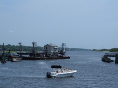
Sunset Beach Pontoon Bridge almost open for boat traffic

Sunset Beach Pontoon Bridge almost open for boat traffic
We happily passed into North Carolina and prepared to deal with our next navigational challenge: the Cape Fear River. The name itself suggest there could be trouble for the careless or unlucky mariner. Through the centuries Cape Fear has been responsible for turning sea lovers back to land lubbers, living and dead. Some of the most dangerous shoals along the entire Atlantic coast run for upwards of 30 miles out to sea from Cape Fear. Look at a map and see where the Atlantic Ocean can come full force right up the Cape Fear River, which we had to cross over to continue on our journey. On this day, King Neptune granted us safe passage with minimal winds and a favorable tide; we rocked and rolled a bit, but FLUKE held the course steady and we went onward.Carolina Beach basin was our intended anchorage.
We sucked sand from the bottom to get into the basin on a low tide. Our cruising guide indicated holding could be poor, which proved to be true. From the bow, we tried setting the Delta twice, then switched over to the Super Max (you would think an anchor with a name like that would be good for anything), which was much inferior to the Delta, so we switched back to the Delta. We had the Fortress set off the stern. I can't even begin to tell you how much mud was on the deck (E has taken to calling it black paint), having brought those anchors up and down so many times. Still not satisfied with the holding, but seeing 7:00 p.m. on the clock, we evaluated the risks we posed to others and ourselves, set the anchor alarm, and decided to sleep with one ear open all night and called it a long, long day.
MILITARY HOUSING
Due to a tight fit, and position of FLUKE, it was time consuming getting both anchors up without running aground. Right after we managed to get underway, having taken to cleaning that lousy mud off the boat with a pressure washer using our valuable tank water, the handle on the pressure washer broke as E was carrying it waist high. The full force of the p.w. hit the deck and chipped it, then bounced up and landed on E's instep. Justifiably so, as evidenced by the swelling, E spent the next 3 days trying to gather sympathy points for the injury. We all must suffer for the Cause. We anchored two nights (needing more rest and to do FLUKE chores) at a spot known as Mile Hammock Bay, located on Camp LeJeune property.
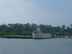
The military lets the public use the man-made basin to anchor, but boaters cannot go ashore. Military personnel do use the shoreline, with a gigantic ramp area and lots of dock footage, to launch boats and fish.The basin was dredged during WWII so that the marines could practice amphibious landings. The threat of German U-boats offshore prohibited them from using the beach itself. So, a full-scale mock up was made of a troop transport ship so the trainees could practice climbing up and down the netting wearing a full set of gear. Today, a rusting marine landing craft is tied to the dock; by its looks, it seaworthiness is definitely questionable. Camp LeJeune covers 246 square miles and is home to 50,000 marines and navy personnel. It has 89 maneuver areas, 25 tactical landing zones, and 54 live-fire ranges, which would affect our progress when we got underway.
IN THE LINE OF FIRE
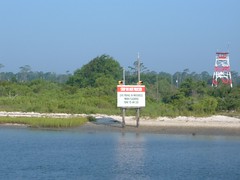
On this, the 17th day of July we have our first foggy morning. Fortunately, the sun is bright and the channel is narrow, so there aren't a lot of places we can get into trouble. Our electronic charts help guide us where the fog is thick and visibility is poor. However, up ahead, still being on base property, we will have to pass through a live fire range during a 5 mile stretch of our route. I had called the Coast Guard yesterday to find out if there would be live firing going on which would close the waterway for up to 1 hour. The CG replied that we should watch for the light signals and an armed patrol boat would prohibit our passage anyway. We luck out, no blockade is in force, and we move onward through the battlefield. It is interesting seeing the targets: old pieces of various types of military equipment, riddled with thousands of bullet holes. I wonder how far away they are when they are having live firing practice and aiming right across the waterway on which we are traveling.
ABDUCTED BY ALIENS ?
We had a short travel day to get to Belhaven, N.C. on July 18. We decided to try to go to land to send and receive email at the public library and go to the grocery store. Belhaven has a reputation as being a boater friendly town, little did we realize how well deserved that would turn out to be.Belhaven sprung up in the late 1800's around the lumber and grain industries. Now the town of 2000 residents is trying to tap into the waterfront craze of development (its potential for success being questionable), losing much of its old charm. Development is the biggest industry we have seen along the waterway since leaving the home dock. The faces of the waterfront towns are really changing, the new pushing out the old.When we finished at the library, after drastically over-extending our allotted time on one of their 4 slow computers (the librarian said we could have more time as long as no one was waiting), we were walking down Main street (the other main roadway is called Water street), headed to the outskirts of town to go grocery shopping. A car with a woman driver pulled over next to us and asked us if we were going to the grocery store. She said she was, and had driven by us, turned around and came back to ask us if we wanted a ride! We were so flabbergasted that she would do this-where we come from we would be lucky to have one of our neighbors take the time and make the effort to pull off the road and offer to give us a ride. She introduced herself as the town clerk and told us a little bit about Belhaven and her life growing up there.
Shortly after we left the grocery store and were walking along the road, a man with a pick-up truck pulled off the opposite side of the road, going in our direction and asked if we were going to the public dock and would we like a ride. We piled into the back of his truck, shook our heads again and figured we must have anchored on another planet.We helped the Belhaven economy by taking on 650 gallons of diesel fuel for $1750.00.
On this the 20th day of July 2006 I am writing this real time, before my shift at the helm begins. We hope to go ashore later today in Elizabeth City, N.C. We will try to post this update of the journey and some photos. Leaving there we will try to traverse through the shallow Dismal Swamp and move on into Virginia.
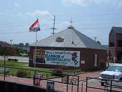
We are tied up at the complimentary dock at Elizabeth City. We were greeted and helped into a tight slip by the very friendly and helpful "Rose Buddies" started by Fred Fearing in 1983. He is 92 now and rides around in his golf cart and gives a rose to each lady on board. The town also has free Wi-Fi which I am using to update the blog and upload photos to flickr. See http://flickr.com/photos/wb4us for all our uploaded photos.
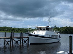
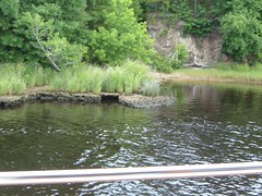


Wow!
ReplyDeleteOutstanding commentary - really enjoyed every segment!
I feel like I've been sailing by proxy.
Can't wait for your next post...
Happy Sailing,
Jerry
gotta go Donna wants to read it...