It's about 160 miles from Troy, NY to the Verrazano Narrows Bridge. It takes us 4 days because we can only go 25 miles the first day, there are a limited number of places where we can safely anchor, the tidal current on the Hudson can be severe, and we don't want to do any traveling after dark. I've decided to take you on a navigation picture story of what we had to deal with.
We didn't leave Waterford until 9:00 a.m. (late for us) since we planned to only go 25 miles to Schodack Creek adjacent to Houghtaling Island where we would anchor and put the mast back up.
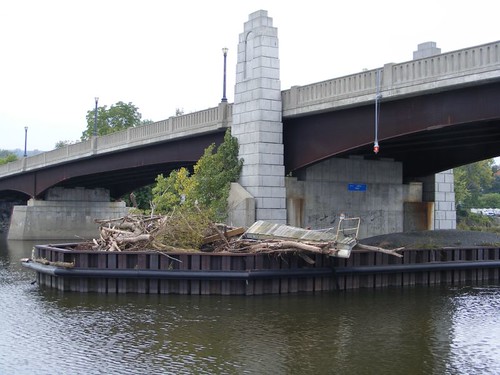
High water bridge debris
About a mile from the dock we just left, we came to this bridge where all the abutments were piled with debris, indicative of the high water level of the Hudson during Irene. Notice not only all the tree debris, but also that big section of dock. It looked like we were floating in chocolate milk since all the run-off from waters flowing into the Hudson were still full of mud. Plus, with all the rain, more was being added almost daily.
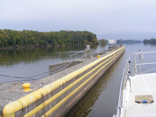
At Troy Federal Lock
The Federal Lock in Troy was only a couple of miles away. The standard procedure to enter into the lock is to hail the lock chief on the VHF. We tried doing that several times, waiting for 15 minutes and never got a reply. That's very unusual. So, I called the lock on the phone, and trying to be nice about the situation, explained that we had tried calling on the VHF and had not gotten a reply. I explained that we had just put up a new antenna and we thought maybe it wasn't working properly. The guy said, “Oh, I had my radio turned off. Sorry about that!” I really wanted to say “Well, duh, doesn't your job need to have the radio ON all the time?!” So, we had to wait longer for him to prepare the lock. When we pulled up we could see that the railing all along the top of the lock wall had been damaged when the water was up that high and all the debris was hitting it. Lots of big trees were still hung up in the dam. Just downstream from the dam was an overturned boat.
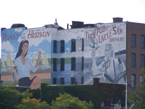
Old building mural
The light was right to be able to get a decent photo of this mural that took up the whole side of the building in the old part of Troy.
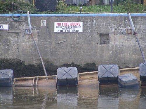
No boats at all
The 1400' long Troy public docks, what was left of them, were upside down. You can see the floatation barrels. The water had risen over the wall. We saw several small marinas which had damaged docks, or none at all.
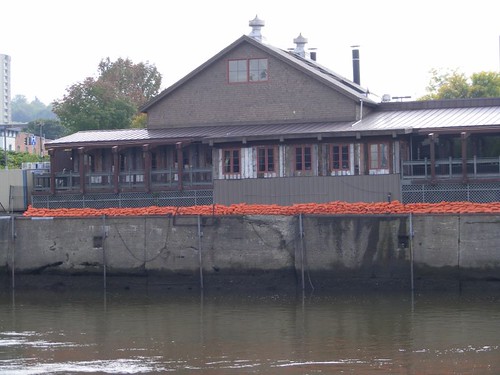
A swim in restaurant
This restaurant, on the Troy waterfront, tried to fend off the rising water with all the orange sandbags.
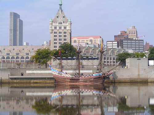
Half Moon
Albany is only about 7 miles away from Troy. The replica ship, Half Moon, Henry Hudson's vessel, was docked at a public landing area in front of the present day government buildings. The calm river water made for an interesting reflection.
We lucked out at Schodack Creek, with the anchor setting on the first try and not having any rain yet. After lunch, it was time to get the mast put back up before it started raining. Raising the mast is dangerous and difficult enough without having to do it with everything all wet. We needed to get it done here because there is no boat traffic and we are protected from the wind. We can't have FLUKE rocking and rolling when we are pulling the mast back up. The job went successfully, or so we thought, and FLUKE was ship shape again. Not having her mast up is like a whale not having a dorsal fin; it just doesn't look right.
Day 2 would take us 50 miles to Roundout Creek, right outside of Kingston, NY. The sun was only out from 0800-0805 the whole day! We also found out that the anemometer wasn't working properly. It sits right on top of the mast we had just put up. We are hoping that it will “fix” itself, although those things seldom do. We won't be lowering the mast to fix it before we get back, as much as we would like to have it operating.
Putting debris to good use
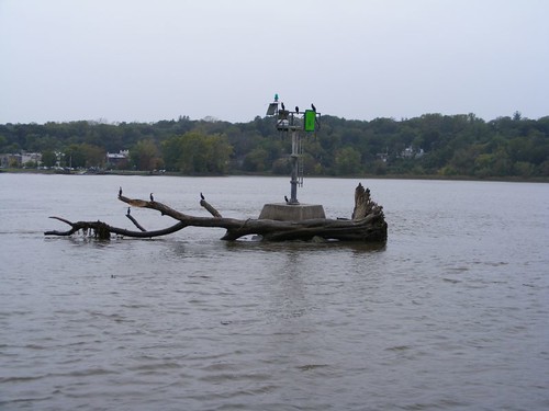
We had to be on the lookout all the time for floating debris of all sizes. Large mats of nasty Chinese waterfoil, usually only found in the shallow water, had been broken loose by the flood waters and were floating free out in the channel, often concealing big chunks of other debris. Sometimes the mats stretched across the entire channel, and we just had to pick our way through, hoping that we didn't snag anything.
We saw 2 more sunken boats, a 30 yd dumpster (can you imagine hitting that?!), and even heard the tug captains talking to each other about all the crap in the water.
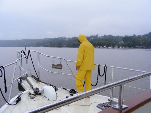
Anchor duty
We dropped the hook, in the rain of course, just south of the jetty for Roundout Creek. We have always had good holding here, and if it's late enough in the day, you won't be bothered by wakes from boat traffic, other than a couple of tug and barge rigs.
The farther south we moved, the more we were influenced by the tidal flow of the Hudson. With the engine running at a constant 1500 rpms, our speed varied from 4.3 – 8.7 KTS depending on which direction the tide was flowing. That is another reason why the river retains so much debris; the garbage remains in a flux state, just getting pulled and pushed up and down the river with the tidal changes instead of getting flushed out to sea. So, it's possible that the T & B captains could see the same floating debris for weeks on end. Of course, they just run over everything since they can't move those big barges out of the way very easily.
Day 3 would take us 55 miles to Croton Point in Haverstraw Bay. That's where we road out the hailstorm and waterspout when we were headed north, so we knew we would have good holding there.
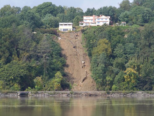
More mud added
Places where people had cleared the land of the native tree vegetation had landslides after the ground became waterlogged and no roots were there to help hold up the soil. A couple of places we could see where roads running along the river had been underwashed.
No ants here
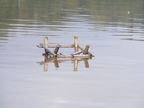
We even passed this floating picnic table. We heard a couple of tug captains talking about it, so we were on the lookout.
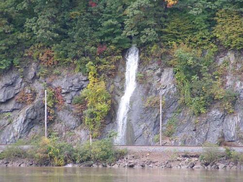
The water keeps coming
Several of the steep rocky areas had waterfalls cascading down between the railroad tracks that run right along the river bank and the solid rock cliff facings. We could see several areas where the railroad track rock bases had to be repaired with new rock. We wondered if the tracks had gone underwater in the real low areas.
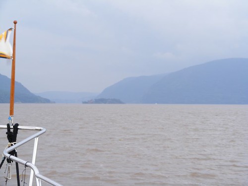
Can't hide the Highlands
One of the most scenic (on sunny days) areas of the river are the Hudson Highlands. That's where we have stopped in the past to hike Anthony's Nose and Bear Mountain. Even in the rain, the Highlands has a mystical quality about it looming in the distance.
West Point is located along this section. With an exceptional high tide, and still high river waters, the dock area and road adjacent to it, were flooded.
It wasn't raining when we reached Croton Point, but we had a current conflicting with the wind direction which made setting the anchor difficult. It took us two tries, and while we felt we had good holding, it was a bumpy night at anchor. Another rain storm, of course.
The fourth and final day on the Hudson would take us by all the sights that New York is famous for in movies, books, and songs. Cruising along the New York City waterfront is NEVER boring, and when you think you've seen everything you always see something new.
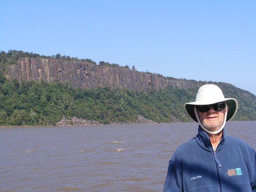
Eddie and the Palisades
The light was finally right for me to get some nice photos of the spectacular Palisades. I could look through the binoculars and see people way up on top, looking down at the river and us, just like I was looking up at them.
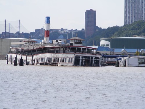
Having that sunken feeling
This old boat, converted into a floating restaurant, isn't serving meals these days. It is another way more junk gets added to the river's debris field.
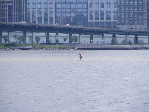
Not for me
We passed two guys near the Upper West Side who were on stand up paddle boards. There must be a better place to do this sport. Plus, we were inside the pilothouse, wearing long pants and long-sleeved shirts, and these guys were flopping around in the dirty Hudson with no shirts on!
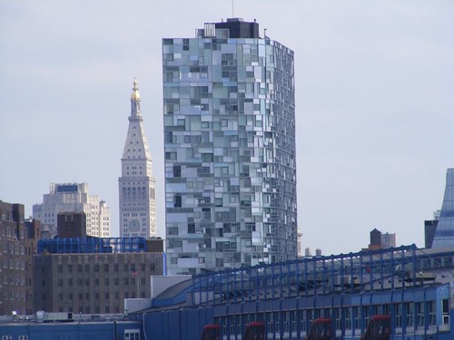
All kinds of mirrors
This unusual, mirrored building is near the cruise ship docks. We thought it interesting since it had so many different sizes and colors of mirrors.
The sky cleared enough to be able to get some decent contrasts of Lower Manhattan's buildings.
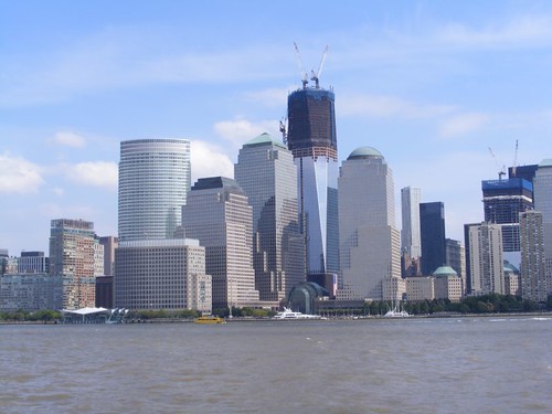
No one has forgotten
The Freedom Tower is really moving along, and you can get a feel for how it will fit in with the buildings around it. Note the big flag at the base of the building.
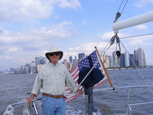
The most famous skyline
You just can't beat the view of the city from the water, even with Eddie in the picture!
New York Harbor is gigantic. From just below the Battery, as seen above, we still had another 3 hours to travel to be able to find a safe area to anchor near the south side of Staten Island in Raritan Bay. It was too rough to go offshore, and we would have to wait for a weather change, days ahead. Good thing we're not in a hurry.


The 'Half Moon' pic is totally cool!
ReplyDeleteThanks!
Jerry