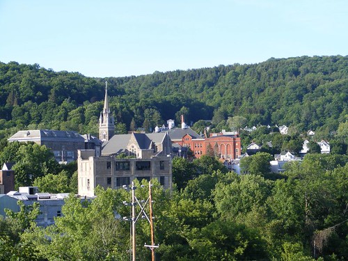
Tuesday, June 28, 2011

Falling Behind a Little

June 19 – 20, 2011

Valley town of Little Falls

The small town of Little Falls is nestled in the narrowest point in the Mohawk Valley. I think it is the most picturesque village we will pass on the canal. It is also noted for having the highest lock lift, 40'. Back in the early days, Little Falls was noted for being a cheese capital. Farmers from all around would bring in their huge rounds of cheese to have it auctioned off and sent on the canal boats down river.

Hello down there
Hello down there

Tourists who park in town take the walk out to the lock to watch the interesting lift in operation. It is fascinating to see boats enter the lock. Unlike the other locks we have used whose gates open back and forth, Lock 17's gate is a vertical lift gate. Boats have to go under the dripping gate, and you and all your stuff will get wet if your boat doesn't have a cover. Because of the size of the lock, a LOT of water has to get pumped in, and the fill process can be quite “violent” with boats really getting pushed against the wall. This is the only lock that requires boats to tie only to the south side to try to minimize the push from the fill process When we locked through, we asked for a slow fill so FLUKE wouldn't get slammed into the wall as much, and it really made a huge difference for us line handlers.

Most of the lockmasters are very friendly and cooperative. If opening the lock is going to take longer than anticipated because of traffic in the opposite direction they will let you know so you can decide how you want to wait. Some cruisers will tie up to the wall if it is going to be a long wait. We had to go into one lock where the west gate was having work done to it. I heard the lockmaster ask an eastbound tug what his beam was and if he had enough room to get through the gate and he was narrower than we were. So, after he locked through and it was our turn to enter, we asked if the gate was going to be a problem for us. The lockmaster asked our beam and when we told him it was 18', he said he would talk to the workers about getting both gates open so we would be able to get out. It took over an hour (instead of the usual 20 min.) for us to lock through since they had to use a barge and cable to pull open the second gate. The wind had kicked up and we had a difficult time holding FLUKE steady in the full lock while we were waiting for the gate to get open enough for us to get out. My arms were sore the next day from holding the lines so tightly.

Hold on tightly
Hold on tightly

Tourists also come to watch the rock climbers. A climbing permit costs $3/day. Cruisers can also watch the action as they go by like the people on the sailboat in this photo. The climbers are climbing on what is known geologically as gneiss (pronounced nice) rock formation. It is considered to be the oldest type of rock in the Adirondacks. The climbers here use two types of rock climbing techniques depending on if they are trying to climb a wall with a lot of outcroppings or if they are just trying to go up a flat face. The one shown here requires a climber to go to the top of the formation and secure the lines with a pulley system to the top climbing point. Someone else has to function as a counterweight and line handler whereby they stand on the ground (like the woman in the photo ) and keep watch on the person climbing. If the climber falls, his descent distance will be reduced by the line handler. Rather than falling all the way to the ground, he will just swing a short distance and get smashed into the rock wall if he can't get his feet to block his direction.

Spiderwoman
Spiderwoman

This woman is climbing up the face of the wall. She has to go along and find cracks in the rock to cram pins into. She attaches a safety rope that is attached to her to the pin, with the theory that if she begins to fall, her safety rope will be held in place by the pin. The guy on the ground is there in case the pins in the wall get pulled out from the weight of her falling, and he has to call 911. At least she is wearing a helmet. We FLUKESTERS have tried a variety of sports, but this won't be one of them, using either technique.

These boulders form the canal side face for what is called Moss Island. It is a lovely, small island with fascinating rock formations, small caves, dense vegetation, and lots of moss. The trails are very good, and a walk here should not be missed.

This is the third time we have stopped at Little Falls, and we have always tied up to the eastern most end of the canal wall on the east side of the lock. You don't need to worry about the water rushing out from the lock and causing too much turbulence to your boat, and even though you are under the highway bridge, the noise is minimized from how far down you are.
The walk up and over the lock and into town is a pleasant one.

Our destination in town this time was to specifically go to the Little Falls Community Co-Op. It is the best one of these kinds of stores we have ever been to. There is every kind of spice you can think of, sold in bulk amounts by the ounce. If you only want 1 ounce, just put it in a plastic bag yourself. There are many types of organic products, flours, home cooking and canning products, and locally grown produce when its available. The prices are very reasonable. Wayne was searching for some specialty flours, particularly pumpernickel.

So, we when we walked up to the store early on Monday morning we were happy to see 2 cars in the parking area since we didn't know if we were too early. We walked right in the store, and a woman came up and told us the store was closed on Mondays, and they were in the process of doing inventory. We told her about our adventure and how we were really counting on shopping there as we had done in the past. She told us just to go ahead and get whatever we wanted!

The shopping result
The shopping result

Wayne made these 2 loaves of pumpernickel bread. The dark one is produced by the addition of cocoa to the dough, but you don't get any of the cocoa flavor.

The CanalWay Trail runs by here in an elevated area on the south side. It is a great place to walk and get elevated views of the village and surrounding countryside. You also walk through a couple of sections with more of the gneiss rock formations. We took a footpath off the CWT that went by a little waterfall and opened to a small neighborhood higher up the hillside. A friendly woman invited us into her yard to see the fabulous views of the village and its surrounds.

The claw barge
The claw barge

I've mentioned that there has been a lot of debris in the water because of the rainy spring (and rainy summer so far from our observations!), and that the maintenance crews do a good job of keeping the waterway clean. This is one of the types of vessels that they use to grab big logs out of the waterway, usually pushed around by a cute little tug.

Herkimer is 10 miles from Little Falls. We planned to stop there for the day so Eddie and I could walk to a nearby WalMart for a few items that had accumulated on our shopping list, like an umbrella for Eddie. I had to listen to Eddie whine the whole way back about our shopping cart being too heavy for him to pull, even though I offered to trade to pull the cart if he carried the totes I was lugging. We lucked out when we passed a woman selling fresh-picked strawberries. I offered to trade Eddie for some berries, but she wanted cash instead.

In the 2009 blog I told you about our fun adventure trying to find some Herkimer diamonds. Well, if the weather had been better this year I would have talked Eddie into riding his bike with me to the outside of town where the rock mines are located and tourists can dig for their own Herkimer diamonds. Another factor in favor of not staying at the Herkimer dock for the night is the fact that it is right next to the entrance to the NY State Thruway, and the traffic noise is the worst ever. I did manage to scavenge another nice bouquet from a nearby weedy area though.

Parking lot beauty
Parking lot beauty

We were headed to Lock 20, where we would be sleeping with the frogs, crickets, rustling leaves, and a honking goose.

Monday, June 27, 2011

Just as Good the Second Time

June 17 – 20, 2011

Erie Canal summary
Erie Canal summary

As the title suggests, we are having just as good a time as when we cruised the Erie Canal in 2009. In some ways, it is more relaxing because this time we can try to do the things we weren't able to do back then for one reason or another.

I saw the information in the opening photo on one of the sign boards next to a lock we stopped at. Most all of the locks have some sort of kiosk with signs talking about aspects of life along the Erie Canal. A lot of them have old photos from the day when the Canal was booming, and it is interesting seeing the different canal vessels of that time. The only commercial vessel we've seen so far is the one that had to put its barge alone in Lock 2 at Waterford. I also wanted to add that the fee for FLUKE to pass through all the locks in the NYS Canal System as many times as we want this season is $100, which we think is a real bargain considering all the work that has to go into maintaining the locks and canals.

Canajoharie's major intersection

There might be one more intersection in the “downtown” area, which only extends for about a block. There are some architecturally fascinating buildings from the canal era days, but most are closed up; the town just hasn't been able to establish a drawing theme to its downtown area. The major industry was the Beech-Nut plant (started in 1891), but it closed in March to relocate about 12 miles away, leaving its behemoth factory behind.

The town tries to draw in recreational boaters by offering free dockage with electric at a nice canal front park. The town of Palatine Bridge is across the canal, where there are a number of shopping opportunities that would appeal to cruisers (grocery, laundry). It is also the site of an Amish community which provides seasonal produce and crafts.

Canajoharie is a Mohawk word meaning “The Pot That Washes Itself”. If you are a nature person, this should be on your list of places to stop so that you can walk a ways from downtown up the Canajoharie Creek along Floral Ave. and see how the name was derived. As the creek flows downhill, it has to go over a series of varying sized falls which causes the water to swirl and weave between different types of rocks. Some of the swirls get into softer sections of rock and make huge, open, perfectly round holes. When the water is low, you can walk right out in the creek bed and wade through the small holes or jump right into the big holes, like what the Indians thought of as a pot, but now people would call a spa or hot tub. It is a beautiful setting.

The creek gorge
The creek gorge

If you are really motivated you can ride your bicycle all the way up to Wintergreen Park to see Canjoharie Creek gorge and the falls. That was what we did, not thinking about how really uphill it was going to be most of the way. In fact, the road was so steep in some places, we had to stop and walk our bikes. One section was so bad, Wayne took my bike because I had Ursa in the basket and it was extra hard to push uphill with my sore arm.

Pot jumpers
Pot jumpers

Once you get to the top there is a trail that leads to an overlook to view the largest of the creek falls. A gigantic “pot” has been created from the path of the water. In the photo you can see how very round it is. There were people jumping off the very slippery sides into the rushing water 30' below the rim of the pot. Some locals were on the observation platform looking over at the same time we were and said that jumping was prohibited because 4 people had been killed in recent years, mostly from slipping and not jumping out far enough and then hitting their heads. Helicopters have to air lift accident victims out of the gorge because it is too steep for any vehicles to get to the bottom. The people said that the kids who jump now come from Albany; all the local kids know how really dangerous it is. With the recent rains, the falls were really pounding over the edge, and we wondered how the jumpers kept from drowning. Once they landed in the water, they were swept away out of sight. Maybe that's why we only saw each of them jump once!

Pastoral countryside

The bike ride downhill was quite a thrill to say the least. We had to really watch for potholes and apply our breaks most of the way down. Fortunately we were able to look out over the countryside on the way up, because there was little opportunity to do so on the fast way down. I thought Ursa and I must look like a couple of cartoon characters speeding downhill with the wind in our faces and our hair flying out behind us!

Farmer's market goods

After the downhill, roller coaster bike ride, we stopped at the local Saturday's farmer's market. Seasonal produce is just starting to come to market, so is limited. With all the rain that they've had there is a lot of concern about crops making it to market at all. We saw two vendors that remembered us from 2009. One of them had seen us with our bikes on the big hill outside of town earlier in the morning and was kind of laughing about it wondering how we had done with the ride, knowing how steep it is and how old we are. Eddie, who loves to patronize the market vendors, tries to get something from them all and ended up buying: eggs (from the cute girl with the “pet” chickens), some kind of French radishes (from the guy who looks like he could be John Stossel's brother), an almond cranberry banana bread (sold by the jolly husband who couldn't answer anything about how his wife makes it), and a free range chicken (from the farmer whose home burned down in May last year). Obviously, part of the requirement for Eddie to buy something is that the vendor has to talk to him. I enjoyed talking to the woman who has 30 alpaca to use for their wool production. I was thankful Eddie didn't have a conversation with her; I don't have time to knit sweaters or hats!

Arkell Hall
Arkell Hall

Despite the condition of the downtown, many of the1800's period homes and churches of the local community are kept in immaculate condition. Arkell Hall is a retirement home for women, donated by a descendent of the Arkell family who also founded the Beech-Nut corporation. It's park-like grounds and unique features make it a real eye catcher, and the tower peak is even visible from down on the canal.

To each her own
To each her own

Not everyone wants to go with the traditional look. I wasn't sure what came first: the purple color for the house or the pink flamingos!

Hitched up
Hitched up

The Amish travel with their horse and buggy made street legal: note the head and taillights, as well as the slow moving vehicle decal. I saw these wagons go down a dirt rode next to the dock and told Eddie we should walk down there to see where they went because I thought it was a dead end. So, we did and figured out that the driver was taking people down to the canal dam (Lock 14) and dropping them off to walk across the dam as a short cut to get to their community on the opposite side of the canal.

Dam walkway
Dam walkway

When we got to the entrance to the dam walkway, there was no sign or lock on the gate, so we decided we would walk across (single file only!) just like the Amish. It was an “interesting” walk since the water was pouring over the dam with a lot of force, really vibrating the walkway. When we got to the other side we walked around the lock area grounds, which were in wonderful shape, with nice shade trees and open grounds for picnicking and lots of wall space for boats to tie up. We could see the young lockmaster out weedeating by the main road entrance, so we decided to go talk to him. Being very friendly he asked “Where did you come from?” We said “Florida”, and he looked at us and smiled and said “No, I mean, how did you get here on the lock property? I didn't see you go by me” We told him we walked across the dam. He said we weren't supposed to do that, and we told him there wasn't a sign or lock on the gate and we saw the Amish do it. He said they've been told not to do that either. Strangers on the dam are considered potential terrorist threats. So, I promised him we didn't have any terrorist intentions and even commented that only a really lame terrorist would want to take the time to blow up one of the canal dams when so many more “glamorous” targets existed.

We told him how beautiful his lock facility was and asked why it was closed to boaters and not for public use. He pointed to the railroad tracks that run adjacent to the facility and to the typical railroad crossing sign attached to the caution lights, but there are no crossing gates to block the tracks. Up until a few years ago, the lock was operated like the other ones for public use. One day a grandmother had brought her 7 yr. old grandson to the lock for fishing, and was leaving with the boy in the back of a pick up truck and stopped and froze on the tracks when the train was coming. The boy was killed, so now no one can use the facility until crossing gates are put in. That is a tragic story, but I can only think of our visit to New Bern, NC with the train tracks running right down the middle of the street, sharing the same street with cars and homes on both sides.

Mr. Healthy Heart
Mr. Healthy Heart

The county is trying to encourage residents to get fit and has put up educational signs and marked walking trails with mileage signs so people can know how far they walk.

On the Canalway trail

The New York State Canal Corporation has undertaken a project to utilize the old canal corridors and tow paths as recreational pathways to encourage users (bicyclers, cross country skiers, walkers, runners, snow mobilers, and horseback riders) to get out and see their countryside and learn more about their historical heritage. When it is fully completed the Erie Canalway Trail will offer 348 miles of recreational trails. We decided we would use the trail to bike over to Fort Plain, about 5 miles from Canajoharie. This particular part of the trail is a wide, paved path, very easy to ride on.

Fort Plain information

Fort Plain is the name of the town where the original Fort Plain was located. The fort was located on what appears to be one of the highest hills in the area. There are no human guides; you just walk around and read placards. When all the revolutionary fighting was going on, many small forts (some were only 12' x 12' in size) were set up at strategic locations to try to block the movements of enemy troops. Local families would move to the fort (frequently just setting up camp outside the block house) so that they could get protection too. On the hill where Fort Plain was located you get a good feel for the role these small forts played in helping the war effort. Reproductions of maps from those times showed the locations of the forts, and the important geographic features that aided in their defense, most often some river, creek, valley, or hill. There are no structures at Fort Plain because most of the fort was made of wood which deteriorated long ago. Some excavations and archeological digs have uncovered cooking areas and stone bases as well as small artifacts which can be viewed at an on site museum. We spoke to a “volunteer” mowing the field who seemed to have spent the last 60 years of his life tending to the fort area and participating in digs on the site. He lamented about the lack of funding available for gleaning more artifacts from the area and the lack of volunteers to just maintain the grounds.

Warehouse mural
Warehouse mural

The little town of Fort Plain is very plain. There are a few well-preserved period buildings from the 1800s and a library/museum that sheds more light on the revolutionary days. Eddie asked some Amish girls who were parking one of those horse and buggy vehicles in a shopping center parking lot if he could take their picture, and they said he could take a picture of the vehicle, but not them.

Rounding the river bend

After a nice couple of days in Canajoharie it was time to see what was around the bend and over the next hill.

Thursday, June 23, 2011

The Waterford Way West on the Erie Canal

June 13 – 18, 2011

See the plan
See the plan

I saw this map on one of the information signs near the Waterford Harbor Visitors Center and thought it would be perfect to use to help explain the currently planned route of our voyage. We will take the Erie Canal west to the Oswego Canal which empties into Lake Ontario. That is the same route we took for our 2009 voyage. However, at that time it was too late in the year to go further north, so we turned around and went back to Waterford. This time we will head out into Lake Ontario and up into the Thousand Islands, staying on the U.S. side of the border (see the dotted line). We only want to enter and leave Canada once, so we will head northward a bit on the St. Lawrence River and then backtrack to reach the Rideau Canal. We will head up to Ottawa and then over to Montreal via the Ottawa River. Then we will cross over to the Richelieu River (it has an extensive canal system) to get down into Lake Champlain. The Champlain Canal begins on the south end of the lake and then goes back to Waterford.

Pointed in the right direction

Here is FLUKE tied up at the Waterford Harbor Visitors Center. You can see our solar panels on the pilothouse roof; they are working wonderfully, when the sun finally comes out. Lock 2 (there is no Lock 1) is straight ahead; it is the first of 5 locks in a row that lift you up 184' to get your trip started on the Erie Canal. Notice the pavement on the walkway next to the dock is done in two colors: brick color and gray. The gray, going up and down and back and forth, depicts the Erie, Oswego, and Champlain canal systems, showing the locks and key towns along the way. It is very interesting and informative. Where the brick pavers end, the path turns to concrete which is imprinted with bare feet prints and mule shoe prints because that is how the barges were pulled from land through the locks and canals back in the days before they became motorized. Old photos show the big ruts alongside the canals and locks from walking the same paths over and over.

We spent 3 nights in Waterford, catching up on a variety of things, both for work and pleasure.
For more detailed information about Waterford and the other places we visit along the Erie and Oswego Canals, look at the 2009 blog entries.

The bridge to my favorite place

I took this photo in late afternoon, just after a stormy day. The angled light and no wind lent such a peaceful feel to the landscape, just like I feel when I take the bridge over to Peebles Island State Park. I think about the contrast of today compared to when the factory workers took the same bridge across the river to work at the bleaching factory and how I would not have been a happy factory working woman. Now, the 3 miles of hiking trails give you a variety of vistas across the Mohawk River, let you walk through deep woods or stand on high bluffs, and see some wildlife.

The old mill
The old mill

The once prosperous mill town of Cohoes is next to Waterford. The trail hike offers views of the old cotton mill buildings, quite impressive in their own right. These buildings with some fascinating architectural features and views of the river and Cohoes Falls (not visible in this photo) are being converted into condos, instead of being left to deteriorate like many of the old buildings we see.

FLUKE and the others

Out on one of the bluffs, and a peek through the trees, offered a good view of FLUKE across the river at her dock berth. The second boat behind FLUKE is a “relative”, a Krogen Manatee, somewhat of a smaller version of our Krogen Whaleback. When you own a Krogen, you automatically become a Krogenite.

Ursula of Switzerland

That is the name of the business that occupies this building. Once an old mill building, a fashion designer of woman's clothes fell in love with its unique style and decided to base her operation of design and making of the fashions in Waterford. The building's impressive steeple top is easy to spot from Peebles and most other places in the village. Located next to Lock 2, the operator told us that he likes having Ursula there, because the steeple gets hit by lightning a lot instead of hitting the lock.

It will not fit
It will not fit

Lock 2 gets watched by people of all kinds, not just cruisers. The Waterford Harbor Visitors Center supplies information to tourists arriving by car. Most of them stop to take the time to watch the lock in operation either from down by the dock where FLUKE is located or by taking an easy walk up to the top of the lock itself. From there, you can look way down over the side and see the boats tie up and the water spill into the lock to lift the boat up. Boats, like FLUKE, that have a lot of mass under the water, can get really pushed around by the incoming water if the chambers are filling up quickly, so it is important to hold the lines that are attached to the lock walls tightly in place. We have one person on the bow and one person on the back upper deck holding a line and we have to pull very hard at times. It is critical to have good fenders to keep the boat from scraping the sides of the lock.

It is a treat for everyone when vessels like those in the above photo lock through. It takes them a long time to get aligned properly, and you wonder how in the world they will be able to fit in the lock. This barge had less than 2' of clearance on either side when it was finally positioned in place. Plus, its tug could not get in the lock at the same time. Since we had never seen this happen before, we wondered what was going to happen to the barge when it got lifted up without its tug.

When the lock had fully filled, the workmen attached lines from the barge to a huge capstan located on top of the lock wall. The capstan could be operated with electrical power by the lockmaster, slowly pulling the barge's lines tight and allowing the barge to gain some slow forward momentum. After it was started, the barge handlers could pull the barge along by hand, until it was beyond the lock gates and could be tied off to the wall. Then the lock was emptied out to allow the tug waiting down below to get in and be lifted up to reconnect to the barge. Were we ever glad that we were not waiting behind the tug and barge to try to use the locks the same day. It took over an hour and a half compared to what is about a 20 minute operation for us to lock through Lock 2 alone, and you have to lock through all five of the first locks without stopping once you get going.

No turtle soup for me

This snapping turtle (over 2' long, excluding the tail!) was trapped between the barge and lock wall. The barge handlers were even cheering for it to get out of the way before the barge crushed it, and by some luck it managed to move forward of the barge and get out first when the gates were opened.

Be on the lookout
Be on the lookout

We were entertained by a group of teenagers having some old fashioned fun jumping off the bridge. Eddie and I would have been doing that back in our day at that age, maybe even now if we were out in the middle of nowhere and the water wasn't so cold! Apparently, it is now “against the law” and the kids had to be on the watch for the police to show up, which they did. Plus, the woman on the boat behind us was bitching about them making noise when they hit the water and splashed her boat. Game over.

Keeping up our carbs

Wayne was up to his elbows in flour as he took the time at the dock to catch up on some baking he had been wanting to do. Now we have many choices.

While Wayne was baking on the main deck, Eddie was below deck filling up our water tanks and doing other things at the same time. Suddenly, we heard the sound of cascading water and a mad scramble to try to control the flooding. The tanks had been overfilled and water was spilling onto the floor, including into one of the tool boxes. Eddie had a big clean-up on his hands, which was punishment in itself. There was no point in yelling about it, since we knew it could happen to any one of the Sea Stooges

My favorite wildlife “treat” came on our final evening. Eddie called me to the window to look out at something moving purposely through the water towards the shore by the entry to the lock. Only the head of the animal was visible, so I waited until it got to shore. I was SO surprised to see a huge beaver pull itself out of the water to go up on the shore and eat wild grape leaves. The beaver is the NY state animal, but we had never seen one here before. I would have loved to have gotten a picture, but with the distance and fading light, it wasn't possible. Eddie, being the man of the world that he thinks he is, said I didn't need one anyway because “all beavers look the same”.

The art of stone
The art of stone

With mixed feelings, sadness for having to leave the comfort of Waterford, but eagerness to get going again, we began the westward journey with our entry into Lock 2. Right after you exit the lock, you can see the remains of the original old Champlain Canal and some of the other stonework associated with earlier versions of the Erie Canal. Before the advent of concrete, all the stonework on the canals was done by hand by craftsmen who took a lot of pride in their work and built structures to last. In a few places some of the old locks are now on dry land, and I love to touch their walls and feel the cuts in the big stone blocks.

View from the top
View from the top

It takes about 2 hours to get through the first five locks. It is a pretty view looking back to the east from where we started our day. Notice the paint details on the canal railing. All the locks use the same colors, but vary in what areas get what colors. One thing is for sure: they are all kept up like parks. The lockmaster is responsible for doing all the painting, minor mechanical repairs, and landscape maintenance to the entire lock area.


View in the canal
View in the canal

This shot gives you an idea of some of what we see along the way. The lock has just opened to let us and another boat exit. The sailboat has its mast down; it is a pain for them because the mast has to extend right over their cockpit where they have to sit. Notice the crisp look of all the painted areas: railings, lock house (where the controls are located to operate the gates on the west end), the lightposts, and lamp. Also, this lock wall has recently been refinished since the surface is very bright and smooth. Some of the locks are very rough, with pieces of stone 3-4” in size exposed on the surface. That makes for a rough scrape for the poor fenders. On the left side you can see the bollards, the short, fat, blue posts with the yellow tops which are used to tie off to if a vessel has to wait to lock through (mostly barges use them, but we use them to tie off to if we are spending the night at a terminal wall like you see here). Notice the wall, made out of the big blocks. See the pretty trees and the mowed grass area above the wall.

We will move through the area, visible on the right, that had to be cut through solid, higher rock. That is not the norm since most of the canal follows the path of the Mohawk River, which generally went through lower, valley areas that had lots of marsh lands.

That structure up ahead is a water flow control dam. They help regulate the flow of water going downstream to the lock in times of high water flow. If the water can be slowed down, it will be less likely to damage the lock facilities. Plus, they help regulate the proper height of the water between locks, so it isn't too high for boats to get under the bridges.

The BIG place
The BIG place

The buildings along the canal vary from old, abandoned mill factories to places like this, some with spectacular views of the canal or surrounding countrysides. In many sections of the canal, there is not any kind of development, just open marsh or forest lands, especially where the canal follows the natural, winding path of the river.

Swinging on the river

School's out, so the local kids head to the river for some wet fun. They could really get out far from the shore with this long rope and being able to jump from higher up on the river bank.

Our stops are not always scenic

We had gone far enough for one day, so decided to tie up to a terminal wall in the middle of nowhere right after we had gone through Lock 10. I had to show you what our view was: an abandoned power plant and rock mine. However, nature supplied a nice surprise. I could just step right off the boat and pick a vase full of daisies. I had been wanting to pick some for days, but don't like to do that where the local people will think I'm stripping the fields of their flowers. I was relieved that I wasn't bending over in the opposite direction when Wayne snapped this shot from the boat.

Daisy days of summer

When I finished picking the daisies, I took a stroll around the terminal wall. I was so surprised to peek over the side of the wall and see many pairs of beady eyes staring back at me.

Who has the Old Bay
Who has the Old Bay

There were crayfish clinging to the sides of the wall, feeding off of debris floating on the surface of the water. I could see many more crawling on the rocks close to shore and on submerged branches. I went back after dark with a flashlight. There were so many crayfish along the water surface on the side of the wall, they were packed in pincer to pincer, hundreds that I could see, and who knows how many more that weren't visible. I was wondering if they were edible like those I've eaten at a crayfish boil. Yummy. But, I'm too chicken to try these guys, and I don't want to stink up the boat cooking them up.

Meet you behind the wood pile

Early on I told you that the canals were delayed in opening because of high water. That means there was a lot of debris washing in. We've had to be on the lookout for floating logs, and even worse, those that are slightly submerged and pointed toward us and may not move easily. The canal workers do a good job of pulling many of them out of the water using cranes on barges. Plus, many get caught up in the spillway dams. We've seen piles of them along the canal, and we just so happened to stop where we went by a pile walking Ursa.

Dam work
Dam work

This spillway dam is having work done to it, as indicated by the cover on the right hand side. The covers help contain all the debris that gets scraped off the metal and dust that accumulates. Each one of the segments of the dam can be individually controlled by lifting its gate up by using an overhead lift mechanism that moves on a track across the top of the dam. That way, water flow can be regulated from side to side as needed. There can be as many as 30 or 40 gates depending on how wide the dam is. The lock we have to enter is way over on the right hand side of the photo. If there is a lot of turbulence coming from the dam, the lock operator usually tells us to be prepared for how it may affect our entry into the lock. Plus, they have tried to make the lock walls long on the side where the dam is to reduce the affect of the water coming from the dam on the vessels trying to enter into the lock. Since the locks are so narrow, you don't want to be pushed sideways into the lock wall and smash your boat.

The insect behind us

This trimaran was following behind us for a while and I thought it looked like a water bug since it was so flat to the surface of the water. The two guys aboard had quite a time trying to keep their balance when locking through since they don't have any railings and those pontoons are so tippy. Notice that when they are both standing on the same side, the other side of the boat comes completely out of the water! I kept waiting for the guy in the back to fall overboard since he seemed to be having such a difficult time moving around and the other guy kept yelling at him. Boating seems to generate a lot of yelling.

In fact, I'm being yelled at right now to finish this up, so I can take Ursa for a walk in the rain and then get dinner going. You know I'm still on FLUKE: tick tock, eat by the clock!

Monday, June 20, 2011

Hail on the Hudson

June 9 – 12, 2011

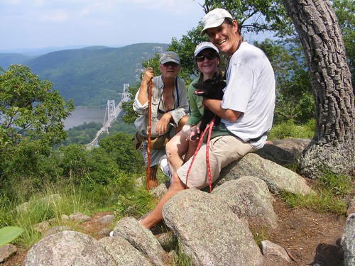
Flukesters at Base Camp Alpha

Remember, readers, I told you in the last blog that this trip up the Hudson wouldn't be filled with a lot of historical details. I will be focusing on the “action” of our adventure and the sights we see as we cruise up the river. From the title, you should surmise that we didn't have the best weather to say the least. That means my photos aren't going to be as clear as I would like, but will still help with bringing you along for the journey.
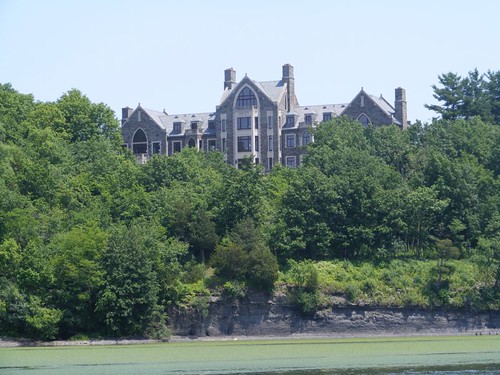
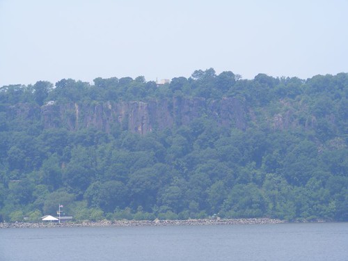
Majestic Palisades
Majestic Palisades

This gives you a perspective of how the New Jersey Palisades tower (up to 522') straight up from the west side of the Hudson. Notice how small the building appears next to the water. The colors of the rock are beautiful and interesting. Fortunately 13.5 miles of this formation received protection from being excavated for construction purposes around 1900 and remain a park today. In a few places where there are openings at the top we can spot people looking down at the river.

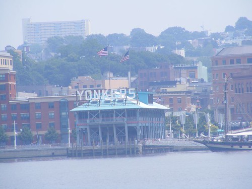
Maybe it looks better at night

Check out the contrasting view on the eastern shore, complete with all the hustle bustle noise of the city life. Amtrak trains seem to run continuously in both directions with their whistles blowing.
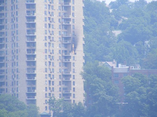
Burned out
Burned out

I think it is amazing to see a fire in a high rise building and wonder how it is able to be contained so well to just one or two units. Credit surely is due to the skills of the city fire fighters and their high tech equipment.

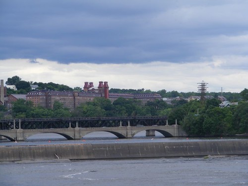
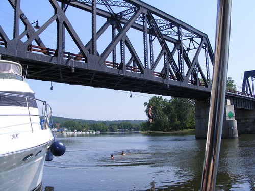
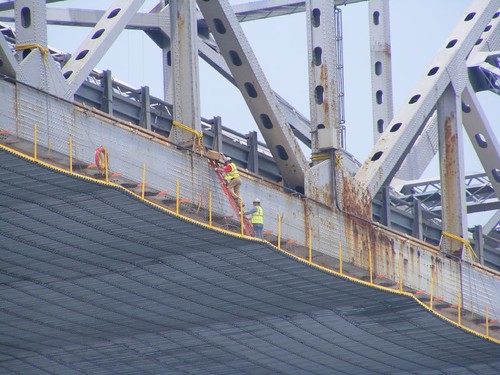
Hold that ladder steady

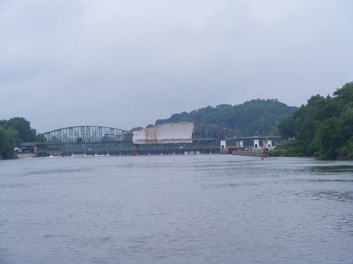
The Tappan Zee bridge, at 2.5 miles long, is the longest bridge across the Hudson. The New York State Thruway runs over it. All the Hudson River bridges, like those on the C&D canal, have to have at least 135' of clearance since ocean-going freighters use the Hudson to go about 140 miles up to Albany, NY. It was difficult to determine what kind of work was being done on the bridge since the entire underside was covered with some kind of safety work “drape”. Barges underneath the bridge held generators and other equipment with lots of cords extending up to the bridge. I think having to keep the bridge cleaned and painted would give a lot of people job security.

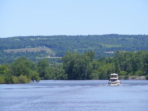
We were fighting an outgoing tide most of the way, at some times only making around 5 KTS of speed. Fortunately, we only planned to get to Haverstraw Bay, about 30 miles upriver, and anchor near a place called Croton Point. We anchored there before and knew we could have good holding. Getting to the anchorage in early afternoon, we had plenty of time to get settled and acquire internet weather information. Judging from the rumbles coming from the far side of the mountains on the west side of the bay, and the darkening skies, we were in for some potentially turbulent weather. It appeared that the bad weather would be coming from the northwest, the worst possible direction for us. Haverstraw Bay is very wide and open from that direction and we were on its opposite side, so there would be plenty of room for the wind to come all the way across the bay.

Shortly after we arrived, a 40' trawler also arrived and rafted up with a Sea Ray, about 34-36'. So, both of those boats were sharing the Sea Ray's anchor, and they were in very close to shore. We were quite a ways from shore since we don't like to be around other boats, and just in case bad weather comes, we want to have plenty of room to maneuver.

When all the boats had anchored, the wind had been coming out of the southwest, so anchors were set with that direction in mind. When the storm began approaching, the boats were swung around, opposite to how their anchors were set. I kept waiting for the trawler and Sea Ray to split up and set their own anchors with the pending storm. That never happened.

Batten down the hatches

With some flashes of lightning and huge gusts of wind, the storm came barreling over the mountain to the west. Eddie yelled that a waterspout was trying to form and was whipping by our starboard side. I grabbed the camera to try to take a shot. In the photo you can see the white strip on the water; on the right hand side the water is being raised up into the air. It couldn't fully form because it ran out of water and dissipated when it hit the nearby land. The rain pelted down in full force; we couldn't see the other boats behind us, towards the land. Next came the hail, extra loud since it was hitting our solar panels. Wayne started our engine, expecting that our anchor would get pulled up when we saw 46 KTS (53 MPH) on our wind gauge. Hooray – we held tight and rode out the rest of the storm!

When we could finally see towards shore, the trawler and the Sea Ray had been blown all the way through a roped off swim area and were banging into each other on the sandy shore. Looking through the binoculars I could see both boats had some scrapes and bent railings. Local townspeople began showing up even though it was still raining. A land police car pulled up, followed shortly thereafter by a water sheriff and NYS water police. Sea Tow came and pulled away the Sea Ray. The trawler captain wouldn't let Sea Tow pull him off the shore because the tide had fallen, putting the trawler even higher up on shore. We heard him say on the radio that he would wait until the high tide in the morning.

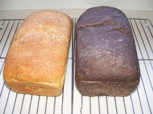
The storm cleared through and gave us a calm night. The next morning we only had a short ways to travel, about 10 miles to Bear Mountain where we hoped to spend two nights. Wayne took the travel time to bake a couple of loaves of bread.
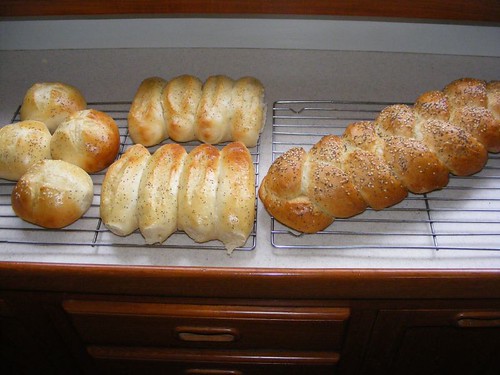
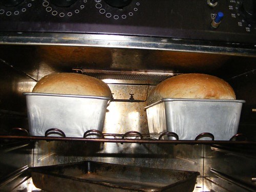
Too tight
Too tight

Remember before I told you I thought we had figured out how to use the gas oven? Well, you can see we still have some issues to work out. The bread rose so much it hit the top of the oven and Wayne had to tilt the pans sideways to extract the loaves. I burned the cookies I made right after that.

She's coming round the mountain

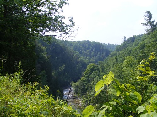
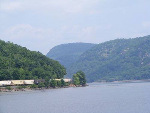
The area a couple of miles south of Bear Mountain marks the beginning of the segment of the river called Hudson Highlands which runs for 11 miles to the north, with some of the most spectacular scenery on the river. The river narrows and twists between this part of the Appalachian mountains. The train tracks on both the east and west sides of the river run right along the edge where they were the easiest to build although we have seen several tunnels. All the mountains have many wonderful hiking trails with sweeping vistas at their summits. We hiked up Anthony's Nose during our 2009 cruise, and when we were at its summit looking across to Bear Mountain on the west side of the river, we said we would have to come back to hike up Bear Mountain too. So, that was our plan.

We safely got the hook set in almost the exact same spot we set it the last time we anchored at the base of Bear Mountain. Since the days are longer now, we figured we could hike up and down the mountain before dark. But, we had to EAT lunch first, building up our strength for the big climb since the fat reserves don't help for that.

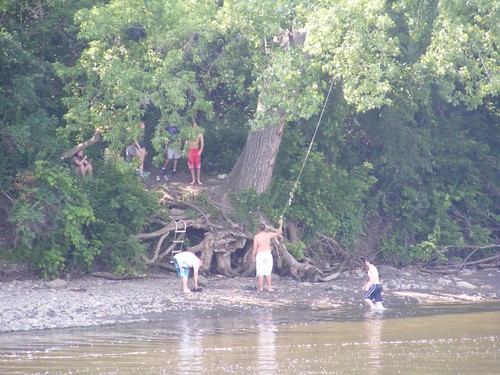
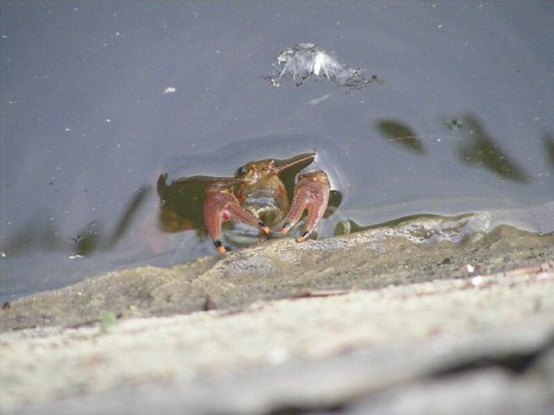
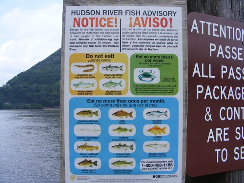
You had better know your fish

We didn't eat fish for lunch. After we launched the dinghy and got to the public dock on shore, I saw this sign. I never heard of anyone eating goldfish from the wilds, not that I've heard of eating a lot of those other fish on the list either!
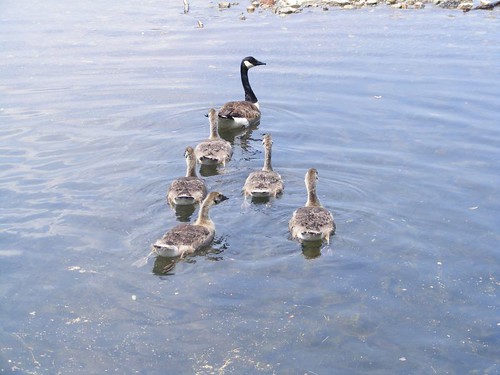
Stay in formation
Stay in formation

We had to pass by Hessian Lake, a beautiful, scenic mountain lake that is located part way up the mountain. It is large enough such that the park rents out small paddle boats and row boats to tour across the lake. The rental season hadn't started yet, so the Canada geese had the lake all to themselves, new families with their broods in tow.

Our plan was to take the Major Welch trail up the mountain and then to use the Appalachian Trail to hike back down the mountain. That way we would get to see two different sides of the mountain and use two different trails. The trail head for the MW trail is about ¾ of the way across the west side of Lake Hessian, and you have to look carefully to see the marked beginning. Once you get going, it is easy to find most of the trail marks. While the trail is not improved, it offers fairly good footing, is not too steep, and doesn't have a lot of loose rock areas.
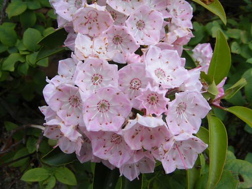
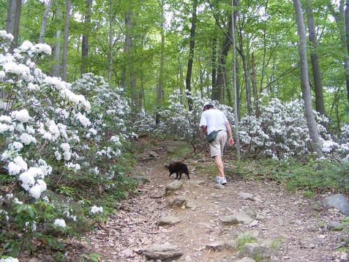

Forest splendor
Forest splendor

On our hiking day we were truly rewarded with a wonderful surprise. Mountain laurel was in full bloom. The thick boughs of blossoms brightened up the whole understory, ranging in color from bright white to soft pink. I laughed when I would look ahead to see the white flowers clinging to Ursa's black coat from when she would brush up against a plant.
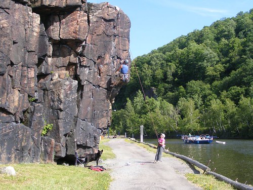
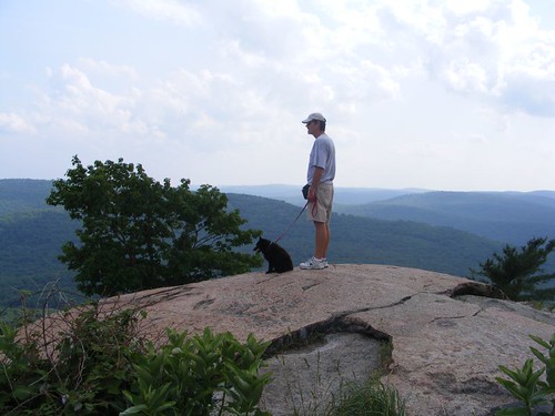
We were in the pink
We were in the pink

The opening photo is one of my favorites so far. We had all decided to stop for a break before we made the final push to ascend to the 13000 ft. summit (just kidding, it's really 1300'!!). I found the perfect rock to set the camera on so that we could use the delayed shutter close function to get us all in the picture in time. You can't hear all the yelling that was going on from the guys while I tried to get the whole photo staged, but the result was worth it, and we all look happy. The view was truly amazing and brought back great memories from our 2009 trip. You can see Anthony's Nose in the background. When we were on AN, we were right above where Eddie's head is in the photo. The beautiful Bear Mountain Bridge and Hudson River are visible down to the left.

Standing at the summit

The trail ended in a parking lot at the summit. There is an observation tower (Perkins Tower) that would enable great views over the tree tops that block out some views from ground level. However, it was closed. 3 guys in their 20's, who had gotten out of their car were making fun of Ursa. I heard one of them say she looked like a pig. I went over to him and said “This pig is 13 years old and has just walked all the way up this mountain from the river!” They were rightly impressed, asked all kinds of questions about her, and wanted to take her picture.

While Eddie and Wayne went off to visit some vending machines (and hopefully bring me back a cold drink) I was thinking about our afternoon adventure as I gazed off to the mountains in the distance. I've known Wayne for 40 years, and he still puts up with me. Next year will mark the 10th anniversary of Eddie's heart attack and open heart surgery; in Jan. of this year he had 5 more stents put in. While they both drive me crazy, I'm lucky to be part of their crew and count on them more than I tell them I do. So, even when we're down on the river, we're really still on top of the world.

I had a bad feeling when I saw Wayne coming back without a drink. Eddie followed a ways behind, also empty-handed. The vending machines weren't operating. It would be a dry descent since we had drank all our water on the way up.

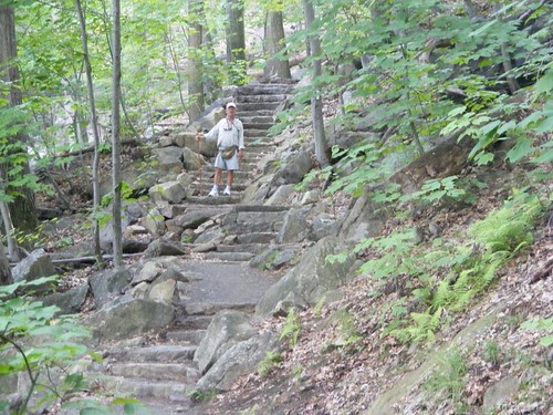
Only 400 steps to go

We were surprised to find that the Appalachian Trail was improved most of the way down. Using mostly volunteers, enormous amounts of rock were cut and moved to make sturdy steps and flat areas for the trail. There are even small bridges that help close big gaps between boulders and get over streams. Obviously, this is the main thoroughfare for hikers to use to go up and down the mountain from the main parking area. It is also much shorter in length than the Major Welch trail. Since it is on a different side of the mountain than the Major Welch trail, the vegetation is also different, practically no mountain laurel, but still interesting none-the-less. It is much rockier with more open spaces and you can see straighter down the mountain staircase for long distances as you descend.
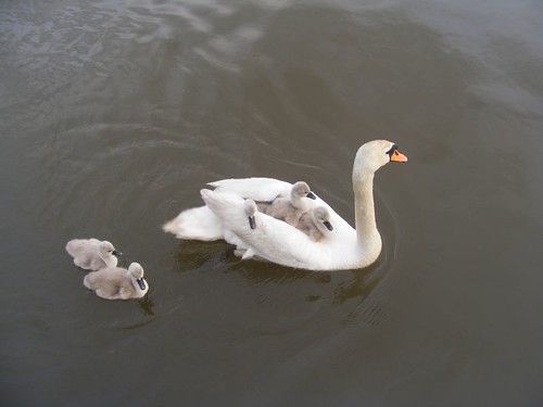
My turn to ride
My turn to ride

After we got back to FLUKE, we had some unexpected visitors: a swan family. I had never seen the swans venture far from the shoreline to go to any boats or to the public dock area to beg for food from the fishermen. The male was in the lead and went over to the dinghy and bumped it several times; he may have thought that white dinghy was a threat. Since we wanted to be able to get some pictures of the whole family, I threw some Cheerios into the water for them to eat. All family members readily gobbled them up; the 3 babies on Mom's back slid off so they could get some too. If I extended the camera too far from the transom's cap rail, the huge male would start to hiss at me. The babies looked so downy soft and cuddly; I wanted to pick one up and snuggle it. There was no chance of that happening with Mom and Dad keeping close watch.

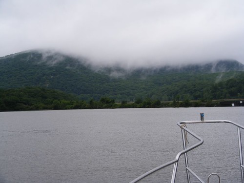
Mist on Bear Mountain

The next, miserable, rainy day (most of the time we couldn't see the top of the mountain) was brightened up by the company of our friends of 30 years, Kathy and Joe. They only live about an hour away, so we had scheduled a rendezvous pending weather conditions and our ability to safely anchor at Bear Mountain. You know who your friends really are when they bring blueberries, strawberries, and beer. Then they were even kinder to so willingly take the recyclables that we had saved up until we could find a disposal site. The day flew by and I was sad to see them leave.

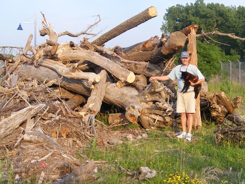
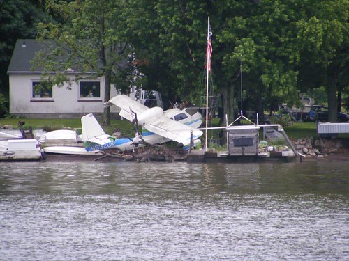
Odd way to tie up an airplane

Shortly after leaving the anchorage at Bear Mountain, we passed by a section of riverfront homes and I spotted this airplane kind of tied up to shore in amongst all the other “stuff” stored at the same location.

The U.S. Military Academy at West Point is only about 5 miles from Bear Mountain. Since we had hiked the mountain and met with our friends I had decided not to belabor the issue of trying to stop somewhere nearby so we could tour the facility. Prior to 9/11, cruisers could dock their boats at the Academy's riverfront docks. At least we can still cruise right by the place and not have to observe any zones of security mandating we keep a certain distance away. The beautiful facility takes up about 2 miles of winding, mountainous riverfront with spectacular views, including the section of water with the deepest river depth, 216'.

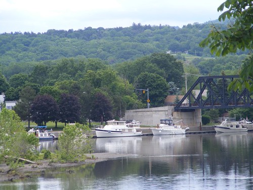
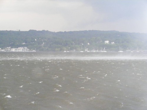
Our cruise northward through the Highlands ended as we passed the rocky face of Storm King Mountain jutting out into the river. After this, the river opens up quite a bit and becomes Newburgh Bay. We pass large cities like Newburgh and Poughkeepsie, but most of the riverfront towns are small, with old buildings still standing from the days when they were just another stop on the early riverfront highway for tradesman, hunters, and mariners. Captivating historic lighthouses still stand, most restored and beautifully maintained. I took photos of all of them in the 2009 trip and wrote about their significant features.

Replica paddlewheel tour boat
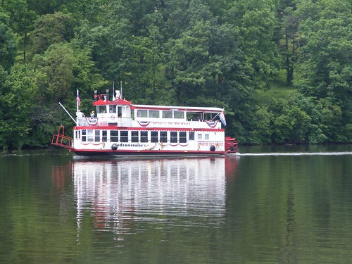
Replica paddle wheel tour boat

With the skies being overcast and the temperature on the cool side, deer were visible on some of the hillsides. I saw bald and golden eagles and several species of ducks in the rural areas. There wasn't much boating traffic, and even less cruising traffic than we remember in our 2009 adventure.

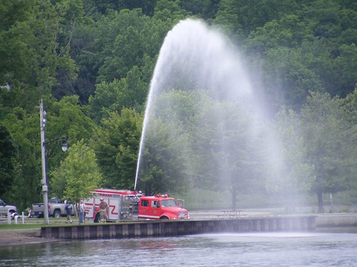
Testing the little truck

Apparently this little riverside town of Coxsackie (pronounced Cook sackie for some reason) doesn't have to worry about fighting any highrise fires like we saw back in Yonkers. The water show entertained us as well as some of the locals.

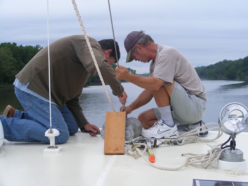
The beginning of the job

Our goal for the day was to get to the Schodack Creek anchorage before dark where we would be protected from any passing boat wakes since it is mostly a dead end creek. The time had come for the mast to be lowered to enable us to pass under the bridges and lock gates on the Erie and Oswego canals. It is a scarey job, requiring the stays holding up the mast to be unscrewed (the guys are working on the main one which sits on the pilothouse roof in the photo) and then slowly lowering the mast using a come-a-long that we hope never slips too quickly.
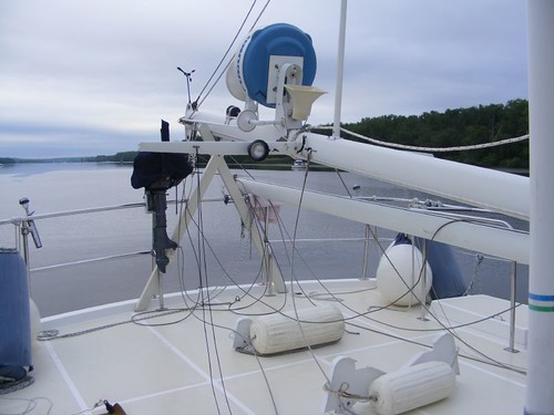
Unwired
Unwired

Once the mast is lowered it is set in a cradle. All the loose wires get tied up out of the way. It is a pain having to duck under the mast to get from one side of the upper deck to the other. Also, we end up losing our best place to be able to hang wet clothes and towels. Since our radar and anemometer are located on the mast, they get taken out of service too. We really don't need the radar on the canals for boating traffic anyway.

We awoke the next morning to some welcomed sun. We didn't have a long day planned since our goal was to try to get into Waterford, NY by midday. We hoped by arriving at that time the morning cruisers would have left the dock at the Waterford Visitors Center, and the later day cruisers wouldn't have arrived yet, meaning there would be space for us.
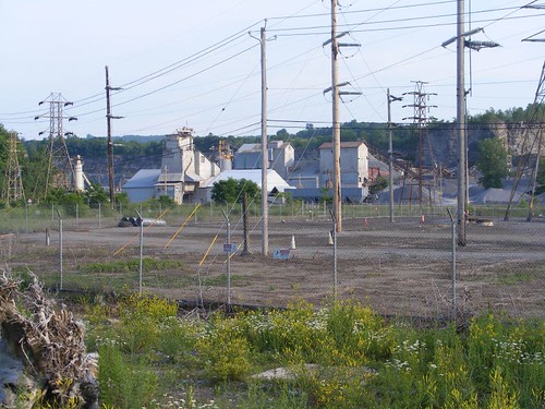
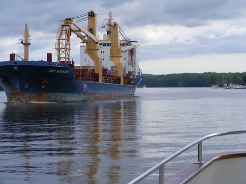
Fill her up
Fill her up

The last segment of the trip goes through some industrial areas, including several stone and gravel operations. In fact, when we are traveling up the Hudson, we hear tug and barge operators talking up pushing their loads to or from these areas.
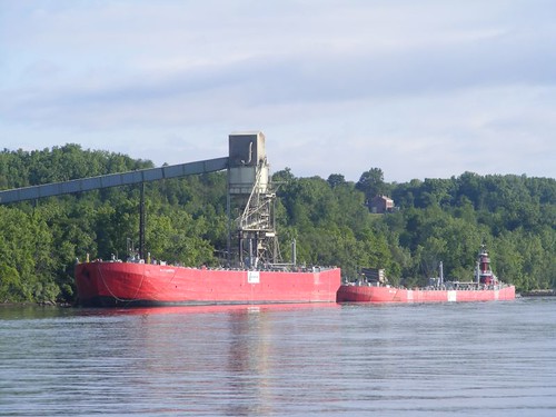
Not full
Not full

This freighter passed us, just south of Albany, NY. You can tell it is not filled up by where the water line is located on the hull. Ideally all of these ships would like to drop off cargo up river and pick up new cargo to take down river. But not in this economy!

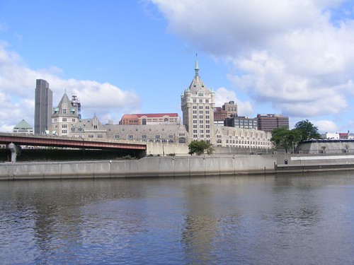
Albany from the Hudson

I find it very strange that the city of Albany, being the capital of NY, doesn't really showcase its waterfront. One area is nothing but expressway. Other areas are devoted to marine shipping, fuel storage areas, and just look industrial. There aren't even any waterfront condos. Having never stopped there, because it is not convenient, I don't know the history of how the city developed away from the waterfront, which in most large cities is the most valuable property.
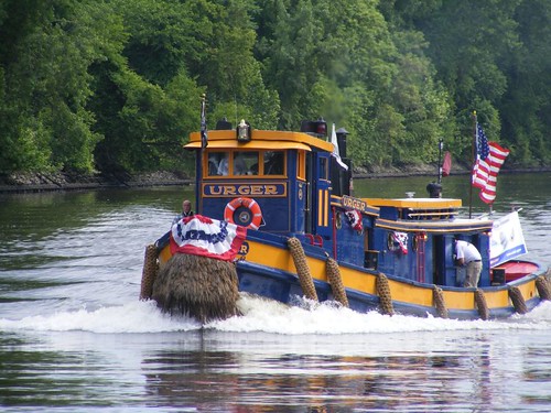
Tug URGER
Tug URGER

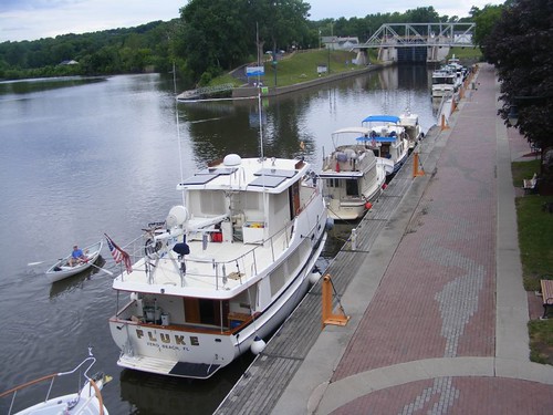
The New York State Canal System has many operating vessels of historical importance that are still used for work and educational purposes. URGER passed us on flag day, all dressed up for the occasion. Notice the old-fashioned rope fenders and “beard” on the bow.
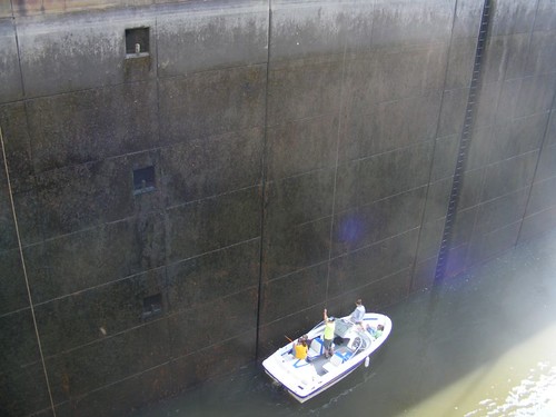
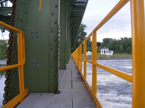
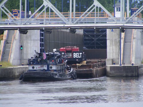
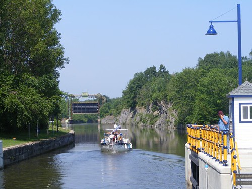
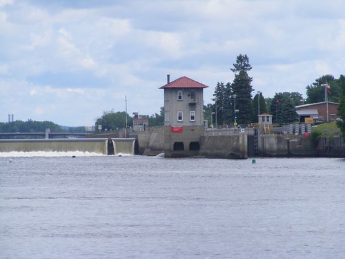
Troy Federal Lock
Troy Federal Lock

The Troy Federal Lock marks where the Hudson River had a series of cataracts and navigation through that area was not possible, so northbound boats are now lifted up over the current day dammed area by going through the lock free of charge. Notice in the photo that there is an arrow pointing to the right where you enter the lock. Plus, look above the arrow for the green light. That means that the lock is open for our direction of travel and we can enter to be lifted up 16' to the next height of the river.

Once we locked up, we only had a short distance to go with a sharp left-hand turn to get on the Erie Canal, the next segment of our journey.