Sunday, May 27, 2012

We Bought Crack and Uncovered an Ass


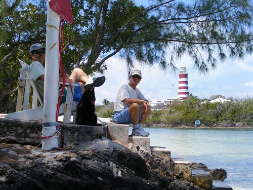
(We decided to do one more post, that makes 5 today. You wouldn't believe how slow uploading the photos is even at reduced resolution.)

May 22 – 26, 2012

Ha-ha, with that title I don't need to have an opening photo to get your attention to read the blog this time!!  Cruisers go to extremes when the weather is bad, and we have had our share of poor weather.  That same low I spoke of last time has hung around, and we have been boat-bound for 7 days.  For 4 days in a row, it rained all day and night, the longest stretch of continuous rain we have ever seen in our travels here.  One of the islanders told me they broke rain records.

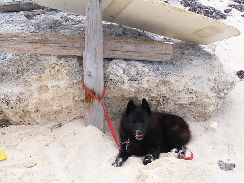
Ursa contemplates walking the plank

Poor Ursa was going crazy.  She could see and smell land, hear the island dogs (a.k.a. potcakes in Bahamian speak) barking all the time, but couldn't set foot on land.  She would go out on the upper deck to the land side of the boat and hold her nose in the air, catching the smells coming from the land.

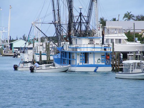
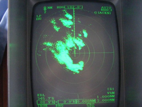
We were the only boat in the harbor for 3 days.  I kept looking to the entrance several times a day and would ask the guys when the other cruisers were going to show up.  When a sailboat finally did show up, we couldn't make personal contact with them because of the constant rain.  They had come over from the Exumas and said they just traded one rainy anchorage for another.

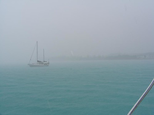
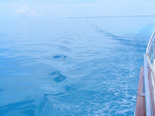
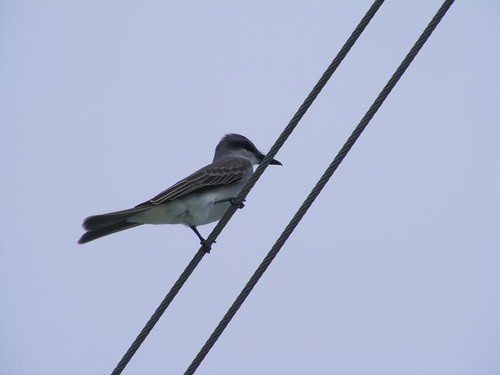
Neighbors in the mist

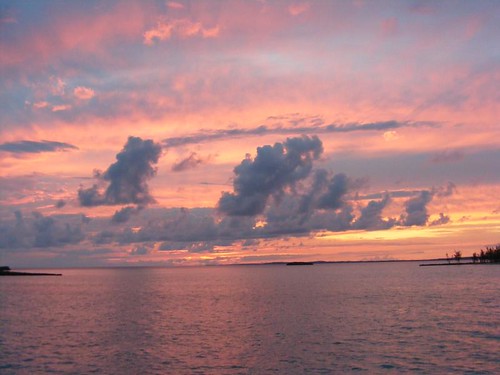
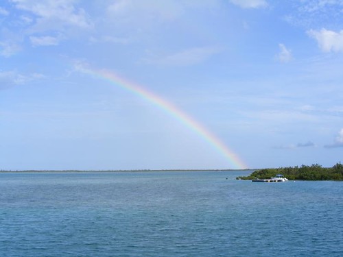
Rays of optimism shown down through the skies on the evening of the 6th day when we were treated to a blazing sunset.  It seemed like we were going to have a break in the weather.

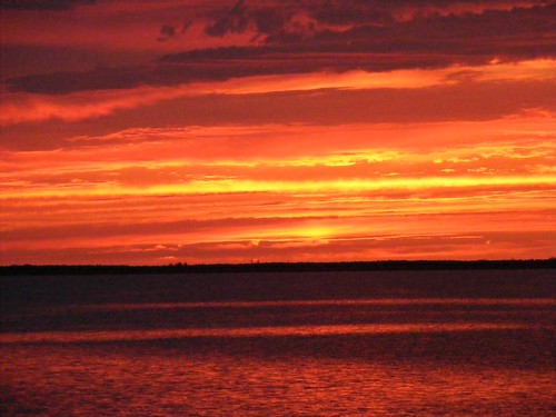
Red sky at night, cruisers delight

We awoke on Sat. morning to partly cloudy skies, but at least we could see the sun – hooray!  It meant we could go to land, walk around the community, finally try to get some internet service, and do some minor shopping before the stores closed for Sun. and Mon. (Bahamian holiday called Whit Monday).

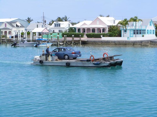
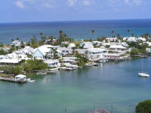
The settlement of Rock Sound is the most populated community on Eleuthera, which is only relative to the others on the island.  There are only a few hundred residents, but there are some convenient, well-stocked stores and a few restaurants/bars that cruisers appreciate.  It is not a tourist destination.  Noticeably absent, are locally owned boats that zip about in the big harbor.  The residents do not take to the sea, but do some fishing from land.  They get about this section of the island by automobile, driving at whatever speed they wish, and always giving a little toot on the horn when they go by.  I didn't see any golf carts – they wouldn't be able to keep up with the cars and its too far to go to outlying communities to ride in a golf cart.
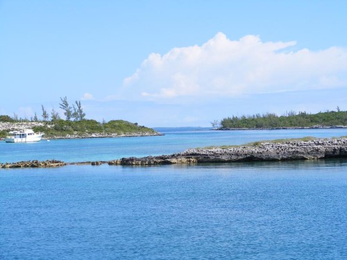
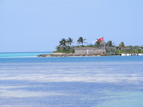
Harbor greeting
Harbor greeting


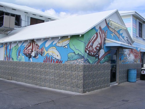
This community doesn't have a lot of frilly island decorations like I've shown you at the other places we've visited.  The modest homes are typical of a working class community, which doesn't have a tourist-based clientel to cater to.

Our first stop on our community walk about was the Ocean Hole Park.  This is a big blue hole right in the community proper.  Like most blue holes, it is almost perfectly round, with ragged limestone sides.  One section of this one has had the wall modified with concrete to make a platform and swimming area and a nice place to feed the variety of different fish that are in the hole.

Blue hole
Blue hole

It is easy to see the fish in the clear water and it is apparent that fish feeding is a regularly occurring activity by the way the fish came over to the wall even though we didn't have any food to drop in.

Sunshine in the water

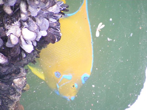
This brilliant queen angelfish stayed around all the time.  The overcast skies didn't do justice to the real brightness of the colors, especially the contrasts between the yellow and blue markings.

It looks like they had recently constructed a chickee hut gazebo.  The pretty, tight thatching on the roof even smelled good.

Island building craft

There were several short sable palms in bloom in the park, and they had spider wasps feeding on the flowers.  These are some of the largest spider wasps I've ever seen, up to 2” in length and with pretty, maroon-colored wings.  They are named that because the wasps capture spiders to lay their eggs on, so the developing wasps will have a food source, eventually killing the spider.
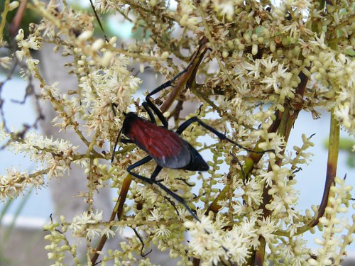
Spider wasp
Spider wasp

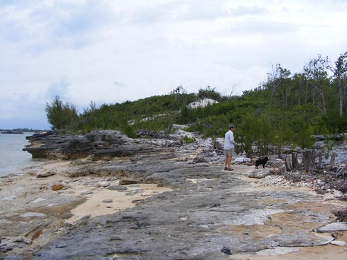
After we left the park we decided to walk over to the Atlantic Ocean side of the island, 1.5 miles away.  One of the friendly local kids told us it was a L-O-N-G way away and gave us some tips on what to do when we got to the end of the paved road we were walking on.

Pack of potcakes
Pack of potcakes


Pot cakes came running and barking at us from all directions.  The dogs come running at you at full speed, snarling and barking, and then stop suddenly and won't come near you except if you turn your back.  Wayne would pick up Ursa, who didn't feel like bonding with any potcake she saw.  One dog, Sally, was very friendly and would let us pet her, but she was mean to the other dogs.  A Bahamian woman said Sally behaved like that because she was spayed. Right!  Judging by all the puppies, nursing female dogs, and fully hung male dogs I saw on the walk, this island's humans are not big about spaying and neutering their pets, unfortunately.

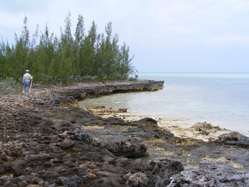
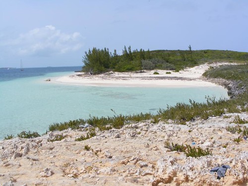
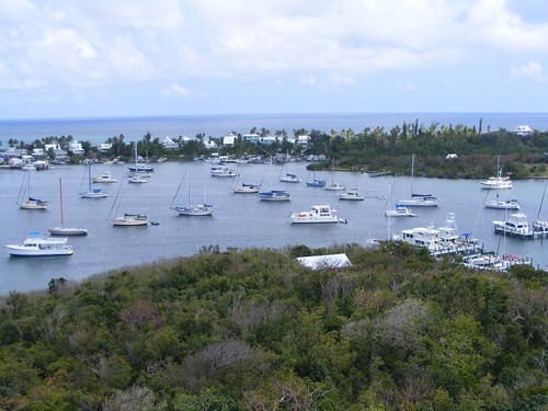
It is not a flat walk to the other side of the island.  So, when we got to the highest point we could see west to the bay and east to the ocean.  This photo gives you an idea of what the community looks like and how it is positioned on the bay.
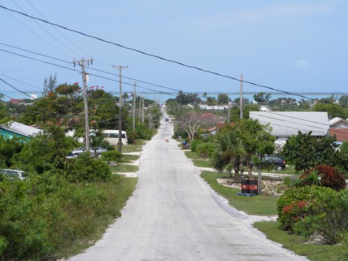
Sight of the sound
Sight of the sound

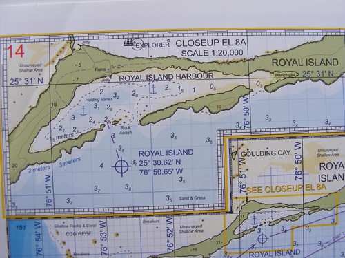
You can see the thin blue band of the sound at the very top of the photo.  The sound extends 4 miles north to south and is about 1.5 miles wide, so at least there is room for a lot of cruising boats, should the need ever arise.  The holding varies.  In fact, we were originally anchored on the south end of the bay, with relatively poor holding and even before our first night came, we elected to move off the town proper because the holding was better.
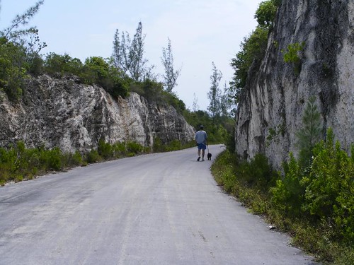
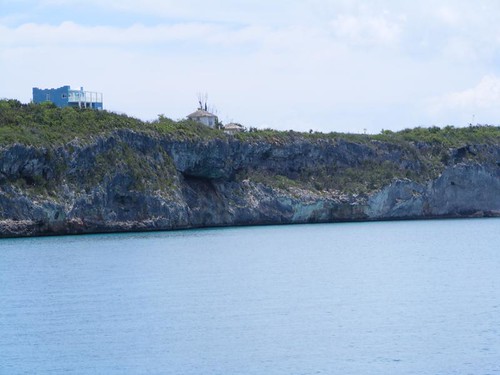
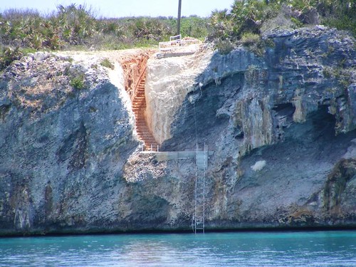
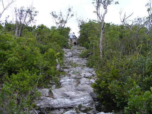

Through the rock
Through the rock

We keep having to remember to walk on the right side of the road, since they drive on the left side of the road.  Some of the cars have the steering wheel on the right and some on the left, even though they drive on the left side of the road.  There are some blind curves and rises, like you see here, and drivers aren't expecting many walkers, especially in the outskirts of town, so walkers need to be alert.  There are no shoulders to walk on:  it's the pavement or the brush.

The local kid ended up peddling his bike to catch up with us and make sure we made it to the beach OK.  He was telling us who lived in the houses we passed, most of which seemed to be one of his relatives of some sort.  He also told us about locals going out in the bush to collect the land crabs and wanted to know if we ate them too.  He grabbed one of them when we were walking through the bush on the final leg to the dunes.
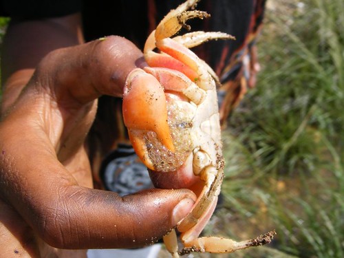
Bubble face
Bubble face


I guess the crab bubbled up so much as some sort of defense mechanism.  I remarked that the crab seemed too small to eat, and the kid said that they were made into some sort of soup.  I told the kid we ate the crabs out of the sea, not the land variety.
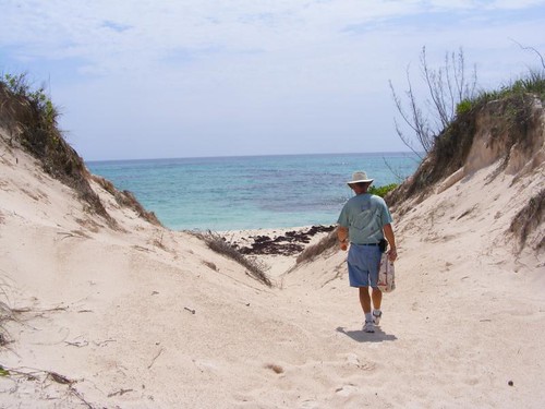
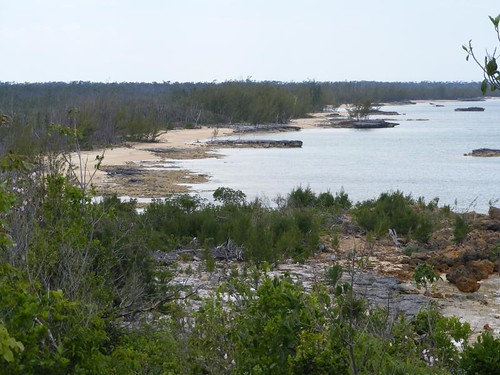
Island dunes
Island dunes

It was surprising how the big sandy dunes rose so abruptly from the dense island vegetation in this area.  We have not typically seen such large piles of sand, but rather more of the hard rocks, of lower elevation on the ocean side.

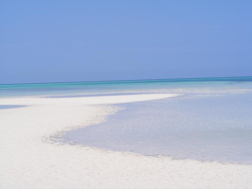
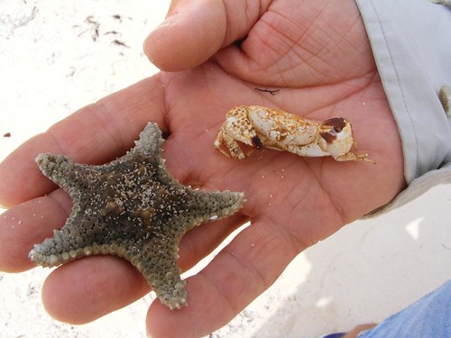
The beach here is quite pretty with a variety of landscape, both the sand areas and some rocks.  It looks like it may be a good place to snorkel when the seas are calm.
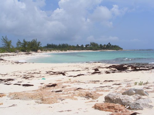
Ocean beach
Ocean beach


We all went our separate ways to do some beach combing.  I was up near the dune line, and a Bahamian man came walking into the bush.  I asked him what he was looking for, and he told me he was trying to find some kind of a vine that was used for curing the flu.  He said he had seen the vine nearby earlier in the year, but couldn't find any of it again, presumably because it had already dried up.

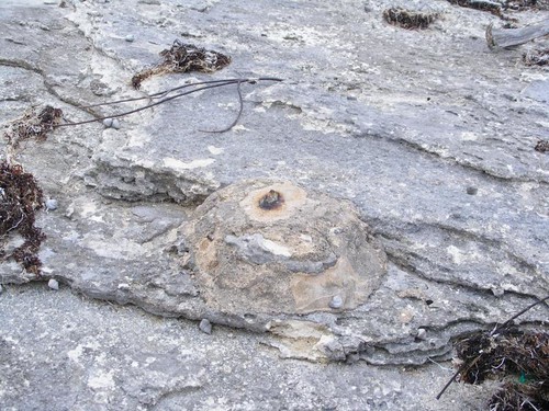
Soon after he left, I saw a big bone sticking out of the ground and pulled it out all the way.  It kind of reminded me of a scapula, and I also saw several large rib bones.  I decided to keep digging in the area, finding a whole backbone and more rib bones.  I called Eddie over to help me dig and find out what kind of animal it was.  At first he was whining that it probably died from some kind of disease that we were getting on our hands, but I always tell him that's what we have skin for and don't worry about it, just dig.  We finally got to some large plate-like pieces and then saw some teeth.

The uncovered ass
The uncovered ass

It didn't appear to be big enough for a horse, so we think it must be a donkey.  Now we can add archeologists to our cruising resume.

With that job done, it was time to make the hike back to civilization and do some shopping.  I really wanted to find a place to buy some Crack before everything closed down.  Eddie wanted to buy some medicine to put in his swimmer's ear, a chronic problem he seems to wind up with on these trips.  The medicine he brought with him expired in 2010, and what remains in the container sounds like a little rock bouncing around instead of a medicinal slurry.

We stopped at Halls Variety Store, which was bustling with a lot of shoppers.  The proprietor told Eddie he didn't have anything to sell him for his ear, but that he should just heat up some olive oil and put that in it.  Yea, maybe some lettuce too.  I should have just asked that Bahamian man I met in the beach bush if there were any plants I could harvest to cure Eddie's ear.  So, Eddie bought some vanilla pudding and water instead.  If you are going to have an earache, you might as well not be hungry or thirsty.

I wanted to buy some rubber bands for my hair and described them to a young girl worker.  She said something to the owner, which I couldn't understand, other than hear him say, “take her next door”.  She motioned for me to go outside with her and pointed to the gas station next door and said “I'll open the front door for you”.  It turns out that the gas station doubles as a beauty supply annex to the store, carrying all kinds of hair accessories, jewelry, and grooming products.  I got the rubber band, having a wide selection from which to choose.

I found Wayne and Ursa sitting in the dirt under a big fig tree outside the store with an empty bottle of gin right next to them.  Ursa was covered with the cool dirt, just like the potcakes, and Wayne was busy trying to keep the mosquitoes off both of them.  Island life.

The variety store didn't have any Crack, and I told the guys I wasn't going back to the boat until I got some Crack.  Plus, we still needed to go to Dingles to try to buy some internet time.   Maybe Dingles would sell me Crack.

Dingles was only about a 1/4 mile from Halls, and along the main road, so it was easy to find.  Internet cost $10/day (as in 24 hrs from the time you pay).  Supposedly boats in the harbor can access one of several WiFi “towers” Dingles has up along the waterfront.  Dingles didn't sell Crack, but a Bahamian guy leaving the store said I could probably get some about a 1/2 mile down the road.  That was OK with me, because the grocery store was down that way too, and I wanted to try to buy some romaine lettuce, assuming they had any.

I have to tell you that it was already past noon, and you know what that means for the tummies of my crew mates.  They were both getting testy, and wanted to go back to the boat to eat, but I said I wasn't going back until I bought Crack and I would walk a mile to get some, along with lettuce, of course. 

I ended up stopping at 3 more places before I finally bought some.

My Bush Crack
My Bush Crack

That is quite a name, huh? This is supposed to be a premium Bahamian beer, but I haven't gotten to try it yet.  I'll let you know how it is in a future post.  One thing is for certain though, I won't become a Crack addict, because I can't buy it in my neighborhood.

Have to run, our internet clock is ticking down, and we want to get this post off to keep you updated.  We hope to be moving out of Rock Sound and heading south, maybe tomorrow.  No telling when we can connect again.


Remembering Why We Haven't Cruised to Eleuthera Before

(Last of 4 posts today, before paid WiFi runs out!)


May 21, 2012

By the time you are reading this post, you will probably be wondering how we have fared with the low pressure system that has persisted over the southeastern U.S. and most of the Bahamas for the last 10 days.  It is the one that has spurned the first two tropical depressions of the 2012 hurricane season which doesn't officially start until June 1.  While we haven't had to deal directly with them since they moved way north of us, we have had the tail of that moist, unsettled weather that fed their birth.  We have NOT been happy cruisers.

For all the years we have been cruising the Bahamas, we have never cruised to Eleuthera and most years, never even talked about doing so.  There are several reasons, the biggest one being that there are not many places to hide out comfortably during bad weather, and even more importantly, there are fewer places to anchor if you are expecting an unfavorable weather shift relative to where you are anchored, and they usually occur in the middle of the night when you are asleep and can't see anything.  The open ocean east side of Eleuthera has no places to get into out of the ocean.  The shallow water west side of the 100 mile long island is mostly wide open to the west and only has a couple of harbors that give you all around wind protection.  Fishing and diving are very limited on the west side.  So, over all, there isn't much appeal for us to cruise these waters.  We decided to this year with the idea we would just spend a couple of days looking at the unusual coastal terrain since we had never seen it before.

Things started out fine, conquering our first challenge of the day, Current Cut, with no problems.  Current Cut is a deepwater, narrow cut through the north end of Eleuthera, so when the tide is at a maximum flow, the speed of the current can be as much as 6 KTS.  Therefore, slow boats like FLUKE are best advised to wait until the tide is close to slack to go through the cut.  For us, it meant that we would have to wait until 10:00 a.m. for high slack, which was fine since we also needed to have good light to be able to read the bottom once we made it through the cut.  The following is a nav chart section showing the cut and relevant info.

Current Cut
Current Cut

We traveled from west to east, left to right on the chart.  After you get through the cut itself, you have to make a sharp right hand turn to stay in the deep water and not drift onto the shallow sand bars to the east.  That is another reason to make the transit at slack – so you don't get pushed by the strong current onto either the sand bars or the rocks to the west.  The water is crystal clear, and we could see many tracks in the bottom where boats had gone on low water or had strayed out of the deepest part of the channel.

Like a rose
Like a rose

This is what you can see looking back through the cut.  It is quite picturesque, but full of hidden dangers that you need to be aware of or you will be in big trouble if you make the wrong move or go at the wrong time.

It was so nice to finally have a calm, sunny day while underway.  We could see everything on the sandy bottom, only about 10' deep.  A dolphin riding the bow wake appeared to be in the air rather than in the water.

Our kind of seas
Our kind of seas

The water is deep very close to the western shoreline, so you can get in close to see the big cliffs, some of which are 100' high.  The predominately limestone rock weathers and erodes at different rates, leaving areas with huge sea caves and blow holes where storm-pushed water  can shoot up and make big sprays.  Some houses seem to be precariously perched close to the edge.

Cliff houses
Cliff houses


Some homeowners went to great lengths to be able to have access to the water for swimming.  No docks are even possible because the shore rocks are straight up and down and the water is deep, so when the westerly winds pick up they move a lot of water into and up the rock face.

Stone carved staircase

The highest western side cliffs are more toward the northern end of the island.  As we moved more southerly, the rocky cliffs gave way to some small, shallow beaches in little coves.  Phoebes would fly out from the shore-side vegetation and land on our rigging.  Then, they would hop up next to the mast light to look for insects that had been attracted to the light at night and eat them.  Then they would poop on the deck, and their droppings were nothing but dried pieces of insect bodies.  I could just sweep them up with a brush and dust pan.

Feathered visitor
Feathered visitor

Since the light winds had a mostly northwestern element to them, we anchored in the north end of Alabaster Bay near Pelican Cay.  The chart indicated the area had poor holding, but the south end of the bay has a hard bottom, so that is just as bad.  We got the anchor to set well enough, or so we thought.  Eddie dove it and swam out to look at the anchor; it had dragged across the bottom and hung up on a grass ledge.  Since we had put out 200' of chain we knew we would also get some holding from that.  Even though winds and seas were very light, our stern was facing the beach, and we don't feel comfortable about that.  It feels like being trapped.  Another power cruising boat that had been anchored at the south end came up and anchored near us, thinking we had better holding.  Bad assumption.  There was a pretty sunset, giving hope that the weather would stay decent.

Almost the last sunset

Storm clouds moved into the area by 10:00 p.m., and the waves started kicking up a bit and FLUKE started bouncing around.  I got up at 11:00, and Wayne followed shortly thereafter to make sure that our anchor was holding and to check the radar for what may lay ahead.  The wind continued to strengthen and the seas built higher and higher.  White rollers were hitting us on the bow and side depending on how we swung on the anchor.  It was just like being at sea:  Visitor threw up, stuff banged in the cabinets and fell off the shelves. 

At around 1:00 a.m., the boat next to us starting dragging anchor and had to move.  I felt so sorry for them as I watched them try to pull in their dinghy so its line wouldn't get caught in the prop and then have to shine their spot light on the foredeck to be able to see to try to bring in the anchor while their boat was hobby horsing violently.  The guy was on his hands and knees trying to get to his bow, and I just kept hoping I could continue to see him on the deck and not overboard.  Once they were underway, Wayne called them on the radio to ask what they planned to do at that point and tell them that we were still holding, although we sure felt scared and uncomfortable.  They ended up going back to the south end of the bay and it took over an hour for them to get down their anchor again.

By the time the winds and seas died back down to a more reasonable level that we felt safer with, it was 4:00 a.m.  We all laid down to try to get some sleep.  However, I woke up at 6:45 when I heard the wind picking up again and the boat beginning to move more.  I looked outside and saw storm clouds closing in.  I woke up the guys and told them we needed to get the anchor up ASAP and get underway and get out in more open water where we could have better control of the boat.

We had a five hour run to Rock Sound, where we were optimistic that we would find calmer conditions for the upcoming stormy weather.  I had plenty of time to remember why we had never cruised in Eleuthera before.


Spanish Wells

May 18, 2012


Part of the fleet
Part of the fleet


Spanish Wells is a bustling small island (about a mile long) that sits between Royal Island and Eleuthera.  The island was named by the Spanish slavers because they were able to find an abundance of fresh water on the island, uncommon in these parts.  Today's residents trace their roots to English Puritans who arrived in 1648 in hopes of finding a place where they could worship in any manner they wished and to Loyalists who fled America during the Revolution. As a result, the population is predominantly white, unlike the black majority population of most of the rest of the Bahamas.  It takes a careful ear to be able to understand the locals when they talk because they don't speak just traditional American English, British, or Bahamian, but more like a combination of all of them.  I think it is the friendliest island and cleanest we have ever visited.

The unique community's economy is based on fishing, not tourism like a lot of the other   islands I've described so far on this trip.  Several of the commercial fishing vessels are visible in the opening photo.  The two small boats were pushing the big boat from its side into the dock so it could take on fuel. These fishing boats are the cleanest, best painted, and most well-kept commercial fishing boats we have ever seen.  One of the locals said it is because the entire crew owns the boat (as opposed to an off-site owner or corporation) and takes pride in its upkeep and how it looks compared to the others. 

The stone crab season just ended, and we talked to one of the local crabbers who told us about going out for 3-5 weeks at a time, all the way over to Andros and the far southern Bahamas before returning home again.  There is a seafood packing plant right in the middle of town, at dockside.  It is as clean as a whistle, no debris or fish smell, just like the boats.  They have a marine railway and lift dock for hauling any size vessel out of the water to work on the bottoms.  So, all facets of marine work are taking place within this interesting community.

All things seafood
All things seafood

Ronald's, dockside, is the place to buy any kind of locally caught seafood you want.  We bought some stone crab claws as a lunch treat for $10/pound. The colorfully painted storefront is a real eye-catcher.  Since there are really only two streets on the island, the one along the waterfront, and the one “upland”, it is easy to find everything if you just take the time to walk around.  “Progress” has invaded this island too, with an abundance of golf carts, owned by most residents, or for rental.  Some of the carts have custom paint jobs and are named.

The big island of Eleuthera is only about a mile away, just across a narrow channel of water that is right in front of the mooring we tied up to for the night.  Spanish Wells is a “dry” island, i.e., no liquor is sold, but you can buy it on Eleuthera and bring in back over.  In fact, there is a liquor store steps away from the government dock where the ferries land.  After getting off the ferry, you can probably run into the liquor store and buy what you want and get back on the ferry before it leaves to go back.  Several types of ferry vehicles run back and forth many times each day between the two islands.

Vehicle ferry
Vehicle ferry

I was going to call this a car ferry, but I saw it carrying golf carts and even some kind of small kiosk.  The people sit in their car and chat with the ferry driver.  Early in the day, the ferry driver's little boy (about 5 yrs old) was aboard, dressed just like his dad: work pants, suspenders, boots, but no hat.  That little boy was running all over the ferry, picking up the big planks to position them to load the vehicles on the barge, actually learning how to do productive work early in island life.  We laughed and remarked that if we were witnessing this back in the States, the father would be charged, sadly, with numerous counts of child endangerment:  no safety gear, not in school, too much physical labor, no access to electronic devices, etc.

Big island ferry
Big island ferry

This government operated fast ferry travels from Nassau to several of the out islands, including Eleuthera, and even has a stop at little Spanish Wells, on a limited schedule throughout the week.  It is a good way for the out islanders to be able to link themselves with bigger population centers to get medical and business matters taken care of.

In the vehicle ferry photo you can see some of the colorful island homes in the background.  The homes are well-kept, some with interesting architectural decorations.  Most of them also have hand painted signs giving the home an island name like I've pointed out before on other islands.

Dolphin theme
Dolphin theme


The use of the dolphins on the corners of the house is a pretty touch.

It is not an island without palms


Even though they don't sway in the breeze, they are still nice to see.

Clean and quiet
Clean and quiet

One porch had a flock of these cute gulls sitting on the railing.

Artsy recycling
Artsy recycling


Another porch had several of these fishing net floats that were painted with different animal faces.

Coconut fish
Coconut fish

Even some of the boathouses had colorful decorations.  There were a couple of large fish pens under this boathouse that had several big grouper of various species in them, one of which was a jewfish that must have weighed 100 pounds. 

Garden color
Garden color

I admired the efforts of the people to try to grow anything with the limited fresh water that they have.  Most of them have to rely on cisterns, so there isn't a lot for yard use.  Yet, some of the homes have nice small lawns with a variety of ornamental and flowering plants.  This queen conch plant bed edging was extensive and must have taken a lot of work to keep the grass from growing into the shells.  The  exposed, flat island has been hit by hurricanes in recent years, so there aren't many large trees left to provide yard shade.

No one plays hooky
No one plays hooky

School was just getting out for the older students as we were taking our island walk.  Notice that the boys are wearing ties.  The girls do too, but they dress in skirts, tucked in shirts, and black, flat shoes.  It appeared the students had to walk home, not get picked up in a golf cart.  Island life is tough on the young ones!

When you are done learning

The cemetery was the most colorful we have ever seen – anywhere!  The orderly, well-kept graves were heaped with artificial flower decorations.  Looking at the headstones, about 3 names predominate, indicating a real tight knit genealogy.  That might explain why so many of the people look alike!

Both the school and the cemetery are on the “upland” road, where you can access the beautiful beach on the north side of the island.  Because it is protected by an offshore reef, there is a wonderful sandy beach.  At low tide, sand bars extend way out into the water; the scenery would fit well on any island post card.

Take off your shoes or even your clothes!

There is a deepwater channel that runs between Spanish Wells and the northwestern point of Eleuthera, Gun Point.   The channel weaves its way through an area filled with coral heads, part of the offshore reef area called the Devil's Backbone.  Cruisers wishing to take that route are encouraged to hire native pilots that know the waters to guide them through the heads safely, especially when visibility is limited by overcast skies or bumpy seas.  The FLUKESTERS had no need to go that route on the eastern side of Eleuthera in the open Atlantic since we had charted our course to southward on the western side of the island.  We still enjoyed the view of Gun Point and took a short dinghy ride out through the channel.

Gun Point, Eleuthera

We visited Spanish Wells on this particular day because we thought the weather was questionable, with overcast skies and possible showers, the usual fare these days.  However, the sun came out enough to make the day bright.  Once we finally got back aboard FLUKE a storm cloud moved in east of us.  Instead of dropping any rain though, it gave us a pretty rainbow, very fitting for such a pleasant island.

There's gold in these islands

Not Really the Royal Treatment


May 16 – 20, 2012

We had watched many boats come up from the south and enter the Little Harbor cut over the two days we were anchored by Lynyard Cay and hadn't heard anyone complaining about sea conditions. So, with what appeared to be a good weather day to make the 60 mile open ocean crossing from Lynyard Cay south to our destination of Royal Island near Eleuthera, we hauled up the anchor after sunup on May 16. We planned to eat breakfast underway.

While the passage over the reef went smoothly, the waters east of the land mass area we left, weren't the greatest for our type of vessel.  Winds were forecast to be 10 -15 KTS with seas 2 – 4', but we started out with the high numbers of both categories.  We knew if we didn't cross today, conditions were forecast to get worse, and it would be several days before the next opportunity.  So, we decided to tough it out. 

Conditions were certainly not dangerous, just uncomfortable.  Visitor threw up within the first hour – I was surprised he lasted that long.  Eating was out of the question for any of us, since no one wanted to go down below anyway.  As luck would have it, the engine room bilge light came on, so Wayne had to go down to check it out.  The float switch had stuck, so once he fiddled with it, it worked properly for the rest of the time.  Since we were in the open ocean, we decided to pump out the holding tank, so Wayne stayed down below for that operation too. By the time he came back up, he wasn't feeling well at all.

Seas changed for the better once we got into an area with a lot of rain, but less wind than what we experienced in the clearer skies.  Fortunately, there was no lightning and no waterspouts.  I thought you might be interested to see what the radar image showed for the storm area we were in.  All the dark green spots are rain clouds – we are out in open ocean, so there are no land masses that show up on the screen (the boat is right in the center of the image).  It was a strange feeling to be traveling in the middle of the system and see some heavy downpour areas and very dark clouds all around us. However, we were relieved to get a break from the wind.

In the eye of the storm

Before we left the anchorage I had dressed for a big day of trolling, with high hopes of catching a dolphin.  We haven't caught ANY fish since we've been here, and our palates are clambering for some fresh fish.  Plus, the open ocean area we were traversing is a good fishing ground for some of the big game fish.  I was looking forward to some action.
However, since the seas were too wishy-washy I couldn't even put the lines out for most of the day.  If we did catch a fish, it would be too hard to bring it in with FLUKE rocking around so much.

Dressed for action
Dressed for action


I'm sharing this rather unflattering photo with you and will reveal a personal secret.  It's only fair, since I rag out on the guys so much.  Because I have to keep covered up to reduce sun exposure, I wear a full set of long sleeved pants and overshirt.  I like the clothes to be loose-fitting, white, and lightweight to be as cool as possible, even though they make me look like the Pillsbury Dough Girl.  It is an exceptionally chic fashion addition if I happen to have a pair of colored underwear on that day too, and that gets the guys to make derogatory comments.  Because my clothes usually get salt, blood, and fish guts on them,  I want to wear fabrics that are easy to rinse out and will dry quickly.  I like to go to thrift shops and look for these kinds of clothes, so I don't feel guilty getting them torn or soiled like I would if I bought something new.  In this photo, however, I have stooped to a new level of thrift, I am wearing a pair of pants that my 88 year old mother gave me!!  I'm laughing as I write this because I can't believe I'm admitting to wearing them.  Say what you want, but “go girl, good for you” would be nice, especially because the guys think I look ridiculous and make fun of me and say it's a good thing the fish can't see me.  I am thankful there are no fishing fashion police.  None-the-less, I managed to catch one jack just as we were approaching our destination of Royal Island, and I threw it back.

Navigational chart overview

I decided to use this photo of the nav chart we are using so you could see what the Royal Island anchorage looks like.  The little island harbor is almost totally surrounded by land (the green area in the photo) so boaters can get good protection from most wind directions.  You only enter the harbor straight through the narrow opening between the rocks indicated by the purple dotted line.  The numbers within the blue area in the harbor indicate the depth of the water (in meters at mean low tide) and we like to see at least 2 meters (almost 7') since FLUKE draws almost 5.5', and we need a cushion of water underneath so we don't bounce off the bottom.  The text says that the holding varies, so you have to look around for what looks like a sandy area and hope that your anchor will bury in it to hold the boat in case the wind kicks up.  Since the harbor is very enclosed, waves aren't much of an issue.  The numbers in the green (land) part of the chart indicate the elevation, and you can see there are some nice little hills which really help block the wind.  The chart also indicates significant man-made features that are on the land, in this case, ruins and a jetty.  More about them later on.

It was a relief to get out of the wind, the anchor set and the engine turned off and just feel the quiet, even though the no-see-ums were out in bloodthirsty force.  By the time we started eating (we hadn't eaten all day), it was already 4:00 p.m.  No tick-tock, eat by the clock, day for the FLUKESTERS.  I decided we should all be rewarded for our crossing effort by eating a Fat Boy Jr.  I guess since we were exhausted from trying to keep our balance for hours and fighting off sea sickness the guys didn't complain about eating the Jrs this time.  We had the company of seven sailboats tucked in the harbor with us the first night.

Not the scenery you would expect

This is the view from where we are anchored – yucky, huh?  I know it is not the usual kind of island scenery I like to share.  The story behind it is not an uncommon one for many places we have seen over here, especially in recent years with the downturn in the economy. 

Back in the 1930s Royal Island was purchased by a man from Florida who built a grand plantation estate (the ruins on the nav chart) that was used and maintained for over 30 years. After he passed away and his relatives decided they didn't want to maintain the property, it went into disrepair, with nature, the elements, and vandals wrecking havoc on the remains.  In more recent history, a group of entrepreneurs decided that it would be a good place for an exclusive out island retreat, complete with a golf course, villas, and luxury marina.  Work got underway with some clearing, infrastructure, and a few villas built over the hill from the anchorage in a cove with a pretty, secluded beach.  Then the economy went sour, and no more work could proceed.  From our observations, it appears that the villa area I just mentioned is in operation.  There isn't a golf course; just a reminder that there was going to be one since the shuttle boats have the names of ROYAL TEE and GULF PRO.  Guests probably fly in to one of the airstrips on the north end of nearby Eleuthera and then are transported by boat to a protected dock area within the anchorage and then take a land shuttle over the hill to the small resort.  My first thought when I saw this dump within sight of our boat, and the resort dock, was what the guests must think when they show up to visit this high end resort for their “idyllic” island get away and see the same dump I see.  Not a good first impression to say the least.

So, you can imagine our surprise when around 10:00 our first morning, we got a call on the VHF from a voice saying they were Royal Island.  I acknowledged receiving the call and asked what they wanted.  The man said that a big construction barge was scheduled to arrive within an hour and FLUKE was in the way of accessing the area where the barge wanted to land so we needed to move.  We ended up moving to the area shown on the chart across from the 1930s ruins. 

Then we waited for the barge to show up.  We could hear it chugging along before we could see it since our view within the harbor was blocked from the hills on the south side of the anchorage.  We watched as the tug lined up to push the whole rig through the little opening into the harbor and then lined up perpendicular to shore to drop down the big front gangplank for off-loading the equipment.   For about 3 hours, the dump area was partially cleaned up and 3 big dumpsters were filled with debris.  The following is what the rig looked like upon departure.

Island waste
Island waste

We spent the rest of the day catching up on boat chores.  It was too cloudy and overcast to go snorkeling anywhere, and the threat of rain kept us from going on any land tour.

The following day, May 18, with the weather forecast still not good for any in water activities we decided to up the anchor early in the morning and visit Spanish Wells, about an hour away.  We figured that we would pick up a mooring there and walk around town, even in the rain.  That  fun day is covered in the following blog.

We returned to Royal Island in the morning of the 19th.  It was early enough in the day for us to finally go ashore and tour the ruins of the original plantation.  There are the remnants of what was a big concrete pier with adjacent harbor side roadway.  We tied up to the pier area to easily get out of the dinghy. A long cascading steep stone staircase takes you right from the pier to the top of the hill where the buildings are located. The sturdy stone arched walls, terraces, and driveways are still intact and give you a feel for what the place looked like in its prime.  There are multiple buildings, like a main house and several guest buildings, a dining lodge and kitchen, free-standing bath, and boathouse, all built out of big blocks of heavy stone.  The floors are ceramic tile, colorful and pretty when they were new.  The whole property facing in the harbor was terraced to be used as planting areas, with many of the ornamental plants still growing, along with the native vegetation that has reclaimed the land.

Overgrown dreams
Overgrown dreams

The view from the top gave the residents vistas of the sapphire blue Atlantic Ocean to the north (we could see a big Nassau bound cruise ship in the distance) and the aqua color of the shallow waters to the south of the harbor where we were anchored.  There was a road that ran all the way down to the north shore, where there was another pier ruin, built to provide protection for a small cove area, good for swimming.  We all walked down there to check out the rubble and look for “treasure”.

Treasure hunting
Treasure hunting

You can see that the shoreline is very rocky and not easy to walk on.  Since it was low tide, we were at least able to walk a short distance along the shore.  That rocky area is covered with the high tide, and there really isn't much of a place to walk without getting up in the bushes.  We found several nice pieces of driftwood, enough such that we all had something to carry back.  Even Captain Wayne willing slung one of the large pieces over his shoulder and headed up the hill.  Eddie and I carried the largest one (35#) between us and each had two other pieces in our other hands.  It was a good workout getting back up the hill and down all the stairs.  Eddie thinks the Bahamian Feds are going to pull us over for “stealing” driftwood when they see it strapped to the railings.  I told him to tell them we are collecting wood for a beach bonfire.

The sun FINALLY came out in the morning of the May 20th.  We decided to head out to the reef area on the NW side of the island and see if we could have any luck spearfishing.  While the visibility was good, we only saw a couple of “eligible” fish, and they had seen humans before and weren't letting us get too close.  Another fishless day for the FLUKESTERS.

No one had to light a fire under us to encourage us to continuing to move southward when the weather forecast looked good enough for us to make a move the following day. 

The End of the Abacos – For Now!


(This is the first of 4 posts I need to do before our 24 hrs of paid WiFi ends this afternoon, so don't miss any.)

May 12 – 15, 2012


After we left Hope Town we motored just a few miles south to an area called White Sound where we planned to spend a couple of nights out in the fresh air and be able to swim in the clean water.  We generally avoid swimming in any of the harbors.  You can imagine what goes overboard from the boats and what runs off from the land.  Besides, the harbor waters are so cloudy, you can't see anything anyway.

This is a good time to talk about how the refrigerator and freezer are working since we had trouble with them early on.  The freezer is running like a champ.  No real complaints, other than from Eddie, who says his ice cream isn't hard enough.  Do you know how many cruisers even get to carry ice cream aboard, much less worry about how hard it is?!!  While I'm on the frozen treats topic, both the guys have complained that I bought Fat Boy Jr. ice  cream sandwich bars instead of the “man” size.  The Jrs. come 9 to a package, and the others only come 6.  So, I decided we would have them periodically for just a little ice cream “fix”, but that's not OK with the guys.  Too bad.  I did see a 48 oz. container of Breyers for $10.50 at one of the Bahamian markets, so maybe they should pool their funds and go pig out behind a palm tree somewhere.

Cold air in, warm air out


The refrigerator is requiring some babying to say the least.  We felt that we have always lost too much cold air out and let too much warm, humid air in whenever we opened the door.  So, before we left we put flexible plastic flaps over the front of the shelves as seen in the photo.  You can see the left, hinged side of the unit and the flaps connected to the shelves with quick ties.  I think it is making a difference and is probably worth the hassle it takes to have to lift up the plastic flaps when you want to look for something in the refrigerator.  We usually just lay the flap on our heads so we can use two hands to move stuff around.

The humidity is really making the unit frost up, and we have already defrosted twice.  However, we are getting good at it, and it only takes about 15 minutes.  We have also noticed that the unit is very sensitive to having warm items put in it, even though you would think their size would be insignificant compared to the size of the refer.  To help with that issue, we have started pre-cooling things in the freezer.  We caught on early about the necessity of setting a timer after we forgot things in the freezer and had them freeze.

Both Wayne and I have talked to the “experts” at the main manufacturing facility, who assure us that similar systems are used extensively in tropical climates with great success.  I don't doubt that either considering how long the company has been in the business and its reputation.  However, we still don't think our unit is working like it should and will have to glean more information from the “experts” when we return and have reliable phone access.

Speaking more about the cold – the water is still too cold for us, even with our heavy wetsuits in shallow water.  However, Jacquelyn and Lloyd still ply those frigid waters in search of treasures.  Unfortunately, I don't take a camera, so can't share pics of what we see in the water, not that there has been that much anyway since we haven't had good weather to get in the water in the first place.

We did have an unusual fish encounter when we were snorkeling along the shoreline.  We swam up into a cove where the water was only about 2' deep, bordered by an extensively hollowed out rocky shoreline.  Eddie had spotted a float up in the rocks and wanted to go get it.  When he was tottering up on the rocks I looked ahead into one of the holes and saw a 15” ocean trigger fish crammed head up in one of the rocks.  Apparently, we had frightened it as we swam toward the shore and it tried to get away, but wound up in the dead end hole and couldn't get out.  We pulled it out and let it go.

We had some better luck treasure hunting at our next stop, Lynyard Cay.  We didn't arrive there until late on the 14th.  First thing in the morning the next day, Wayne comes in to tell me that Ursa's pee mat had fallen off its hooks when he threw it overboard to soak and was on the bottom.  So, my first “treasure” of the area was having to jump in and go retrieve the pee mat before Eddie was even out of bed.  Talk about getting a good wake up swim for the day!

Cabana dog
Cabana dog


Eddie and I went ashore to scour the south end of the cay for what we see as “treasure” and Captain Wayne many times calls junk.  Although, he has been very good so far about not complaining about the things we are hauling back to the boat.  Since the sun actually came out for a while, we built a shelter for Ursa so we could leave her in the shade while we scouted around.  I looked back one time and saw sand flying high in the air when she was excavating for a cooler spot.  The next day her poops were full of sand!

We managed to find quite a bit of sea glass and driftwood pieces, even a few shells.  The outgoing tide had left behind a couple of interesting creatures, reflective of their collectors.

Left to right- Carol and Eddie

When I mentioned this revelation to Eddie, he asked why I get to say those things.  I simply replied, “because I am the writer of the blog”.

It's always pretty when the sun shines


You can see our dinghy, on the beach.  Fortunately, we found a sandy spot, because the tide was rising and with the wind pushing it on shore, we couldn't keep it out in the water.  Eddie and I started our beach combing outing with a big argument about where to park the dinghy in the first place, but at least we finally reached an agreement.  Sunny days like this have been few (not the arguments though!), so we are hoping that we will find more of them as we leave the Abacos behind and cross the open ocean to the big island of Eleuthera.

Monday, May 14, 2012

Being Cool in the Abacos


May 9 – 11, 2012


Cool guys with their cool dog

Summer temperatures have not yet arrived to the Abacos.  With overcast skies, steady breezes from multiple directions, and frontal passages coming off the U.S., we are only having temperatures in the low 80s during the day and into the low 70s at night.  Thus, we are truly being cool people without even having to alter our behavior.

In the last post I told you we had to up the anchor since the wind was going to change directions and we needed to find another place to go where we would find some calmer waters.  A lot of other people had the same idea as evidenced by how many boats we saw transiting Whale Cay Passage at the same time we were.

Whale Cay Passage is a deep point where the Atlantic Ocean meets the Sea of Abaco, so a LOT of water passes through.  It can be very turbulent if the wind conditions are not calm enough to match the tide conditions.  In fact, years ago, the Disney Corporation built one of their out island hideaways near WCP.  It was a beautiful facility and employed a lot of locals.  However, they had to abandon it because there were too many times the WCP was so rough even the cruise ships could not get safely through the passage.  Every day cruisers seek information over the radio about WCP conditions to help them make the decision to move from one area of the Abacos to another.  

We anchored near a little used area, called Archers Cay, still off of Great Abaco like we had been farther north, not by any area of population.  We decided to go ashore to explore an area that looked like it may be under some sort of construction.  I told Wayne that the tide was falling, and with the water close to the shoreline being shallow and rocky, we should just anchor the dinghy out from shore and walk in through the water.  That way when we came back the dinghy would at least be floating.  He said that since we wouldn't be gone that long we could just find a sandy area closer to shore and leave it there.  Bad idea.

The landing party is ready to go


Our destination was across a rocky outcropping, as seen in the photo above, and towards what appeared to be a rise in the terrain.  We have investigated many building sites during our tours ashore, they typically have two things in common.  One is that the property boundaries are marked with pieces of rebar set in the ground covered with a mound of cement.  The following photo shows the one marker set down along the shore.  Since it is in an area where the seawater can hit it, the metal has eroded, but the lump of concrete is still there.

Property boundary marker

The other property boundary characteristic is that someone comes in early on during the site selection and/or clearing process and cuts swaths through the thick underbrush.  They look like trails to us, and they are usually what we take to get to where we think we want to go.  Wayne and Ursa are heading up one of these “trails” in the photo below.  The rocks you see haven't been piled up; they are what the ground looks like underneath the thick brush on either side of the trail.  The plants just grow up through holes in the rock.  You have to be very careful where you walk because the holes vary in size from peas to basketballs, and there are a lot of loose rocks.

Trailblazers
Trailblazers


I think it is always worthwhile to make the effort to reach the tops of any elevated areas.  While, it seems obvious what we will see from the side of which we came, it always looks different looking down from above.  The colors are more distinct and the distances you can see along the shorelines are longer and give you a different perspective of the shape of the shore and other geographical features.  When we reached the top we were so surprised to see a pond in a lower area beyond where we came up and extensive pine lands with a whole different type of plant community underneath.  Someone had already begun planting some coconut palms and other ornamental plants on the property.

Rocky, shallow shoreline

In this photo, the water is shallow enough to be able to walk from the rocks on the far right of the picture all the way to shore.  If we had stayed until low tide, more rocks would have been exposed and the beach would have extended farther from the left.

Ridge road
Ridge road

We could see that the home would be built on the high point of the ridge, giving views of the water and the pine forest.  However, the land was too steep to build the road straight up, so a lot of fill had to be brought in, and a more gently sloping road constructed.  This bulldozer was left right in place when the day's work was done.

When we climbed down and got back to the dinghy, I wasn't surprised to see that the dinghy was no longer floating, and the tide was still falling.  Wayne had already started trying to get it into some deeper water, but wasn't making much progress.  I knew we needed to act quickly or we would be stuck until the evening hours, and the bugs would eat us up.

We Sea Stooges aren't totally stupid and are able to learn from our mistakes (most of the time!) .  Having been really stuck bad once, we learned that if you can get a pipe under the dinghy you can push the dinghy across the pipe and move it a little at a time by pulling out the pipe and repositioning it and pushing/pulling the dinghy over and over until you get in deep enough water to float it.  So, we had even brought some PVC pipe pieces from home to use for this “dilemma”.  Of course, we hadn't put them in the dinghy yet, so they weren't much use being back on mother FLUKE.  We scrounged around and found a cut log that was fairly straight and used that.  With a lot of grunts and groans, the dinghy got floated.  I wanted to take a photo of this operation, but Captain Wayne was in no mood to allow me to stop pulling and lifting for a Kodak moment.

I would have liked to stay another day in this area and go back to shore for another beach walk and exploring, but some really bad weather was in the forecast and we needed to move to a more protected area.  Since we weren't too far from Hope Town, we decided to go there.  The harbor is virtually protected from all sides, and moorings are available for $20/night.  On the way there, we heard that there were two waterspouts north of us.  Thunderstorms were eminent, and we wanted to get secured ASAP.  While we have visited Hope Town many times, we had never picked up a mooring inside the harbor.  We were lucky to get one of the last ones available since many other boaters had come in to seek shelter from the turbulent weather.

Bird's eye harbor view


FLUKE is on the far right of the photo.  I was glad to be on the outside perimeter since less boats were around us then.  You never know how well the moorings will hold and a boat could break loose.  With the stormy weather predicted, I asked Eddie to pull out four of our big fenders in case we, or someone else broke loose, so we could be ready for immediate action.
Since we ended up staying 2 nights we had plenty of time to go ashore and walk around and see what was the same and what was new from our last visit.

It was still early in the morning so we figured we had a chance at getting a key lime pie from Vernon's Grocery even though we hadn't ordered one.  When we got to the store, Vernon said it would be 15 minutes before they came out of the oven, and there would be plenty for us to buy one.  We plan to eat a slice for lunch.  At $15/pie, this is one of our island treats!  I'm not sure how many of these we've eaten in our cruises through the Abacos, but I think I still have some of the fat from all of them in deep storage on my upper thighs.

Only 500 calories a slice

Hope Town is very colorful, with tropical island paint colors, lots of flowering plants, and the all the colors of blues and greens reflecting off the surrounding water.  It is a great town to walk around and look at the details in the buildings, interesting signs, decorations, colorful clothing, and daily activities.  One of the things that cruisers like about staying in the area is mostly reliable WiFi access to the internet.  We signed up for 1 week's service with Out Island Internet for $35.  That's pretty good considering when we were here in 2010 it cost $40.  Competition and free enterprise are wonderful.  It has enabled several towers and repeaters to be erected down the island chain, providing reliable communication for both residents and visitors.

A necessity everywhere there are humans

The police station is under the post office housed in a colorful building right in the center of town at the main public dock.  While it's bright on the outside, it is quite dark on the inside since there aren't any windows.  Notice the thick walls.

Curlytails have rights too

The big curlytail lizards scurry everywhere and drive Ursa crazy.  I think they are a neat part of the island fauna and it makes me sad to see them get run over by the now too prevalent golf carts.

Lizard Lodge
Lizard Lodge

One of the locals has a small replica of his own house in his front yard, the Lizard Lodge.  When we were looking over the pretty picket fence, we saw this guy sunning himself. 

It is an acceptable practice for visitors to the island to place signs on trees indicating their home towns.   There are a few of the taller trees that have a lot of signs on them.

People visit from everywhere

Some of the private homes and guest cottages have unique, island names.  Most of them use the house name as their radio call sign.  Yes, even the land homes use the VHF radio as an easy, inexpensive, efficient means of communication.  While most of the signs are done by hand on a plank or piece of driftwood, this particular sign's owner created a pretty work of art using mosaic tiles.

The house is bright yellow

I thought this business sign said a lot about all aspects of island life: color, language, dress, wildlife, and attitude.

Cold drinks with friends, old and new

The real landmark of Hope Town is the red and white lighthouse as seen in the opening photo.  We can't stop here without a trip to the top of the lighthouse, no matter what the weather conditions. 

Walk round and round

This photo shows the spiraling 111 steps looking down from one of the top levels.  You can see my big foot in the foreground and Wayne's hand on the well-worn railing on the left.  The wooden stairs are ground very smooth from all the sandy footsteps that have climbed them.  The lighthouse flashes from sunset to sunrise and gets its light from a magnified kerosene flame.  The kerosene has to be carried up in 5 gal. jugs and added to the burner every 2 hours to keep the flame burning.  The current lighthouse keeper took over from his father who had the job for 30 years.  The gigantic, 1800# lens “floats” on a layer of mercury.  Eddie had leaned on the lens housing, and it began to move, almost causing Eddie to blow one of his stents out.  It was amazing how smoothly it glided and how long it took to come to a complete stop.

Island in the sun
Island in the sun

The panoramic view from the top of the lighthouse is wonderful.  It is a great way to start and end a visit to Hope Town.

It would be easy just to stay in Hope Town and wile away our time, but the weather improved and we have old and new places to explore. FLUKE is a cruising boat, not a harbor mother, so we need to get going.