Saturday, June 30, 2012

Stranded Naked

June 29, 2012

This is one of those rare times I am writing the blog “real time”.  Today is really June 29, and I will be talking about what we did today.  If all goes well, we will be able to post this tomorrow.

After we left Hope Town harbor yesterday, we had a four hour run northward, including transiting the Whale Cay Passage again.  All was mostly calm and uneventful.

Since it was already past 6:00 p.m. when we rounded the Whale and were back in the Sea of Abaco, we decided to anchor in Crossing Bay, on the north end of the Treasure Cay beach.  Winds were forecast to be light out of the NW, so we thought we would be fine there.  We never did get enough west wind so gentle rollers rounded the northern tip of land off the beach making for too much roll to suit my comfort level.  Plus, around 3:00 a.m. no-see-ums started to attack.  Turning on the fan helped ward them off, but sure didn't help with the roll. 

I couldn't wait to pull up the anchor this morning and move north to Manjack, one of our favorite anchorages where we would have an easy dinghy ride over to the Stranded Naked party on Fiddle Cay this afternoon. 

Wayne and Ursa at the main sign

I think if you looked in the previous blogs where I have talked about this event you couldn't tell much difference from the photos I'll post today.  The sponsors reuse all the same “props”, tents, transportation vehicles, cooking gear etc.  We even recognize many of the same people year after year, and many people remember Ursa.  The whole party is very family oriented, including a big welcome for dogs.

Stranded Naked is the kick-off party for the annual event known as Regatta Time in Abaco.  Over the next week, sailing regattas and their accompanying award party celebrations will be held on several islands here in the Abacos.

Recognizing patriots

Even though this is a Bahamian party for their annual event, Stranded Naked is a swimwear line owned by an American couple who have sponsored this party for years.  Plus, mostly tourists attend the parties, so showing some American patriotism is acceptable.

Lines of people and boats

It is amazing what a great job the party goers do getting their boats all lined up in an organized fashion around the big sandbar on the west side of Fiddle Cay.

There are 3 main lines:  the food line, the bar line, and the merchandise line.  Believe it or not, the merchandise line is the one that moves the slowest.  Once the bar gets open, drinks fly out quickly until there isn't a line left, and you can just walk up and grab a drink.  Alcoholic choices are a rum punch or margarita.  There is regular punch or ice water for the non drinkers.

The food line moves at a moderate pace, while people choose between a total of two cheeseburgers or hot dogs.  Today, they didn't remember to thaw out the hot dogs ahead of time, so they put big blocks on the grill to try to thaw them.  So, people moving through the line early didn't even have a choice of hot dogs.  It looked like the hot dogs were really taking a beating by the time I got there.   After you get your meat, you move over to the french fryer and then on to the condiment table.  If you don't like what you got, you can't get your money back, because all of it is FREE!

The spa
The spa

People cool off before and after eating.  Some set up umbrellas and chairs right in the water and eat their food at sea.

THERE IS A LOT OF EXPOSED SKIN visible and sunburning in progress.  You can't be bored with all the people watching there is to do:  good, bad, and ugly.

Haul in the anchor
Haul in the anchor

There are games and contests for the kids.  The sponsor is a HUGE Jimmy Buffett fan and his appropriate island music blares loudly from the big speakers.  JB memorabilia is strung up around the bar tent.

Safety first
Safety first

The Green Turtle Cay Fire & Rescue had a booth this year soliciting donations and advertising an upcoming benefit steak dinner.  I thought their new logo was cute.

One more for the road


We made an early exit before the onrush of people who stayed and helped drain the bar supplies so there would be less to clean up decided to leave. 

Everyone had to notice that this was the most beautiful day of weather in 3 weeks: scattered clouds in a bright blue sky, moderate temperature, and very light wind.  A perfect day to start the Regatta Time in Abaco festivities.

We hope that this weather continues.  If all goes as planned, tomorrow we will back track a bit to nearby Green Turtle Cay to try to connect to the internet.  We hope to post this and run a couple of land errands in the morning. Then we will move north and westward, leaving behind our internet connection opportunities.  I'll keep writing about our adventures, but probably won't be able to post until we get back to Florida, within a month, depending on weather conditions.

There's Still Hope


June 24 – 28, 2012

With several days of poor weather in the forecast associated with tropical storm Debby, we made a good decision to go back to Hope Town where we could pick up a secure mooring.  We wouldn't have to worry about our anchor dragging and other boats running into us when the wind kicked up and the rains poured down.  We would have access to land and the internet and be around some of our cruising friends.  We could all commiserate together about the extended bad weather.

Public dock welcome sign

One morning Wayne, Ursa, and I took a walk all the way to the north end of the island, about 1 1/2 miles.  The road is one lane and mostly dirt with some shade, so it is good for getting a little protection from the sun, but all the vegetation proves to be a good place for the mosquitoes to hide.  The road gives you chances to see both the Atlantic Ocean side and the Sea of Abaco (bay side).

Natural fencing
Natural fencing

Several homes use the Aralia plants as hedges.  All you need to do is cut off a stalk and stick it in the ground and it will grow into a new plant.

Warning sign
Warning sign


The owner of this property doesn't need a hedge.  I've mentioned before that most all the homes have a name associated with them and some go to great lengths to put up creative signs using all sorts of materials.

There are some tracts of undeveloped land.  When we came to one of the vacant Atlantic side lots, the property was blocked off and several signs said no golf carts we permitted, presumably to try to preserve the vegetation and help prohibit dune erosion.  I liked the sign that said “Let no one say, and say it to your shame, that all was beauty here, before you came!”  Fortunately a lot of the private home development on the island has landscaped with  native vegetation.

The lighthouse is on the west side of the harbor, and it has its own little dock where you can land your dinghy to make your visit.  You can't walk there from the main part of town because the harbor entrance splits the areas. 

One morning I had Wayne drop me off at a marina facility on the west side, south of the lighthouse, and I wanted to find a back way path to get to the lighthouse.  Eddie was being lazy and didn't want to go with me.  I asked a couple of locals who were working at the marina which way to go and soon found a road up through some thick underbrush.  I had Ursa with me and once we got in the thick vegetation out of the wind, we were both covered with mosquitoes, especially on Ursa's nose.

Mosquito gun
Mosquito gun

The old canon sits in front of Lighthouse Marina.  Two tour groups of teenagers had just been let off at the dock so they could visit the lighthouse.  Many of them wanted to stop and pet Ursa.  When Ursa and I were walking back to our pick up area I looked up and could see the kids on top of the lighthouse so I waved at them.  I could hear a couple of them say to the others “Look down there, it's the lady with the dog!”  Shortly after that, we got caught in a heavy downpour.

When I got back Eddie was still in his PJs.  In fact, he still had them on at 3:00 when Wayne suggested that they try to work on fixing the dinghy steering since it had continued to decline.  Eddie remarked that it was 3:00, quitting time, and Wayne and I both chimed in “You never even got started today!”  It is easy to put off things while we are aboard, and we all do it more than we should.  I think we should have a rule that we all should do something productive every day, but the guys don't like that idea.

My life is like this sign


By the third day, and with a 70% forecast of rain, I made the announcement that I was going to rent a bicycle in the morning and check out the southern end of the island, 3 miles away.  I knew that the road was paved in that direction.  I said I was tired of trying to figure out the rain forecast and if I got wet it wasn't the end of the world.  Both guys decided they wanted to go too.  The bikes had baskets, so Ursa could also go.

The bicycles are rented for $12/day, and coincidentally they are rented out by the same guy, Andrew, who owned the mooring ball we were on.   Wide tires, fat seats, and one speed, easy to pedal.  Andrew remarked that there was really only one hill on the route, but we ended up having to walk the bikes up several inclines, and I was a little nervous during some of the speedy downhill runs.  I didn't like thinking about crashing and having to go back to Marsh Harbor to get patched up.

Hope Town School
Hope Town School


This is the cutest island school we have ever seen.  The month before when we were here they were putting on the newest addition, the one you see here, closest to the road.  The colors and shutters are so islandy!  The contractor was there checking everything, and I told him how great it turned out.

School emblem
School emblem


Notice the things in the school emblem, all reflective of the heritage of the little settlement.

There was a new neighborhood outside of town, now only with a couple of homes on the platted lots.  One of its “claims to fame” was having a disc golf course scattered throughout the development.  You play it like golf, only you throw a frisbee-like disc and try to get it to land in the basket.

The hole
The hole

The course has shell rock tee boxes (most of which are overgrown) and a hole sign telling you the distance and what the par is for the hole.  The person with the least amount of throws is the winner.  This course is so tucked into the vegetation, if you have a poor throw that goes into the brush, you cannot retrieve the disc.  We determined that the course wasn't much of a draw for selling lots.

Parts of the southern end of the island are a lot more open and exposed than the northern end.  When hurricane Floyd hit the island in the 1999, the ocean washed over sandy section of the island, wiping out several homes and cutting the island in two pieces.  It took a LOT of fill to piece it back together again.

On the edge
On the edge

Even today portions of the road show a lot of erosion, and it is difficult to justify funds for paving if the road is going to keep getting washed out.  This photo shows a popular surfing area, off the rocky point in the upper left hand portion.  I think this might be the only place to surf in the Bahamas, and it looks like a dangerous spot to me.  I had a hard enough time on the road just trying to stay out of all the holes.

We made it all the way to the end of the roadway, Tilloo Cut and Tahiti Beach with strong head winds.  I was glad to have the wind on my back helping me along for the return trip because it was past the noon feeding time and the sun was getting pretty hot.

We made a couple of more detours on side streets to look at some interesting homes and island yard art.

Tropical guards
Tropical guards

In addition to the sculptures, notice the heavy rope and shells lining the road.  The driveway is made of freeform patches of concrete with turfgrass growing in between, very attractive.

Pay at the pump
Pay at the pump

These prices are why gas golf cars are so popular instead of everyone having an automobile.  We could have rented a golf car for $40/day, but we all agreed the bicycle ride was a lot more fun.  Plus, we could really use the exercise since our time in the water has been so limited.

One more letter
One more letter


On the 28th, when the remnants of Debby finally passed, the harbor began to clear out.  I made one last trip to the Post Office (above photo) to mail a letter and say good bye to the post mistress, Nora.  I had asked her many questions, so she was probably glad to hear I was leaving!  Wayne wanted to get another key lime pie from Vernon, but when we went to the store in the morning, we were told the eggs hadn't arrived on the freight boat that morning and so no pies were made.  5000 calories were eliminated from the menu!

We turned in the keys to the bike locks to Andrew and wished him good luck for his sailing competition in the upcoming Regatta Time in Abaco races.  Then we waited for the tide to rise to mid level, 2:00 p.m., so we would have enough water to get out of the harbor and be on our way.


Potpourri


June 20 – 23, 2012

The title of this post wasn't named because we've been watching Jeopardy! or have seen Alex Trebek on one of the megayachts that has passed us.  I'm just going to talk about how we came full circle back to the Abacos and some of the sights along the way.

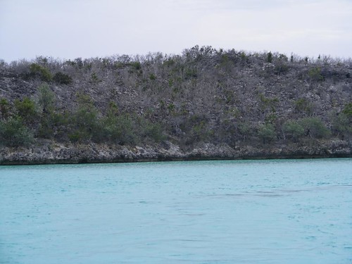
After we departed the Exumas Land and Sea Park, we had a windy ride up to Ship Channel Cay which would be our last stop in the Exuma chain.  The sun never came out, but we didn't have to deal with any thunderstorms and the wind was mostly off our starboard stern quarter, so it wasn't a rough ride.  Our cat comfort gauge never went off, i.e. Visitor didn't throw up.

A lot of cruisers miss taking advantage of using the good anchoring grounds off of Ship Channel Cay when the winds are out of the prevailing easterly direction.  There are even a few nice isolated coral heads nearby for snorkeling to pass the time.  I could only dream about doing that since the sky was too dark, and we wouldn't be there long enough to justify launching the dinghy anyway.

The following day we had a 7 hour crossing to get back to Current Island/Eleuthera area where we had last been on May 21.  We were only in deep trolling water for 1 1/4 hours and just managed to catch a couple of barracuda.  Can you hear the guys yelling?!

We arrived at the area where we wanted to anchor, just north of Current Cut off the settlement of Current, amidst a heavy thunderstorm.  We circled around almost an hour waiting for the rain and gusty winds to abate so we could drop the hook.  3 other small boats had been trying to go through Current Cut, but with the poor conditions, gave up and also ended up anchoring for the night.  They weren't are only neighbors.
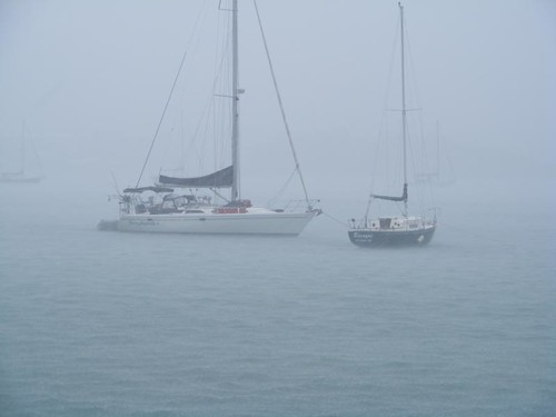
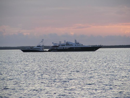
A megapair
A megapair

We have never seen this anchoring arrangement before.  The 180' megayacht on the right was already anchored when we came in.  After the squall line moved through, the sportfish on the left showed up, with the same paint job as its megayacht mothership, and backed up stern to the megayacht and tied off for the night.

After the squall line moved through, it was a nice, cool evening.  Even though we were a mile offshore, I could smell a sweet fragrance in the air coming from the tropical blossoms onshore.  We finally had a starlit night again!

We awoke on June 22 to a forecast for favorable winds and calm seas to allow us to comfortably make the 9 hour passage across the open ocean back to Lynyard Cay at the south end of Great Abaco.  Even though the ocean swell was running 3 – 4' making for a little roll, Wayne was able to make a normal loaf of bread while we were underway.  We trolled the whole way but only caught 1/2 of a big tuna.  We never saw what got the other half, other than all the water splashing up from when it was getting chewed in half.

Since we had departed Current Island area at sunrise, we arrived at Lynyard just after 3:00 so I had plenty of time to get into the water.  I finally finished cleaning the starboard side of the hull.  The port side looks worse than ever, and my scrubbing sponge has seen better days.  I'm not sure I'll be able to get it done.  I might have to put some pressure on the guys!

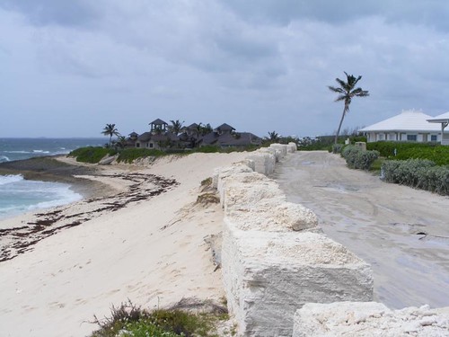
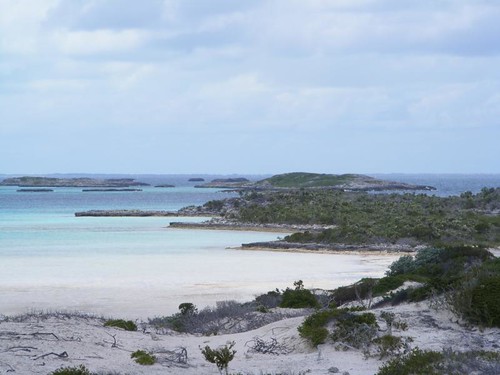
I wanted to stay in this area another day to snorkel at Sandy Cay,, an underwater preserve, but since it was Friday when we arrived, we would only have Saturday to try to find another clinic to take care of Eddie's ear infection so we had to leave.

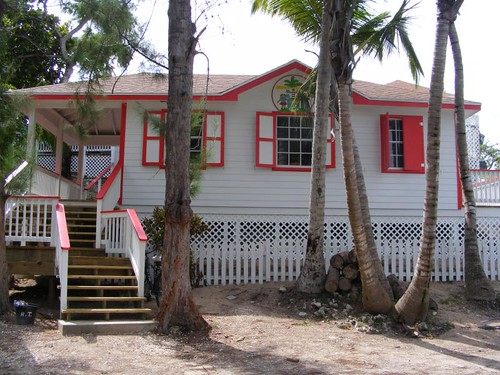
Our only choice with our current geographical position was to try to make it to Marsh Harbor, the Hub of the Abacos, early enough on Saturday and hope that we could find a clinic that was open.  If not, it would mean we would be stuck in Marsh Harbor until Monday when we knew the government clinic would be open for sure.
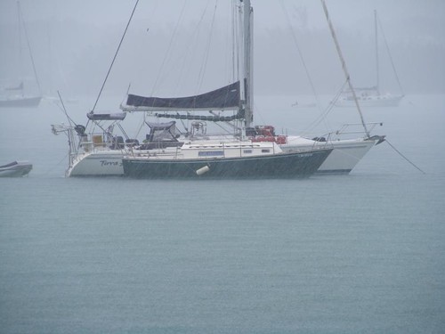
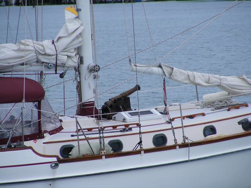
Our armed neighbor
Our armed neighbor


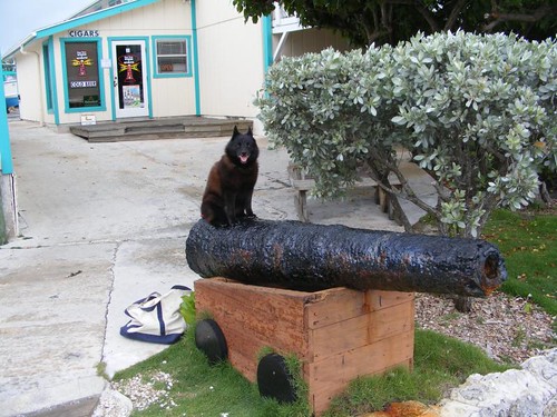
We left right after sun up again to make it to Marsh Harbor well before noon in case the clinic closed at noon.  We had put out a call on the VHF for clinic information, and had a reply from another cruiser that the government clinic was open until 3:00 p.m. The harbor wasn't crowded and we found an area with plenty of anchor room for us to feel comfortable in thinking that we would have to spend at least one night there.  This is the scene of the worst day in the FLUKESTERS' cruising lives (you can read about it in a past blog) so we are apprehensive about anchoring in the harbor with unsettled weather conditions.  We were less than pleased when a sailboat came and dropped anchor closer than we would have liked, even after telling him where our anchor was located.  Who can argue with someone that cruises with a cannon on the deck?!

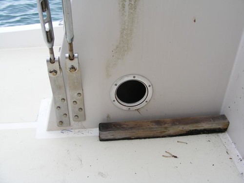
The usual small workspace


See that metal bracket strap on the right?  That is used to secure one of the stays that holds our mast up.  Remember, we use the boom connected to the mast to hoist our 850# beast of a dinghy which we would need to launch to get to shore.  Eddie discovered that the bracket was loose, so much that there was a gap between the metal and the fiberglass; you could move the bolts with your fingers.  That hole is what you have to reach through to access the nuts that hold on the bolts.  However,  that access hole is not ordinarily visible.  There is a big fiberglass deck box that fills the space in front of it that we keep loaded with gear.  Before the hole could be accessed the deck box had to be emptied and moved.  Nothing is simply done in a straightaway fashion on a boat! 

When the deck box was unscrewed and moved from its wooden mounts, the wall and floor underneath were really filthy, so I cleaned all that and then turned the area over to the guys to  tighten the bolts through the one-hand-only hole.  This is the first time we have had to do that job and even wonder how the bolts came loose in the first place.

When everything was tightened properly, the deck box remounted, all the gear put back, we could then launch the dinghy and try to find a clinic for Eddie, about 1 1/2 miles from the dock. 

After eating an early lunch, it was a hot and dusty walk along the dirty, paved, busy with island traffic, main thoroughfare.  They are in the process of activating their second traffic light, and Marsh Harbor is the only town in the out islands that even has a light.  When we made it to the clinic, it turned out to be closed on the weekends.  We spoke to an employee at the newly-opened kidney center next door and was told a private clinic close to the dock we had first started from was open.

On the way back, I bought a small watermelon off a guy selling them from the back of his pickup truck, so I had to lug that the rest of the journey.  There are a limited number of signs along the streets (they all get blown away from hurricanes, and there are few spaces next to the road to mount them anyway) so after asking another 4 people where the clinic was, we finally found the place (Integrated Medical Centre).  Eddie was admitted with no waiting. 

The first attendant took his blood pressure with one of those standard electric machines that is mounted on wheels and gives a digital display.  It read 85/60, and she just calmly writes it down and gets ready to take his temperature!!  I said “What was that?  That can't be correct because if it is, I'll need to be looking for a cemetery”  Another attendant arrived and took a manual pressure reading and then another electronic one and they were about the same.  They asked Eddie if he was feeling faint or dizzy.  He wasn't, but I remarked that we had walked about 3 miles in the hot, humid weather and Eddie hadn't had anything to drink.  They said the doctor would have to evaluate the BP issue.

The doctor was a boater himself, so we exchanged pleasantries as he examined Eddie.  Eddie had already made up his mind not to squeal during the examination, thinking that the doctor in George Town may have missed some important “sights” when Eddie hadn't let him stick the otoscope all the way in.  This examination revealed that the infection was limited to the outer ear, and the eardrums were intact.  The doctor took his BP again, normal, at 110/65 and attributed the earlier readings to vasodillation from our heated walk.  He prescribed a prescription antibiotic and some eardrops, which required getting filled at a local pharmacy a short distance away.  The doctor also told Eddie not to wear headphones, which he described as “turbocharging” the infection because they reduced air circulation and draining.

Eddie got out of the clinic for $90.  The pharmacy bill was another $43.  Remember, the government clinic visit in George Town was $39 for everything. 

We made it back to FLUKE before the afternoon thunderstorms started their downpour and high winds.  I was glad that it was still daylight so that we could keep our eyes on the other boats, with good reason.  We were also happy that the storm came from the direction our anchor was set, so we felt pretty secure.

Dragging in the rain

This, thankfully small, sailboat began dragging across the harbor and no one was aboard to do anything to try to stop it or redirect its path.  You can see its anchor line and the line of the larger sailboat it is nearing.  Getting hit by another boat is bad, but if the other boat also pulls up your anchor, that can be much worse.

Taking a rest
Taking a rest

The small sailboat came to rest alongside the bigger sailboat.  From the radio chatter, both of the boats were owned by locals who knew each other.  The woman resident of the big sailboat sounded like she was well into having had one too many sundowners and was only mildly alarmed to have the small sailboat resting alongside.  When the storm ended, several people showed up in a couple of dinghies to relocate the little sailboat to a new location.

Our insecurity alarm went off at 3:00 a.m. with the arrival of another thunderstorm from the OPPOSITE direction we set our anchor.  All the boats turned around, and we were on red alert to see if our anchor was going to hold.  The guy in the sailboat that had anchored too close to us was up on his deck with a flashlight shining it on us, hoping we didn't let loose and drag right into him.  So were we, and we were really angry that he had jeopardized both of us in the first place.  Fortunately we stayed secure during the 3 hour deluge.

Ironically the next morning, the guy on the sailboat yelled over telling us that when the storm came and reversed the boat positions we were only one boat length ahead of him, and he thought that was too close.  Well, duh, why do you think we said anything to him in the first place when he came in to anchor?  There was all kinds of room farther from us where he could have chosen to anchor.  He said we shouldn't have had out so much chain (125'), not understanding that we have a bow that is 10' off the water compared to his that is 4', and we draw 5 1/2' and have 4 times the windage he has with his sailboat.  In reality the 70' of chain he had out gave him more scope than what we had with our 125'.  We said we were leaving anyway, so he didn't have to worry about having us around anymore.
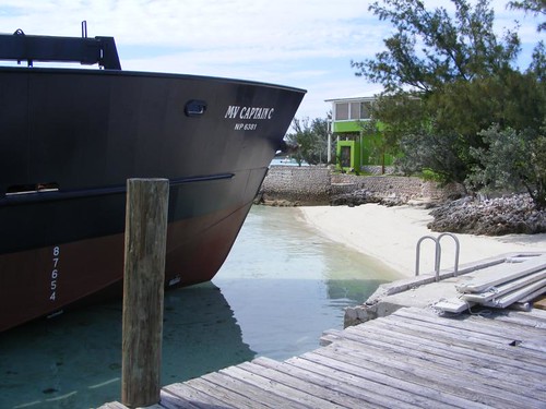
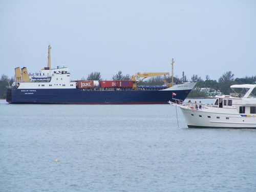
Harbor giant
Harbor giant


There are two large, by out island standards, freighters that service Marsh Harbor.  They bring freight from the states or other foreign ports into the harbor, and then the inter-island smaller freighters, like the mailboats I mention, pick up the supplies from Marsh Harbor to deliver to the out islands.  That's why it is called “The Hub of the Abacos”.
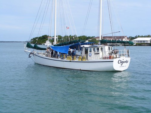
Learning adventure
Learning adventure

Several sailing vessels use Marsh Harbor as a base to take young kids out on sailing adventures.  We watched about a dozen teens board this ship.  They will come back different people after their working trip aboard.

We upped our anchor not long after they left the harbor, feeling as happy as the kids were to get under way again.  With high winds and even worse weather in the forecast, we had decided to head to Hope Town harbor and pick up a secure mooring again where we would be well-protected for the turbulent weather so we could sleep more peacefully at night.
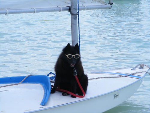
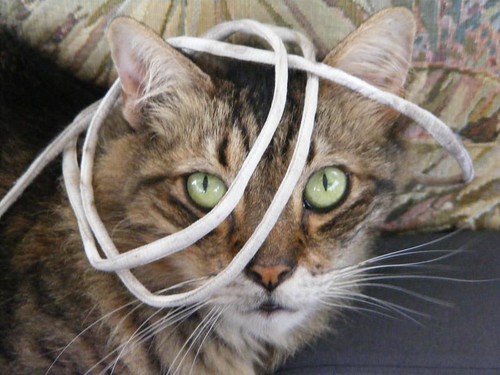
Strung out
Strung out

Eddie decided to “play” with Visitor on the way over to Hope Town. 


Wednesday, June 27, 2012

Dying a Slow Death


June 18 – 19, 2012

After we departed from Big Majors we decided to go visit the Exumas Land and Sea Park as it had been quite a few years since our last visit.  The ELSP covers the area of 15 big cays, 22 miles in length by 8 miles in width, from Wax Cay cut on the north end to Conch Cay cut on the south end.  There are no commercial developments within the park boundaries, but there are a few cays that have private homes on them.  The entire area of the park is a no take zone: no fishing, no shelling, no removing anything living or dead.  As far as the underwater life goes, the ELSP is a great place to be able to see the animals in their natural habitat where they have had the opportunity to live unmolested by humans.  As a result, the species abundance is greater and the animals as a whole don't exhibit the same skittish fear as those in the areas where they are hunted on a daily basis.

By lunchtime, we were fully secure on a mooring ball in the Emerald Rock anchorage, off of Warderick Wells, the cay where the park headquarters is located.  This choice of location was based on the weather forecast of strong easterly winds.

Emerald Rock
Emerald Rock


There are several scattered coral heads in the area, and I was looking forward to snorkeling on those heads and around Emerald Rock.  Several different species of birds were nesting on Emerald Rock, so there was a lot of bird noise and activity within ear shot of our mooring – my kind of neighborhood on the western side.  The white balls in the water are some of the other mooring balls.

However, the picture on the eastern side, the elevated land of Warderwick Wells was another story.  As soon as we got close to the land I remarked to Wayne “something really bad has happened here”.

Where have all the flowers gone


With all the rain that the islands has been getting, I've told you many times how green and lush the landscape has appeared everywhere we have stopped.  I think that this is the greenest I have ever seen the out islands.  I've remarked how dense the undergrowth is when we have been on a land hike and have told you how we wouldn't have been able to walk anywhere if someone else hadn't already cut a trail.  In the above picture, there is very little green vegetation remaining, and what you see is mostly dead sticks of shrubs and small trees.  Even the contrast to nearby little Emerald Rock is apparent in the photos.  I had a hunch what had happened and that was confirmed when we dinghied into the park headquarters after lunch.

Eddie enjoying the view

If you have never been to the ELSP before, you should at least stop at the park headquarters to get an overview, literally and figuratively, of what the park has to offer.   You can pick up all kinds of useful nature guides, historical books, tee shirts, and “souvenirs” that are all reflective of the park and out island life.  It is not tacky tourist stuff!  There are bones, shells, and preserved specimens on display that are relevant to what you can expect to see as you explore the park.  Plus, there are staff members present that can answer questions you may have.  You probably won't be surprised when I tell you that I had a written list of questions so that I would remember everything I wanted to ask.  I know you are laughing at me now!

In addition, the headquarters building is elevated on a prominent point, so it gives you a good view of the main mooring field and the elevated lands to the north and south.  There is a huge wrap around porch, and you will be tempted just to sit out there in the comforting breeze and enjoy the breathtaking views in all directions.  I've had a difficult time trying to decide what pictures to post.

The main mooring field


When you see a picture of ELSP, you will probably see a scene like this one.  It is usually the first choice area to get a mooring so that you can be near headquarters and be safely secured in this beautiful setting, where the current rips through the narrow channel at every tide turn.  We stayed here during our first visit to the park.  After you stay here though, you should not miss exploring other areas of the park because they are all unique in their own special way.  It may be difficult to choose a  favorite spot.

The destroyer
The destroyer


This nocturnal, rodent-like animal is a hutia (a preserved specimen).  You can also see some skulls and chewing teeth in the display.  I think they look like a giant brown guinea pig.  The hutias were endemic to the Bahamas, but their population was reduced to only a small number on the Plana Cays, a tiny set of very isolated islands way south.  The people in charge at the time (early 70s) were concerned that the hutia would be a lost species, and decided to relocate several breeding pairs to Wax Cay and Warderick Wells, where there were no natural predators.  The hutias flourished, and unlike some mammal species whose populations don't respond well to crowded conditions, the hutias have just kept on increasing in numbers eating the island vegetation bare.  In a balanced system, the hutias would typically eat undergrowth and lower parts of the plants, and the vegetation could continue to keep growing and reproduce itself.  What has happened now is that the hutias ate everything low and even the upper levels of vegetation, including the growing tips.  They have even stripped bark.  The native plants are being wiped out and cannot reproduce.  The hutias were put on a protected species list, so there is all kinds of controversy involved now as to how to solve the population explosion on Warderwick Wells.  Well, the problem will be solved when there isn't anything left to eat.

If you look in the mooring field photo, to the right, you can see an elevated hill called Boo Boo Hill.  You can hike there from park headquarters and at 70' high, you can get a great view of the surrounding lands and seas.  We had brought Ursa in to hike with us, but found out that dogs are now restricted to staying on the beaches only.  They might harm the native animal populations.  Yes, it wouldn't matter about the hutias, but there are a lot of rock and ground nesting birds.  Wayne said he would stay at the beach pavilion with Ursa while Eddie and I hiked over to Boo Boo Hill.

Thanks for low tide
Thanks for low tide

It was just lucky coincidence that we were making the trek on low tide.  This photo shows the lowest area you have to cross to get over to BBH, and at higher tides, it's underwater.  You can see the red mangroves sticking up out of the sand and even some standing water.  We had worn our sneakers, so I didn't want to get them wet and have the sand stick all over them when we got to the hilly portion of the trail.  A portion of the trail goes over solid, sharp rock with lots of holes, where you need to really watch your footing, so you have to wear safe shoes.  I could see hutia footprints and scattered poop all along the trail.

Legend has it that Boo Boo Hill got its name because some islanders said that you could hear the cries from the ghosts of a group of missionaries that had shipwrecked on the island years ago.  Now it is the destination of most all cruisers visiting the park, and the sounds you hear are those of laughter and glee and oohs and aahs as visitors look at the 360 degree awe-inspiring views.

So many cays, too little time


While the main theme throughout the park is “Take all the pictures you want, but leave only footprints”, the one spot where they have made a concession to every visitor's need to leave  his or her mark, is on Boo Boo Hill.  You can add a piece of driftwood, painted or carved, with your name on it.  Most visitors have the name of their boat and a date on it.  Some people go to great lengths to make pretty, elaborate signs ahead of time, knowing that they will be making this wonderful hike. The pile grows enormous until it is all blown away by a hurricane, and then it grows again.

Leave your name on Boo Boo Hill


The eastern side has the Atlantic Ocean crashing into a rocky shore, where there are several blow holes that can shoot mists up very high if there is a strong onshore blow.  At this time of year, the tropic birds are nesting in the rock holes in the cliffs and you can watch the graceful birds, always flying in pairs, with their beautiful long tails sailing on the winds down to the water in search of food.

Looking towards our neighborhood

This is the southern view, where we are moored, but the land obscures the view of FLUKE.  If you look far to the right you can see one of the mini megayachts secured on a mooring.  The park supplies safe moorings for yachts up to 150' in length. There is some room to anchor out on your own hook, but at $20/night the moorings are a good way for us to help support ELSP. The moorings are designed to allow a lot of vessels to occupy more space and preserve the sea bottom.

Before we left headquarters we signed up for the WiFi service.  The park is generous to share its precious two way satellite connection with cruisers, so the connection is slow and there are restrictions (no internet telephony, no audio or video sites permitted).  The fee is $10/day, limited to 24 hrs or 100 MB, whichever comes first, and only 1 hookup/vessel.  The paper you are given says “If you think the network connection is too slow, take a look around you and enjoy the scenery and the setting...after a long look at the different shades of blue water, the sandy beaches, and the beauty of the park, your page should be back up and ready for you to try again.”  I would add, if you REALLY NEED it at all!

When we got back to FLUKE it was still early enough and the sun was out, so I wanted to snorkel the coral heads near our mooring and around Emerald Rock.  I told the guys I was taking the dinghy and would be off on a snorkel expedition.  Eddie started whining that he wanted to go, but needed another day for his ear “issue” and begged me to wait until the next day so he could go with me.  I relented and just ended up swimming to the rocks near shore and then back to FLUKE to work on continuing to scrape the growth off the bottom until the current got so strong I couldn't stick close to the boat without a lot of effort.

The next day it rained all day!  The moral of this part of the story is “Snorkel while the sun shines”.  I watched a group of young people from a charter boat try going out to the coral heads in the pouring rain to snorkel, but they didn't stay long and came back and just jumped off their boat and played in the water until they got too cold.

I had made a plan for the day that I wasn't going to give up, like yesterday's lost snorkel opportunity.  I had decided to go ashore right before dark in hopes of seeing a hutia.  Even though it was still raining, I asked Wayne to drop me off at Rendezvous Beach where I planned to take one of the trails up into the bush to look for the hutias.

Warderwick Wells has many well-marked trails, the most on any of the islands.  I scrambled up the steep, rocky sloped Davis Plantation Trail that shortly led to a site with Loyalist ruins from the late 1700s.

Poop and pottery
Poop and pottery

I was shocked by the density of hutia feces.  The amount that you see in the photo wasn't an area that was just a collection site.  The ground was covered like that everywhere.  I can't imagine how many hutias it took to make that huge amount or maybe the feces just don't decompose very fast.  You can see two pieces of pottery, artifacts from the Loyalist settlement.  There are stone and mortar ruins nearby.  With all the vegetation stripped from the hillside, I could see a great distance.  No hutias were in sight, maybe I was too early or else they didn't want to come out of their holes and crevices in the rain. 

We couldn't stay another day in the park and risk losing a good weather window to make the open ocean crossing back to the Abacos.  I know there are hutias in those hills and lots of fish in the emerald sea that are waiting for me.  Warderwick Wells will have to be on my list again for a future visit.


Monday, June 25, 2012

With the Pigs and Big Dogs


June 16 – 17,  2012

After we left Black Point early in the morning, we only traveled a short distance (1.5 hrs in time, but even that much was because we had to go around a big rock bar) north to Big Majors Spot.  It is a popular anchorage because of its big size, good holding, sandy beaches and clear water.  We have anchored here several times in years past.

Little FLUKE at Big Majors

You can't feel alone here because the anchorage is packed with multimillion dollar charter yachts in the 70 - 200' range.  They pick up their guests in Nassau and use Big Majors as a southern terminus point where the charterers can fly out of the small airstrip on nearby Staniel Cay if they don't make the return trip to Nassau.  Some guests may begin their charter here.  The yachts supply all kinds of aquatic toys for their guests, and the waters around Big Majors are perfect for guests of all ages.  It is interesting watching the big yachts arrive, get anchored, and bring out all the toys, and within minutes, the guests are jumping in the water.  We like looking at the different styles of yachts; it is amazing how varied they are. 

Captain Wayne decided to treat us to pizza for dinner, so Eddie and I went ashore on Staniel Cay while he stayed aboard and worked on his dough.  Staniel Cay is an old settlement, but has undergone a lot of vacation home development over the years and enjoys a lot of visits from cruisers and sportfishermen on a regular basis which is the basis of the local economy.  The Staniel Cay Yacht Club is one of those old time bar/restaurants where you could walk in and see some celebrity bellied up to the bar blending in with everyone else, talking fish or boat speak.

Staniel Cay villas
Staniel Cay villas


Staniel Cay's popularity is aided by the fact that it can provide a family atmosphere and not just function as a sportfishermen's hideaway.  The cute, island color villas are scenically located and provide amenities just like home.  If you rent the villa closest to the fish cleaning table you can watch the sharks and rays eating fish scraps right from your porch.  The in town beach is easily accessed and has its own set of water toys.

Old town
Old town


The older parts of town still have the very narrow streets from the days when there were few automobiles, or like now more commonly seen, trucks, on the cay.  I remember coming here years ago and only seeing tiny, foreign made “vans” and a couple of golf cars.  Most everyone walked everywhere.  Notice the bright blue buildings in this photo, obviously not government buildings.  All the buildings on Staniel Cay are painted with a whole rainbow of tropical island colors, more so than I can think of on any other island.

Bahamian rainbow
Bahamian rainbow

We just happen to luck out and find the mailboat, CAPTAIN C tied up to the government dock, but it had already unloaded the cargo and was getting ready to pull away.  A couple of men aboard the boat were flirting with and making lewd remarks to a woman on shore, and that got everyone laughing.  When the boat began backing and turning from the dock, the anchor on the bow caught the top of the end piling, making a loud crunching sound while we were still standing on the dock.  I thought the whole corner of the dock might get ripped off, but the anchor tilted and freed itself without pulling over the piling.

Aground!
Aground!


Because the channel into the government dock is so narrow, the CAPTAIN C just can't back off the dock and make a straight away turn.  The captain has to pull forward toward shore and run the bow aground in the shallow water.  Then the powerful engine is used to slowly turn and back the boat within the confines of the channel until it is deep enough to pull off the bow.

If you look in the background of the photo you can see a wall that looks like it has a design on it.  If you can enlarge it, you will see that the pattern is made from conch shells imbedded in the wall, literally thousands of big, ocean conchs, upright, side by side.  I've never seen another unique wall made like that!

Little racer
Little racer

This pretty little regatta racer was tied up close to the dock.  They are always christened with clever names and usually have fancy paint jobs.

Get your BIG drinks here

There was a new bar just a few paces from the government dock.  I thought it was aptly named for the clientele that visit the island.  From the breed in the photo, I was wondering if that slime quarterback Michael Vick might be part owner.

We had beached the dinghy on the town beach and headed back there with the idea of taking a detour before going back to FLUKE. 

The number one attraction in the area is Thunderball Cave where the movies Thunderball and Splash were filmed.  You can snorkel inside the cave, which is open in the roof for good lighting, and you will think you are in an aquarium.  The fish are used to being fed and will come right up to your swim mask.  We could see several boats outside the cave, and I knew there was a lot of laughter going on inside.  I love snorkeling in there, but didn't expect to have the chance to during this visit. 

The number two attraction is what I call Pig Beach, for reasons which are obvious in the following two photos.  Everyone at least dinghies close to shore to visit the “locals”.

Don't get my feet wet!

The pigs reside on a beautiful, sandy beach with a clear bottom and no rocks.  Some people anchor their dinghies and get out to pet the pigs, feed them by hand, and just float around in the water.  I don't think those people have ever seen pig poop like I have, which is why I will not lounge in the water with the pigs.  The bigger the pig, the bigger the stool.

Getting ready for the pig roast

The pigs are so conditioned to people bringing them something to eat that they swim out to every boat that comes near their beach.  If you don't have anything, they will just turn around and head back to shore or to the next boat they see.  The pigs get fattened off the scraps from all the boaters until they are big enough to meet the demand for a pig roast.

When we got back to FLUKE it was still early enough to pile Ursa in the dinghy and take her for a beach walk since she had been on the boat all day and would like the exercise.

Wear your water shoes

Even though the water is crystal clear and you can easily see the rocks, if your foot slips off you could get stuck by sea urchins which hide under the rocks during the day.

Eddie and I scavenged the beach for driftwood and other “treasures”.  All the cays in this area are frequented by people, and it is common practice to “mark your presence” by adding a stone to a cairn.  Cairns are generally located on a prominent point of land, but they can get started anywhere there are smooth rocks that people just want to pile up one on another.  There is just this strange urge to have to add another rock to the top, and some cairns end up being several feet tall.

Just one more rock
Just one more rock

The following morning was devoted to a 3 hr. dinghy ride through the scenic Pipe Creek area, where we thought we could get protection from the wind coming out of the east.  We were fine most of the time, but there are ocean cuts which got pretty bumpy, and we ended up getting soaked.

Island sailors
Island sailors


We never get tired of seeing the colorful sights that abound throughout the tiny cays in this area.  Every turn brings another surprise and affords a new opportunity for exploration.

While the morning was for fun, the afternoon was for work.  The W & E Marine Maintenance Team took the dinghy to a pigless beach so that they could work on a problem with the dinghy motor's turning swivel joint.  It has been getting stiffer, and we are wondering if we have waited so long and let it get so hard to turn, that maybe damage has occurred in the steering mechanism behind the wheel in the helm too.  The WEMMT did a big grease job on the whole thing, and it does turn a bit easier.  However, it is in need of some more extensive exploratory surgery when better operating conditions are available.

Rather than stay longer at Big Majors, we decided to spend some more time in the Exumas by visiting Exuma Land and Sea Park, several miles north.  We headed up that way in the morning of June 18.


Sunday, June 24, 2012

Getting to the Point

June 14 – 15, 2012

Sea conditions were calm enough in Exuma Sound for us to use that offshore route for 8.5 hrs. to go all the way to Great Guana Cay and anchor off the only settlement on the 12 mile long cay, Black Point.  It was overcast and squally most of the day, but seas didn't kick up enough to bother us.  The autopilot was not working at all, but since we were trying to follow the depth contours for our fishing fun, we were manually altering course all day anyway so the autopilot wasn't missed that much.

We fished all day in the 100 – 300' depths with some exciting activity.  We hooked a dolphin and had it all the way up on the swim platform before the line broke, and we lost it.  I had already started thinking about how I was going to prepare it for dinner!  We also caught and released a jack, barracuda, and spanish mackerel.

We dinghied into the newly built government dock early on Friday morning.  Post Office, with an obvious sign, is right across the street, and I needed to go there to buy some stamps and ask questions to the friendly post mistress.

Black Point residents are known for their palm plaiting, and many of the older residents, male and female, were busy plaiting under shade trees.  They are friendly and welcome the opportunity to answer questions and tell you about their work or about activities in the settlement.

Weaver woman
Weaver woman


They all plait in the same fashion that you see in the photo.  The woven strips are about 6” wide and 30' long.  This woman could weave the 6 or 8 palm strips very quickly; I couldn't keep up with her weaving fingers to watch the order.  The pieces that you can see sticking out the sides of the finished strip are just trimmed off with a knife.  The finished strips are rolled up and are sent by the mail boat over to Nassau where people sew the strips together into the products that are sold in the straw markets:  baskets, hats, totes, mats, etc.  It is a true cottage industry for the Black Point residents, and they all can work at it as much or as little as they please.

As we walked down the road, we were approached by a mentally handicapped young adult shell entrepreneur.  He was well dressed, polite, and so enthusiastic about the mixed, very ordinary shells he had jumbled together in a basket we couldn't help but show an interest.  Any one I picked up he said was wonderful, special, or very good.  I finally settled on an old, small, beat up and mostly broken, cowrie shell that I would have never even picked up off the beach for myself, but I wanted to choose one that I would remember where I got it from.  He was thrilled to death to make a sale (.30) and wanted to know our names to record them in his “book”.  I regret not having taken a picture of him with Eddie since I believe they had a common bond of some sort!

Our destination for the morning outing was the Garden of Eden.  It is one man's (Willie Rolle) “art” collection based on his visions of what he sees in the driftwood and stone pieces he has spent the last 34 years collecting.  Eddie and I could really relate to Willie's love of collecting nature's treasures.

Willie's collection is set up in what you would call his yard, and you just walk in off the street and look around.  Nothing is labeled, so if you can't think outside of the box or can't relate to that type of creative vision, you will not “get” it and will wonder why someone told you to walk all the way to the outside of the community to see it.  We really did get it, and had an added bonus of having Willie himself come out from his house.  Once he saw that we also had the vision gift, he jumped right in and wanted to show us his favorite pieces, sometimes quizzing us first by asking what we saw before he told us his idea.  We all had a lot of laughs and even debates about the figures.

The lion
The lion


Since this one is so easy it is a good test to see if you have the gift of vision.  If you really can't see the lion, you just don't have it and might as well just resign yourself to eating only vanilla or chocolate ice cream.  Don't even think of visiting the Ben & Jerry's ice cream factory in Vermont because you won't be interested in trying the flavor or the day or visiting the Graveyard of Flavors Past.  Too bad.

Willie's drunken man

With its striking color, all three of us looked at this at the same time and just “knew” what it was – an orangutan, of course.  I didn't want to get into a debate with Willie about how come I was convinced it was meant to be an orangutan since he was the original finder.  I would have loved to have taken this one home with me.

The back forty
The back forty

Willie told us to walk around the back.  Notice the whole place is just solid rock with holes of varying sizes.  This is Willie's “farm”.  He grows bananas, papaya, sapodilla, lemon grass, guava, okra, sweet potato, pumpkin, citrus, and tamarind.

Way below ground level

These bananas and papaya plants are about 3' below ground level, but it is a pocket that accumulated enough organic debris to support their growth.  Some of the holes were only big enough for one small plant, like an okra or a small clump of lemon grass.  Willie really made efficient use of the area that he has available.  When he realized I knew most all of the crops, he took me under his wing, readily sharing how he used the fruits and vegetables and smiling with appreciation that I was interested in learning what he had to say.

I asked Willie how old he was, and he said 74.  Eddie jumped right in to shake his hand and told Willie that he was 70, and Willie commented how good he looked.  We told Willie that he looked pretty fit himself and that he shouldn't stop adding to his collection since he really had the “vision”.  He laughed and said that while he had slowed down, he would continue to add to it when he “saw” something interesting.

Sunshine and clean hair makes me happy


The walk around Black Point, seeing the simple sights and meeting the friendly townspeople, added to some sunshine and my clean hair put me in good spirits.  Years ago one of the old timers on Man-O-War cay in the Abacos told us that whenever the locals used to find “stuff” along the shoreline, they would say “it was sent to me”.  Eddie and I still use that expression, and I will tell you those cool sunglasses were “sent to me”!