July 18 – 20, 2007
Eddie and I whined enough, and Wayne finally relented, to have a few days in New York City to be tourists. Being the thrifty minded individuals that we have to be now, we decided we would check out the West 79th Street Boat Basin facility. We had talked to a sailboat while we were heading south on Delaware Bay who mentioned they were thinking of going there too and how inexpensive and convenient it was.
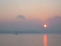
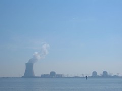
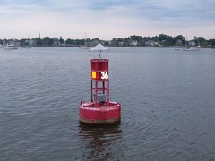
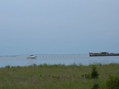
The skies looked bleak the entire morning, and we were waiting for the fog to lift enough for us to get through New York Harbor. By 1400 we had to decide to make the move or not as we had about 22 miles to go to get to the marina, and we wanted to get there before the rush hour peak and/or dark. So, we upped the anchor and began heading toward the Verrazano Narrows. A thunderstorm struck with heavy rains, but fortunately, not terrible winds. We had to creep along from one channel marker to another. After the storm blew through, we had good visibility, but the going was slow because of the outgoing strong current pushing against us. The heavy rains had washed the city streets clean and all the debris was in the waterway in huge floating masses: plastic, paper, tree leaves and limbs, auto parts, lumber, and pier and dock pieces. Just one more thing to have to worry about!
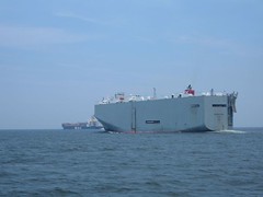
Passing through New York Harbor is always exciting because there is so much activity. The colorful orange Staten Island ferries and yellow New York City water taxis buzz about in stark contrast to the drab barges. I must say, though, that some of the tugs they use have some nice paint jobs and interesting shapes. I call one type a giraffe tug because it has a pilothouse that sits high atop a long extension from the lower deck so that the pilot can see over the tall barge it has to push. Today we are treated to the sight of the majestic Queen Mary 2 which had just docked earlier in the day.
We make the turn past the Battery to take our first trip up the Hudson River. We pass over the Lincoln and Holland tunnels and can see their huge ventilator shafts, the only visible evidence we are even going over them. We pass through an empty commercial dock section which we later see is where cruise ships dock. We are amused to see a multi-level driving range fully enclosed with netting and people hitting golf balls right out into the Hudson River. We wonder what keeps the people from falling off the platform and how many clubs must be laying on the river bottom!
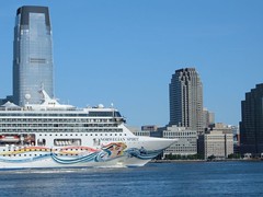
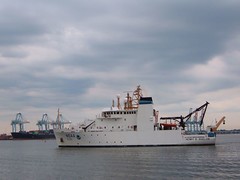
Norwegian Spirit Arrival
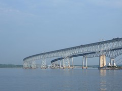
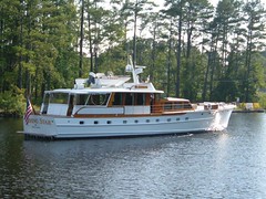
By 1730 we have picked up our mooring lines and are as secured as we're going to be for our stay. Located adjacent to the Upper West Side, south of the George Washington Bridge and contiguous with Riverside Park, the marina is run by the City of New York Parks & Recreation. The facility operates 24hrs/day. There are docks for full time liveaboards, and the entire property is fenced off and locked up. To get in, you have to hail the office and be let in or let in by someone you know already there. They have an ice machine and free washer and dryer.
From a boating viewpoint, it appears that the boats at the docks take a real beating. Despite having a breakwater to cut down on wakes from the busy traffic on the Hudson, there is still a lot of wave action around the docked boats. Many fenders were flattened, boats with scraped hulls, bent rails, all evidence of lots of movement. The floating docks are very tippy; you have to be careful crossing from one section to the next. Carrying anything is a challenge. At least being on a mooring keeps the boat from being damaged, but it is a wake adventure to say the least. Since we were gone all day every day we didn't have to be bothered by it as much. At night traffic is at a minimum, so you don't have to really worry about getting rolled out of the bed from a bad wake.
Standing outside on our upper deck is quite interesting. We are right next to the buildings of the Upper West Side. Donald Trump has purchased a lot of property adjacent to the waterfront and has erected a couple of new high rises; the one right next to us is Trump Place. For developmental permits, builders are required to provide green space for community use, so a lot of improvements have been made to Riverside Park. This heavily treed area has attractive flower gardens, biking, walking, and running concourses, special seating and entertainment and dining areas. The city sponsors a summer program called Open Air Flicks whereby a huge screen is set up on a renovated pier (next to us), chairs are put out, and people can watch free movies. The city lights, especially those of the George Washington Bridge, look beautiful at night from our vantage point. I can't get good pictures of them from the boat because it is moving and distorts the photo.
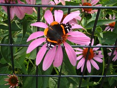
Color in the Park
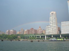
NYC Rainbow
City personnel are in the process of setting up for a Triathlon which will take place on Sunday. Participants will swim in the Hudson (a cringing thought for we swimmers of Bahamian waters!) right by where FLUKE is moored.
Central To Our Thoughts
After a restful night's sleep, we (including Ursa) started out early to spend the day in Central Park which was within easy walking distance from the marina. Right after we arrived there we knew we would not be seeing the whole park in one day, so we focused our efforts on seeing the sights within the area bounded by Central Park West and Fifth Avenue and W59th St. and W81st St.
We learned that Central Park is so beautiful thanks to the efforts of the Central Park Conservancy which manages the Park under a contract with the City of New York. The CPC was formed in 1980 and has raised over $325 million dollars from private citizens, foundations, and corporations to transform Central Park from the beat up condition of the late 70s to the outstanding model of an urban park that it is today. There is something for everyone now to enjoy in a safe, serene or entertaining, and invigorating atmosphere.
Park and the City
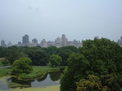
We were so surprised by the diversity of activity and sights within the Park. There are open fields where organized sports and functions are held to little corners with quiet benches where people are required to use headphones to listen to music. Cultivated flowers provide bright, attractive spots of color. In contrast,The Ramble is an area left in its native state so you can walk in a natural, densely wooded forest more like you would see in areas far removed from the City. Fountains and plaza areas showcase architectural styles. Fascinating sculptures catch your eye. Science isn't left out as you can visit the zoo or hike up to the meteorological station at Belvedere Castle which also provides a great elevated opportunity to see the Park from above. Rent a row boat and enjoy some solitude and exercise on the lake.
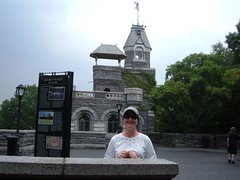
Belvedere Castle
When it was time for lunch, rather than using a Park vendor, we walked over to Lexington Ave. and found a deli. We took the food back to the Park and ate on a bench like hundreds of other people were doing. Pigeons and sparrows flocked around to get the tiny crumbs that Ursa left behind or that we threw out just for them.
Ursa proved to be a real people magnet, even for the likes of New York City. Children and adults want to pet her (many think she is a “puppy”), and dog lovers are so curious about what kind of breed she is. Despite her dislike towards other dogs, she welcomed the opportunity to take a break from walking to get friendly rubs from strangers. One attractive woman wearing a little black dress talking on her cell phone motioned for us to stop so she could pet Ursa. While doing so, she kept talking on the phone, seemingly ignoring our presence, and said “They're going to pay for your sperm”!
We were all dragging by the time we walked back to FLUKE, but had already started talking about what we planned to do the next day.
The Downtown Tour
After yesterday's adventure, we were looking forward even more to spending Friday in the City.
A short walk to the nearest subway station led to the first “challenge”. None of us had ever purchased subway fares, so we had to figure out what to do. At least we knew where we needed to go, but didn't realize there were express routes, so we mistakenly got on a regular commuter route and stopped at all the stations. Not to worry though, we had allowed time for such “mistakes”. Our jaws dropped when we climbed up the stairs at our Times Square destination and saw all the lights, tall buildings, and hustle and bustle in the crowded streets.
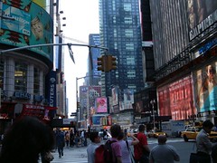
Times Square
We needed to find Madame Tussauds where we would begin our Downtown tour on a City Sights NY bus. The buses all provide top deck seating to give passengers the best views possible. Guides narrate, pointing out historical and popular City sights and provide interesting anecdotes about people, places, and events. You can hop off and on at any stop. There are so many buses in service, waits for the next bus are seldom more than 20 minutes.
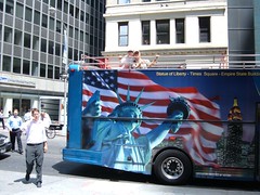
Tourists (on the bus)
Our tour stops included: Madison Square Garden, Macy's, Empire State Building, SoHo, Chinatown, Little Italy, World Trade Center Site, Wall Street, Financial District, Battery Park, South Street Seaport, Lower East Side, United Nations, Rockefeller Center, Carnegie Hall, and Broadway.
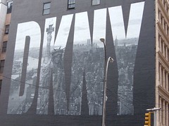
DKNY
Since we wanted to “see” as much of the area as time would permit, we agreed we wouldn't take time to do any shopping. Plus, we elected to do a lot more walking from area to area rather than getting on and off the bus.
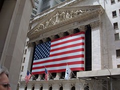
NYSE
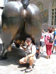
Bullish
We bought deli sandwiches near the World Trade Center site and ate in a park in the Financial District. Then we walked over to Wall Street where Eddie grabbed the famous Bull by the balls because we heard it was supposed to be good luck, but the Market has fallen ever since! We passed the beautiful old Customs House and walked on to Battery Park which was packed with people waiting in lines by the hundreds to get on the ferries to visit Ellis Island and the Statue of Liberty.
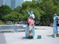
Liberty Man
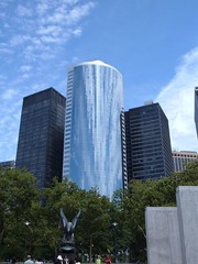
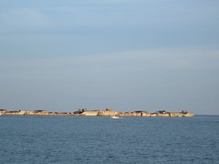
Battery Park Skyline
We spent the most stationary time at Rockefeller Center. The famous ice skating rink is an outdoor cafe during the summer, complete with tropical plants and gushing, sparkling fountains. A farmer's market was in full swing where the giant Christmas tree sits during the holiday season. We entered the GE Buidling and took the super fast(2 min. 45 sec.) elevator with blue lights in the ceiling that twinkle like stars to the 70th floor. This is the Top of the Rock, where you go to the outdoor observation deck to see the City from above. On a great weather day, this was the place to be! We were able to identify many of the places we saw on our bus and walking trips and even see all the way into Long Island Sound where we would be traveling the next day.
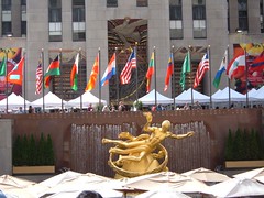
Rockefeller Plaza
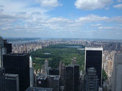
Central Park Overview
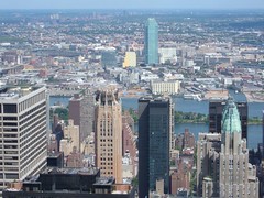
East River and Beyond
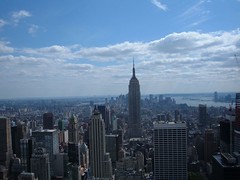
Empire State Building
While we couldn't bring ourselves to buy “I Love NY” tee shirts (only 5/$10), we did love our time in the City and look forward to return visits.