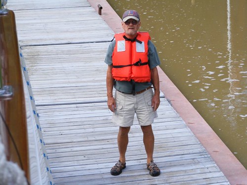
September 11 – 15, 2011
For this section of locks, after leaving Lock 11, we ended up spending one night at Lock 9 and four nights at Lock 7. I'm going to divide the post into canal scenery for the lock series and then Lock 7 history and activities.
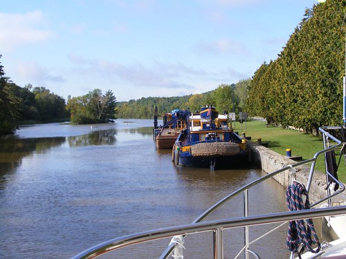
As a reminder, the Champlain Canal from Locks 12 – 7 is a 24 mile man-made, mostly straight “ditch”, with little variation in the width and a defined depth. Below Lock 7, you begin traveling on the Hudson River portion of the Canal for the remaining 36 miles. Like most natural rivers, it is winding, with a variable width and depth. It is critical to follow the navigational markers to avoid rocks and shoals.
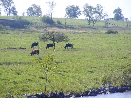
The smell of dairy farms is ever present. Some of the cows are right next to the canal. We even went by a pig farm, and did that ever have a pungent odor! All the muddy, rainy weather suited the pigs just fine; they were covered with mud, rooting and wagging their curly piggy tails.
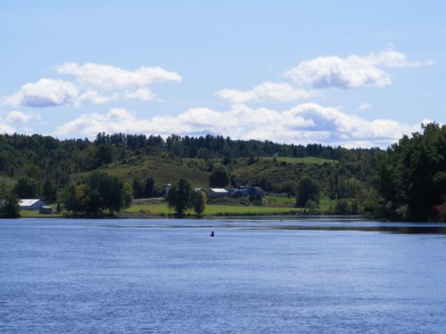
The scenery isn't just “flat” canalside views. There are vistas with a bit of hilly terrain and variations in the vegetation so that you won't be bored creeping along the Canal. You will go by the Saratoga Battlefield National Park and be able to see how the elevated terrain would be a great lookout post over the river.
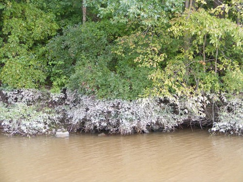
After we left Lock 9 we could see a 4' high water mark as indicated by a deposit of fine mud sticking to the canalside vegetation. That is a lot considering it was in a section with better controllable depths and not the free-flowing river. We didn't realize what water depth deposits we would sadly see as we got further downstream. Flooded lands, with lots of standing water, have become breeding places for mosquitoes, and they are out in full force on our walks.
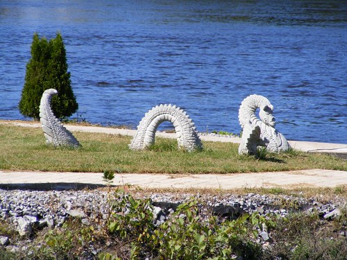
I saw this canal monster basking in the sun in someone's yard.
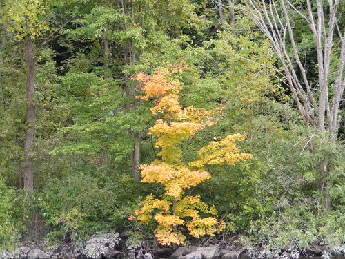
Temperatures have begun to drop into the 40s at night. There is evidence that Fall is coming by subtle changes in the the colors of the leaves on some of the trees. I wish we could be up here for the full color change, but we would be too cold most of the time. Plus, we get so much condensation on the inside of the boat I have to use towels to wipe the window frames.
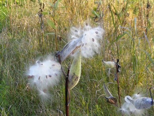
Another sign of Fall are the milkweed plant pods bursting open. Some fields will be white with all the seeds getting airborne when the wind picks up.
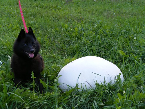
I wasn't sure what I was seeing when I was walking Ursa and saw a big white dome sticking out of a grassy field. Even when I walked over and touched it I still wasn't sure what it was since it felt like smooth leather. Looking around, I could see a couple of other ones which had split apart and browned up. I could also tell it was attached to the ground, so then I knew it was a gigantic puff ball, the biggest I have ever seen. I had Ursa sit next to it to give you a perspective for its size.
Locks 6, 7, and 8 are associated with the town of Fort Edward, NY. Cruisers wishing to tour historic Ft. Edward and/or stop there for shopping errands typically stay at Lock 7. There are 3 choices to tie up. The town wall, with an adjacent park, right next to the Scotties factory, is the nicest and best located, has free electric and water, but if you are southbound you have to go through Lock 7 and then under a low bridge to get to it. Plus, it is located on the Hudson River so if the river is in a rage it's not the best place to tie up. We couldn't fit under the bridge, and the water depth next to the town wall is too shallow for us.
A lot of boaters tie up on the Lock 7 wall, north and west of the lock. When we got there, all those spaces were filled up, so we tied up on the floating dock north of the bridge north of Lock 7. The floating dock is right in front of a tiny park associated with the Old Fort House Museum complex, and it was a good place for us.
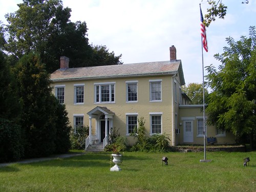
If you want to get tourist information, you need to walk to the Wing-Northrup House, 1815. The Washington Country Historical Society runs the place, and you can pick up brochures and talk to volunteers. The house itself is interesting to see.
Back in the mid-1700s the British constructed Fort Edward to run part of their military operations for fighting in the French and Indian War. The area was known as “The Carrying Place” because it was the end of the navigable part of the Hudson River. Boats would have to unload and then get carried to nearby Lake George in order to keep moving north to Lake Champlain since the Canal didn't exist then. Thus, Fort Edward was in a strategic position to be able to control the waterway from the south and north.
Rogers Island Visitors Center is a good place to visit to learn about the archeology and early history of Fort Edward. Displays indicate Native Americans, mostly the Mohicans and Mohawks inhabited the area as long ago as 6,000 BC. Modern excavations have turned up a lot of their artifacts, including some grave sites. Several yards of local residents have yielded artifacts when constructing additions to homes or basements that required digging.
The Island is named for Robert Rogers, leader of Rogers' Rangers. You can watch a TV segment from one of those history shows which tells the story of Robert Rogers. Rogers was arrested for counterfeiting, but rather than serve a prison sentence, he volunteered to command a renegade band of militiamen attached to the British Army for the Seven Year War. The band was mostly composed of men who had lost family members from Indian attacks, and the men wanted revenge. The Rangers went behind enemy lines for reconnaissance and killing raids, patterning their stealth warfare techniques after those used by the Indians. The British soldiers scoffed at the crude ways of the Rangers, but with many continued successful missions, Rogers reached rank of Major and trained some squads of British soldiers. The Rogers' Rangers proved so successful, many members went on to become leaders of the American Revolutionary War. And now you know the rest of the story.
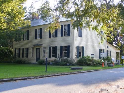
Constructed in 1772 using timbers taken from the ruins of Fort Edward, the Old Fort House was built as a private residence for Patrick Smyth. However, it ended up being used as a headquarters by both the Americans and British during the Revolutionary War. You can tour it and several other buildings on the property.
The most noticeable waterfront activity happening at Ft. Edward is the controversial GE PCB dredging project. From 1948 – 1977 a GE factory on the Hudson River in Ft. Edward dumped PCBs into the river with approval of the NY DEC.
After years of legal presentations, in 2002, several environmental organizations won a suit to have the PCB contaminated sediment removed from the river bottom. GE agreed to cooperate with the EPA on the cleanup. Many people were not happy to have the massive project get underway since all the evidence did not indicate that the PCBs were as harmful as might be thought. Since they were buried deeply and bound under the sediment, some people felt that leaving them there would be okay compared to disrupting the river bottom, building ancillary facilities on the shore, having petroleum powered heavy equipment operating on the river, noise pollution, and a host of other factors. So, they decided to implement Phase 1 in 2009 and see how that went.
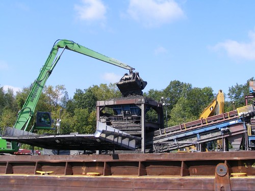
The plan called for the 2.4 million cubic yards of sediment to be dredged from a 40 mile stretch of the river and then transported to a landfill. Dredging operations run 24 hours/day, six days/week. A dewatering facility had to be constructed by Lock 8, about 2 miles from where the dredging is taking place. The “dry” sediment is shipped by train to Texas or Idaho.
To date, Phase 1 has collected 35,000 lbs PCBs from 286,000 cubic yards of Hudson River mud. GE has spent $561M, employing 250 contractors with 500 workers. The total mud which will be removed is conservatively estimated to fill 4 football stadiums. However, the PCBs were found to have sunk even deeper than expected, so the dredges are having to dig deeper, pulling up even more sediment to get to the PCB layer. One landowner whose property is adjacent to the dried sediment mountain complained that dust from the pile blows off to the surrounding lands.
Clean fill is supposed to be dumped into the excavated river bottom and then the area is supposed to be planted with indigenous plants. An archeologist is employed to analyze the dredged material for anything of historical value.
Many barge loads of sediment go through Lock 7 each day, and recreational vessels have to wait for the commercial traffic. Cruisers also have to navigate through the dredge area, communicating with the dredge captains for passage information.
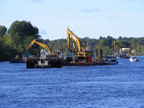
There are multiple dredges working at the same time. Some barges carry the river sediment and some carry the clean fill. At least they go in two different directions so they don't have to tie up the lock. Only the PCB barge goes through the lock.
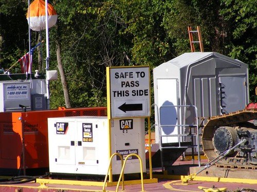
Boating traffic has to pay attention to what is happening with the barges. You can't rely on the chart markers because the barges dictate where the traffic can pass.
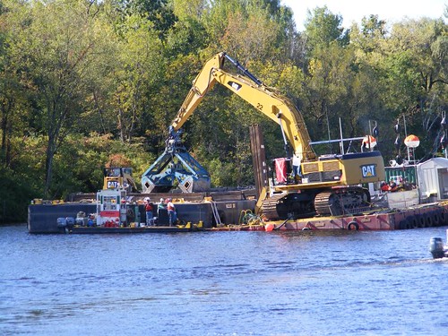
The morning we were leaving we could hear a lot of radio chatter about one of the barges taking on water and being in danger of sinking. Divers had to be brought out to dive under the barge to see what could be done. We went by and never heard the result.
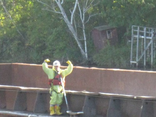
We saw dozens of barges pass where we were docked and wondered how come they looked so clean when we could see the big clam shells dropping the splattering mud into the barge. This guy in the hazmat suit hammed up for Eddie's shot. His job was to shovel the overflow caught up on the edge of the barge back into the hold.
The Federal Lock at Troy finally opened on the 13th, so now all the boaters can get going again. Wayne and Eddie decided to remove the satellite dome and search light, getting us down to 16', a little better margin to get under the lowest bridge which still lies ahead for us. Unfortunately, we don't have to worry about if our antennas are up any more!
Saturday, September 24, 2011
Thursday, September 22, 2011
Trapped in the Champlain Canal: Locks 12 and 11: The Sea Stooges biggest blunder
September 6 – 10, 2011
In the chronological order of the blog, by date, I wrote that we had gone all the way to the southern end of Lake Champlain and had wanted to lock through Lock 12 to get into the Champlain Canal. However, Lock 12 was closed. It's time for an overview of the Champlain Canal.
Completed in 1822, the Champlain Canal connects the Hudson River to Lake Champlain to supply controllable water depths for waterway traffic, a distance of about 60 miles. The Canal travels uphill from its southern end for Locks 1 – 8, and then goes downhill from Locks 9 – 12 (there is no lock 10). There are several rivers and creeks that feed into the Canal which play a role in its ability to remain operational. 27 fixed bridges cross over the Canal, with a minimum clearance height of 17'. If the water is high, like from Irene, the bridge clearance height is reduced, and for us, that is the difference between moving or staying tied to a wall and waiting for the water level to drop down.
Irene and Lee, bringing extensive amounts of rain and runoff, caused many problems to the Canal system. Locks were damaged by flooding, causing some issues with their electrical operation. Debris, including full-sized trees, interfered with the lock gates opening properly. Navigational aids on the Hudson River portion of the Canal below Lock 7 were moved or torn out of place. Excessive waterflow over the dams located adjacent to the locks caused dangerous currents which made it unsafe to open the locks or to allow cruising boats to remain in the area. The Federal Lock in Troy, and several of the lower locks on the Champlain Canal had not operated since August 28.
So, when we arrived at Lock 12 it couldn't be opened because so much water was flowing over the dam, creating a suction effect on the lock adjacent to it, and the lock gate could not be safely opened.
Two marinas are right outside of Lock 12. Whitehall Marina suffered extensive damage to their docks when the hay bales went over the dam and hit the docks, taking several downstream. We could tell just by looking that there was no where for FLUKE.
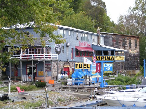
We called Lock 12 Marina, and they had a space big enough for FLUKE. The main building was used as an ammunition warehouse for the U.S. Navy during the War of 1812. The town of Whitehall, NY is located right on the other side of the lock and touts itself as the birthplace of the U.S. Navy. Sadly, we would not get to visit the little town.
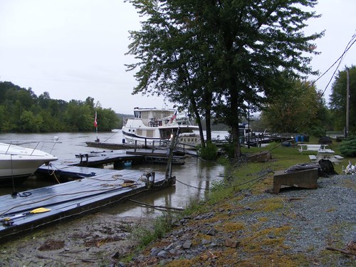
I think we were put on some kind of “annex “ dock since it was cockeyed and offset from the main section. A partially submerged wooden ramp allowed us to get out on the part we were tied to. They only had 30 AMP power, so we couldn't use that and had to run our generator. The potable water line had been damaged by the storm event, so we couldn't top off our tanks, and we were low on water. However, we still had to pay $96 for the night.
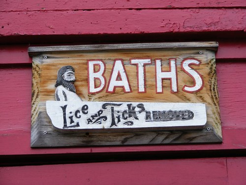
I saw this sign on the lower portion of the building. Since we couldn't get any water, I was wondering if this was a joke or not!
As soon as we were tied up, Wayne and I put on our raingear and walked up through town and over the bridge to the lockhouse to talk to lockmaster Bill to find out what was going on with Lock 12. He explained how the water going over the dam created the suction problem on the gate's ability to operate. The dam at Lock 12, unlike the others on the this side of the system, has controllable flow gates. If the dam gates are closed, water can be held back to an appropriate level in the Canal. The other dams just let excess water flow over with no control gates. He told us to check again in the morning and see if he was permitted to open the lock based on the flow going over the dam.
When morning came, we put on our raingear again and went to talk to Bill. He said, as we were speaking, Lock 12 was open and we could go through. We told him it would take 20 minutes for us to get back to FLUKE, but that we would want to lock through and tie up on the wall above the lock.
Bill opened the lock for us, but said he had no idea how long it would remain open. If he had to open more gates on the dam, he said that we would have to move up to Lock 11 where we would be safer from the rising water. At around 4:00 p.m., Bill knocked on the boat and said he would be opening more of the dam and we needed to move.
It was raining, and Eddie and Wayne needed to take off the ladder that goes to the roof of the pilothouse, since we knew that some of the bridge clearances were going to be too close for us to clear safely. Removing the ladder, gave us 16'9'', not much room for error, and certainly not enough to clear the bridges further on which required 17' at normal water. At least we could make it to Lock 11 though.
We slowly pulled up to the first bridge, taking the boat out of gear just to coast under or be able to reverse the engine if it looked like we wouldn't be able to clear with the satellite dome and search light still on the roof. Eddie stood up in the center back to see if it looked like we could clear. It was apparent that the bridge height measurement doesn't include anything hanging off the bottom of the bridge like lights, pipes, or brackets, so you have to make sure to dodge those things.
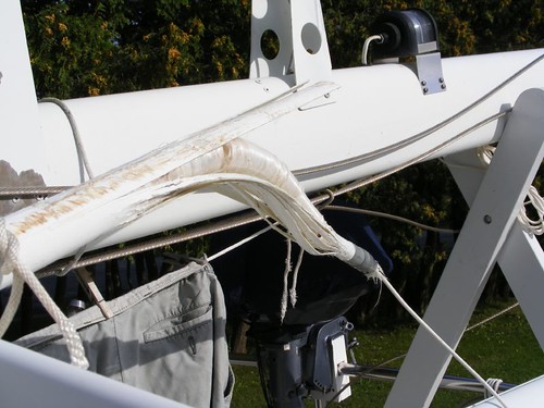
Just as we were easing under the first bridge, we heard an awful LOUD scraping and splintering sound, following by a crashing sound coming from the back deck. We thought Eddie had fallen off the stool he was standing on. Glancing out the back windows we saw that both the VHF and the single side band antennas had not been lowered. They had both been shattered in half, bringing parts of the rusty underside of the bridge down with all the splintered fiberglass from the antennas.
We had established a “procedure” that said whoever put up the antennas was supposed to pull the key out of the ignition and put a card on the helm that says “Antennas up”. Eddie had put up the antennas so there was more room to walk around the back deck, but he never pulled the key or put up the card. I was so angry I didn't go out on the back deck for 2 days because I just couldn't stand to look at the broken antennas. This also presented a dilemma for the need to acquire and replace the VHF antenna before we would be able to head back out in the Atlantic Ocean to return home.
We cruised the 6 rainy, and depressing miles, and locked through Lock 11 and tied up with safety and security behind a couple of old friends we met in 2009 in Waterford, seen in the above photo. My spirits were brightened a bit because I was hoping Capt. Pete would still be aboard the Cleveland, and I would get to chat with him. That came to pass, and we found out that they had been sent up this way to clear debris, and the generator had broken on The Chief, so they were tied up for repairs.
Lock 11 is really in the middle of nowhere, so to pass time the 4 nights we spent there, we went walking on the rural roads to see what we could see.
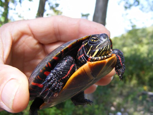
We saved this colorful baby painted turtle from getting run over in the road and moved him into a roadside pond.
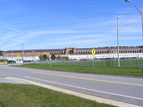
This massive, ominous looking maximum security prison opened in 1911. Seeing this place made me feel good for having made the decision not to kill Eddie for the antenna incident, although I probably could have gotten off with a plea of temporary insanity when all the other things he's done to push me to the brink were taken into consideration. Down the road from it, and across the canal from where we were docked, was another prison, but we could only see the bright lights from it.
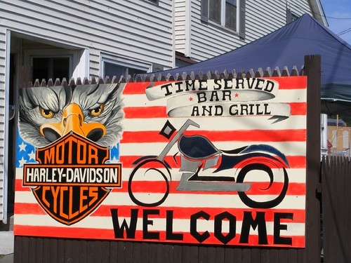
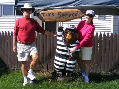
This bar was on property adjacent to the prison, and I laughed when I saw its name, Time Served!
We had fun with the wooden bear out front of the bar.
No other boats had been able to lock through Lock 12 for the first 3 days we were there, so we didn't have any boating company. However, my brother and sister-in-law were at their cabin in Vermont, and came over to visit with us. Their company uplifted our spirits and added some cheer to the gloom that had settled over the Canal. Plus, we went out for a pizza and were able to get some grocery shopping done without having to worry about how to carry everything back to FLUKE.
We all drove down as far as Lock 7 to get an idea what would lay ahead for us when we would be able to move FLUKE further south. The boats on the wall above Lock 7 had been there for 2 weeks, having been trapped there from the storm because the raging Hudson River was on the other side of the lock, and was flowing too fast and high for cruising traffic. However, we liked the looks of the Ft. Edward community at Lock 7 and decided that we would be stopping there when conditions improved enough for the boats already packed in there to move on, freeing up some space for us.
Tuesday, September 20, 2011
Vergennes, Vermont
August 26 – September 2, 2011
The first thing you should notice are the dates which indicate that this is the longest that we have stayed in one place for the entire summer. Of course, that wasn't totally by choice as I indicated when I posted the Irene update three weeks ago when we were “trapped” in Vergennes.
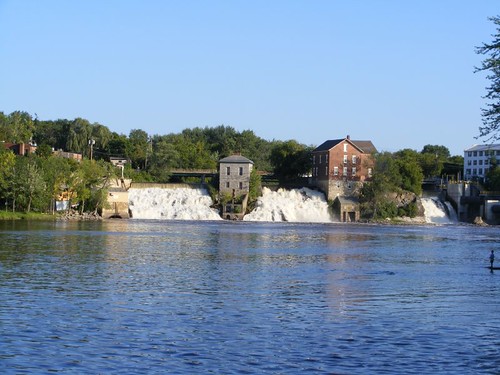
This time I will be writing about what a wonderful little town Vergennes is, another place that should be on every cruiser's list. I would tell you the same thing if you were traveling by car. Otter Creek Falls are so beautiful, except during a storm rage when you are wondering what may be coming over the falls and heading towards your boat not far away.
When we first arrived, we tied up to the floating portion of the dock since the stationary, solid wall had a couple of other boats on it. One of the people off one of those boats said they would be leaving in a couple of hours and that we could move onto the more secure wall after they left. When that time came, a kind boater from Montreal moved his boat, which was smaller, more forward from the wall and helped us with our lines such that we were securely in place. We were happy to be set and thought we would be safe for the storm event.
Historical information says that Vergennes is Vermont's oldest “city”, created in 1788. Because of the 40' high Otter Creek Falls, the village prospered as an industrial center with forges, blast furnaces, and a wire factory.
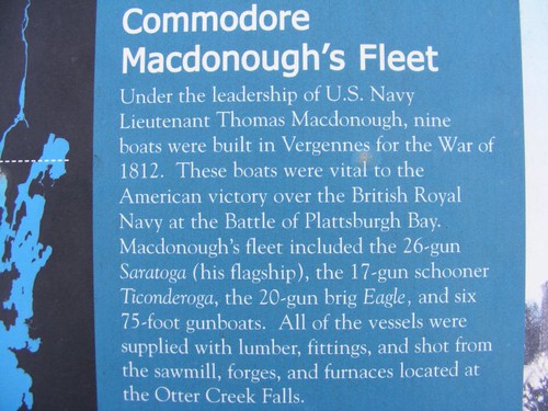
Because of its protected location, 7 miles off Lake Champlain and up deep Otter Creek, and having already established industries, the ship building business took off. After the War of 1812 ended, the Lake Champlain Steamship Company used the shipyard to build 4 lake steamers. Ruins of the shipyard are still visible right next to where we were docked.
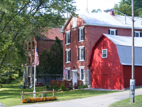
This picturesque distillery building, converted to a private residence, is right next to the public dock. Matt, the current owner, should be given the title of Ambassador of Vergennes since he heartily welcomes boaters and takes it upon himself to keep the creekside park area picked up. We talked with Matt almost every day after he got off work, mostly about the water level in the creek. Eddie and I spent a day after the storm cleaning up the whole park, using Matt's tools that we took out of that beautiful red barn. We collected a giant pile of debris and put it in a pit next to one of the shipyard ruins where Matt would burn it when conditions were right. We felt that we should do something to help the community since we were staying at the town dock for so long.
There is a big house across the street from Matt's dating back to the late 1700s that was used by the military and travelers for boarding. Today it is a private residence named The Otter Side, which I thought was really clever.
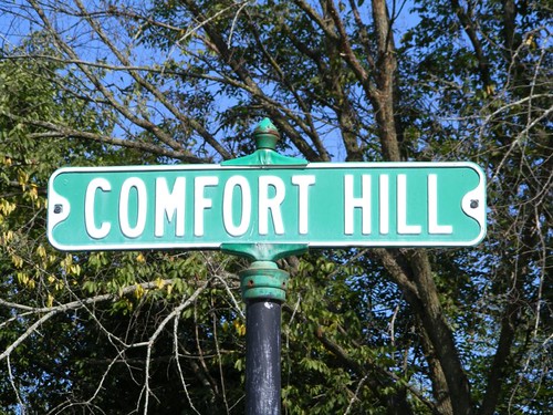
This is the first street adjacent to the town dock. I laughed the first day we got there, knowing that Irene was coming and hoping that we would be comfortable there. The street is on a steep hill; it took me 6 days to be able to walk at a brisk pace to the top of the hill without feeling like I needed to stop because I couldn't breathe or my legs hurt. I am such a flatlander!
Early one morning, Wayne and I were trudging up Comfort Hill, and a little boy stepped out to us, pulling on his backpack, and said “First day of school today. I'm in 3 day!”. He was so proud to be starting school. His older brother stepped forward, with swagger, and said “Well, I'm in kindergarten!” They were so cute and as excited as could be. We told them they were lucky and would be able to meet new friends and learn exciting things.
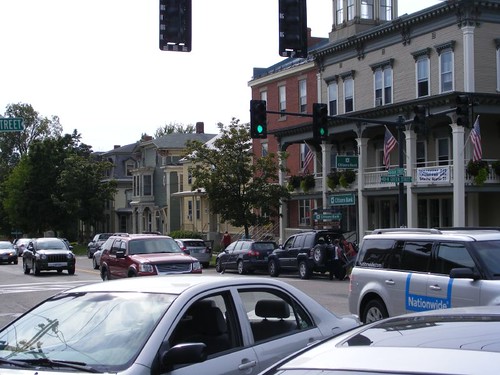
The original city street is still intact and most of the buildings are occupied. There are several good eating places (don't miss 3 Squares for a delicious sandwich), some boutiques, banks, the historic Old Opera House, and a chocolate store, but the ice cream shop is a good walk a few blocks north of the main part of town. It is a delightful place to walk around, and when you need a rest, just stop at the town green located right in the middle of town. Wayne went to one of the banks to change Canadian money back into American, only about $100. The teller told him that the bank charged a flat $20 transaction fee plus the regular exchange rate. He asked if all the banks did the same, and she whispered that she didn't think that the bank around the corner charged anything. That's where he went, and there was no ridiculous fee.
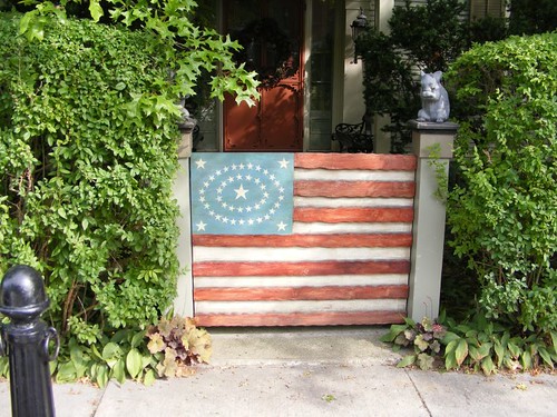
You will walk pass this pretty gate when you head downhill to the ice cream shop. Get a double scoop since you will need the extra energy to walk back uphill to the main part of town again.
It was just a coincidence that we happened to wind up in Vergennes on Saturday, August 27, the town celebration of Vergennes Day. There were several events going on, including a music fest on the town green Friday night which kicked off the event. Eddie went to that and had a late night out.
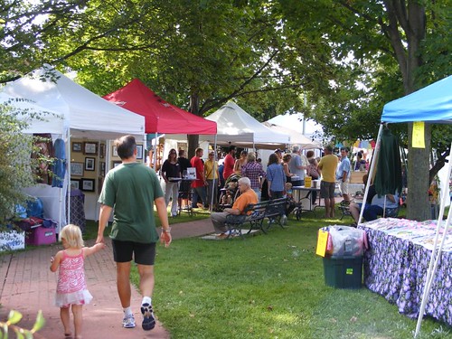
The morning started off with a 5K and 10K run which began and ended right next to the town green. By 10:00 a.m. vendors had set up booths for arts and crafts, baked goods, and public service presentations. Musical groups played live music throughout the day. The Lions Club was getting everything in order to hold their annual chicken BBQ, and I shucked corn for them for an hour to help them out. They thought I was a new person in town and wanted me to join their club until I told them I was on a boat from Florida trying to hide out from Irene.
The Rotary Club's annual event is the Rubber Duckie Race. Eddie and I bought 4 chances each, but our duckies didn't reach the winner's line. To start the race, the ducks are all dumped out below the Falls, as seen in the photo. The fire department stretches a hose across Otter Creek a short ways downstream. The first 3 ducks to touch the hose are the winners: $250, $100, and $50.
The 1862-class replica canal schooner, the Lois McClure, arrived for Vergennes Day festivities. The schooner was built by using plans derived from underwater studies of two schooner shipwrecks on the bottom of Lake Champlain. Lois McClure's home port is the Lake Champlain Maritime Museum, located on Lake Champlain, not far from Otter Creek.
Canal schooners like the Lois McClure were usually run by a family who lived aboard and ran a business of hauling freight of all kinds: apples, grains, timber and stone products. When the schooners were in the canal system, they had to be towed by mules since they had no engine and their masts had to be lowered. However, when they were moving on the Lake, they could hoist sail and move efficiently under their own power. Lois McClure is capable of going 8 KTS, about what we cruise at aboard FLUKE at times. You can see the old tug moving Lois in the photo; the tug is her water mule!
Lois McClure is an ambassador for the Maritime Museum, going from port to port to promote the history associated with the commerce, agriculture, forestry, and fisheries of Lake Champlain. She is open for free tours, and it is fun climbing on her decks and in her hold, wondering what life was like for her owners back in the 1800s.
While the storm event damaged many of the local vegetable crops, a few vendors did show up for the Thursday afternoon colorful market at the town green. We always welcome the chance to buy just picked produce or homemade jellies.
Even though we had been at Vergennes for 8 nights, we probably would have stayed longer. We were planning on heading south to the Champlain Canal, and it was closed with reports of some locks being damaged. Extremely high water levels were prohibiting operation of the lock gates, and until the water drained, the Canal would have to remain closed. Heavy amounts of debris were reported on lower Lake Champlain and on the Canal. So, we really didn't have anywhere to go.
However, when the weather forecast indicated possible heavy rains associated with remnants of Lee passing through our area, we figured we had pressed our luck enough with the dock at Vergennes. Water levels had fallen for 3 days after Irene, but then went back up again as more water drained into Otter Creek from upstream areas. We didn't want to be at the dock or take a more risky ride out the Creek back to Lake Champlain with more water rushing over the Falls.
Getting off the dock with the current and wind trying to push us back onto the dock wasn't going to be easy. We made sure Eddie had on a life jacket in the event he fell off the dock while he was trying to throw off the lines to me. We even talked about what we would all do if he did fall in and got quickly swept away. The water you see in the photo to the right isn't supposed to be there; it is on the land side of the dock, so you can see how high it still is over a week after the main storm event.
Wayne gave FLUKE a power boost to pull away from the dock. Once the current got us, we were swept quickly downstream. The trip out to the Lake went smoothly, but Otter Creek sure looked a lot wider than when we had gone upstream the previous week!
The first thing you should notice are the dates which indicate that this is the longest that we have stayed in one place for the entire summer. Of course, that wasn't totally by choice as I indicated when I posted the Irene update three weeks ago when we were “trapped” in Vergennes.
This time I will be writing about what a wonderful little town Vergennes is, another place that should be on every cruiser's list. I would tell you the same thing if you were traveling by car. Otter Creek Falls are so beautiful, except during a storm rage when you are wondering what may be coming over the falls and heading towards your boat not far away.
When we first arrived, we tied up to the floating portion of the dock since the stationary, solid wall had a couple of other boats on it. One of the people off one of those boats said they would be leaving in a couple of hours and that we could move onto the more secure wall after they left. When that time came, a kind boater from Montreal moved his boat, which was smaller, more forward from the wall and helped us with our lines such that we were securely in place. We were happy to be set and thought we would be safe for the storm event.
Historical information says that Vergennes is Vermont's oldest “city”, created in 1788. Because of the 40' high Otter Creek Falls, the village prospered as an industrial center with forges, blast furnaces, and a wire factory.
Because of its protected location, 7 miles off Lake Champlain and up deep Otter Creek, and having already established industries, the ship building business took off. After the War of 1812 ended, the Lake Champlain Steamship Company used the shipyard to build 4 lake steamers. Ruins of the shipyard are still visible right next to where we were docked.
This picturesque distillery building, converted to a private residence, is right next to the public dock. Matt, the current owner, should be given the title of Ambassador of Vergennes since he heartily welcomes boaters and takes it upon himself to keep the creekside park area picked up. We talked with Matt almost every day after he got off work, mostly about the water level in the creek. Eddie and I spent a day after the storm cleaning up the whole park, using Matt's tools that we took out of that beautiful red barn. We collected a giant pile of debris and put it in a pit next to one of the shipyard ruins where Matt would burn it when conditions were right. We felt that we should do something to help the community since we were staying at the town dock for so long.
There is a big house across the street from Matt's dating back to the late 1700s that was used by the military and travelers for boarding. Today it is a private residence named The Otter Side, which I thought was really clever.
This is the first street adjacent to the town dock. I laughed the first day we got there, knowing that Irene was coming and hoping that we would be comfortable there. The street is on a steep hill; it took me 6 days to be able to walk at a brisk pace to the top of the hill without feeling like I needed to stop because I couldn't breathe or my legs hurt. I am such a flatlander!
Early one morning, Wayne and I were trudging up Comfort Hill, and a little boy stepped out to us, pulling on his backpack, and said “First day of school today. I'm in 3 day!”. He was so proud to be starting school. His older brother stepped forward, with swagger, and said “Well, I'm in kindergarten!” They were so cute and as excited as could be. We told them they were lucky and would be able to meet new friends and learn exciting things.
The original city street is still intact and most of the buildings are occupied. There are several good eating places (don't miss 3 Squares for a delicious sandwich), some boutiques, banks, the historic Old Opera House, and a chocolate store, but the ice cream shop is a good walk a few blocks north of the main part of town. It is a delightful place to walk around, and when you need a rest, just stop at the town green located right in the middle of town. Wayne went to one of the banks to change Canadian money back into American, only about $100. The teller told him that the bank charged a flat $20 transaction fee plus the regular exchange rate. He asked if all the banks did the same, and she whispered that she didn't think that the bank around the corner charged anything. That's where he went, and there was no ridiculous fee.
You will walk pass this pretty gate when you head downhill to the ice cream shop. Get a double scoop since you will need the extra energy to walk back uphill to the main part of town again.
It was just a coincidence that we happened to wind up in Vergennes on Saturday, August 27, the town celebration of Vergennes Day. There were several events going on, including a music fest on the town green Friday night which kicked off the event. Eddie went to that and had a late night out.
The morning started off with a 5K and 10K run which began and ended right next to the town green. By 10:00 a.m. vendors had set up booths for arts and crafts, baked goods, and public service presentations. Musical groups played live music throughout the day. The Lions Club was getting everything in order to hold their annual chicken BBQ, and I shucked corn for them for an hour to help them out. They thought I was a new person in town and wanted me to join their club until I told them I was on a boat from Florida trying to hide out from Irene.
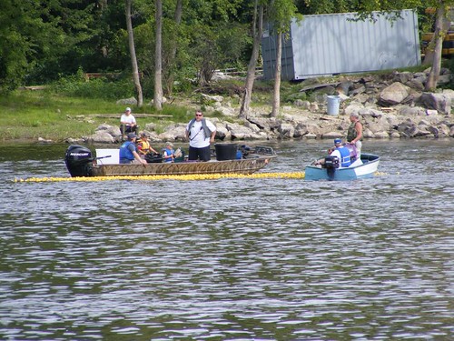
The Rotary Club's annual event is the Rubber Duckie Race. Eddie and I bought 4 chances each, but our duckies didn't reach the winner's line. To start the race, the ducks are all dumped out below the Falls, as seen in the photo. The fire department stretches a hose across Otter Creek a short ways downstream. The first 3 ducks to touch the hose are the winners: $250, $100, and $50.
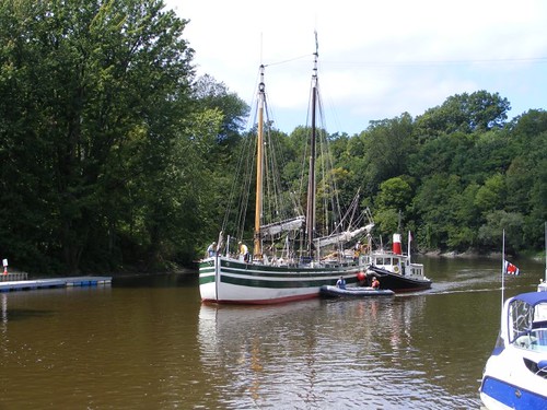
The 1862-class replica canal schooner, the Lois McClure, arrived for Vergennes Day festivities. The schooner was built by using plans derived from underwater studies of two schooner shipwrecks on the bottom of Lake Champlain. Lois McClure's home port is the Lake Champlain Maritime Museum, located on Lake Champlain, not far from Otter Creek.
Canal schooners like the Lois McClure were usually run by a family who lived aboard and ran a business of hauling freight of all kinds: apples, grains, timber and stone products. When the schooners were in the canal system, they had to be towed by mules since they had no engine and their masts had to be lowered. However, when they were moving on the Lake, they could hoist sail and move efficiently under their own power. Lois McClure is capable of going 8 KTS, about what we cruise at aboard FLUKE at times. You can see the old tug moving Lois in the photo; the tug is her water mule!
Lois McClure is an ambassador for the Maritime Museum, going from port to port to promote the history associated with the commerce, agriculture, forestry, and fisheries of Lake Champlain. She is open for free tours, and it is fun climbing on her decks and in her hold, wondering what life was like for her owners back in the 1800s.
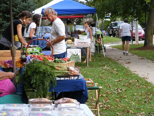
While the storm event damaged many of the local vegetable crops, a few vendors did show up for the Thursday afternoon colorful market at the town green. We always welcome the chance to buy just picked produce or homemade jellies.
Even though we had been at Vergennes for 8 nights, we probably would have stayed longer. We were planning on heading south to the Champlain Canal, and it was closed with reports of some locks being damaged. Extremely high water levels were prohibiting operation of the lock gates, and until the water drained, the Canal would have to remain closed. Heavy amounts of debris were reported on lower Lake Champlain and on the Canal. So, we really didn't have anywhere to go.
However, when the weather forecast indicated possible heavy rains associated with remnants of Lee passing through our area, we figured we had pressed our luck enough with the dock at Vergennes. Water levels had fallen for 3 days after Irene, but then went back up again as more water drained into Otter Creek from upstream areas. We didn't want to be at the dock or take a more risky ride out the Creek back to Lake Champlain with more water rushing over the Falls.
Getting off the dock with the current and wind trying to push us back onto the dock wasn't going to be easy. We made sure Eddie had on a life jacket in the event he fell off the dock while he was trying to throw off the lines to me. We even talked about what we would all do if he did fall in and got quickly swept away. The water you see in the photo to the right isn't supposed to be there; it is on the land side of the dock, so you can see how high it still is over a week after the main storm event.
Wayne gave FLUKE a power boost to pull away from the dock. Once the current got us, we were swept quickly downstream. The trip out to the Lake went smoothly, but Otter Creek sure looked a lot wider than when we had gone upstream the previous week!
Subscribe to:
Posts (Atom)