Sunday, May 27, 2012
Not Really the Royal Treatment
May 16 – 20, 2012
We had watched many boats come up from the south and enter the Little Harbor cut over the two days we were anchored by Lynyard Cay and hadn't heard anyone complaining about sea conditions. So, with what appeared to be a good weather day to make the 60 mile open ocean crossing from Lynyard Cay south to our destination of Royal Island near Eleuthera, we hauled up the anchor after sunup on May 16. We planned to eat breakfast underway.
While the passage over the reef went smoothly, the waters east of the land mass area we left, weren't the greatest for our type of vessel. Winds were forecast to be 10 -15 KTS with seas 2 – 4', but we started out with the high numbers of both categories. We knew if we didn't cross today, conditions were forecast to get worse, and it would be several days before the next opportunity. So, we decided to tough it out.
Conditions were certainly not dangerous, just uncomfortable. Visitor threw up within the first hour – I was surprised he lasted that long. Eating was out of the question for any of us, since no one wanted to go down below anyway. As luck would have it, the engine room bilge light came on, so Wayne had to go down to check it out. The float switch had stuck, so once he fiddled with it, it worked properly for the rest of the time. Since we were in the open ocean, we decided to pump out the holding tank, so Wayne stayed down below for that operation too. By the time he came back up, he wasn't feeling well at all.
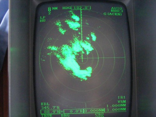
Seas changed for the better once we got into an area with a lot of rain, but less wind than what we experienced in the clearer skies. Fortunately, there was no lightning and no waterspouts. I thought you might be interested to see what the radar image showed for the storm area we were in. All the dark green spots are rain clouds – we are out in open ocean, so there are no land masses that show up on the screen (the boat is right in the center of the image). It was a strange feeling to be traveling in the middle of the system and see some heavy downpour areas and very dark clouds all around us. However, we were relieved to get a break from the wind.
Before we left the anchorage I had dressed for a big day of trolling, with high hopes of catching a dolphin. We haven't caught ANY fish since we've been here, and our palates are clambering for some fresh fish. Plus, the open ocean area we were traversing is a good fishing ground for some of the big game fish. I was looking forward to some action.
However, since the seas were too wishy-washy I couldn't even put the lines out for most of the day. If we did catch a fish, it would be too hard to bring it in with FLUKE rocking around so much.
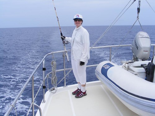
I'm sharing this rather unflattering photo with you and will reveal a personal secret. It's only fair, since I rag out on the guys so much. Because I have to keep covered up to reduce sun exposure, I wear a full set of long sleeved pants and overshirt. I like the clothes to be loose-fitting, white, and lightweight to be as cool as possible, even though they make me look like the Pillsbury Dough Girl. It is an exceptionally chic fashion addition if I happen to have a pair of colored underwear on that day too, and that gets the guys to make derogatory comments. Because my clothes usually get salt, blood, and fish guts on them, I want to wear fabrics that are easy to rinse out and will dry quickly. I like to go to thrift shops and look for these kinds of clothes, so I don't feel guilty getting them torn or soiled like I would if I bought something new. In this photo, however, I have stooped to a new level of thrift, I am wearing a pair of pants that my 88 year old mother gave me!! I'm laughing as I write this because I can't believe I'm admitting to wearing them. Say what you want, but “go girl, good for you” would be nice, especially because the guys think I look ridiculous and make fun of me and say it's a good thing the fish can't see me. I am thankful there are no fishing fashion police. None-the-less, I managed to catch one jack just as we were approaching our destination of Royal Island, and I threw it back.
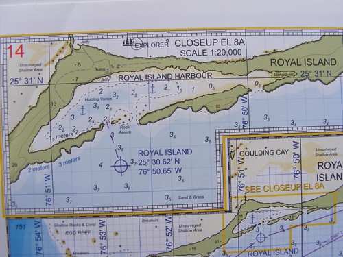
I decided to use this photo of the nav chart we are using so you could see what the Royal Island anchorage looks like. The little island harbor is almost totally surrounded by land (the green area in the photo) so boaters can get good protection from most wind directions. You only enter the harbor straight through the narrow opening between the rocks indicated by the purple dotted line. The numbers within the blue area in the harbor indicate the depth of the water (in meters at mean low tide) and we like to see at least 2 meters (almost 7') since FLUKE draws almost 5.5', and we need a cushion of water underneath so we don't bounce off the bottom. The text says that the holding varies, so you have to look around for what looks like a sandy area and hope that your anchor will bury in it to hold the boat in case the wind kicks up. Since the harbor is very enclosed, waves aren't much of an issue. The numbers in the green (land) part of the chart indicate the elevation, and you can see there are some nice little hills which really help block the wind. The chart also indicates significant man-made features that are on the land, in this case, ruins and a jetty. More about them later on.
It was a relief to get out of the wind, the anchor set and the engine turned off and just feel the quiet, even though the no-see-ums were out in bloodthirsty force. By the time we started eating (we hadn't eaten all day), it was already 4:00 p.m. No tick-tock, eat by the clock, day for the FLUKESTERS. I decided we should all be rewarded for our crossing effort by eating a Fat Boy Jr. I guess since we were exhausted from trying to keep our balance for hours and fighting off sea sickness the guys didn't complain about eating the Jrs this time. We had the company of seven sailboats tucked in the harbor with us the first night.

This is the view from where we are anchored – yucky, huh? I know it is not the usual kind of island scenery I like to share. The story behind it is not an uncommon one for many places we have seen over here, especially in recent years with the downturn in the economy.
Back in the 1930s Royal Island was purchased by a man from Florida who built a grand plantation estate (the ruins on the nav chart) that was used and maintained for over 30 years. After he passed away and his relatives decided they didn't want to maintain the property, it went into disrepair, with nature, the elements, and vandals wrecking havoc on the remains. In more recent history, a group of entrepreneurs decided that it would be a good place for an exclusive out island retreat, complete with a golf course, villas, and luxury marina. Work got underway with some clearing, infrastructure, and a few villas built over the hill from the anchorage in a cove with a pretty, secluded beach. Then the economy went sour, and no more work could proceed. From our observations, it appears that the villa area I just mentioned is in operation. There isn't a golf course; just a reminder that there was going to be one since the shuttle boats have the names of ROYAL TEE and GULF PRO. Guests probably fly in to one of the airstrips on the north end of nearby Eleuthera and then are transported by boat to a protected dock area within the anchorage and then take a land shuttle over the hill to the small resort. My first thought when I saw this dump within sight of our boat, and the resort dock, was what the guests must think when they show up to visit this high end resort for their “idyllic” island get away and see the same dump I see. Not a good first impression to say the least.
So, you can imagine our surprise when around 10:00 our first morning, we got a call on the VHF from a voice saying they were Royal Island. I acknowledged receiving the call and asked what they wanted. The man said that a big construction barge was scheduled to arrive within an hour and FLUKE was in the way of accessing the area where the barge wanted to land so we needed to move. We ended up moving to the area shown on the chart across from the 1930s ruins.
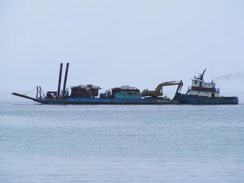
Then we waited for the barge to show up. We could hear it chugging along before we could see it since our view within the harbor was blocked from the hills on the south side of the anchorage. We watched as the tug lined up to push the whole rig through the little opening into the harbor and then lined up perpendicular to shore to drop down the big front gangplank for off-loading the equipment. For about 3 hours, the dump area was partially cleaned up and 3 big dumpsters were filled with debris. The following is what the rig looked like upon departure.
We spent the rest of the day catching up on boat chores. It was too cloudy and overcast to go snorkeling anywhere, and the threat of rain kept us from going on any land tour.
The following day, May 18, with the weather forecast still not good for any in water activities we decided to up the anchor early in the morning and visit Spanish Wells, about an hour away. We figured that we would pick up a mooring there and walk around town, even in the rain. That fun day is covered in the following blog.
We returned to Royal Island in the morning of the 19th. It was early enough in the day for us to finally go ashore and tour the ruins of the original plantation. There are the remnants of what was a big concrete pier with adjacent harbor side roadway. We tied up to the pier area to easily get out of the dinghy. A long cascading steep stone staircase takes you right from the pier to the top of the hill where the buildings are located. The sturdy stone arched walls, terraces, and driveways are still intact and give you a feel for what the place looked like in its prime. There are multiple buildings, like a main house and several guest buildings, a dining lodge and kitchen, free-standing bath, and boathouse, all built out of big blocks of heavy stone. The floors are ceramic tile, colorful and pretty when they were new. The whole property facing in the harbor was terraced to be used as planting areas, with many of the ornamental plants still growing, along with the native vegetation that has reclaimed the land.
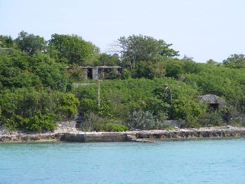
The view from the top gave the residents vistas of the sapphire blue Atlantic Ocean to the north (we could see a big Nassau bound cruise ship in the distance) and the aqua color of the shallow waters to the south of the harbor where we were anchored. There was a road that ran all the way down to the north shore, where there was another pier ruin, built to provide protection for a small cove area, good for swimming. We all walked down there to check out the rubble and look for “treasure”.
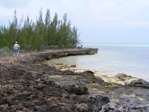
You can see that the shoreline is very rocky and not easy to walk on. Since it was low tide, we were at least able to walk a short distance along the shore. That rocky area is covered with the high tide, and there really isn't much of a place to walk without getting up in the bushes. We found several nice pieces of driftwood, enough such that we all had something to carry back. Even Captain Wayne willing slung one of the large pieces over his shoulder and headed up the hill. Eddie and I carried the largest one (35#) between us and each had two other pieces in our other hands. It was a good workout getting back up the hill and down all the stairs. Eddie thinks the Bahamian Feds are going to pull us over for “stealing” driftwood when they see it strapped to the railings. I told him to tell them we are collecting wood for a beach bonfire.
The sun FINALLY came out in the morning of the May 20th. We decided to head out to the reef area on the NW side of the island and see if we could have any luck spearfishing. While the visibility was good, we only saw a couple of “eligible” fish, and they had seen humans before and weren't letting us get too close. Another fishless day for the FLUKESTERS.
No one had to light a fire under us to encourage us to continuing to move southward when the weather forecast looked good enough for us to make a move the following day.
The End of the Abacos – For Now!
(This is the first of 4 posts I need to do before our 24 hrs of paid WiFi ends this afternoon, so don't miss any.)
May 12 – 15, 2012
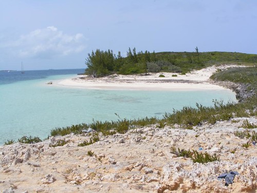
After we left Hope Town we motored just a few miles south to an area called White Sound where we planned to spend a couple of nights out in the fresh air and be able to swim in the clean water. We generally avoid swimming in any of the harbors. You can imagine what goes overboard from the boats and what runs off from the land. Besides, the harbor waters are so cloudy, you can't see anything anyway.
This is a good time to talk about how the refrigerator and freezer are working since we had trouble with them early on. The freezer is running like a champ. No real complaints, other than from Eddie, who says his ice cream isn't hard enough. Do you know how many cruisers even get to carry ice cream aboard, much less worry about how hard it is?!! While I'm on the frozen treats topic, both the guys have complained that I bought Fat Boy Jr. ice cream sandwich bars instead of the “man” size. The Jrs. come 9 to a package, and the others only come 6. So, I decided we would have them periodically for just a little ice cream “fix”, but that's not OK with the guys. Too bad. I did see a 48 oz. container of Breyers for $10.50 at one of the Bahamian markets, so maybe they should pool their funds and go pig out behind a palm tree somewhere.
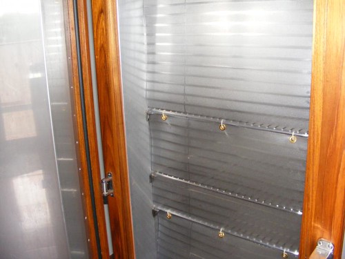
The refrigerator is requiring some babying to say the least. We felt that we have always lost too much cold air out and let too much warm, humid air in whenever we opened the door. So, before we left we put flexible plastic flaps over the front of the shelves as seen in the photo. You can see the left, hinged side of the unit and the flaps connected to the shelves with quick ties. I think it is making a difference and is probably worth the hassle it takes to have to lift up the plastic flaps when you want to look for something in the refrigerator. We usually just lay the flap on our heads so we can use two hands to move stuff around.
The humidity is really making the unit frost up, and we have already defrosted twice. However, we are getting good at it, and it only takes about 15 minutes. We have also noticed that the unit is very sensitive to having warm items put in it, even though you would think their size would be insignificant compared to the size of the refer. To help with that issue, we have started pre-cooling things in the freezer. We caught on early about the necessity of setting a timer after we forgot things in the freezer and had them freeze.
Both Wayne and I have talked to the “experts” at the main manufacturing facility, who assure us that similar systems are used extensively in tropical climates with great success. I don't doubt that either considering how long the company has been in the business and its reputation. However, we still don't think our unit is working like it should and will have to glean more information from the “experts” when we return and have reliable phone access.
Speaking more about the cold – the water is still too cold for us, even with our heavy wetsuits in shallow water. However, Jacquelyn and Lloyd still ply those frigid waters in search of treasures. Unfortunately, I don't take a camera, so can't share pics of what we see in the water, not that there has been that much anyway since we haven't had good weather to get in the water in the first place.
We did have an unusual fish encounter when we were snorkeling along the shoreline. We swam up into a cove where the water was only about 2' deep, bordered by an extensively hollowed out rocky shoreline. Eddie had spotted a float up in the rocks and wanted to go get it. When he was tottering up on the rocks I looked ahead into one of the holes and saw a 15” ocean trigger fish crammed head up in one of the rocks. Apparently, we had frightened it as we swam toward the shore and it tried to get away, but wound up in the dead end hole and couldn't get out. We pulled it out and let it go.
We had some better luck treasure hunting at our next stop, Lynyard Cay. We didn't arrive there until late on the 14th. First thing in the morning the next day, Wayne comes in to tell me that Ursa's pee mat had fallen off its hooks when he threw it overboard to soak and was on the bottom. So, my first “treasure” of the area was having to jump in and go retrieve the pee mat before Eddie was even out of bed. Talk about getting a good wake up swim for the day!
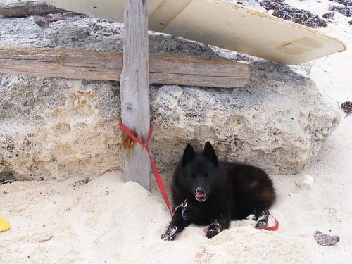
Eddie and I went ashore to scour the south end of the cay for what we see as “treasure” and Captain Wayne many times calls junk. Although, he has been very good so far about not complaining about the things we are hauling back to the boat. Since the sun actually came out for a while, we built a shelter for Ursa so we could leave her in the shade while we scouted around. I looked back one time and saw sand flying high in the air when she was excavating for a cooler spot. The next day her poops were full of sand!
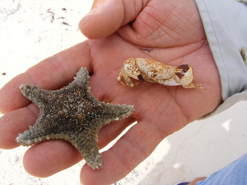
We managed to find quite a bit of sea glass and driftwood pieces, even a few shells. The outgoing tide had left behind a couple of interesting creatures, reflective of their collectors.
When I mentioned this revelation to Eddie, he asked why I get to say those things. I simply replied, “because I am the writer of the blog”.
You can see our dinghy, on the beach. Fortunately, we found a sandy spot, because the tide was rising and with the wind pushing it on shore, we couldn't keep it out in the water. Eddie and I started our beach combing outing with a big argument about where to park the dinghy in the first place, but at least we finally reached an agreement. Sunny days like this have been few (not the arguments though!), so we are hoping that we will find more of them as we leave the Abacos behind and cross the open ocean to the big island of Eleuthera.
Monday, May 14, 2012
Being Cool in the Abacos
May 9 – 11, 2012
Summer temperatures have not yet arrived to the Abacos. With overcast skies, steady breezes from multiple directions, and frontal passages coming off the U.S., we are only having temperatures in the low 80s during the day and into the low 70s at night. Thus, we are truly being cool people without even having to alter our behavior.
In the last post I told you we had to up the anchor since the wind was going to change directions and we needed to find another place to go where we would find some calmer waters. A lot of other people had the same idea as evidenced by how many boats we saw transiting Whale Cay Passage at the same time we were.
Whale Cay Passage is a deep point where the Atlantic Ocean meets the Sea of Abaco, so a LOT of water passes through. It can be very turbulent if the wind conditions are not calm enough to match the tide conditions. In fact, years ago, the Disney Corporation built one of their out island hideaways near WCP. It was a beautiful facility and employed a lot of locals. However, they had to abandon it because there were too many times the WCP was so rough even the cruise ships could not get safely through the passage. Every day cruisers seek information over the radio about WCP conditions to help them make the decision to move from one area of the Abacos to another.
We anchored near a little used area, called Archers Cay, still off of Great Abaco like we had been farther north, not by any area of population. We decided to go ashore to explore an area that looked like it may be under some sort of construction. I told Wayne that the tide was falling, and with the water close to the shoreline being shallow and rocky, we should just anchor the dinghy out from shore and walk in through the water. That way when we came back the dinghy would at least be floating. He said that since we wouldn't be gone that long we could just find a sandy area closer to shore and leave it there. Bad idea.
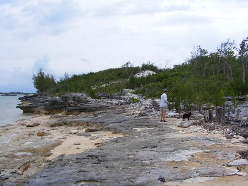
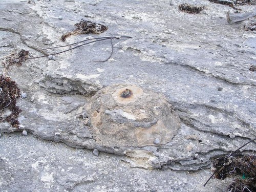
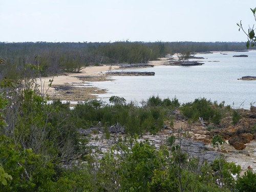
Our destination was across a rocky outcropping, as seen in the photo above, and towards what appeared to be a rise in the terrain. We have investigated many building sites during our tours ashore, they typically have two things in common. One is that the property boundaries are marked with pieces of rebar set in the ground covered with a mound of cement. The following photo shows the one marker set down along the shore. Since it is in an area where the seawater can hit it, the metal has eroded, but the lump of concrete is still there.
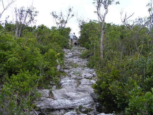
The other property boundary characteristic is that someone comes in early on during the site selection and/or clearing process and cuts swaths through the thick underbrush. They look like trails to us, and they are usually what we take to get to where we think we want to go. Wayne and Ursa are heading up one of these “trails” in the photo below. The rocks you see haven't been piled up; they are what the ground looks like underneath the thick brush on either side of the trail. The plants just grow up through holes in the rock. You have to be very careful where you walk because the holes vary in size from peas to basketballs, and there are a lot of loose rocks.
I think it is always worthwhile to make the effort to reach the tops of any elevated areas. While, it seems obvious what we will see from the side of which we came, it always looks different looking down from above. The colors are more distinct and the distances you can see along the shorelines are longer and give you a different perspective of the shape of the shore and other geographical features. When we reached the top we were so surprised to see a pond in a lower area beyond where we came up and extensive pine lands with a whole different type of plant community underneath. Someone had already begun planting some coconut palms and other ornamental plants on the property.
In this photo, the water is shallow enough to be able to walk from the rocks on the far right of the picture all the way to shore. If we had stayed until low tide, more rocks would have been exposed and the beach would have extended farther from the left.
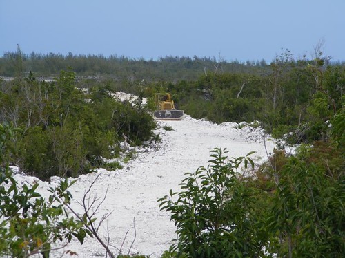
We could see that the home would be built on the high point of the ridge, giving views of the water and the pine forest. However, the land was too steep to build the road straight up, so a lot of fill had to be brought in, and a more gently sloping road constructed. This bulldozer was left right in place when the day's work was done.
When we climbed down and got back to the dinghy, I wasn't surprised to see that the dinghy was no longer floating, and the tide was still falling. Wayne had already started trying to get it into some deeper water, but wasn't making much progress. I knew we needed to act quickly or we would be stuck until the evening hours, and the bugs would eat us up.
We Sea Stooges aren't totally stupid and are able to learn from our mistakes (most of the time!) . Having been really stuck bad once, we learned that if you can get a pipe under the dinghy you can push the dinghy across the pipe and move it a little at a time by pulling out the pipe and repositioning it and pushing/pulling the dinghy over and over until you get in deep enough water to float it. So, we had even brought some PVC pipe pieces from home to use for this “dilemma”. Of course, we hadn't put them in the dinghy yet, so they weren't much use being back on mother FLUKE. We scrounged around and found a cut log that was fairly straight and used that. With a lot of grunts and groans, the dinghy got floated. I wanted to take a photo of this operation, but Captain Wayne was in no mood to allow me to stop pulling and lifting for a Kodak moment.
I would have liked to stay another day in this area and go back to shore for another beach walk and exploring, but some really bad weather was in the forecast and we needed to move to a more protected area. Since we weren't too far from Hope Town, we decided to go there. The harbor is virtually protected from all sides, and moorings are available for $20/night. On the way there, we heard that there were two waterspouts north of us. Thunderstorms were eminent, and we wanted to get secured ASAP. While we have visited Hope Town many times, we had never picked up a mooring inside the harbor. We were lucky to get one of the last ones available since many other boaters had come in to seek shelter from the turbulent weather.
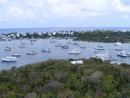
FLUKE is on the far right of the photo. I was glad to be on the outside perimeter since less boats were around us then. You never know how well the moorings will hold and a boat could break loose. With the stormy weather predicted, I asked Eddie to pull out four of our big fenders in case we, or someone else broke loose, so we could be ready for immediate action.
Since we ended up staying 2 nights we had plenty of time to go ashore and walk around and see what was the same and what was new from our last visit.
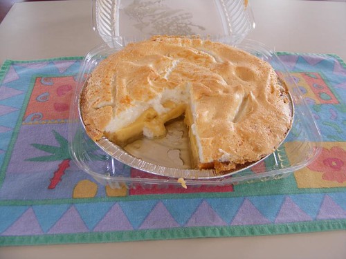
It was still early in the morning so we figured we had a chance at getting a key lime pie from Vernon's Grocery even though we hadn't ordered one. When we got to the store, Vernon said it would be 15 minutes before they came out of the oven, and there would be plenty for us to buy one. We plan to eat a slice for lunch. At $15/pie, this is one of our island treats! I'm not sure how many of these we've eaten in our cruises through the Abacos, but I think I still have some of the fat from all of them in deep storage on my upper thighs.
Hope Town is very colorful, with tropical island paint colors, lots of flowering plants, and the all the colors of blues and greens reflecting off the surrounding water. It is a great town to walk around and look at the details in the buildings, interesting signs, decorations, colorful clothing, and daily activities. One of the things that cruisers like about staying in the area is mostly reliable WiFi access to the internet. We signed up for 1 week's service with Out Island Internet for $35. That's pretty good considering when we were here in 2010 it cost $40. Competition and free enterprise are wonderful. It has enabled several towers and repeaters to be erected down the island chain, providing reliable communication for both residents and visitors.
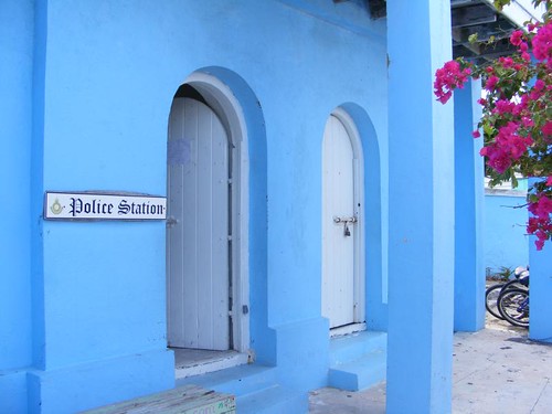
The police station is under the post office housed in a colorful building right in the center of town at the main public dock. While it's bright on the outside, it is quite dark on the inside since there aren't any windows. Notice the thick walls.
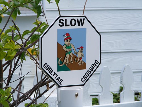
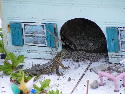
The big curlytail lizards scurry everywhere and drive Ursa crazy. I think they are a neat part of the island fauna and it makes me sad to see them get run over by the now too prevalent golf carts.
One of the locals has a small replica of his own house in his front yard, the Lizard Lodge. When we were looking over the pretty picket fence, we saw this guy sunning himself.
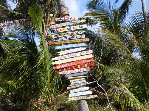
It is an acceptable practice for visitors to the island to place signs on trees indicating their home towns. There are a few of the taller trees that have a lot of signs on them.
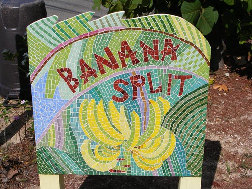
Some of the private homes and guest cottages have unique, island names. Most of them use the house name as their radio call sign. Yes, even the land homes use the VHF radio as an easy, inexpensive, efficient means of communication. While most of the signs are done by hand on a plank or piece of driftwood, this particular sign's owner created a pretty work of art using mosaic tiles.
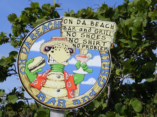
I thought this business sign said a lot about all aspects of island life: color, language, dress, wildlife, and attitude.
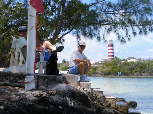
The real landmark of Hope Town is the red and white lighthouse as seen in the opening photo. We can't stop here without a trip to the top of the lighthouse, no matter what the weather conditions.
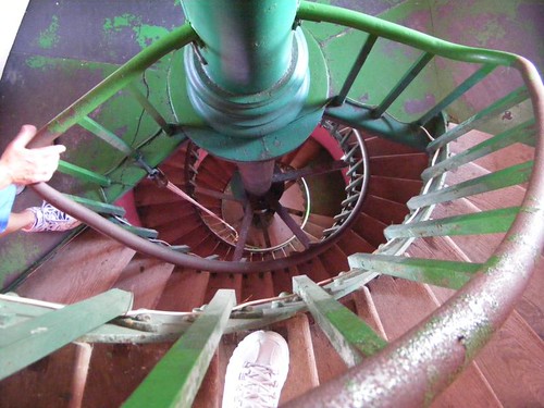
This photo shows the spiraling 111 steps looking down from one of the top levels. You can see my big foot in the foreground and Wayne's hand on the well-worn railing on the left. The wooden stairs are ground very smooth from all the sandy footsteps that have climbed them. The lighthouse flashes from sunset to sunrise and gets its light from a magnified kerosene flame. The kerosene has to be carried up in 5 gal. jugs and added to the burner every 2 hours to keep the flame burning. The current lighthouse keeper took over from his father who had the job for 30 years. The gigantic, 1800# lens “floats” on a layer of mercury. Eddie had leaned on the lens housing, and it began to move, almost causing Eddie to blow one of his stents out. It was amazing how smoothly it glided and how long it took to come to a complete stop.
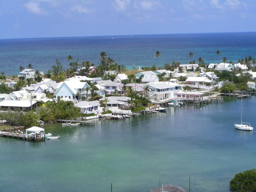
The panoramic view from the top of the lighthouse is wonderful. It is a great way to start and end a visit to Hope Town.
It would be easy just to stay in Hope Town and wile away our time, but the weather improved and we have old and new places to explore. FLUKE is a cruising boat, not a harbor mother, so we need to get going.
Subscribe to:
Posts (Atom)