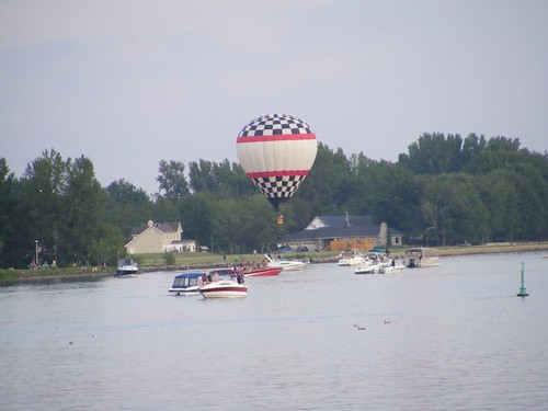
August 22 – September 5, 2011Lake Champlain is supposed to be the kind of place where cruisers could spend most of the summer, exploring the islands, coves, and towns that call the big Lake home. The clean water, striking scenery, historical sights, and ease of travel all add to the list of reasons for making it a destination. When we entered the Lake after coming down from Canada I posted a list in the pilothouse of all the places I wanted to stop. That list pretty much just washed away in all the endless rain storms that plagued us the whole time we were in the area.
I've decided to take you on our tour of Lake Champlain with a pictorial trip from north to south, as we traveled, telling you about a few stops we took along the way. The miserable weather forced us to exit the Lake much earlier than we had hoped. I will highlight a couple of places with separate posts.
We left St. Jean amidst a cloudy, dreary sky, but with the forecast for improved conditions later in the day. We had about 20 miles of nice, river cruising to reach the U.S. border where we would have to clear U.S. Customs.
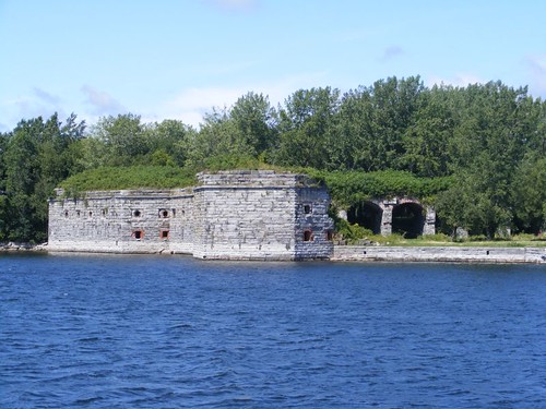 Fort Montgomery
You can't miss seeing these ruins right on the border. Fort Montgomery has also been called Fort Blunder because when the fort was built in 1816 to protect against British attackers from Canada it was built on the Canadian side of the border! It had to be disassembled and moved to its present location. By 1870, for the American Civil War, Fort Montgomery was a structurally sophisticated fortress, complete with a moat. It never saw any action, fell into disrepair, and was scavenged by the locals for building materials. In 1926 it was sold at public auction. There is a big sign posted today that says the 94 acre property is for sale for $2.95M.
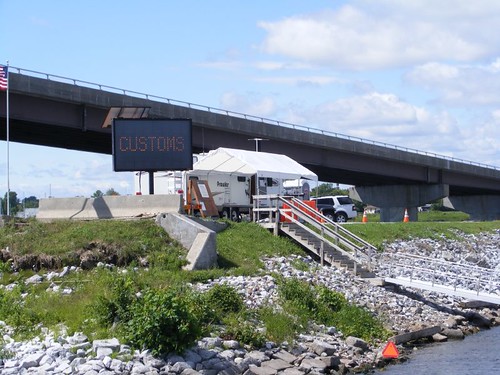 Meet the Feds
The U.S. Customs “office” is right next to Fort Montgomery. We had to stop here to clear back into OUR country. Two Border Patrol Agents were standing out on the dock as we came into view; they watch all the boats going by. If you try to ignore them they will sound a loud horn to get your attention, and if you don't stop they will hop in their own boat and come after you. We know this because we saw them do it.
Their trailer is on the west side of the lake, and the wind was blowing hard out of the west, making it difficult for us to pull up to their weenie dock. They both tried to help us get tied up, but at one point, I thought we were going to pull out one of their plastic cleats since BPA #1 had only managed to get one line secure, and it was taking all the weight. I yelled at BPA #2 to hurry and get a line tied or we would pull the cleat out, so he moved quickly to get it done.
According to our cruising guide info, the procedure for clearing back in says that only the captain of the vessel will go ashore to fill out the paperwork. So, Wayne had everything in order and got off FLUKE to head up the ramp. BPA #1, with a cheerful (later to be identified as a sly fox) smile, said that we should all get off the boat, as though he was doing us a big favor by letting us see what was up under his tent. As we were heading up, he told Wayne that the BPAs might want to board FLUKE to look around (but not when they would), and Wayne said we wouldn't care.
As soon as we were up at the tent, Eddie turned around to see BPA #2 boarding FLUKE! Fortunately, I had taken Ursa with me, but what if we had another dog aboard that might not like seeing BPA #2 by himself? Or what if we left one of our gold bars on the table, and it was gone when we got back on the boat? Or what if BPA #2 fell into a hatch we left open, and his gun went off and punctured the sewer tank, spilling raw sewage into Lake Champlain (that is illegal) – who would be responsible? The whole point is, we have NEVER had any waterway official from any country we've visited ever board any vessel we've ever been on without being accompanied by someone from the vessel. We didn't want to make a scene, but we were rather alarmed about that procedure.
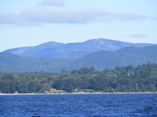 Adirondacks of New York
The mountain views are ever present and are really striking. To the west are the Adriondacks of New York, while the Green Mountains of Vermont are on the east. A Fall cruise during the peak of leaf color would be fabulous.
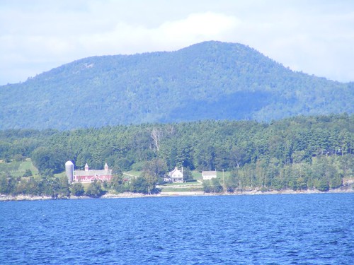 Farm country
Farms are everywhere, and even if you were blind, you would know it because no matter what direction the wind is blowing, you can smell a dairy farm. Early one morning, on a broad, sloping hillside with huge fields, I watched a rider on horseback with a big dog running alongside crossing from one field to another over a ridge and out of sight, so serene.
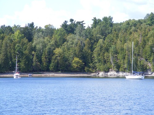
Since the wind was blowing so hard from the west, we decided to seek safety in Pelots Bay. It has great protection for wind and waves because its western side is formed from the bed of an old railroad causeway. There is a little gap in the causeway that allows boats to get into the protected bay.
We sure were surprised to round the corner and see GINGER SNAP at anchor. We had first met Len and Ginger (a.k.a. The Snaps) in Sylvan Beach (Erie Canal) June 29. We had seen them periodically in the Thousand Islands, and had had radio contact in the Rideau Canal, last time being Aug. 2. After we were anchored, they came over for a catch up chat.
The following day the winds and seas had calmed enough for us to have a comfortable cruise down to Valcour Island. That ended up being one of our favorite stops, and I'll cover that in a separate post.
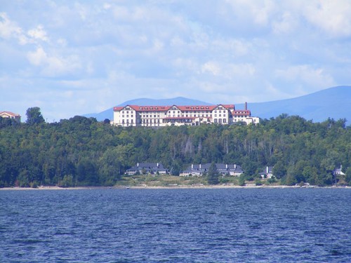 Really, a community college
This is a photo of Clinton Community College. However, that was not what the building with the striking view was originally built as. The setting was the site of Hotel Champlain from 1911 – 1951, and it is easy to see how it would be an upscale lake resort. The property became the college in 1969.
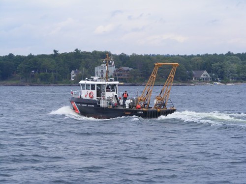 Working rain or shine
We had hoped to spend a couple of days touring Burlington, VT, but with an extended period of bad weather in the forecast, we didn't want to be marina bound or have to walk around in the rain the whole time. So we decided to anchor in Shelbourne Bay, about 2 miles south of Burlington and see what was going to happen with the weather. This Coast Guard ship passed us as we went by the city, where they have a facility. Little did they realize at that point, what havoc Irene would bring their way.
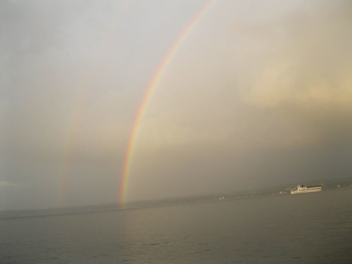 Catching a rainbow
After we got the anchor to set well, the rain turned into a light mist and we were treated to a spectacular, all the way across the sky from left to right, double rainbow. This photo shows a lake tour boat in the mist heading toward the rainbow to let the excited passengers look for the pot of gold at its base. The sky then cleared enough to present a pretty sunset.
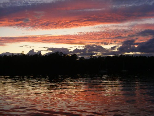 Sunset on the Lake
After a peaceful night in Shelbourne Bay, we had a disappointing weather forecast the next morning. It was clear that our area would be feeling the effects from Irene, and we needed to seek safety from what we thought could be damaging winds or waves.
So, since Vergennes, VT was already on our list of places to visit, and it was located 7 miles up Otter Creek from the lake, we decided to go there. You've already heard about how we weathered the storm there, but I will also write a separate post about delightful Vergennes, minus the misery of the storm.
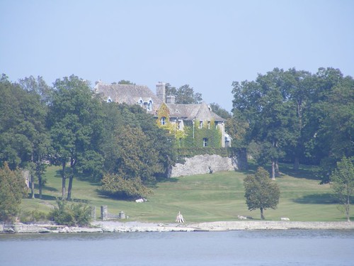 Vintage home
This old estate home, right on the waterfront, was just around the corner from Otter Creek.
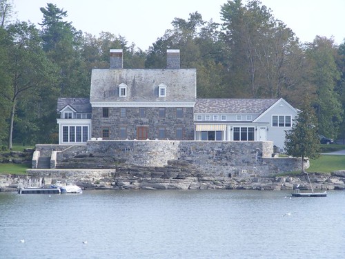 Combining the old and new
After we left Otter Creek, we anchored in Kingsland Bay, right in front of this home. A couple from a local boat came over to talk to us and said the wall in front of the house was a new installation. They did a great job of blending it in with the natural rock of the shoreline. The stone part of the houses dates back to the revolutionary times, like the home in the previous photo.
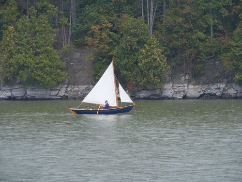 Classic sailing dinghy
We had spent two nights in Kingsland Bay, a nice, scenic harbor protected from all directions except due north. A lot of day boaters use the bay, and a state park with trails and picnic areas is on one of the shores. We would have continued to stay there while we were waiting for navigation information for the Champlain Canal, except at 6:30 p.m. on Sept. 5, the wind abruptly shifted to due north at about 15 KTS. We were pulled 180 degrees in the opposite direction of our anchor, and were getting bounced around like we were at sea. It appeared our anchor wasn't holding well, so we pulled it up and cruised over to Town Farm Bay, just a short distance north. We got good protection from the north wind and sat through an all night rain.
Lake Champlain is about 120 miles long and up to 10 miles wide in some spots. However, towards the more southern end it narrows up so much it seems like it should be called a river rather than a lake.
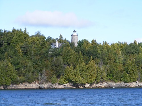 Split Rock Lighthouse
Even in the areas where it seems like the Lake is still wide and should be deep, there are underwater shelves that jut out from the shoreline. Lighthouses were critical for the safe navigation of lake travelers, both recreational and commercial. Most were erected in the 1800s, and restoration programs have salvaged a few of them. There are yellow buoys out on the lake which mark the sites of historic shipwrecks, now underwater preserves, so that divers can visit them.
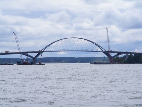 Crown Point Bridge
Crown Point is the narrowest gap between Vermont and New York, and so that's where a bridge was built. It is the only bridge over the Lake until you get to the border where we had to clear customs. While we were in Vergennes, the middle span for the new Lake Champlain Bridge was set in place. To do that, the span was moved down the Lake, straddled between 2 barges, then cranes were used to set the span in place. When we went under the bridge, we had to zigzag through a temporary channel and lots of waterway construction equipment since the new span had not been fully set in place.
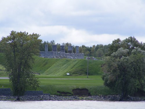 Ft. St. Frederic
Crown Point always played a critical role on the Lake. In the late 1700s, the French erected the first fort there (later a British fort) to protect their holdings to the north. The ruins and expansive grounds are easily visible from the water.
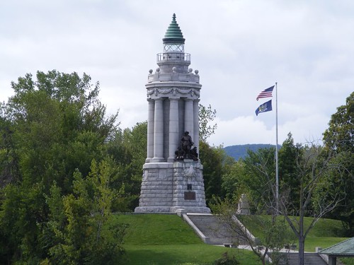 Champlain Memorial Lighthouse
This monument also is at Crown Point, erected to honor Samuel de Champlain. Standing 101 feet above Lake Champlain, right on the shore, it is an impressive sight.
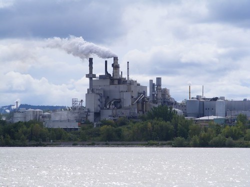 Pulp mill
Surprisingly, this is the only industrial sight we saw on the southern end of the Lake, and it was in a very rural area.
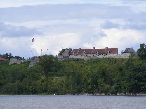 Fort Ticonderoga
We had hoped to stop here to tour the fort, but the weather was so poor we didn't want to leave the boat alone at anchor while we toured the fort. Plus, when we went by we couldn't even see where we could land the dinghy since the Lake water was still so high from the storms.
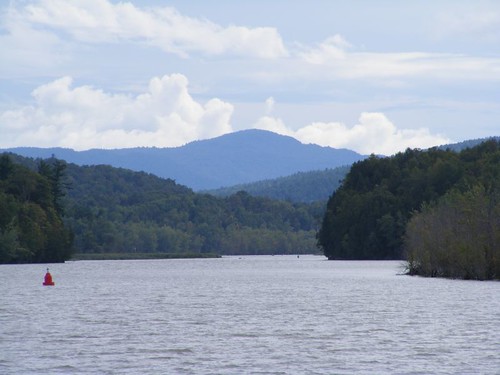 Lower “Lake” view
It's only about 20 miles from Fort Ticonderoga to the beginning of the Champlain Canal. The waterway narrows so much, you are just traveling down a scenic, winding corridor with close mountains on either side.
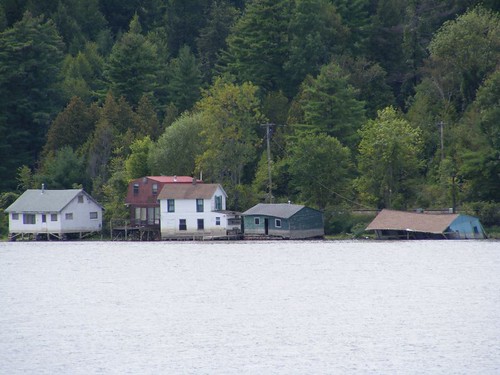 High tide line
You can see the high tide line on the homes in this little settlement. While we weren't traveling at the high level peak, the current against us was strong because the surrounding countryside was still draining the wet lands. A LOT of water was still emptying into the Lake, and every little storm just added more trouble.
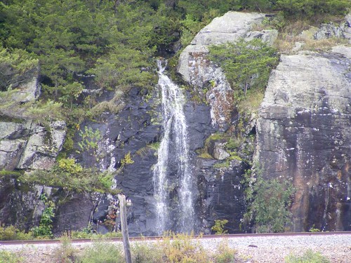 Temporary waterfall
We saw several temporary waterfalls. Some were falling from high cliffs farther north on the Lake. This one is between the railroad tracks and the solid rock wall cut made for the tracks. There were places that we could see where the high water had eroded the railroad track base in little pockets, sure to need repairs.
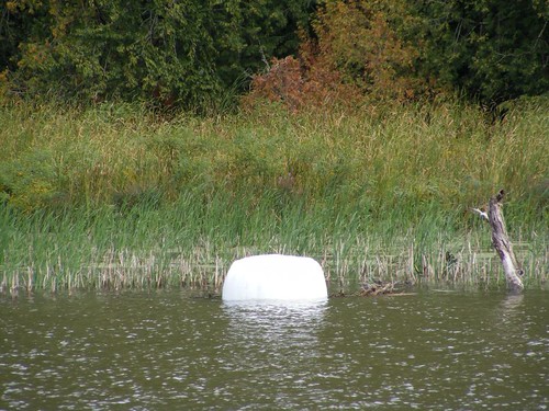 Not a giant marshmallow
This is a newly harvested hay bale wrapped for storage. We saw many of these as we headed south toward the Canal. Lock 12 is the first lock we will have to go through to enter the Champlain Canal. It was closed after the storm because of debris piled up in the lock and in the flow control dam. Part of the “debris” were about 100 bales of this hay that floated out of a farmer's field during the storm event. The hay bales clogged up the dam and the lock, causing the water to get backed up and making the dam and the lock inoperable. They brought in a crane to get the bales out of the lock, but they had no choice but to fully open the dam and release the hay bales to flow into the Lake. Fortunately by the time we got there, the bales had all floated to the sides of the Lake and weren't in our way. At least that was one less thing to worry about, because we had to be alert all the time for all the other logs, whole tree trunks, and trash that was floating in the navigable channel.
At 10:00 in the morning of Sept. 5 we had checked the Champlain Canal's website to verify that Lock 12 had opened again. We decided to leave Town Farm Bay and travel the 60 miles to Lock 12, where we would lock through and stay on the town wall at Whitewall, NY.
After traveling all day, and the sun getting low in the sky, we reached Lock 12. When we called on the radio to lock through, the lockmaster told us the lock had been closed again because of rising water. The only thing he could tell us was to check with him in the morning to find out if it would be open.
The closest place where we could safely anchor was 20 miles back, too far to go at that time of day. We were not happy cruisers at that moment as we had to try to see if any marina could take us with no reservation, and we knew that dock damage had been extensive.