June 9 – 12, 2011
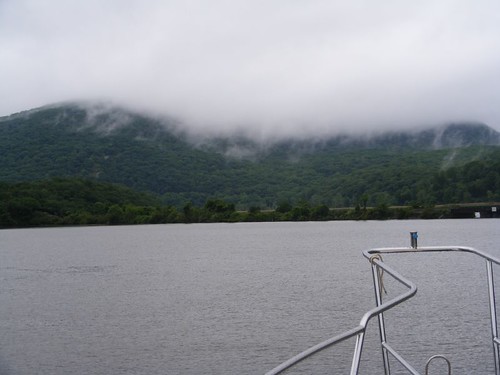
Remember, readers, I told you in the last blog that this trip up the Hudson wouldn't be filled with a lot of historical details. I will be focusing on the “action” of our adventure and the sights we see as we cruise up the river. From the title, you should surmise that we didn't have the best weather to say the least. That means my photos aren't going to be as clear as I would like, but will still help with bringing you along for the journey.
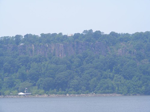
This gives you a perspective of how the New Jersey Palisades tower (up to 522') straight up from the west side of the Hudson. Notice how small the building appears next to the water. The colors of the rock are beautiful and interesting. Fortunately 13.5 miles of this formation received protection from being excavated for construction purposes around 1900 and remain a park today. In a few places where there are openings at the top we can spot people looking down at the river.
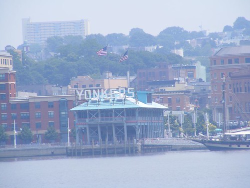
Check out the contrasting view on the eastern shore, complete with all the hustle bustle noise of the city life. Amtrak trains seem to run continuously in both directions with their whistles blowing.
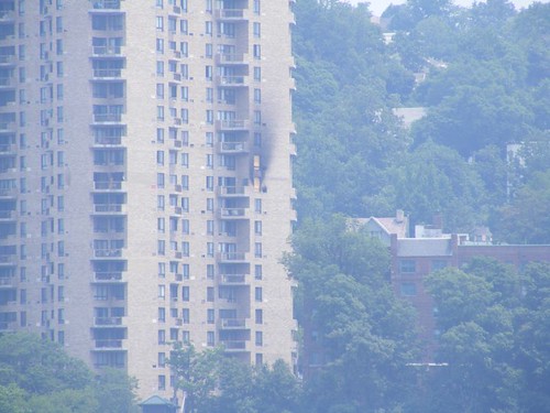
I think it is amazing to see a fire in a high rise building and wonder how it is able to be contained so well to just one or two units. Credit surely is due to the skills of the city fire fighters and their high tech equipment.
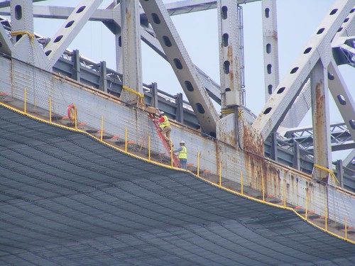
The Tappan Zee bridge, at 2.5 miles long, is the longest bridge across the Hudson. The New York State Thruway runs over it. All the Hudson River bridges, like those on the C&D canal, have to have at least 135' of clearance since ocean-going freighters use the Hudson to go about 140 miles up to Albany, NY. It was difficult to determine what kind of work was being done on the bridge since the entire underside was covered with some kind of safety work “drape”. Barges underneath the bridge held generators and other equipment with lots of cords extending up to the bridge. I think having to keep the bridge cleaned and painted would give a lot of people job security.
We were fighting an outgoing tide most of the way, at some times only making around 5 KTS of speed. Fortunately, we only planned to get to Haverstraw Bay, about 30 miles upriver, and anchor near a place called Croton Point. We anchored there before and knew we could have good holding. Getting to the anchorage in early afternoon, we had plenty of time to get settled and acquire internet weather information. Judging from the rumbles coming from the far side of the mountains on the west side of the bay, and the darkening skies, we were in for some potentially turbulent weather. It appeared that the bad weather would be coming from the northwest, the worst possible direction for us. Haverstraw Bay is very wide and open from that direction and we were on its opposite side, so there would be plenty of room for the wind to come all the way across the bay.
Shortly after we arrived, a 40' trawler also arrived and rafted up with a Sea Ray, about 34-36'. So, both of those boats were sharing the Sea Ray's anchor, and they were in very close to shore. We were quite a ways from shore since we don't like to be around other boats, and just in case bad weather comes, we want to have plenty of room to maneuver.
When all the boats had anchored, the wind had been coming out of the southwest, so anchors were set with that direction in mind. When the storm began approaching, the boats were swung around, opposite to how their anchors were set. I kept waiting for the trawler and Sea Ray to split up and set their own anchors with the pending storm. That never happened.
With some flashes of lightning and huge gusts of wind, the storm came barreling over the mountain to the west. Eddie yelled that a waterspout was trying to form and was whipping by our starboard side. I grabbed the camera to try to take a shot. In the photo you can see the white strip on the water; on the right hand side the water is being raised up into the air. It couldn't fully form because it ran out of water and dissipated when it hit the nearby land. The rain pelted down in full force; we couldn't see the other boats behind us, towards the land. Next came the hail, extra loud since it was hitting our solar panels. Wayne started our engine, expecting that our anchor would get pulled up when we saw 46 KTS (53 MPH) on our wind gauge. Hooray – we held tight and rode out the rest of the storm!
When we could finally see towards shore, the trawler and the Sea Ray had been blown all the way through a roped off swim area and were banging into each other on the sandy shore. Looking through the binoculars I could see both boats had some scrapes and bent railings. Local townspeople began showing up even though it was still raining. A land police car pulled up, followed shortly thereafter by a water sheriff and NYS water police. Sea Tow came and pulled away the Sea Ray. The trawler captain wouldn't let Sea Tow pull him off the shore because the tide had fallen, putting the trawler even higher up on shore. We heard him say on the radio that he would wait until the high tide in the morning.
The storm cleared through and gave us a calm night. The next morning we only had a short ways to travel, about 10 miles to Bear Mountain where we hoped to spend two nights. Wayne took the travel time to bake a couple of loaves of bread.
Remember before I told you I thought we had figured out how to use the gas oven? Well, you can see we still have some issues to work out. The bread rose so much it hit the top of the oven and Wayne had to tilt the pans sideways to extract the loaves. I burned the cookies I made right after that.
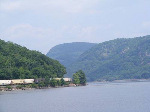
The area a couple of miles south of Bear Mountain marks the beginning of the segment of the river called Hudson Highlands which runs for 11 miles to the north, with some of the most spectacular scenery on the river. The river narrows and twists between this part of the Appalachian mountains. The train tracks on both the east and west sides of the river run right along the edge where they were the easiest to build although we have seen several tunnels. All the mountains have many wonderful hiking trails with sweeping vistas at their summits. We hiked up Anthony's Nose during our 2009 cruise, and when we were at its summit looking across to Bear Mountain on the west side of the river, we said we would have to come back to hike up Bear Mountain too. So, that was our plan.
We safely got the hook set in almost the exact same spot we set it the last time we anchored at the base of Bear Mountain. Since the days are longer now, we figured we could hike up and down the mountain before dark. But, we had to EAT lunch first, building up our strength for the big climb since the fat reserves don't help for that.
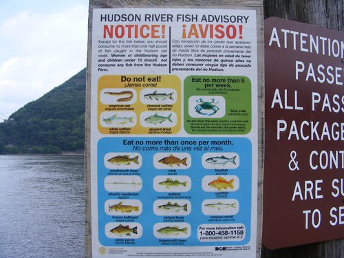
We didn't eat fish for lunch. After we launched the dinghy and got to the public dock on shore, I saw this sign. I never heard of anyone eating goldfish from the wilds, not that I've heard of eating a lot of those other fish on the list either!
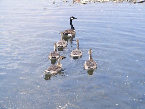
We had to pass by Hessian Lake, a beautiful, scenic mountain lake that is located part way up the mountain. It is large enough such that the park rents out small paddle boats and row boats to tour across the lake. The rental season hadn't started yet, so the Canada geese had the lake all to themselves, new families with their broods in tow.
Our plan was to take the Major Welch trail up the mountain and then to use the Appalachian Trail to hike back down the mountain. That way we would get to see two different sides of the mountain and use two different trails. The trail head for the MW trail is about ¾ of the way across the west side of Lake Hessian, and you have to look carefully to see the marked beginning. Once you get going, it is easy to find most of the trail marks. While the trail is not improved, it offers fairly good footing, is not too steep, and doesn't have a lot of loose rock areas.
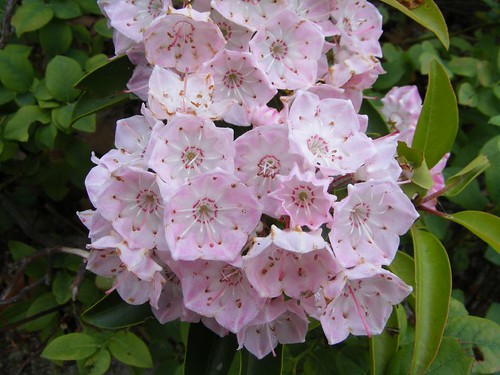
On our hiking day we were truly rewarded with a wonderful surprise. Mountain laurel was in full bloom. The thick boughs of blossoms brightened up the whole understory, ranging in color from bright white to soft pink. I laughed when I would look ahead to see the white flowers clinging to Ursa's black coat from when she would brush up against a plant.
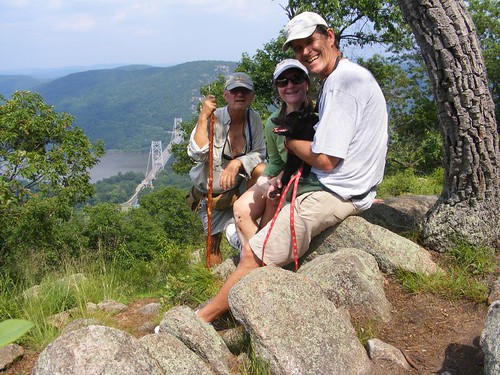
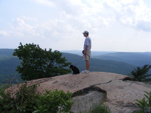
The opening photo is one of my favorites so far. We had all decided to stop for a break before we made the final push to ascend to the 13000 ft. summit (just kidding, it's really 1300'!!). I found the perfect rock to set the camera on so that we could use the delayed shutter close function to get us all in the picture in time. You can't hear all the yelling that was going on from the guys while I tried to get the whole photo staged, but the result was worth it, and we all look happy. The view was truly amazing and brought back great memories from our 2009 trip. You can see Anthony's Nose in the background. When we were on AN, we were right above where Eddie's head is in the photo. The beautiful Bear Mountain Bridge and Hudson River are visible down to the left.
The trail ended in a parking lot at the summit. There is an observation tower (Perkins Tower) that would enable great views over the tree tops that block out some views from ground level. However, it was closed. 3 guys in their 20's, who had gotten out of their car were making fun of Ursa. I heard one of them say she looked like a pig. I went over to him and said “This pig is 13 years old and has just walked all the way up this mountain from the river!” They were rightly impressed, asked all kinds of questions about her, and wanted to take her picture.
While Eddie and Wayne went off to visit some vending machines (and hopefully bring me back a cold drink) I was thinking about our afternoon adventure as I gazed off to the mountains in the distance. I've known Wayne for 40 years, and he still puts up with me. Next year will mark the 10th anniversary of Eddie's heart attack and open heart surgery; in Jan. of this year he had 5 more stents put in. While they both drive me crazy, I'm lucky to be part of their crew and count on them more than I tell them I do. So, even when we're down on the river, we're really still on top of the world.
I had a bad feeling when I saw Wayne coming back without a drink. Eddie followed a ways behind, also empty-handed. The vending machines weren't operating. It would be a dry descent since we had drank all our water on the way up.
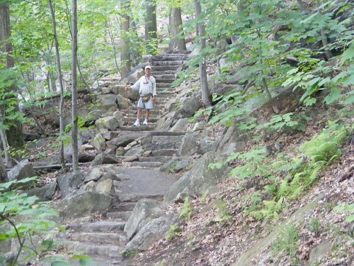
We were surprised to find that the Appalachian Trail was improved most of the way down. Using mostly volunteers, enormous amounts of rock were cut and moved to make sturdy steps and flat areas for the trail. There are even small bridges that help close big gaps between boulders and get over streams. Obviously, this is the main thoroughfare for hikers to use to go up and down the mountain from the main parking area. It is also much shorter in length than the Major Welch trail. Since it is on a different side of the mountain than the Major Welch trail, the vegetation is also different, practically no mountain laurel, but still interesting none-the-less. It is much rockier with more open spaces and you can see straighter down the mountain staircase for long distances as you descend.
After we got back to FLUKE, we had some unexpected visitors: a swan family. I had never seen the swans venture far from the shoreline to go to any boats or to the public dock area to beg for food from the fishermen. The male was in the lead and went over to the dinghy and bumped it several times; he may have thought that white dinghy was a threat. Since we wanted to be able to get some pictures of the whole family, I threw some Cheerios into the water for them to eat. All family members readily gobbled them up; the 3 babies on Mom's back slid off so they could get some too. If I extended the camera too far from the transom's cap rail, the huge male would start to hiss at me. The babies looked so downy soft and cuddly; I wanted to pick one up and snuggle it. There was no chance of that happening with Mom and Dad keeping close watch.
The next, miserable, rainy day (most of the time we couldn't see the top of the mountain) was brightened up by the company of our friends of 30 years, Kathy and Joe. They only live about an hour away, so we had scheduled a rendezvous pending weather conditions and our ability to safely anchor at Bear Mountain. You know who your friends really are when they bring blueberries, strawberries, and beer. Then they were even kinder to so willingly take the recyclables that we had saved up until we could find a disposal site. The day flew by and I was sad to see them leave.
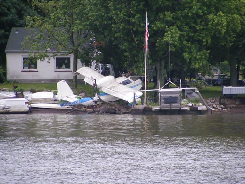
Shortly after leaving the anchorage at Bear Mountain, we passed by a section of riverfront homes and I spotted this airplane kind of tied up to shore in amongst all the other “stuff” stored at the same location.
The U.S. Military Academy at West Point is only about 5 miles from Bear Mountain. Since we had hiked the mountain and met with our friends I had decided not to belabor the issue of trying to stop somewhere nearby so we could tour the facility. Prior to 9/11, cruisers could dock their boats at the Academy's riverfront docks. At least we can still cruise right by the place and not have to observe any zones of security mandating we keep a certain distance away. The beautiful facility takes up about 2 miles of winding, mountainous riverfront with spectacular views, including the section of water with the deepest river depth, 216'.
Our cruise northward through the Highlands ended as we passed the rocky face of Storm King Mountain jutting out into the river. After this, the river opens up quite a bit and becomes Newburgh Bay. We pass large cities like Newburgh and Poughkeepsie, but most of the riverfront towns are small, with old buildings still standing from the days when they were just another stop on the early riverfront highway for tradesman, hunters, and mariners. Captivating historic lighthouses still stand, most restored and beautifully maintained. I took photos of all of them in the 2009 trip and wrote about their significant features.
With the skies being overcast and the temperature on the cool side, deer were visible on some of the hillsides. I saw bald and golden eagles and several species of ducks in the rural areas. There wasn't much boating traffic, and even less cruising traffic than we remember in our 2009 adventure.
Apparently this little riverside town of Coxsackie (pronounced Cook sackie for some reason) doesn't have to worry about fighting any highrise fires like we saw back in Yonkers. The water show entertained us as well as some of the locals.
Our goal for the day was to get to the Schodack Creek anchorage before dark where we would be protected from any passing boat wakes since it is mostly a dead end creek. The time had come for the mast to be lowered to enable us to pass under the bridges and lock gates on the Erie and Oswego canals. It is a scarey job, requiring the stays holding up the mast to be unscrewed (the guys are working on the main one which sits on the pilothouse roof in the photo) and then slowly lowering the mast using a come-a-long that we hope never slips too quickly.
Once the mast is lowered it is set in a cradle. All the loose wires get tied up out of the way. It is a pain having to duck under the mast to get from one side of the upper deck to the other. Also, we end up losing our best place to be able to hang wet clothes and towels. Since our radar and anemometer are located on the mast, they get taken out of service too. We really don't need the radar on the canals for boating traffic anyway.
We awoke the next morning to some welcomed sun. We didn't have a long day planned since our goal was to try to get into Waterford, NY by midday. We hoped by arriving at that time the morning cruisers would have left the dock at the Waterford Visitors Center, and the later day cruisers wouldn't have arrived yet, meaning there would be space for us.
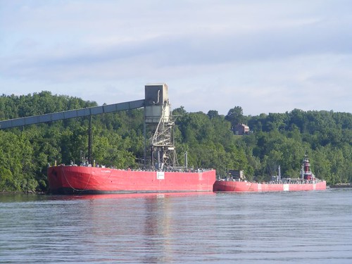
The last segment of the trip goes through some industrial areas, including several stone and gravel operations. In fact, when we are traveling up the Hudson, we hear tug and barge operators talking up pushing their loads to or from these areas.
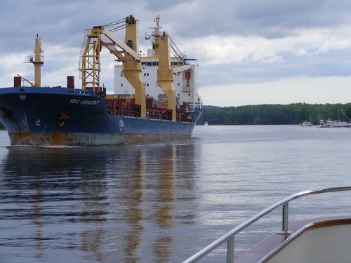
This freighter passed us, just south of Albany, NY. You can tell it is not filled up by where the water line is located on the hull. Ideally all of these ships would like to drop off cargo up river and pick up new cargo to take down river. But not in this economy!
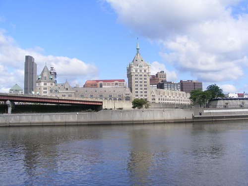
I find it very strange that the city of Albany, being the capital of NY, doesn't really showcase its waterfront. One area is nothing but expressway. Other areas are devoted to marine shipping, fuel storage areas, and just look industrial. There aren't even any waterfront condos. Having never stopped there, because it is not convenient, I don't know the history of how the city developed away from the waterfront, which in most large cities is the most valuable property.
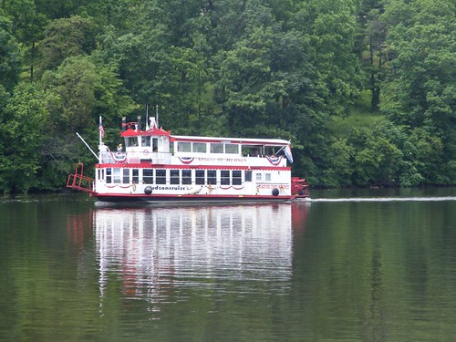
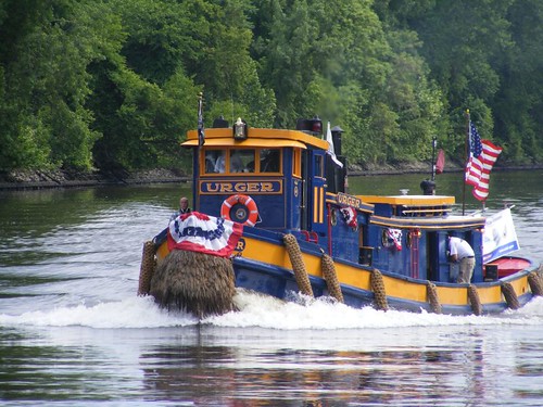
The New York State Canal System has many operating vessels of historical importance that are still used for work and educational purposes. URGER passed us on flag day, all dressed up for the occasion. Notice the old-fashioned rope fenders and “beard” on the bow.
The Troy Federal Lock marks where the Hudson River had a series of cataracts and navigation through that area was not possible, so northbound boats are now lifted up over the current day dammed area by going through the lock free of charge. Notice in the photo that there is an arrow pointing to the right where you enter the lock. Plus, look above the arrow for the green light. That means that the lock is open for our direction of travel and we can enter to be lifted up 16' to the next height of the river.
Once we locked up, we only had a short distance to go with a sharp left-hand turn to get on the Erie Canal, the next segment of our journey.
Monday, June 20, 2011
Subscribe to:
Post Comments (Atom)








and hopefully we can meet up again in August or SEptember and give you Jersey tomatoes, peppers, and beer!
ReplyDelete