With the weather forecast we had in hand, we didn't think that the rougher waters we encountered leaving Oswego would persist, but they did for most of the 5 hours it took us to reach another protected harbor. As usual, under these conditions, Visitor threw up. At about the same time, a watermelon I had in a basket on an end table got thrown out and cracked open on the floor. So, I had a lot to clean up down below, never a good place for any of us to be when we are getting bounced around.
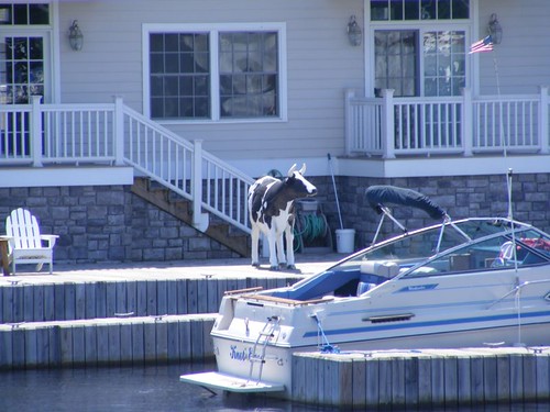
The guard cow
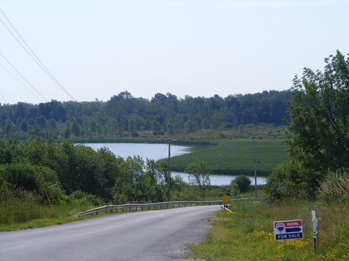
Our destination for the late afternoon was Sackets Harbor, along the southeastern shore of Lake Ontario. From now on, we would have to rely on our charts, cruising guides and reports from other cruisers as to where we could safely anchor or tie up; we had never traveled in these parts before, by sea or by land. One peek into the harbor, and we knew the place wasn't for us. The marina was packed full of boats, and the tiny harbor was way to small for a boat like FLUKE. We said a quick hello and goodbye to this Holstein cow on a condo dock and headed back to sea.
We had to back track 5 miles to Henderson Harbor, and we ended up dropping our anchor in a little protected spot called White's Bay. There was plenty of water for us and good wind protection. A lot of day boaters were out making a lot of noise and wakes, but as soon as the sun set, they all went to their docks. Many of the lakeside communities had fireworks that night, so it was interesting to see all the displays in the distance.
A new problem to deal with
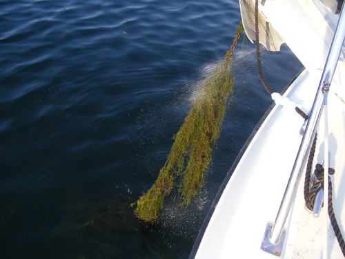
When we hauled up the anchor in the morning, the chain was filled with aquatic weeds, the most we had ever seen. It took a long time to get the weeds off; we couldn't let all that plant material go into the chain locker and turn into stinking rot. We would learn that the weeds were to be the norm, and would cause us many more anchoring moments of aggravation.
FLUKE finds an appropriate dock
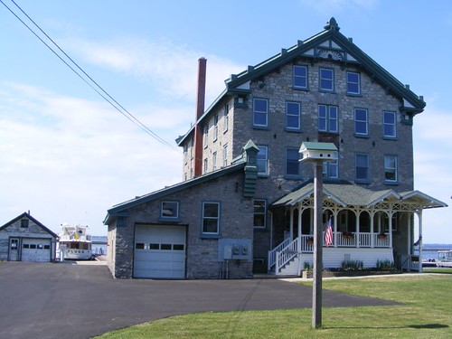
Our destination for the late morning of July 5 was Cape Vincent, NY. The free town dock space was taken up by broadly spaced small boats, but there was room for us at the New York State Department of Environmental Conservation/Cape Vincent Fisheries Station's dock. I thought it amusing that a boat named FLUKE was at a fishery dock.
The attractive 1865 building was originally constructed as a grist mill. As early as 1895 it was converted for use as a fish hatchery. Today it serves as a base for aquatic resource and fisheries research and protection.
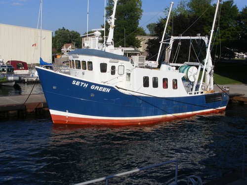
RV Seth Green
This cute research vessel is based out of the DEC facility and would go out from 7-5 daily and be berthed next to us for the evening. The DEC allows pleasure craft 48 hours of free dockage in the unused dock space once built for other DEC vessels, which are no longer berthed at the Cape Vincent facility.
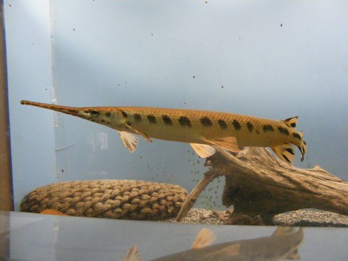
Longnose gar
CV Fisheries Station maintains an aquarium and visitors information center for educational purposes in the basement of the building. Its purpose is to provide information about the species of fish common to Lake Ontario and the St. Lawrence River. Live species of native fish are on display, with information about their ecology. Invasive species are showcased as preserved specimens. The zebra mussels display talks about how effective the zebra mussels have been in helping clean up the waters Great Lakes where they have become established because they filter enormous amounts of water, eliminating the turbidity. This has allowed aquatic vegetation, both native and invasive, to propagate and clog waterways and harbors where a problem had not previously existed.
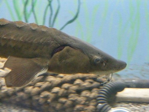
The “prehistoric” sturgeon
The research facility describes fisheries programs designed to protect delicate species, such as the sturgeon which were almost brought to extinction in the lakes and river. The free aquarium is open daily, and you can walk around at your own pace. The grounds are also a park with picnic tables and restrooms, so pack a lunch and make a day of it visiting the wonderful village of Cape Vincent.
Bulking up on the St. Lawrence
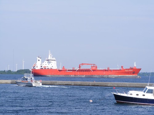
Ship watching is a favorite attraction for visitors. We could see the big, sea-going bulk cargo carriers (grains, coal tar, coal pitch) going right by where we were docked. In this photo, a pilot boat is headed out to drop off a captain that will guide the foreign-registered ship up the St. Lawrence River. You can also see the giant windmills, part of an 86 unit wind farm located on the Canadian island across the river, Wolfe Island. Also, notice the big breakwater between us and the river, designed to keep the big ship wakes from damaging the docking areas.
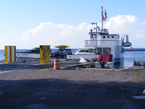
Little ferry on the big river
There is only one ferry that crosses the entire St. Lawrence River, and it goes from Wolfe Island to Cape Vincent and back from May to October, running back and forth continuously all day long, about a 30 minute ride. Another ferry connects Wolfe Island to the big, historic city of Kingston, Ontario, Canada. We watched the ferry cross many times carrying all kinds of vehicles: cars, boats, motorcycles, and bicycles. When I tried to take the photo, a U.S. Customs Border Patrol Agent reprimanded me for going beyond the “proper” boundary, whatever that is supposed to mean, since there weren't any obvious signs. I think there was some concern I might try to mingle with people coming off the ferry before they cleared customs. With 30 million illegal aliens in this country already, this seemed extreme. Not that I said that to the agent, though!
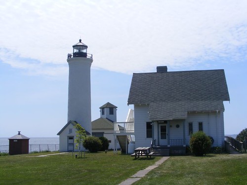
Tibbetts Point Lighthouse
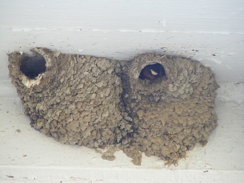
Cape Vincent's tourist slogan is “Where the Lake and River Meet”, and that is best exemplified by the Tibbetts Point Lighthouse, circa 1827. It sits right outside of town on the peninsula of land where Lake Ontario meets the St. Lawrence River, so it played a prominent role in history of providing safe navigation for all kinds of ships and watercraft. In this photo you can the lighthouse, a smaller sound making building, and the keepers house, now an overnight hostel for bicyclists and good place for swallows to build their mud nests!
House on a house
We rode our bicycles out to the lighthouse, a great 3 mile riverside ride since the lighthouse is the end of the road, so there is minimal vehicular traffic. It was a good opportunity to see the town and the river views.
Cape St. Vincent was a bustling community by the late 1800s, mostly deriving prosperity from farming and the river trade industry. It has a strong French heritage because many evacuees and military veterans from the French Napoleonic war settled in the area. In fact, property was acquired for Napoleon to live in if he could be rescued from St. Helena. The French influence is noticed by family names and architectural styles, particularly the use of stone like was seen in the DEC photo. Several, beautiful private residences use stone construction with European detailing. The little Cape Vincent Historical Museum is housed in one of the oldest stone buildings in town and was used as a barracks for soldiers during the War of 1812.
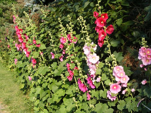
Hollyhock lane
The village is so quaint and really beautiful. The main street has a few, low key shops and restaurants, but they blend in to the feel of the old village. The residential neighborhood of modest, but well-kept homes sits behind the main street, on a gently sloping hill, so if you walk to the end of the street you can see down to the river. Several of the streets that end at the river provide public access, including having a couple of benches where people can sit to watch river activities. Trees and flowers are abundant; there can never be too many of them in my opinion.
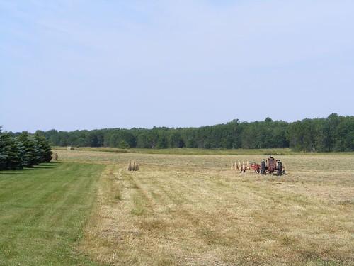
Making hay while the sun is shining
We spent an afternoon on another 3 mile bike loop that took us to the outlying farming areas. It is hay baling time, and what I can't capture in the photo is the glorious smell of this freshly cut hay field. It was the perfect time to stop to catch my breath after trying to peddle up another too steep hill.
A lake inlet
Our goal was to get to this overlook, where an inlet jutted in from Lake Ontario southwest of town. We were surprised to see all the marsh land down the hill adjacent to the water. When we made the turn and were riding the crest of the hill above the marsh, there were old apple orchards, more hay fields, and dairy farms, and even a goat farm.
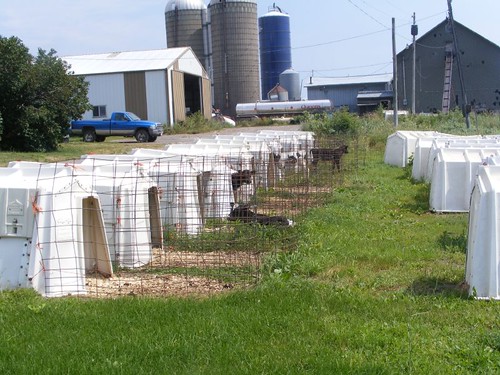
Hey, we've got company
In front of one of the dairy farms, they had a whole row of these calf houses going right out to the road. When we stopped the cute little calves started mooing and came out of their houses to check us out. Eddie and I wanted to go pet them, but figured it would cause a ruckus, either with the calves or the farmer, or both.
Cape Vincent turned out to be one of my favorite ports so far, and it would have been easy to think about spending another day or two. However, the St. Lawrence was flowing quickly and would serve well to move us to our next destination.


I just reread this since we are heading to 1000 Islands on the 19th. In fact we are camping in Cape Vincent at Burnham Point State Park! I took notes on your blog as what to see.
ReplyDeleteWe took a boat tour and found out info about your photo of the collapsing boat house. They sent people in to try to salvage some of the wood but it is in very serious disrepair. When it does collapse they will have to pay a 2 million dollar fine for 'littering'! We don't know why they just don't do a controlled fire to it to save the $.
ReplyDelete