August 3, 2011
Part 10 – Smiths Falls, Where It Finally Happened
It was only 2 miles to reach the first lock at Smiths Falls. I think we were all looking forward to arriving here. A lot of people had talked about it, and the town does the best marketing job of any community along the Rideau promoting itself with a lot of glossy advertising. Turned out for us, the advertising was a lot better than the real thing!
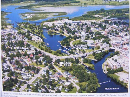
The first thing you should notice is that it looks like we have arrived at a city. For me, it was a culture shock to be in such a congested setting (population 9000). The canal builders had to overcome a 36' drop in a quarter of a mile. One of the contractors wanted to circumvent the falls area altogether, but Colonel By didn't like the alternative which would have been working in extensive swampland with lots of hard rock.
So, in the photo, what we had to deal with was first locking through the detached lock, indicated in the upper part of the photo. If you look closely, up a little, about an inch from the arrow you will see a basin area to the left. That is a wall where boaters can tie up to stay overnight or go shopping at the nearby big box stores of all sorts that have sprung up on the outer part of the original town. Rather than lock through right away since we wanted to do some big grocery shopping, we decided we would tie up to the wall and then lock through after we were finished shopping.
We always pull into the wall area very slowly, and as we were headed towards it, we felt a thump and another thump. I looked over the side, and my heart sank because I could see a rock ledge. I knew that's what we were sitting on. Even though we had hit the bottom in Poonamalie, that really didn't count since we knew we could just push away from the wall, and it wasn't our fault that we touched there anyway. This grounding had the potential for real trouble.
Wayne tried reversing the engine to back off, but we have such limited power that it had no effect. Our only choice was to try to use the same strategy to get pivoting power from the bow thruster. Inch, by slow inch, the bow began turn as we heard the keel getting scraped along. Forget about worrying about the bottom paint, we probably scraped off some gelcoat with that grounding. Fortunately, the keel is very thick, so we have some layers to spare before we have to worry about any leaking or structural damage.
Once we were off, but pointed in the wrong direction to enter the lock, we had to go back out into the lock cut since that appeared to be the only place with enough room for us to turn around again. The lock attendants were yelling at us, asking if we were leaving or wanting to go through. We told them we wanted to go through, so they had to hold the lock open until we made the turn. When we thought we could circle back, we touched the bottom again, but we knew it was silty, so Wayne just powered the bow around with the thruster. By the time we got into the lock, everyone's patience had been tried to the max. We apologized since that's about all we could do.
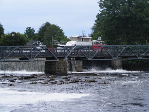
Needless to say, our welcome to Smiths Falls didn't get off to a good start. I was already thinking about leaving as soon as we were tied up! Pretty ironic, since we before we arrived we planned on staying at least 2 nights. Notice we are tied up by another dam, but at least the water running over the dam helped block out some of the traffic noise.
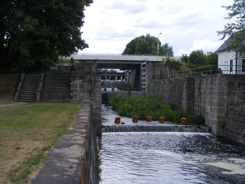
Back to the photo. You can see Combined Lock 29A. In 1973 it was constructed to replace old locks 28, 29, 30 to try to streamline the transits. 29A has the highest lift on the canal, 26'. Unlike all the other lock chambers previously, this one is fenced off all the way around; people can't just walk up to the edge and peer over like they do in the other ones. The lock chamber, hydraulically operated, uses 750,000 gallons for each fill and has its own fire suppression sprinkler system. For historical comparison, the old locks were left in place so people can conveniently view the old and the new. Smiths Falls was the site for the construction of the first locks on the Rideau Canal.
The open area with all the water between detached lock and the combined 29A is park area of varying sorts. On the left, just under the arrow for detached lock is a whole row of RVs, followed by several docks. They are part of a combination campground/marina. Of course the marina supplies hydro. Just above the arrow for combined lock 29A is the lock wall area under the jurisdiction of Parks Canada, and that's where our mooring pass allowed us to tie up, in deep enough water, with no hydro. Most of the green space around the water is city park areas, which get an enormous amount of use for walking, biking, and lock watching.
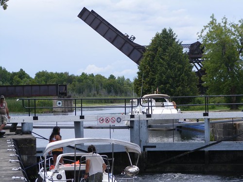
If you look closely above the detached lock you can see this bridge from the overview photo. It is the signature canal marker for Smiths Falls. This bridge is visible from quite a distance upstream as you are making your way through the marshy flats towards the town. The landmark is a National Historic site because it is a rare example of a Scherzer rolling-lift rail bridge (but you probably already knew that, huh?!) which lifts up from one side, rather than swing out. The canal celebrated its 150th anniversary in 1982, and the bridge has been frozen in that position since then.
Some water is diverted into the old chambers and cascades downstream over all the sills. For reasons I have no idea about, huge flower pots are set in the chambers.
We walked out to the new town area with the big box stores and did our shopping. Plus, there was a new laundromat within easy walking distance in the old town area, so I was able to do 4 loads of wash at the same time. Wayne was able to glean helpful and encouraging information from the friendly lockmaster at the combined lock as to what would lie ahead for us and areas we needed to watch most carefully.
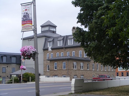
This old mill building is the nicest preserved building in the old town area, visible from the locks. It houses the Rideau Canal museum. I went in and looked around, but since we have been reading every placard and viewing all the videos at all the locks we have stopped at, we decided not to tour this museum.
The residential areas immediately adjacent to the old town area have some fascinating homes from the canal building era. Many of the them are multi-family, duplex type homes that must have been popular in that day to house the growing town centered around the canal building project.
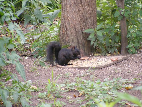
I haven't mentioned that I've been trying to get a good picture of one of these black (the term used is, melanistic), Eastern gray squirrels. When we were walking through an old town neighborhood early in the morning, this one was feasting at a bird feeder and I could get pretty close before it ran away. While I've seen a lot of them, they always scamper off or up a tree before I can get a good picture. My hopes of getting a good loon photo are further diminishing because the canal habitat is changing, and we are seeing fewer of those birds.
After we had been at Smiths Falls for a day and a half, we decided to move on, back out to the rural part of the canal again and better position ourselves for the next lock we wanted to spend time at. This was the first time on the canal that we just looked at each other and said “We've had enough of this place” and left.
August 4, 2011
Part 11 – Kilmarnock Lock
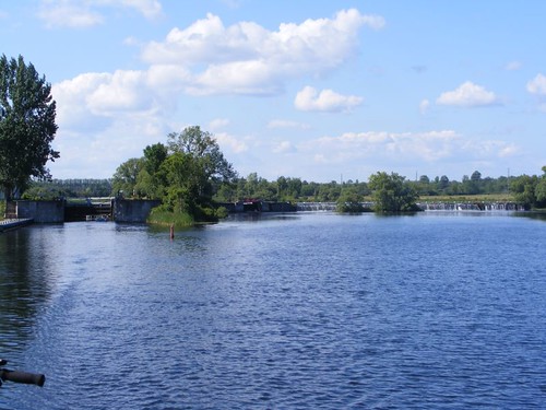
Once you leave Smiths Falls it doesn't take long in terms of distance to get back into the country. We locked through Old Slys and Edmunds Locks without incident. The dam at Edmunds was so long, and the photo gives you an idea of how flat the land has become. No more of the big boulders and rocky rises covered with conifers.
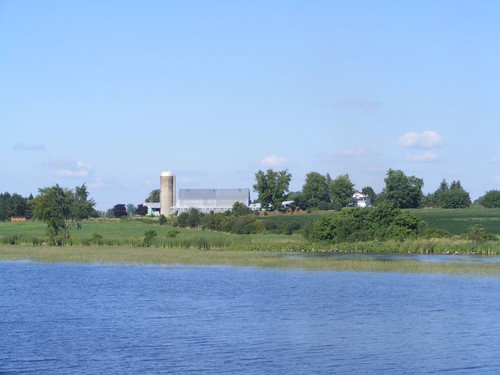
Large farms, mostly dairy, lined both sides of the canal. Corn is coming to harvest and some of the fields go out of sight.
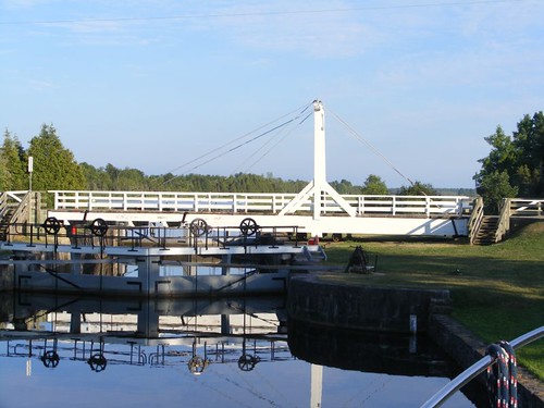
Kilmarnock Lock is really in the middle of absolutely no where. It is the first lock we came to that didn't have any people watching the lock activity, swimming, or picnicking. Although, towards evening some people came to fish. It is as opposite to Smith Falls as you can get; it only has a 2' lift, the smallest on the canal. It has a unique swing bridge. To move the bridge, it is pushed out of a little groove and then just swung to the open position. There is no crank mechanism like I showed you on the other bridges. If you look in the photo you can see cables attached from top to bottom. A couple of times/day, the bridge has to be “tuned” to be able to swing properly. The changes in heat and humidity throughout the day cause it to warp enough such that it will not swing out properly if fine adjustments aren't made.
When we pulled up just short of the lock, the lockmaster and his assistant were standing next to the swing bridge watching us come down the lock cut. When we got close enough, they asked what we wanted to do, and looked surprise when we told them we wanted to stay the night there. Since it wasn't obvious where to tie up (they only had these little rings attached to the side wall), I asked where we should stop. The lockmaster, whose body language clearly indicated he had some kind of attitude, harshly replied and pointed to the spot to stop.
The lockmaster commented that he was surprised we had made it as far as we had. He went on to say that the worse would be ahead of us, and said he doubted that there would be enough water depth for us to make it to the end of the canal. Plus, he knew that the canal level was dropping daily and that the places we had already passed by wouldn't be able to carry us either. He never made any positive suggestions or gave us tips for areas that lay ahead; he was the only, and most negative, lock person we had encountered the whole trip.
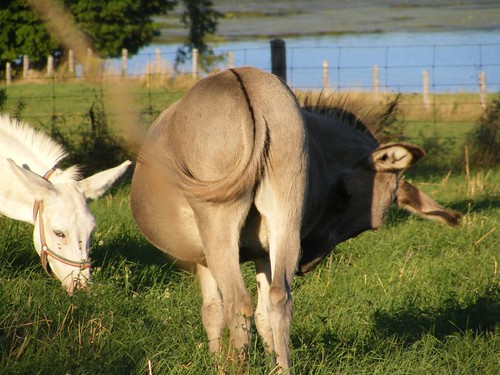
After dinner we took a walk up the hill and along the country road and encountered farm pastures. There were a couple of donkeys in the field and they came over to the fence so I could scratch their heads. The deer flies were eating them up!
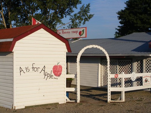
We walked by a beautiful apple orchard. The trees were heavily laden with colorful apples of all sorts. The sign said that the place would be opening in only a week. We were sorry to have to miss it. The orchard is on a hill slope adjacent to the canal and we could see down the tree rows and into the swampy marsh areas of the canal.
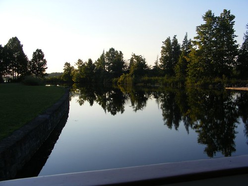
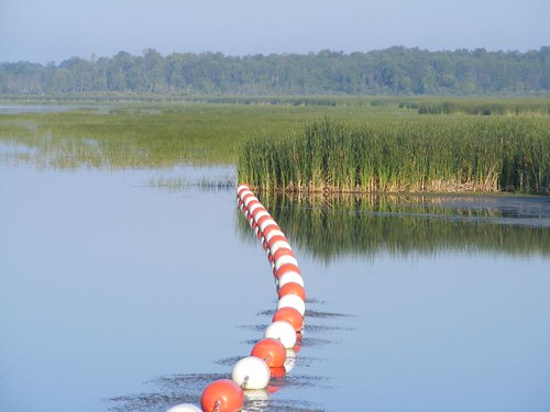
After an exceptionally quiet night's sleep, we went for an early morning walk to look out over the marsh. These colorful dam floats looked interesting in the still waters.
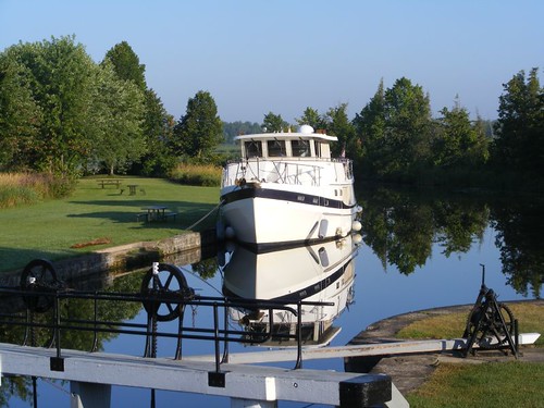
FLUKE looked exceptional, even her reflection in the still water. This photo captures a lot of what I will remember about traveling on the Rideau.
Despite all my anxiety and frustration over that nasty lockmaster, I am happy to say that I may have finally gotten a halfway decent loon photo. I can't show it yet though, because the contest hasn't officially ended and more candidates may be entered. My crewmates will be so relieved when I have completed this miserable challenge.
Monday, August 29, 2011
Subscribe to:
Post Comments (Atom)


Just found your blog and enjoyed following along to this point. Yes..she sure is beautiful. Enjoy every minute of the trip..no matter how boring a lock master can be.
ReplyDelete