May 9 – 11, 2012
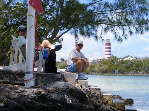
Cool guys with their cool dog
Summer temperatures have not yet arrived to the Abacos. With overcast skies, steady breezes from multiple directions, and frontal passages coming off the U.S., we are only having temperatures in the low 80s during the day and into the low 70s at night. Thus, we are truly being cool people without even having to alter our behavior.
In the last post I told you we had to up the anchor since the wind was going to change directions and we needed to find another place to go where we would find some calmer waters. A lot of other people had the same idea as evidenced by how many boats we saw transiting Whale Cay Passage at the same time we were.
Whale Cay Passage is a deep point where the Atlantic Ocean meets the Sea of Abaco, so a LOT of water passes through. It can be very turbulent if the wind conditions are not calm enough to match the tide conditions. In fact, years ago, the Disney Corporation built one of their out island hideaways near WCP. It was a beautiful facility and employed a lot of locals. However, they had to abandon it because there were too many times the WCP was so rough even the cruise ships could not get safely through the passage. Every day cruisers seek information over the radio about WCP conditions to help them make the decision to move from one area of the Abacos to another.
We anchored near a little used area, called Archers Cay, still off of Great Abaco like we had been farther north, not by any area of population. We decided to go ashore to explore an area that looked like it may be under some sort of construction. I told Wayne that the tide was falling, and with the water close to the shoreline being shallow and rocky, we should just anchor the dinghy out from shore and walk in through the water. That way when we came back the dinghy would at least be floating. He said that since we wouldn't be gone that long we could just find a sandy area closer to shore and leave it there. Bad idea.
The landing party is ready to go
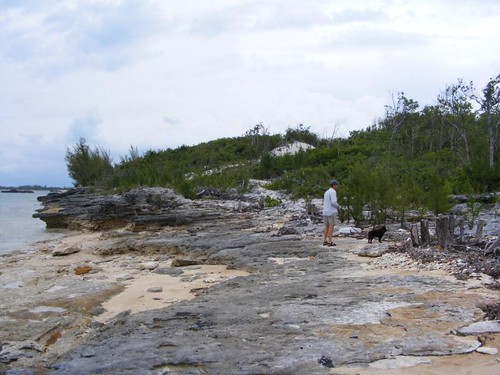
Our destination was across a rocky outcropping, as seen in the photo above, and towards what appeared to be a rise in the terrain. We have investigated many building sites during our tours ashore, they typically have two things in common. One is that the property boundaries are marked with pieces of rebar set in the ground covered with a mound of cement. The following photo shows the one marker set down along the shore. Since it is in an area where the seawater can hit it, the metal has eroded, but the lump of concrete is still there.
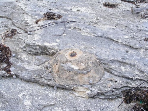
Property boundary marker
The other property boundary characteristic is that someone comes in early on during the site selection and/or clearing process and cuts swaths through the thick underbrush. They look like trails to us, and they are usually what we take to get to where we think we want to go. Wayne and Ursa are heading up one of these “trails” in the photo below. The rocks you see haven't been piled up; they are what the ground looks like underneath the thick brush on either side of the trail. The plants just grow up through holes in the rock. You have to be very careful where you walk because the holes vary in size from peas to basketballs, and there are a lot of loose rocks.
Trailblazers
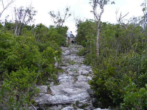
I think it is always worthwhile to make the effort to reach the tops of any elevated areas. While, it seems obvious what we will see from the side of which we came, it always looks different looking down from above. The colors are more distinct and the distances you can see along the shorelines are longer and give you a different perspective of the shape of the shore and other geographical features. When we reached the top we were so surprised to see a pond in a lower area beyond where we came up and extensive pine lands with a whole different type of plant community underneath. Someone had already begun planting some coconut palms and other ornamental plants on the property.
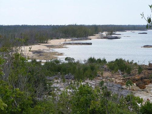
Rocky, shallow shoreline
In this photo, the water is shallow enough to be able to walk from the rocks on the far right of the picture all the way to shore. If we had stayed until low tide, more rocks would have been exposed and the beach would have extended farther from the left.
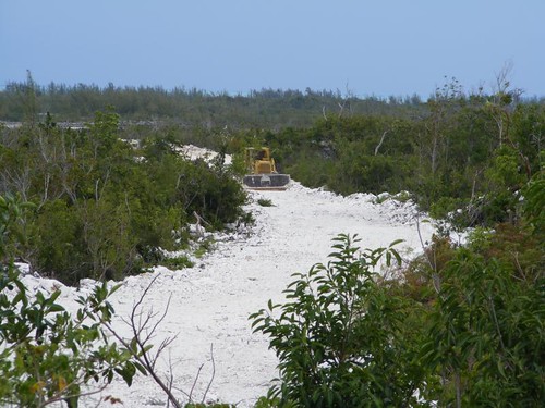
Ridge road
We could see that the home would be built on the high point of the ridge, giving views of the water and the pine forest. However, the land was too steep to build the road straight up, so a lot of fill had to be brought in, and a more gently sloping road constructed. This bulldozer was left right in place when the day's work was done.
When we climbed down and got back to the dinghy, I wasn't surprised to see that the dinghy was no longer floating, and the tide was still falling. Wayne had already started trying to get it into some deeper water, but wasn't making much progress. I knew we needed to act quickly or we would be stuck until the evening hours, and the bugs would eat us up.
We Sea Stooges aren't totally stupid and are able to learn from our mistakes (most of the time!) . Having been really stuck bad once, we learned that if you can get a pipe under the dinghy you can push the dinghy across the pipe and move it a little at a time by pulling out the pipe and repositioning it and pushing/pulling the dinghy over and over until you get in deep enough water to float it. So, we had even brought some PVC pipe pieces from home to use for this “dilemma”. Of course, we hadn't put them in the dinghy yet, so they weren't much use being back on mother FLUKE. We scrounged around and found a cut log that was fairly straight and used that. With a lot of grunts and groans, the dinghy got floated. I wanted to take a photo of this operation, but Captain Wayne was in no mood to allow me to stop pulling and lifting for a Kodak moment.
I would have liked to stay another day in this area and go back to shore for another beach walk and exploring, but some really bad weather was in the forecast and we needed to move to a more protected area. Since we weren't too far from Hope Town, we decided to go there. The harbor is virtually protected from all sides, and moorings are available for $20/night. On the way there, we heard that there were two waterspouts north of us. Thunderstorms were eminent, and we wanted to get secured ASAP. While we have visited Hope Town many times, we had never picked up a mooring inside the harbor. We were lucky to get one of the last ones available since many other boaters had come in to seek shelter from the turbulent weather.
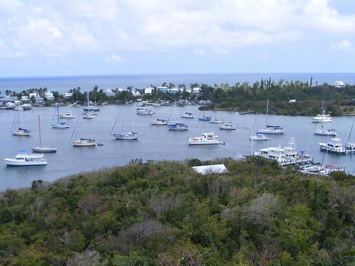
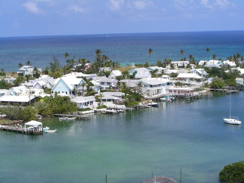
Bird's eye harbor view
FLUKE is on the far right of the photo. I was glad to be on the outside perimeter since less boats were around us then. You never know how well the moorings will hold and a boat could break loose. With the stormy weather predicted, I asked Eddie to pull out four of our big fenders in case we, or someone else broke loose, so we could be ready for immediate action.
Since we ended up staying 2 nights we had plenty of time to go ashore and walk around and see what was the same and what was new from our last visit.
It was still early in the morning so we figured we had a chance at getting a key lime pie from Vernon's Grocery even though we hadn't ordered one. When we got to the store, Vernon said it would be 15 minutes before they came out of the oven, and there would be plenty for us to buy one. We plan to eat a slice for lunch. At $15/pie, this is one of our island treats! I'm not sure how many of these we've eaten in our cruises through the Abacos, but I think I still have some of the fat from all of them in deep storage on my upper thighs.
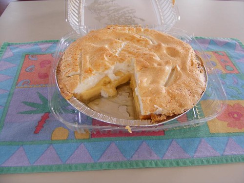
Only 500 calories a slice
Hope Town is very colorful, with tropical island paint colors, lots of flowering plants, and the all the colors of blues and greens reflecting off the surrounding water. It is a great town to walk around and look at the details in the buildings, interesting signs, decorations, colorful clothing, and daily activities. One of the things that cruisers like about staying in the area is mostly reliable WiFi access to the internet. We signed up for 1 week's service with Out Island Internet for $35. That's pretty good considering when we were here in 2010 it cost $40. Competition and free enterprise are wonderful. It has enabled several towers and repeaters to be erected down the island chain, providing reliable communication for both residents and visitors.
A necessity everywhere there are humans
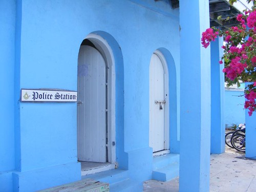
The police station is under the post office housed in a colorful building right in the center of town at the main public dock. While it's bright on the outside, it is quite dark on the inside since there aren't any windows. Notice the thick walls.
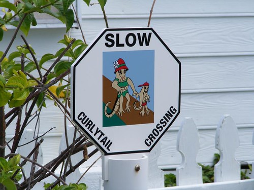
Curlytails have rights too
The big curlytail lizards scurry everywhere and drive Ursa crazy. I think they are a neat part of the island fauna and it makes me sad to see them get run over by the now too prevalent golf carts.
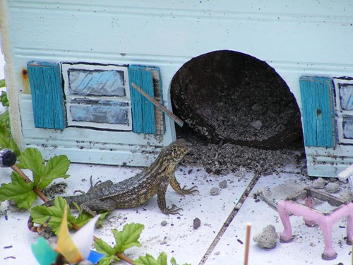
Lizard Lodge
One of the locals has a small replica of his own house in his front yard, the Lizard Lodge. When we were looking over the pretty picket fence, we saw this guy sunning himself.
It is an acceptable practice for visitors to the island to place signs on trees indicating their home towns. There are a few of the taller trees that have a lot of signs on them.
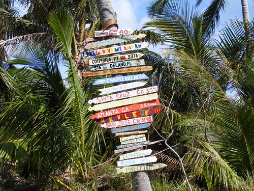
People visit from everywhere
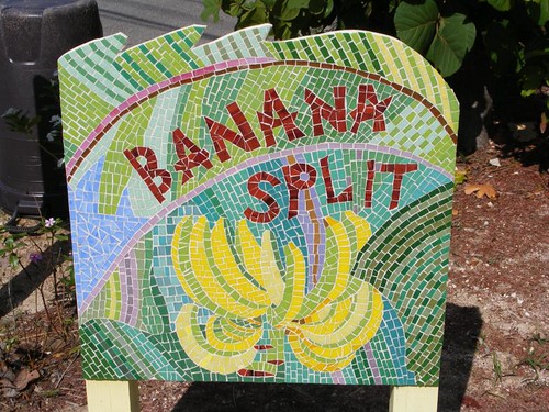
Some of the private homes and guest cottages have unique, island names. Most of them use the house name as their radio call sign. Yes, even the land homes use the VHF radio as an easy, inexpensive, efficient means of communication. While most of the signs are done by hand on a plank or piece of driftwood, this particular sign's owner created a pretty work of art using mosaic tiles.
The house is bright yellow
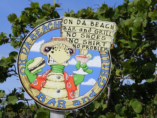
I thought this business sign said a lot about all aspects of island life: color, language, dress, wildlife, and attitude.
Cold drinks with friends, old and new
The real landmark of Hope Town is the red and white lighthouse as seen in the opening photo. We can't stop here without a trip to the top of the lighthouse, no matter what the weather conditions.
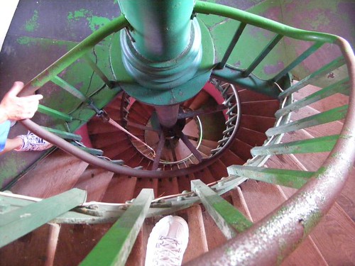
Walk round and round
This photo shows the spiraling 111 steps looking down from one of the top levels. You can see my big foot in the foreground and Wayne's hand on the well-worn railing on the left. The wooden stairs are ground very smooth from all the sandy footsteps that have climbed them. The lighthouse flashes from sunset to sunrise and gets its light from a magnified kerosene flame. The kerosene has to be carried up in 5 gal. jugs and added to the burner every 2 hours to keep the flame burning. The current lighthouse keeper took over from his father who had the job for 30 years. The gigantic, 1800# lens “floats” on a layer of mercury. Eddie had leaned on the lens housing, and it began to move, almost causing Eddie to blow one of his stents out. It was amazing how smoothly it glided and how long it took to come to a complete stop.
Island in the sun
The panoramic view from the top of the lighthouse is wonderful. It is a great way to start and end a visit to Hope Town.
It would be easy just to stay in Hope Town and wile away our time, but the weather improved and we have old and new places to explore. FLUKE is a cruising boat, not a harbor mother, so we need to get going.


Nice!
ReplyDeleteLooks so peaceful...
Thanks for sharing.
Jerry
Loved the curlytail crossing...and curlytail!
ReplyDeleteThanks for sharing.
Bob and Dorinda
Great post! Checking out maps to follow along and amazed at the number of islands. I'm sure you want to explore as many as possible. But just in the interest of stent safty, you might want to steer clear of Booby Cay.
ReplyDelete