Monday, August 14, 2006

Cape May, NJ to Old Lyme, CT

CAPE MAY, NJ TO OLD LYME, CT

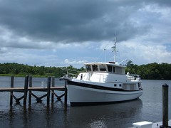
Old Lyme Marina-FLUKE in middle

As I write this latest update, the fourth installment of the 2006 Journey north, on August 13, 2006, I am sitting in the pilothouse on FLUKE at the Old Lyme Marina in Old Lyme, CT using my travel journal to organize my thoughts. We have been here since August 1, and the time has flown by. Note: it is a gorgeous day (clear, high 70's), with hundreds of boats passing by on the Connecticut River, so it is difficult to focus on the task at hand. We regret the absence of interesting photos from our travels in the Chesapeake and Delaware Bays, but there were so many days of light fog which wasn't conducive to getting any nice outdoor shots. Since then we have so many pretty shots it will be difficult to choose which ones to post.Internet access, as a whole, has been more difficult than we originally anticipated. We have only been to land a small percentage of the time, and most of those times we have had a full agenda of tasks to tend to. Then too, we have faced time limitations on computer use at some locations. Even though I can create the text for the blog at my leisure while we are underway, posting to the blog for on-line viewing can be time-consuming. The photos have to be uploaded and then inserted into the text at appropriate spots, all on-line. We don't want to just use the small format photos, so inserting for the large format use is what takes the most time. Answering personal emails is very doable, as we can just post with a regular text answer. So, keep those questions and comments coming, and we'll get back to you when we can get on-line. Sign up with the blog update feature by entering your email address in the box on the right hand side of the blog page to get notification when a new installment is posted rather than counting on getting an individual notification from us.
Now, going back in time:

MAY WE USE YOUR CAPE?

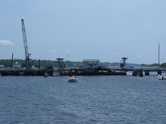
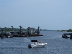
We were heading into the Cape May Canal on July 28 at the same time of the day that the local fishing boats, tour boats, and ferries were heading to their ports, so there was a lot of congestion, complicated by low tide in an area with relatively low water anyway. Fat FLUKE needs to stay in the middle where the water was the deepest, so there was some tight squeezing going on with the local boats. Our destination marina was in a dredged area that needs continual dredging, so we had the low water alarm buzzing just trying to get to our none-too-large slip at the marina. We had elected to stay in a marina because it was a Friday night, in a resort area with a lot of potential for weekend boaters, and we didn't feel quite clear on where we could find a place to safely anchor anyway. It was a good decision, as shortly after we were in our slip a thunderstorm squall line passed closely by, bringing some high winds and rain. Being tied in to the pilings felt good. Ursa jumped off the boat and bolted at full speed down the dock to a destination she didn't even have in mind-she was just going. Fortunately she ran into a dead end and was able to be trapped. Sitting and staying is actually one of her two dozen or so tricks, but when her wild streak gets turned on, there is no switch to turn it off. This is a common problem with Schipperkes according to other owners we have talked with. Laundry (6 loads) and posting to the blog were the main priorities. I figured no one would be doing laundry at the marina laundry facility on a Friday night, but I still had to wait! I had the laundry going on the boat too, but with so much to get done, I wanted to use the shore machines too. The marina boasts of having wireless internet service, but it is a very large facility, and we were informed that we may not be able to pick up a connection at the dock we were at, which proved to be true. We had to sit on a picnic table under a street light to make the chapter 3 postings, with the connection fading in and out-very frustrating since we wanted to get up at 0500 to make the long run to Sandy Hook, NJ on Saturday.

WE WERE HOOKED!

We enjoyed settled seas for our 15 hour run to Sandy Hook, but it was quite hot and we were attacked by thousands of house flies, forcing us to put up the screens and be even hotter. As we got closer to Sandy Hook we could see large freighters and commercial ships laying up at anchor, waiting their turn to go into New York Harbor, our intended destination the next day.We had decided to anchor off the Coast Guard Station: guide said good holding in settled weather. Plus, it looked like a large area and had good navigational aides which we needed with our 9:00 p.m. arrival. We were so tired, and just wanted to get the anchor set and get a good night's sleep so we could feel alert the next day. The anchor held tight on our first try, and we shut everything down and went to sleep. Sometime in the wee hours of the morning a tremendous wake hit us and practically knocked us out of bed. Despite rising early, we were surprised to see many boats already out on the water, at anchor fishing in the bay or headed out the channel to the ocean. Initially I thought there must be some kind of event taking place since they were pouring into the bay by the hundreds. Turned out to be a typical NJ/NY nice weather weekend boating day for those locals.We wanted to time our trip through New York Harbor to travel going with the current to make steering easier and more predictable, so we were anxious to get the anchor up and head up the East River. When we went to pull up the anchor we felt more resistance than usual, but kept on hauling until we saw that the anchor was hooked to a large, underwater cable that was tightly pulling downward against our upward efforts on that morning of July 29. Early on in the 2006 Voyage North, we had added a trip line and float to our anchor: to mark our anchor so others could see its position and to have an alternate way of being able to pull the anchor loose in the event it hooked on something laying on the bottom, most likely a log or rock. We never imagined we would need it to release a cable, but we were so glad to have it. Grabbing the trip line and cleating it off on the bow, enabled the anchor chain to have enough slack in it to where the cable could be pushed off the anchor. I'm not sure how we would have gotten rid of the cable without the trip line.

NEW YORK, NEW YORK: THE THRILL OF IT ALL

Despite being one of the world's busiest harbors, traveling through New York Harbor can be enjoyable and exciting with proper planning, paying attention, and observing the rules of the road (basically go slow, give way to everything bigger and faster than you). Absence of fog, rain, or wind helps too.
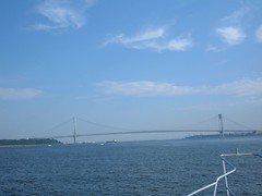
Verrazano Narrows Bridge

We crossed under the Verrazano Narrows Bridge at around 9:30 a.m. From the water, VNB looks very impressive, spanning the mile wide opening between Staten Island and Brooklyn.
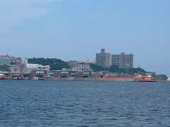
Staten Island Ferry
Staten Island Ferry

We passed by the quarantine area, where many commercial ships were lying in wait, mostly tended by tugs, for clearance to their docks. We were on alert for the giant freighters with limited maneuverability and slow stopping ability. There was much other water activity: ferries, harbor cruisers, water taxis, and pleasure craft. It was difficult to be able to enjoy the sights of the New York skyline, waterfront, even seeing down the streets while worrying about our own navigational situation.
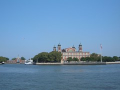
Beautiful Ellis Island
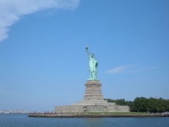

MS Freedom
MS Freedom

We intended to use the 14 mile East River to gain passage into Long Island Sound. The East River is only one of two rivers in the world with two mouths and no source. It is well marked, and there are lots of sights to see traveling through Manhattan, Brooklyn, and Queens, going under eight high level bridges, including the most famous, Brooklyn Bridge.
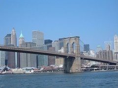
Brooklyn Bridge
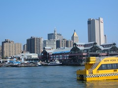
Brooklyn Bridge

NYC Waterfront Transportation
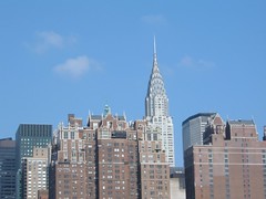

Chrysler Building
Chrysler Building

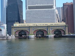
Original, Ornate Ferry Terminal
Ornate Ferry Terminal

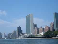
United Nations Building

We passed safely through Hell Gate, the most dangerous area of the East River. Currents can run as much as 5 knots, with lots of unpredictable eddies, whirlpools, and crosscurrents caused by water depths ranging from 34 to 107 feet in a few hundred yards. Maximum strength currents can produce 2' high waves, so timing the passage is critical for boating safety. Holding the helm wheel steady even under our good passage conditions was challenging. Shortly after that we passed Rikers Island (where bad boaters are sent to prison!) and the runway to LaGuardia airport (certainly looks different from ground level).
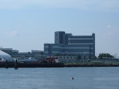
Place for Bad Boaters-Rikers Prison

A couple of gallons of diesel later, we entered into beautiful Long Island Sound, same water as the East River, but a 100% different boating vista. Catching our breath, we all agreed it was an exciting passage that would be enjoyed again on other trips, and even better if someone else was piloting the boat, so we could all take more time to see everything.
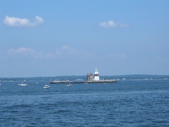
Execution Rocks Light - Long Island Sound
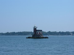

Stepping Stones Light - Long Island Sound

OYSTERS AND COLD SPRINGS

Checking our guide book, we decided that we would head into Oyster Bay, located on the south side of Long Island Sound. Since leaving the East River at an early time we figured it was still early enough in the day to be able to find a spot to anchor, despite being a beautiful Sunday. When we motored into the Bay off the Sound we were surprised to see all the boats already in the Bay. The inner harbor was packed tightly-we didn't even think of going in there, but even the outer harbor was crowded, with what mostly looked like day boaters. We found a more isolated spot on the outskirts of all the “action” and only dropped 100' of chain, but the guide book said it had good holding. Right. We couldn't get the anchor to set, but figured that later in the day, most people would leave and we could try to reset the anchor. So, throughout the afternoon, boats came and went. Several boats dropped anchors around us, disregarding our large, obvious float marking the anchor, and put out so little line with their anchors that if the wind had picked up, FLUKE would have passed their anchors and engulfed them like a whale eats krill. Finally people starting leaving, but 6:00 p.m. was approaching and we needed to get hooked properly. We tried again and failed, so we decided to try the holding around the corner in Cold Spring Harbor. Both OB and CSH are in beautiful settings with hills (180'), wooded, sparsely populated (because there are large estate homes that have enormous pieces of property) set around long-fingered inlets that come off Long Island Sound. CSH was so named in 1653 because the settlers found icy, freshwater springs in the harbor (Eddie went in the water to check out the bottom of FLUKE and said he agreed with the early settlers because he could feel pockets of frigid water swirling around him at times). In the 1800's CSH was one of Long Island's leading whaling ports and today sports a whaling museum set right amongst period homes, now converted to gift shops. We were able to find good holding in a nonpopulated area of water. Because we were still tired from the run to Sandy Hook and wanted to do some boat chores, we ended up spending July 30 and 31 peacefully hooked in the serene setting.

HOME SWEET HOME

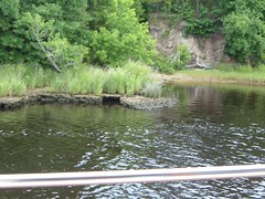
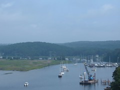
Finally on August 1, 2006, we reached another intermediate destination of the 2006 Voyage North: Old Lyme, CT. This was the birthplace of one person near and dear to too few: Eddie. His brother and sister, have resettled nearby, and Carol's brother (who has graciously loaned us a vehicle) lives in neighboring Niantic. Plus, we have friends living in close proximity. It has been great seeing everyone, but best of all, it just feels good not to be on the move and wondering where we will be able to safely stop next. Old Lyme is mainly a residential community (approx. 8000 people), founded in the 1600s. It fronts Long Island Sound for about 5 miles and extends 12 miles north up the CT River. Old downtown is typical of many of the old New England towns, with picturesque old homes that have become too expensive to keep up, but are wonderful to look at. We have been staying in Old Lyme Marina, located just off the Connecticut River, on the north side of the I-95 bridge. OLM is not normally used by transient cruisers like ourselves, catering mostly to locals and weekenders. The facility provides repair services of various sorts for smaller boats and is a family owned business. We love it because of the low-key atmosphere and ideal location for things we like to do. Of course, we have trade-offs, like no internet service, but the library is not far away and we can do what we need there. The setting is what is really ideal. We get to watch all the boating traffic on the CT River. There are so many vintage vessels in this part of the country, and they are our favorites. Boating history abounds along the CT river, affording the opportunity for day cruises to interesting harbors, like Essex and Deep River. Hundreds of boats of all sizes and types pass by on the weekends. We are protected from wakes from Calves Island, visible in the photo. The area is tidal, so we see dramatic changes along the shoreline a couple of times a day. Various wading birds, shoreline birds, geese, and a swan family come to feed among large mud flats. We have watched fledging ospreys leave the nest and capture their own first meals instead of counting on Mom for a handout. With the cooler weather, turtles pull themselves up on the mud shore to heat up in the sun.Even the marsh grasses and plants have been beautiful to see. Purple loose strife and rose swamp mallows provide striking contrasts of purples and pinks to the brilliant greens of the grasses. Gentle breezes off the river make the colors dance about. The sounds of the water lapping the edges and wind going through the reeds are so peaceful to the senses.
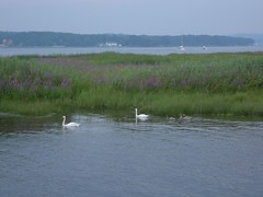
Our Marsh Friends
Our Marsh Friends

We have visited Gillette's Castle, built by William Gillette, actor who created the stage character of Sherlock Holmes. The home was designed by him, with a creative and artsy flair, which you would expect from an actor. The home has 47 doors, no two alike. The wood working and stone work are fascinating.
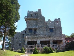
Gillette Castle
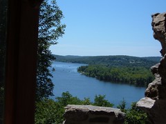
Gillette Castle

View From Window of Gillette Castle

Not far away is Devils Hopyard State Park. This picturesque park was the site of a grist mill in the 1600s, easily imagined by the natural falling waters.
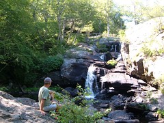
Devil's Hopyard
Devil's Hopyard

While we are comfortable here and have been spoiled by gorgeous weather, conveniences, and comforts of familiarity it is time to move on towards Maine, our final destination for the great voyage north and our intended haven of safety for the remainder of the 2006 Atlantic Hurricane season. We hope to be back here at OLM and spend more time as we head south in the Fall.

Friday, July 28, 2006

Elizabeth City, NC to Cape May, NJ

ELIZABETH CITY, NC TO CAPE MAY, NJ

Interesting Cruising Boat

WHO NEEDS PLYMOUTH ROCK?

Ask a history buff from Elizabeth City that question and they will answer “No one in Elizabeth City”. Records indicate that European explorers sailed into the waters of the Pasquotank River, Elizabeth City's waterfront, in 1585, long before the “official” landings at Jamestown and Plymouth Rock.
Settlement didn't occur in the area until the late 1600's. After undergoing several name changes, in 1801 Elizabeth City finally got its known today name. EC survived the Civil War and with the help of the railroad arriving in 1881 and subsequent building boom EC's lumber mills prospered. Four masted schooners frequented the port, carrying goods along the eastern seaboard into the 1930's.
A U.S. Coast Guard base was established in 1938, remaining there today as the largest air station in the country. Heading up the Pasquotank River to EC's waterfront one's sight is drawn to the enormous mound-shaped structure looming over the trees along the shoreline. This is what remains of the Weeksville Naval Air Station, authorized in 1940 on the eve of WW11, to become the second blimp building station in the country. The blimps were used to provide defense against enemy submarines, escort ships and perform rescue missions. Blimps are still manufactured there by the private sector, no longer for covert operations to say the least!
Today Elizabeth City is best known for its hospitality and southern charm. Many unique and architecturally fascinating buildings still exist in the Main Street Commercial District, housing boutiques and restaurants. Late 19th century homes still exist in residential areas, all visible on walking tours, with detailed maps provided by the well run Visitors Information Center.

THE WELCOMING COMMITTEE

A Warm Welcome
A Warm Welcome

We discovered Elizabeth City midday on July 20. The complimentary city docks are not readily apparent when approaching the waterfront dock area from the Pasquotank River because they are directly ahead, blending in with the seawall. So, FLUKE was motoring along very slowly, crew with binoculars in hand, trying discern exactly where we should go. A booming voice comes over the radio saying “Do you want to come into here to dock?” Well, duh, that is what we had in mind, but we didn't know who we were talking to or where we were going. That was our first introduction to Sam, the unofficial official dockmaster of the Elizabeth City waterfront and a key member of the famous “Rose Buddies” gang. The other two members are Fred and Gus. They comprise the official, but voluntary, cruisers welcoming committee for Elizabeth City complimentary docks. In addition to having a free dock for 48 hrs, ladies are given a rose, clipped from a bush growing in the waterfront park (if they are all gone, Fred gives away cotton bols, readily available from local field crops), plus answers to all your questions about staying in EC. If more than 4 boats show up, the Rose Buddies host a wine and cheese party. Sam and Gus “camp” out at the waterfront park all day, everyday. Fred (age 92) meanders through a few times a day on a golf cart, currently being occupied with trying to get the new Museum of the Albermarle, easy walking distance from the waterfront, running. They are an interesting group to say the least.
We wondered what kind of a community we were docking into when a group of 8 people gathered to watch FLUKE back her 18' beam into an 18' slip. And they are right on top of you when you pull in, elbows on the seawall rail, wondering if the fat boat is really going to fit in that slip. Sam says it will work. Pressure is on not to look like complete boating ineptitudes. Thank you for no wind and no current, and that wonderful bow thruster. We squeeze in with minimal rubbing of the rails. Many hands offer to take the stern lines to secure FLUKE to the bulkhead. The show is over, and people go about their business. This waterfront park, right in the middle of downtown, is a popular place of recreation and relaxation for the locals. Many friendly and curious people continue to stop by throughout the next couple of days to ask questions about FLUKE and our travels.

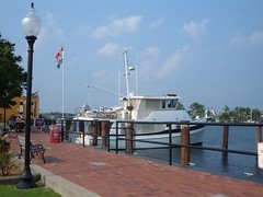
FLUKE at EC dock
Fluke at Elizabeth City Dock

PARROTMAN AND THE DRUNK

Two regular characters to the bench off our stern I dubbed Parrotman and the Drunk. Parrotman showed up in the afternoons on a bicycle, with Pickles, his Yellowed Naped Amazon parrot, clinging to the handlebars. After propping his bike on the lamp post, PM would take Pickles over to the drinking fountain and turn the fountain on full blast and let Pickles bathe in the arcing stream of water. Then PM would place Pickles on a couple of sticks that PM had stood on his bicycle to tie high up on the lamp post. PM would sit on the bench for several hours watching the sites and talking to anyone who happened by. He always had lots of questions for me. Even Pickles would say Hi to me.
PM was one of those men, who women always joke about, that wore a mismatching plaid shirt and different type of plaid pair of shorts. Plus, he wore a stripped railroad engineer's hat. So, he and Pickles reminded me of a clown act in the circus! However, when PM spoke he was articulate, well versed on community and current events, and seemingly well-read. Talking to him was pleasant, other than he usually had more questions about life than I had, so it was difficult to be able to end a conversation with him.
The Drunk was a man of very bronzed complexion with piercing dark blue eyes – I guessed he must do some type of outside work. He showed up in late afternoon, neat and cleanly dressed, with a bag containing a bottle and sat on the same bench with PM. He was a chatterbox, but his extreme southern accent alone made understanding him somewhat difficult and as the afternoon went on and the bottle went lower his language became more difficult to understand, although he seemed happy about everything he said. When I came back from a late afternoon walk with Ursa I asked them if they wanted to see Ursa do her tricks. They were both animal lovers and readily replied “of course”. Ursa proceeded to impress them with her litany of tricks, drawing other passerbys' attentions – just like the circus I envisioned. The Drunk asked if she could shake hands with him, so I gave him a treat to give to Ursa and pulled her near to him. She succeeded, despite the slurred command (fortunately she is trained by sign too for most of her tricks, so putting his hand low was probably enough without having to hear the words). She then proceeded to jump up on his bench and take a sniff of the bottle! The Drunk quickly retracted his booty and said “I'm not sharing my bottle with a dog!”. I didn't want Ursa's lips on it anyway.

HUNTERS AND GATHERERS

We are always on the lookout for fresh produce, since it is usually a while before we have access to land to even try to find any and that's what we use first. We went on a 5 mile roundtrip bike ride to the outer part of town to visit a Walmart to pick up some computer software we couldn't find in downtown. A man was selling cantaloupes from the back of a pick-up truck, so we bought one. I had it in the basket on the front of the bike and hit a bump and the whole basket flipped off the handlebars, dumping the melon on the sidewalk. Fortunately it didn't roll out into traffic or break open. No one said the hunt would be easy. To assuage my frustration over the melon incident, we stopped at City Sweets in the old downtown and got an ice cream cone (always a favorite amongst cruisers) and a couple of hand-dipped chocolate covered strawberries. Sugar – life is good. What melon?
Having spent the majority of the afternoon away from the boat, we decided to infuse some more money into the local economy by ordering a pizza. There is free WiFi at the docks, so we thought it would be a good idea to support the pizza business that was advertising on the WiFi. Plus, they offered free delivery. I called the number and told the girl taking the order what I wanted. She said she needed a phone number, so I proceeded to tell her our cell phone number, but she said she had to have a local number. I explained that we were on a boat, to which she replied “Well, don't you know anyone in town?” I said “I've gotten to be pretty friendly with 3 old men on the dock, but they haven't given me their phone numbers”. She said she couldn't place the order without a local number and asked exactly where I was. I told her I could see the sign belonging to the restaurant next door, which she was familiar with, so she decided to use its phone number and told me she would put me on hold while she looked it up in the phone book. Just a new twist to the hunt – the pizza was great!

GETTING FROM HERE TO THERE

If you are traveling by boat and want to get from Norfolk, VA, where the Atlantic Intracoastal Waterway begins at mile 0, to North Carolina you can take one of two routes: the Dismal Swamp Canal or the Albemarle and Chesapeake Canal. The DSC is traveled primarily by recreational boaters, for reasons which will become apparent as you read further, while the ACC is used more by commercial craft, boaters in a hurry, or boaters of more careful nature. We, being of adventurous nature, decided to take the DSC route. Note: the DSC route recommends boats not draw more than 6' to safely transit the waterway; FLUKE draws 5.5'.

WARNING SIGNS

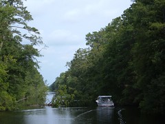
The Pasquotank River connects Elizabeth City to the south lock of the Dismal Swamp Canal. For the most part, the river is very scenic, gracefully winding with a well-marked deep water channel. The shoreline is lined with beautiful, old stands of cypress, gum, and other hardwoods and looks much like some of the swamp lands we encountered farther south. When you get closer to the DSC, a dredged, straight, narrow waterway replaces the natural river. The shoreline is not as stable as that created by Mother Nature, and the continual beating by boat wakes further adds to its instability. During the summer months a lot of vine growth covers the overhanging trees, adding even more weight to their limbs. Summer thunderstorms can bring a lot of wind and rain, enough to give precariously perched trees their final push into the river. We didn't know that when we embarked on our voyage, this the 22nd day of July 2006.
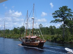
After about 2 hours, we turned off the natural course of the river and entered the straight channel. In the distance it looked like a tree was down in the water, but it was difficult to see how much it was actually obstructing the waterway. As we got closer, it was apparent the very large pine tree was newly fallen and was blocking about 90% of the waterway. Fortunately, a small local tour boat was coming up behind us. We idled down until the tour boat was at our stern and we told the captain we needed help to determine if we could get around the fallen tree. He took Eddie on board and went around the tree to determine water depth along the shoreline and to see if our pilothouse could clear the overhanging branches. Water depth was fine; we picked up a lot of debris from the overhanging limbs and only one scratch on an antenna. The tourists on the boat were thrilled to be involved in an “assistance at sea” maneuver.
We cautiously motored onward; a bald eagle swooped down across our bow and led the way around the bend to the south lock of the Dismal Swamp Canal.
Trouble on the Pasquotank

THE DISMAL SWAMP CANAL

Beginning the Dismal Adventure
The DSC is the oldest operating artificial waterway in the U.S. It is designated as a National Historic Civil Engineering Landmark and entered into the National Register of Historic Places. Its history includes tales of presidents, explorers, writers, scholars, and slavery.
In 1728 Colonel William Byrd II of Virginia returned from a survey trip of the Dismal Swamp region. Despite, coining the area as “dismal” because he and his crew were constantly tormented by yellow flies, ticks, and chiggers, Byrd recognized the potential in being able to connect the sounds of North Carolina with the tidewater areas of Virginia to safely move goods back and forth. However, it wasn't until after the Revolutionary War that enough other people also realized the value a canal would have in helping to make the new country grow and prosper by moving goods along that north/south route.
In 1793, construction began on both ends of the canal. Since it had to be dug almost entirely by hand, using slave labor hired from nearby landowners, progress was slow and expensive. Numerous problems and other proposals to alternate routes of transportation prevented the canal from opening until 1805. When it finally opened, it was so shallow, only flat boats and log rafts could use it, and they had to be manually towed or poled through. This was a big disappointment to canal owners, farmers, lumbermen, and other merchants who had envisioned the canal as a great trade route. Maintenance costs and problems with the water levels led the canal to fall into disrepair and be sold. Private ownership continued to fail until finally in 1925 the U.S. Congress authorized purchase of the DSC. In 1974, Congress established the Great Dismal Swamp National Wildlife Refuge. Then, the water needs of the swamp took priority over the navigational needs of the canal. Today, the canal is maintained to a depth of 6'. The locks at either end of the canal keep the canal 8' above the surrounding waterways. If the water level in Lake Drummond, the main source of water for the canal falls too low, water cannot drain into the canal and the canal is shut down to transportation. The costs of maintaining the canal remain high: cleaning the bottom of the canal, maintenance of locks and bridges, and shoreline maintenance. Such costs are questionable to justify keeping the canal navigable for large cruiser type boat traffic.

THE VOTE WAS UNANIMOUS
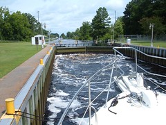
Fluke's 32 mile voyage through the DSC got off to a slow start with a 30 minute wait for the south lock to open. After we locked through, we immediately dropped below 2' on our depth gage, which has an audible alarm set for depths less than 2', so we just turned off the alarm and visually watched the gage. If we dropped below 2', the plan was to idle down, shift into neutral and just coast. Judging by all the overhanging vegetation, rotting logs along the shoreline, logs tied off to the shore, and debris in the water, it was reasonable to assume that there was also the same stuff lying on the bottom. Plus, we had been warned by other boaters and all the literature we read said “Proceed with Caution”. I can't tell you how many times, they were so numerous, we just coasted. We “touched” objects at least a dozen times and dodged debris too many times to count.

FLUKE at NC Welcome Center


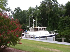
It was 4 miles from the first lock to the North Carolina Welcome Station, a site shared by boaters on the DSC and travelers on Route 17. The complimentary dock can hold a couple of boats for an overnight stay, and that was our plan. I think those 4 miles were the longest we've ever had on any boat we've ever been on. Just getting used to coasting and hearing thumps on the hull, and hoping nothing was getting hung up in our running gear or stabilizers, aged us 10 years.
The Welcome Station is a nice facility with lots of written literature about places to visit in NC, a NC field crop demonstration garden, and a beautiful picnic area. It is site of a 4.5 bike path that winds along the banks of the DSC to a little town called South Mills. We biked the whole loop in the late afternoon to help relieve the anxiety from the morning's travel.
Just as we returned to FLUKE a couple walked up and started up a conversation; they had been live-aboards at one time, based in the Chesapeake. They were nice enough to go over charts with us, giving us a much-needed overview of the cruising area, making useful suggestions on where we could anchor.
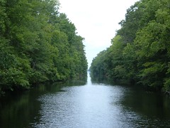
Formidable Passage Through the DSC

We got an early start the next morning, anticipating another arduous day of dodging and coasting. It turned out that the first 4 miles proved to be the worst, not that the rest were easy going. We were thankful that we didn't see another boat in the DSC the entire 2 days, as we would have had to undergo some tight maneuvers to let another boat pass by our fat gem.
If we hadn't taken the DSC I would have always wondered, and probably whined, about wanting to do it. However, having now done it, we all agreed that we will not do it again. The scenery and solitude are nice, but they are no better than several other places we have traveled this 2006 Voyage North. Plus, the risk to the boat is too great to justify that transit. One scenario that frequently crossed our minds, as we passed so many precariously perched large trees on obviously unstable banks, was what would we do if we had to pass another newly fallen tree with no one else around? It could be several days before a crew could be mobilized to move the obstruction. Then we would have no choice but to wait, through who knows how many thunderstorms or else turn around and go all the way back to Elizabeth City, with more downed trees possibly in our path. Leave the DSC for small power boats, kayaks, and canoes.

FROM NOTHING TO EVERYTHING
On July 23 we thankfully exited the north lock of the DSC, ran a short while in the southern branch of the Elizabeth River and plop!, we were in the middle of everything. So much commercial shipping activity and industrial sites along the shore. Lots of noise, steel, concrete, and bustling of boats and machinery. We followed a tug and got through all the bridges of the Norfolk and Portsmouth, VA areas without ever having to stop and wait. It was interesting to see all the docked Naval vessels and freighters up close, and difficult not to get too distracted from our own navigational needs.
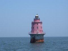
Thimble Shoals Light-Welcome to the Chesapeake

We passed over the Hampton Roads Bridge Tunnel and declared ourselves as having finally arrived in The Chesapeake! We cruised up to Mobjack Bay, entered into Put-in-Creek and set the anchor. The surrounding land had a few farms, single family homes of various styles and ages and lots of trees. It was peaceful and welcoming. I was mesmerized by the scores of jellyfish floating in and out of the depths all around FLUKE. Coming from FL, it was puzzling how there could be so much water and not be able to go swimming because of all the jellyfish. The next morning we waited to exit our anchorage while a crew team, with men and women rowers in 1, 2, and 4 person shells rowed by with their coach traveling in a small skiff booming out orders over a bull horn.

SO MANY CHOICES, TOO LITTLE TIME
Over the next few days it became easy to see why so many cruisers spend summer after summer in the Chesapeake. There are more places to cruise than can be counted. Getting around is fairly easy, with well-marked channels, deep water, and good facilities for marinas, restaurants, and boatyards. There are tourist places to visit to learn about history and nature. We had to take our notes for future reference, as August 1 was just around the corner, and we still needed to head further north to visit family and friends. We dropped our hook at Sandy Point, in the Wicomico River, our last day in VA. We stayed two nights at anchor up Mills Creek in Solomons MD.
I've been writing most of this section of the Great Voyage of 2006 while we have been underway (and I haven't had helm duty), since 5:45 a.m., leaving from the Sassafras River, just south of the C & D Canal, which connects the Chesapeake Bay to Delaware Bay. We have spent the day staying just outside the main shipping channel as large freighters and commercial ships have passed us in both directions, destinations for them could be any of several major ports accessed by this route: all of those in the Chesapeake (Baltimore, Annapolis, Norfolk), up the Potomoc, and up to Philadephia.
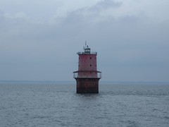
Miah Maull Shoal Light in Delaware Bay

Our destination on this the 28th day of July 2006 is a marina in Cape May, where we will dock for the night, finally hose down FLUKE, get to do laundry, and presumably post this section to the internet for those of you who are vicariously cruising with us.
We need to get rested up for the next leg of the voyage, out to the Atlantic Ocean, into New York Harbor, and into Long Island Sound.
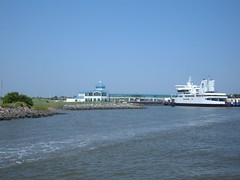
Cape May Ferry Dock along the Cape May Canal

Thursday, July 20, 2006

Waccamaw River, SC to Elizabeth City, NC

(Please note that I finally got photos added to previous post, remember you can click on them to see larger sizes)

LAND HO!

Well, we made it the marina near Murrells Inlet, and I should have sent out the first installment of this epic journey, but technical difficulties interfered. I have no idea when I will be able to post in the future. If you have signed up for the long version, not realizing it was going to be comparable to Homer's Odyssey, and don't wish to have to tie up your disk space, please ask to be transferred to the short version or press delete. I bet no one ever said that to Homer!

FLUKE at Wacca Wache Marina dock

We had FLUKE tied up to the Wacca Wachee Marina dock right after lunch, in hopes of maximizing our stay at the dock. We were the only transient vessel there in our size range, so there was plenty of room. It was a good thing that it wasn't a weekend, this being July 12, as there were a lot of boats and a lot of wakes, and we didn't have much protection. Plus, there was barely enough water at our dock to keep off the bottom at low tide. We made do with the situation and plugged into shore power and cranked the ACs on low to dry out the boat from all the humidity we had acquired going through the swamps. Our pump and a package from our mail service arrived in mid-afternoon, too late to start the installation. E & C washed the outside of the boat, trying to get off the plough residue, salt spray, swamp slime, etc. W went through the mail and caught up on paperwork. We rewarded ourselves by dining out at the Boondocks Grill, located at the marina. The name aptly describes the location, and the atmosphere is casual to say the least. As a result, the restaurant can get away with their motto, “Shut the Duck Up”. No, we didn't buy one of the license plates to display the motto in civilized locations.

WHAT EVER HAPPENED TO QUALITY CONTROL?

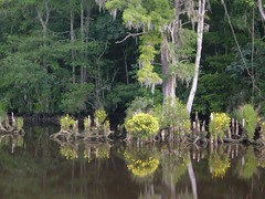
The morning of July 13 was spent on a 10 mile (roundtrip) bike trip to go to the P.O., grocery store, West Marine, and Home Depot. When we got back it was time to call for a pump out of the holding tank, always a potentially exciting event, generally of the unpleasant nature.The dock hand shows up with the hose to connect to the suction fitting that was sticking out of the dock next to the boat, and it wasn't long enough to reach the fitting on our boat, so we had to pull FLUKE backwards. I asked the guy if it was going to work, and he said it was the first time that suction valve had been used, since all the other docks had had theirs already done, and our dock was the last one to get the new system. He assured me that his 5200 suction pump was the strongest on the market and the city of Detroit kept their city dry with them. OK. We managed to get everything hooked up, he turned the on valve and then his fitting going into our deck promptly broke, spilling raw sewer on the foredeck and down the side. Two more hoses, and E figuring out what the problem with his fitting was, finally got us pumped out. The 5200 did the job! We ate lunch at the dock and then took the boat a short ways up the river to what we thought was a suitable anchorage-it was just an offshoot of the river, very scenic. I could look at cypress trees and knees all day. I think the colors and shapes are so fascinating. They can live for 600 years and their heartwoood is rot resistant. Bald cypress are also indicators of the salinity of the water; they can tolerate brackish water, but cannot live in salty water.

Swamp Beauties of the Waccamaw River

W & E decided to install the new washdown pump, only to find out that the new one leaks around the shaft, probably has to do with some seals. Typical. A call to the company and conversation with the “engineer” confirms the theory and he will ship out the seals. Like, how are they going to be delivered, by Alligator Express?! W just tells him we will have to figure out when we can conveniently go to land again and let him know a future shipping date. W & E do a necropsy on the old pump to try to figure out how they will install the new seals once we get them.

ALWAYS FEAR GETTING YOUR CAPE WET

Life in the peaceful swamp took a tumultuous turn very early on this, the 14th day of July, 2006. The crew rose early to try to make the 80 mile run to get to what we thought looked like a safe anchorage. When W & E were preparing to drop the stern anchor line, FLUKE shifted, the anchor line went taught, and W, who was holding the line, was actually propelled into the eerily dark water in belly flop fashion; the noise of his impact with the water shattered the calm stillness and silence of the swamp. He scrambled out of the water onto the swim platform quicker than the nearest alligator could say “Did someone say dinner?” Shortly after that, FLUKE drifted over the stern line float (we were battling some current), and we waited a half hour trying to decide if someone should go in the water to try to free the line, not sure what it was hung up on. Happily, the float appeared and was quickly hauled aboard. As soon as we pulled up the bow anchor and made the turn into the main channel, the rising sun blinded us, not helped by the film of dirt on the inside of the pilothouse window. We just couldn't see at all, a real bad feeling in strange narrow waters, with current, and a 60,000 lb. boat to move. We were lucky no other boats were around as we scrambled to clean the window and make slow headway on this day that we needed to move more swifltly and the Rock Pile was still to come.

The Rock Pile is a 19 mile section of the waterway that is cut through fossiliferous limestone. It took 2 years to blast through this section, and not wanting to spend any more effort to comfortably widen it, it was built with the narrowest of margins. When transiting one extra narrow 3 mile section, boaters issue a securité call to to find out if any oncoming commercial traffic will be using the area at the same time-there wouldn't be enough room to safely pass a tug and barge. We went through the Rock Pile at the lowest of tide, so it was easy to see the rock ledges and stay well clear of them. It would be treacherous to hit those cement-like rocks with any part of the boat.
Close Shore of the Rockpile

We did have to deal with one more dinosaur though, the pontoon bridge at Sunset Beach. It is the last one in the whole country. From the photos you can see that the bridge literally floats on the surface of the water and at designated times via cables, is pulled off to the side so boats can pass through.
Sunset Beach Pontoon Bridge waiting to open for boat traffic

Sunset Beach Pontoon Bridge open for boat traffic

Sunset Beach Pontoon Bridge almost open for boat traffic

Shallotte Inlet, Unusual ICW House
ICW House

We happily passed into North Carolina and prepared to deal with our next navigational challenge: the Cape Fear River. The name itself suggest there could be trouble for the careless or unlucky mariner. Through the centuries Cape Fear has been responsible for turning sea lovers back to land lubbers, living and dead. Some of the most dangerous shoals along the entire Atlantic coast run for upwards of 30 miles out to sea from Cape Fear. Look at a map and see where the Atlantic Ocean can come full force right up the Cape Fear River, which we had to cross over to continue on our journey. On this day, King Neptune granted us safe passage with minimal winds and a favorable tide; we rocked and rolled a bit, but FLUKE held the course steady and we went onward.Carolina Beach basin was our intended anchorage.

We sucked sand from the bottom to get into the basin on a low tide. Our cruising guide indicated holding could be poor, which proved to be true. From the bow, we tried setting the Delta twice, then switched over to the Super Max (you would think an anchor with a name like that would be good for anything), which was much inferior to the Delta, so we switched back to the Delta. We had the Fortress set off the stern. I can't even begin to tell you how much mud was on the deck (E has taken to calling it black paint), having brought those anchors up and down so many times. Still not satisfied with the holding, but seeing 7:00 p.m. on the clock, we evaluated the risks we posed to others and ourselves, set the anchor alarm, and decided to sleep with one ear open all night and called it a long, long day.

MILITARY HOUSING

Due to a tight fit, and position of FLUKE, it was time consuming getting both anchors up without running aground. Right after we managed to get underway, having taken to cleaning that lousy mud off the boat with a pressure washer using our valuable tank water, the handle on the pressure washer broke as E was carrying it waist high. The full force of the p.w. hit the deck and chipped it, then bounced up and landed on E's instep. Justifiably so, as evidenced by the swelling, E spent the next 3 days trying to gather sympathy points for the injury. We all must suffer for the Cause. We anchored two nights (needing more rest and to do FLUKE chores) at a spot known as Mile Hammock Bay, located on Camp LeJeune property.

Mile Hammock Bay at Camp LeJeune

The military lets the public use the man-made basin to anchor, but boaters cannot go ashore. Military personnel do use the shoreline, with a gigantic ramp area and lots of dock footage, to launch boats and fish.The basin was dredged during WWII so that the marines could practice amphibious landings. The threat of German U-boats offshore prohibited them from using the beach itself. So, a full-scale mock up was made of a troop transport ship so the trainees could practice climbing up and down the netting wearing a full set of gear. Today, a rusting marine landing craft is tied to the dock; by its looks, it seaworthiness is definitely questionable. Camp LeJeune covers 246 square miles and is home to 50,000 marines and navy personnel. It has 89 maneuver areas, 25 tactical landing zones, and 54 live-fire ranges, which would affect our progress when we got underway.

IN THE LINE OF FIRE

On this, the 17th day of July we have our first foggy morning. Fortunately, the sun is bright and the channel is narrow, so there aren't a lot of places we can get into trouble. Our electronic charts help guide us where the fog is thick and visibility is poor. However, up ahead, still being on base property, we will have to pass through a live fire range during a 5 mile stretch of our route. I had called the Coast Guard yesterday to find out if there would be live firing going on which would close the waterway for up to 1 hour. The CG replied that we should watch for the light signals and an armed patrol boat would prohibit our passage anyway. We luck out, no blockade is in force, and we move onward through the battlefield. It is interesting seeing the targets: old pieces of various types of military equipment, riddled with thousands of bullet holes. I wonder how far away they are when they are having live firing practice and aiming right across the waterway on which we are traveling.

Live Fire Range at Camp LeJeune; note stop lights

ABDUCTED BY ALIENS ?

We had a short travel day to get to Belhaven, N.C. on July 18. We decided to try to go to land to send and receive email at the public library and go to the grocery store. Belhaven has a reputation as being a boater friendly town, little did we realize how well deserved that would turn out to be.Belhaven sprung up in the late 1800's around the lumber and grain industries. Now the town of 2000 residents is trying to tap into the waterfront craze of development (its potential for success being questionable), losing much of its old charm. Development is the biggest industry we have seen along the waterway since leaving the home dock. The faces of the waterfront towns are really changing, the new pushing out the old.When we finished at the library, after drastically over-extending our allotted time on one of their 4 slow computers (the librarian said we could have more time as long as no one was waiting), we were walking down Main street (the other main roadway is called Water street), headed to the outskirts of town to go grocery shopping. A car with a woman driver pulled over next to us and asked us if we were going to the grocery store. She said she was, and had driven by us, turned around and came back to ask us if we wanted a ride! We were so flabbergasted that she would do this-where we come from we would be lucky to have one of our neighbors take the time and make the effort to pull off the road and offer to give us a ride. She introduced herself as the town clerk and told us a little bit about Belhaven and her life growing up there.

Shortly after we left the grocery store and were walking along the road, a man with a pick-up truck pulled off the opposite side of the road, going in our direction and asked if we were going to the public dock and would we like a ride. We piled into the back of his truck, shook our heads again and figured we must have anchored on another planet.We helped the Belhaven economy by taking on 650 gallons of diesel fuel for $1750.00.

On this the 20th day of July 2006 I am writing this real time, before my shift at the helm begins. We hope to go ashore later today in Elizabeth City, N.C. We will try to post this update of the journey and some photos. Leaving there we will try to traverse through the shallow Dismal Swamp and move on into Virginia.
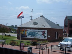
Elizabeth City, NC Welcome Sign

We are tied up at the complimentary dock at Elizabeth City. We were greeted and helped into a tight slip by the very friendly and helpful "Rose Buddies" started by Fred Fearing in 1983. He is 92 now and rides around in his golf cart and gives a rose to each lady on board. The town also has free Wi-Fi which I am using to update the blog and upload photos to flickr. See http://flickr.com/photos/wb4us for all our uploaded photos.