We started the day off with another first for the crew of FLUKE: We used the coin operated sewer pumpout at the Visitors Center. The pump sucked great, and we didn't have any sewer explosions or stinking drips. And, there wasn't any yelling. Maybe you were able to look at the web cam and see us sucking our sewer!
Today we traveled for 6 ¼ hrs to go 23 ½ miles, pretty slow by even walking standards. There are several reasons for the slow pace. We had to lock through 8 locks which take about 30 minutes to complete the cycle. We used the line method to secure FLUKE. Eddie held the bow area line and I held a line at midship. The lines were slimy, but easy to keep a grip on. Wayne jostled FLUKE back and forth with the throttles and side to side with the bow thruster because when the lock was filling FLUKE wanted to move around more than we were able to keep the big girl secure by just holding onto the lines. The method worked much better than securing two lines to the fixed pipe like we did in the Troy lock.
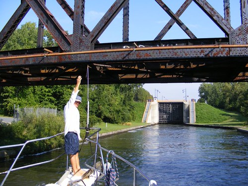
Eddie Checking The Height Gauge
We had to pass under 14 bridges. The photo shows the “gauge” we have mounted on the bow, set to match the top of our ladder, now the highest point on the boat. Supposedly we should be able to get under all the bridges, but just to be sure the gauge will tell us if we can fit before we hit the ladder and tear it and a lot of fiberglass off the boat. The bridge would definitely win that fight!
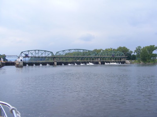
One of the locks was associated with a large dam area and nearby power generating facility.

Power Generating Lock Area
Another of the locks, the one we tied up next to for the night, has a sophisticated mechanism for flood control, a type we have never seen before.
Flood Control Lock Area
We are now traveling along the Mohawk River. In the days when the original Erie Canal was in use, the real canal was located close to the river, or one of its tributaries, in most areas. The river couldn't be used by the barges because it is too wide, the banks are too irregular, and the current can be too swift; the mules wouldn't have been able to walk easily to pull the barges. The areas next to what was the original canal are still used today for recreational areas, bike paths, and walking trails. Portions of the Canal are still visible from the Mohawk River.
There were places where the Erie Canal had to actually cross over the Mohawk River using aqueducts. These were water bridges, constructed of stone. Some of the original (1800s) stone arches from the aqueduct system are still visible.
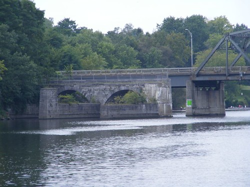
Aqueduct Arches
Today, the NY State Thruway runs right along the Mohawk River, and we have traveled with the noise of the highway not too far away. We have seen a few fishing boats on the river and have passed 2 other cruising boats, headed east. Going so slowly it was easy to be able to enjoy the riverside sights, some of which were unusual.
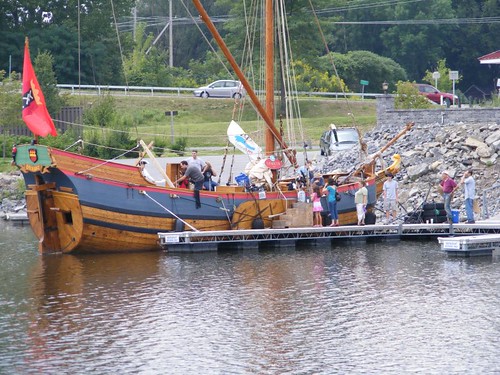
Hudson River Replica Ship
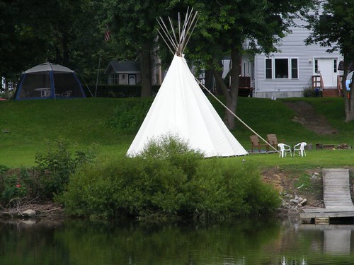
Tribute To The Original Landowners
So, here we are 211' higher up than when we started out up the river this morning. When we are sitting high in the locks after they are filled up all the way, it is an interesting sight to look downhill back to where we were. Who knows what we'll see tomorrow?
(This is from Wayne) I wanted to try using google maps to show you where we are. This is the satellite view. You can also select the map view and then zoom out to see where this is in the bigger picture. If anyone likes this, they can comment or send email and I'll decide if I want to keep doing it.


I vote "yes" for the google map Fluke locator! I'm enjoying your travels in NY.
ReplyDeleteNiece Kathy
Not being familiar with the area, the map was great. I was able to follow the rivers you traveled all the way back, as I recalled your earlier posts on your sightings/stops along the way.
ReplyDeleteAl
I also vote 'yes'. We love maps...Dorinda and I had gotten out our atlas to follow your adventures.
ReplyDeleteThanks for your posts.
Bob and Dorinda